
From Expensive Sensors to Accessible Solutions: The New Era of Low-Cost 3D Mapping
the chairs
From Expensive Sensors to Accessible Solutions: The New Era of Low-Cost 3D Mapping
The rapid evolution of affordable LiDAR, imaging sensors, and mobile mapping technologies is transforming the way 3D spatial information is acquired, processed, and applied across multiple disciplines. This webinar will explore how emerging low-cost and non-conventional sensing solutions are contributing to the democratization of 3D mapping, enabling new applications in urban monitoring, infrastructure assessment, environmental analysis, robotics, and digital heritage.
The session will present the main challenges and opportunities associated with these technologies, including sensor performance evaluation, data quality assessment, integration with artificial intelligence and machine learning approaches, and the development of efficient workflows for large-scale 3D data processing. Researchers and practitioners will discuss how affordable sensing technologies can complement traditional surveying methods and open new possibilities for more accessible, scalable, and sustainable geospatial solutions.
Date: 21 October 2026
Time: 14:00 CEST | 8:00 EDT
Webinar ID: 878 8138 5830
Webinar Secretariat: webinar@mdpi.com
Meet Our Chairs
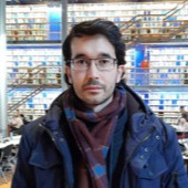
GeoTECH, CINTECX, Universidade de Vigo, Spain;Jesús Balado is a Ramón y Cajal Research Fellow with the GeoTECH research group at the University of Vigo, Spain. His research focuses on 3D geospatial data acquisition and processing, LiDAR, computer vision, and artificial intelligence for BIM, smart cities, and infrastructure monitoring. His work spans semantic segmentation, object detection, physical accessibility assessment, extended reality (XR), and the integration of multi-sensor data for urban and indoor mapping. He has authored more than 100 scientific publications in international journals and conference proceedings, accumulating over 1,200 citations, and has contributed to several national and European research projects in geomatics and intelligent 3D sensing.
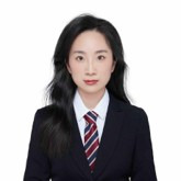
School of Robotics, Xi’an Jiaotong-Liverpool University, Taicang, China;Zhouyan Qiu is an Assistant Professor at Xi'an Jiaotong-Liverpool University, China. Her research focuses on photogrammetry, computer vision, and intelligent 3D sensing, with particular emphasis on multi-sensor fusion, LiDAR and RGB-D data processing, semantic segmentation, digital twins, and artificial intelligence for geospatial applications. Her work spans infrastructure inspection, indoor and outdoor 3D mapping, and intelligent transportation systems, contributing to the development of advanced sensing and digital reconstruction methodologies She has authored more than a dozen peer-reviewed publications in leading journals and conferences in photogrammetry, computer vision, and geospatial technologies.
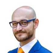
Department of Architecture and Design, Politecnico di Torino, Turin, Italy;Lorenzo Teppati Losè is an Assistant Professor in Geomatics at the Polytechnic University of Turin, Italy. His research focuses on photogrammetry, LiDAR, SLAM-based mapping, and 3D geospatial data acquisition, with particular emphasis on cultural heritage documentation, HBIM, digital twins, and emergency mapping. His work explores the integration of UAVs, mobile mapping systems, 360° cameras, and artificial intelligence to develop accurate and efficient methodologies for reality capture, 3D reconstruction, and semantic modelling of complex-built environments. He has authored numerous scientific publications in photogrammetry, geomatics, and digital heritage, contributing to advances in 3D reality capture and geospatial technologies.
Meet Our Speakers

Mr. Juan Carlos Navares Vázquez
GeoTECH, CINTECX, Universidade de Vigo, Spain;Juan Carlos Navares Vázquez is a Ph.D. candidate with the GeoTECH research group at the University of Vigo, Spain. His research focuses on the application of extended reality (XR), mixed reality, and 3D sensing technologies for indoor and outdoor spatial data acquisition and point cloud processing. His work explores the integration of head-mounted displays, particularly Microsoft HoloLens 2, to support 3D mapping, semantic segmentation, and human–computer interaction in digital construction and geospatial applications.

Mr. Chenye Liu
School of Robotics, Xi’an Jiaotong-Liverpool University, Taicang, China;Chenye Liu is a Master's student at the School of Robotics, Xi’an Jiaotong-Liverpool University, China. His research interests include 3D computer vision, with a focus on point cloud semantic segmentation under long-tailed distributions, emphasizing context-aware feature learning and balanced training strategies.

Université de Strasbourg, CNRS, INSA Strasbourg, ICube Laboratory UMR 7357, Photogrammetry and Geomatics Group, France;Arnadi Murtiyoso is a Junior Professor in Surveying and Geomatics at INSA Strasbourg, France, and a researcher specializing in photogrammetry, computer vision, and 3D geospatial data processing. His research focuses on reality-based 3D reconstruction, semantic segmentation of point clouds, artificial intelligence for geospatial applications, and digital twins for cultural heritage. His recent work also explores neural rendering techniques, including Neural Radiance Fields (NeRF) and 3D Gaussian Splatting, for heritage documentation, as well as applications of 3D sensing in forestry and environmental monitoring. He has authored more than 100 scientific publications in international journals and conference proceedings, with over 1,700 citations to his work.
This is a FREE webinar. After registering, you will receive a confirmation email containing information on how to join the webinar. Registrations with academic institutional email addresses will be prioritized.
Certificates of attendance will be delivered to those who attend the live webinar.
Can’t attend? Register anyway and we’ll let you know when the recording is available to watch.