Event submissions
Published
 10.3390/I3S2021Dresden-10120 (registering DOI)
 This submission belongs to the session S4. Sensor Applications and Smart Systems of the event 8th International Symposium on Sensor Science
Published date
17 May, 2021
Citation
Paul David Carchipulla Morales, Xavier Eduardo Zapata-Ríos, Probabilistic analysis of the spatiotemporal variability of the Pugllohuma wetland using Synthetic Aperture Radar images of the Sentinel-1 Mission, in Proceedings of 8th International Symposium on Sensor Science, 17 May–28 May 2021, MDPI: Basel, Switzerland, doi: 10.3390/I3S2021Dresden-10120
Share
Email
Facebook
Twitter
LinkedIn
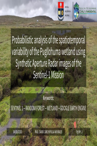
Probabilistic analysis of the spatiotemporal variability of the Pugllohuma wetland using Synthetic Aperture Radar images of the Sentinel-1 Mission

Paul David Carchipulla Morales 1,2
'%3e%3cpath%20d='M12.6647%2010.9104C12.4176%2010.325%2012.0589%209.7933%2011.6088%209.34485C11.16%208.89511%2010.6283%208.53653%2010.0432%208.28891C10.038%208.28629%2010.0327%208.28498%2010.0275%208.28236C10.8437%207.69282%2011.3743%206.73252%2011.3743%205.64907C11.3743%203.85423%209.92005%202.40002%208.12522%202.40002C6.33038%202.40002%204.87618%203.85423%204.87618%205.64907C4.87618%206.73252%205.40677%207.69282%206.22296%208.28367C6.21772%208.28629%206.21248%208.2876%206.20724%208.29022C5.62031%208.53783%205.09365%208.89287%204.64167%209.34616C4.19192%209.79496%203.83334%2010.3266%203.58573%2010.9117C3.34247%2011.4846%203.21128%2012.0987%203.19925%2012.721C3.1989%2012.735%203.20135%2012.7489%203.20646%2012.7619C3.21157%2012.7749%203.21924%2012.7868%203.22901%2012.7968C3.23877%2012.8068%203.25045%2012.8148%203.26334%2012.8202C3.27623%2012.8256%203.29007%2012.8284%203.30406%2012.8284H4.09012C4.14776%2012.8284%204.19362%2012.7825%204.19493%2012.7262C4.22113%2011.7148%204.62726%2010.7676%205.34519%2010.0497C6.08802%209.30686%207.07452%208.89811%208.12522%208.89811C9.17592%208.89811%2010.1624%209.30686%2010.9052%2010.0497C11.6232%2010.7676%2012.0293%2011.7148%2012.0555%2012.7262C12.0568%2012.7839%2012.1027%2012.8284%2012.1603%2012.8284H12.9464C12.9604%2012.8284%2012.9742%2012.8256%2012.9871%2012.8202C13%2012.8148%2013.0117%2012.8068%2013.0214%2012.7968C13.0312%2012.7868%2013.0389%2012.7749%2013.044%2012.7619C13.0491%2012.7489%2013.0515%2012.735%2013.0512%2012.721C13.0381%2012.0947%2012.9084%2011.4856%2012.6647%2010.9104ZM8.12522%207.90243C7.52388%207.90243%206.95792%207.66793%206.53214%207.24215C6.10636%206.81636%205.87185%206.2504%205.87185%205.64907C5.87185%205.04773%206.10636%204.48177%206.53214%204.05599C6.95792%203.63021%207.52388%203.3957%208.12522%203.3957C8.72655%203.3957%209.29252%203.63021%209.7183%204.05599C10.1441%204.48177%2010.3786%205.04773%2010.3786%205.64907C10.3786%206.2504%2010.1441%206.81636%209.7183%207.24215C9.29252%207.66793%208.72655%207.90243%208.12522%207.90243Z'%20fill='%235D1EE1'/%3e%3c/g%3e%3c/svg%3e)
Xavier Eduardo Zapata-Ríos 1,2
1. Department of Civil and Environmental Engineering, Escuela Politécnica Nacional, Quito 170517, Ecuador
2. Center for Research and Water Resources Studies, Escuela Politécnica Nacional, Quito 170517, Ecuador
Abstract
This study presents the spatio-temporal assessment of the Pugllohuma peatland’s surface variability, a highland wetland (over 4100 m.a.s.l.) in the Sustainable water conservation area Antisana, Ecuador. This assessment provided information of the surface variability during dry and wet season. The temporal variability was investigated through the pressure, rain, relative humidity, temperature, and wind, records of two near meteorological stations, while the spatial variability was investigated through images of the Sentinel-1 mission from 2017 to 2019, as well as, elevation and slope data. Their classifications were carried out by using R programming language and Google Earth Engine, and the results were published in the UI service in Google Apps Script.
Keywords
Sentinel-1
wetland
Google Earth engine
random forest
Manuscript
sciforum-029964.pdf
Poster
Carchipulla_David_I3S.pdf
Ultralight, Compact, and Stretchable Electronics for Continuous and High-Quality Cardiac Assessment in High User Activities
Prototyping platform for laser-based sensor technologies: Inspection of conversion coatings on alumina