Event submissions
Published
 10.3390/I3S2021Dresden-10157 (registering DOI)
 This submission belongs to the session S4. Sensor Applications and Smart Systems of the event 8th International Symposium on Sensor Science
Published date
19 May, 2021
Citation
Edmundo Guerra, Antoni Grau, Yolanda Bolea, Rodrigo Munguia, Enriching low-density terrain maps from satellite with autonomous robots data, in Proceedings of 8th International Symposium on Sensor Science, 17 May–28 May 2021, MDPI: Basel, Switzerland, doi: 10.3390/I3S2021Dresden-10157
Share
Email
Facebook
Twitter
LinkedIn
Enriching low-density terrain maps from satellite with autonomous robots data
'%3e%3cpath%20d='M12.6647%2010.9104C12.4176%2010.325%2012.0589%209.7933%2011.6088%209.34485C11.16%208.89511%2010.6283%208.53653%2010.0432%208.28891C10.038%208.28629%2010.0327%208.28498%2010.0275%208.28236C10.8437%207.69282%2011.3743%206.73252%2011.3743%205.64907C11.3743%203.85423%209.92005%202.40002%208.12522%202.40002C6.33038%202.40002%204.87618%203.85423%204.87618%205.64907C4.87618%206.73252%205.40677%207.69282%206.22296%208.28367C6.21772%208.28629%206.21248%208.2876%206.20724%208.29022C5.62031%208.53783%205.09365%208.89287%204.64167%209.34616C4.19192%209.79496%203.83334%2010.3266%203.58573%2010.9117C3.34247%2011.4846%203.21128%2012.0987%203.19925%2012.721C3.1989%2012.735%203.20135%2012.7489%203.20646%2012.7619C3.21157%2012.7749%203.21924%2012.7868%203.22901%2012.7968C3.23877%2012.8068%203.25045%2012.8148%203.26334%2012.8202C3.27623%2012.8256%203.29007%2012.8284%203.30406%2012.8284H4.09012C4.14776%2012.8284%204.19362%2012.7825%204.19493%2012.7262C4.22113%2011.7148%204.62726%2010.7676%205.34519%2010.0497C6.08802%209.30686%207.07452%208.89811%208.12522%208.89811C9.17592%208.89811%2010.1624%209.30686%2010.9052%2010.0497C11.6232%2010.7676%2012.0293%2011.7148%2012.0555%2012.7262C12.0568%2012.7839%2012.1027%2012.8284%2012.1603%2012.8284H12.9464C12.9604%2012.8284%2012.9742%2012.8256%2012.9871%2012.8202C13%2012.8148%2013.0117%2012.8068%2013.0214%2012.7968C13.0312%2012.7868%2013.0389%2012.7749%2013.044%2012.7619C13.0491%2012.7489%2013.0515%2012.735%2013.0512%2012.721C13.0381%2012.0947%2012.9084%2011.4856%2012.6647%2010.9104ZM8.12522%207.90243C7.52388%207.90243%206.95792%207.66793%206.53214%207.24215C6.10636%206.81636%205.87185%206.2504%205.87185%205.64907C5.87185%205.04773%206.10636%204.48177%206.53214%204.05599C6.95792%203.63021%207.52388%203.3957%208.12522%203.3957C8.72655%203.3957%209.29252%203.63021%209.7183%204.05599C10.1441%204.48177%2010.3786%205.04773%2010.3786%205.64907C10.3786%206.2504%2010.1441%206.81636%209.7183%207.24215C9.29252%207.66793%208.72655%207.90243%208.12522%207.90243Z'%20fill='%235D1EE1'/%3e%3c/g%3e%3c/svg%3e)
Edmundo Guerra 1

Antoni Grau 1

Yolanda Bolea 1

Rodrigo Munguia 1
1. Automatic Control Department, Technical University of Catalonia, 08034 Barcelona, Spain
Abstract
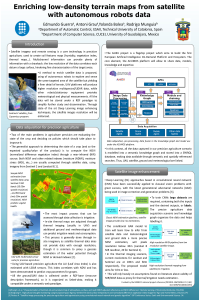
Satellite imagery and remote sensoring has been used for some years in agriculture, creating terrain maps for different soil features (humidity, vegetation index, …). Multichannel information provides lots of data but with a big drawback: the low density of information per surface unit, that is, the multichanneled pixels correspond to a large surface, and it is not possible a fine characterization of the targeted areas. In this research, authors propose the enrichment of such a data by the use of autonomous robots which explore and sense the same targeted area of the satellite but yielding a finer detail of terrain, complementing and fusing both information sources. The sensory elements of the autonomous robots are in the visual spectrum as well as in the near-infrared spectrum together with Lidar and radar information. This enrichment will provide to the final user a high-density map of the soil to improve crops, irrigation, seedling and other agricultural processes. The methodology to fuse data and create high-density maps will be deep learning techniques. The system will be validated in real fields with the use of real sensors to measure the data given by satellites and robots’ sensors.
Keywords
Autonomous robots
Satellite data
Remote sensing
Deep learning
Manuscript
sciforum-029791.pdf
Poster
IS3 Poster v02.pdf
Tungsten Oxide based Hydrogen Gas Sensor Prepared by Advanced Magnetron Sputtering
Photonic Biosensor for Label-Free Detection Based on Photonic Nanostructures on Si-Waveguide Ring Resonator