Event submissions
Published
 10.3390/I3S2021Dresden-10164 (registering DOI)
 This submission belongs to the session S4. Sensor Applications and Smart Systems of the event 8th International Symposium on Sensor Science
Published date
20 May, 2021
Citation
Juan-Carlos Trujillo, Rodrigo Munguia, Antoni Grau, Aerial cooperative SLAM for ground mobile robot path planning, in Proceedings of 8th International Symposium on Sensor Science, 17 May–28 May 2021, MDPI: Basel, Switzerland, doi: 10.3390/I3S2021Dresden-10164
Share
Email
Facebook
Twitter
LinkedIn
Aerial cooperative SLAM for ground mobile robot path planning
'%3e%3cpath%20d='M12.6647%2010.9104C12.4176%2010.325%2012.0589%209.7933%2011.6088%209.34485C11.16%208.89511%2010.6283%208.53653%2010.0432%208.28891C10.038%208.28629%2010.0327%208.28498%2010.0275%208.28236C10.8437%207.69282%2011.3743%206.73252%2011.3743%205.64907C11.3743%203.85423%209.92005%202.40002%208.12522%202.40002C6.33038%202.40002%204.87618%203.85423%204.87618%205.64907C4.87618%206.73252%205.40677%207.69282%206.22296%208.28367C6.21772%208.28629%206.21248%208.2876%206.20724%208.29022C5.62031%208.53783%205.09365%208.89287%204.64167%209.34616C4.19192%209.79496%203.83334%2010.3266%203.58573%2010.9117C3.34247%2011.4846%203.21128%2012.0987%203.19925%2012.721C3.1989%2012.735%203.20135%2012.7489%203.20646%2012.7619C3.21157%2012.7749%203.21924%2012.7868%203.22901%2012.7968C3.23877%2012.8068%203.25045%2012.8148%203.26334%2012.8202C3.27623%2012.8256%203.29007%2012.8284%203.30406%2012.8284H4.09012C4.14776%2012.8284%204.19362%2012.7825%204.19493%2012.7262C4.22113%2011.7148%204.62726%2010.7676%205.34519%2010.0497C6.08802%209.30686%207.07452%208.89811%208.12522%208.89811C9.17592%208.89811%2010.1624%209.30686%2010.9052%2010.0497C11.6232%2010.7676%2012.0293%2011.7148%2012.0555%2012.7262C12.0568%2012.7839%2012.1027%2012.8284%2012.1603%2012.8284H12.9464C12.9604%2012.8284%2012.9742%2012.8256%2012.9871%2012.8202C13%2012.8148%2013.0117%2012.8068%2013.0214%2012.7968C13.0312%2012.7868%2013.0389%2012.7749%2013.044%2012.7619C13.0491%2012.7489%2013.0515%2012.735%2013.0512%2012.721C13.0381%2012.0947%2012.9084%2011.4856%2012.6647%2010.9104ZM8.12522%207.90243C7.52388%207.90243%206.95792%207.66793%206.53214%207.24215C6.10636%206.81636%205.87185%206.2504%205.87185%205.64907C5.87185%205.04773%206.10636%204.48177%206.53214%204.05599C6.95792%203.63021%207.52388%203.3957%208.12522%203.3957C8.72655%203.3957%209.29252%203.63021%209.7183%204.05599C10.1441%204.48177%2010.3786%205.04773%2010.3786%205.64907C10.3786%206.2504%2010.1441%206.81636%209.7183%207.24215C9.29252%207.66793%208.72655%207.90243%208.12522%207.90243Z'%20fill='%235D1EE1'/%3e%3c/g%3e%3c/svg%3e)
Juan-Carlos Trujillo 1

Rodrigo Munguia 1

Antoni Grau 2
1. Department of Computer Science, CUCEI, University of Guadalajara, Guadalajara 44430, Mexico
2. Automatic Control Department, Technical University of Catalonia, 08034 Barcelona, Spain
Abstract
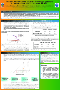
The trajectory planning for ground mobile robots operating in unknown environments can be a difficult task. In many cases, the sensors used for detecting obstacles only provide information about the immediate surroundings, making difficult to generate an efficient long term path. For instance, a robot can easily choose to move along a free path that eventually will have a dead end. This research is intended to develop a cooperative scheme of visual-based aerial simultaneous localization and mapping (SLAM) that will be used for generating a safe long-term trajectory for a ground mobile robot. The general idea is to take advantage of the high-altitude point of view that aerial robots can inherently have, for obtaining spatial information of a wide area of the surroundings of the robot. In this case, it could be seen as having a zenithal picture of the labyrinth for solving the robot's path. More specifically, the system will generate a wide-area spatial map of the ground robot’s obstacles from the images taken by a team of aerial robots equipped with onboard cameras, by means of a cooperative visual-based SLAM method. At the same time, the map will be used for generating a safe path for the ground mobile robot. While the ground robot moves, its onboard sensors will be used for refining the map and thus for avoiding obstacles that were not detected from the aerial images.
Keywords
visual sensing
autonomous robotics
computer vision
visual SLAM
Manuscript
sciforum-029811.pdf
Poster
sciforum-029811 Poster_Sensors_Congreso_A1-1.pdf
Disclosing the Sensitivity and Selectivity of Metal Oxide/Graphene Oxide-based Chemoresistors Towards VOCs
Acetone Bio-Sniffer (Gas-Phase Biosensor) for Monitoring of Human Volatile Using Enzymatic Reaction of Secondary Alcohol Dehydrogenase