Event submissions
Events1st International Online Conference on Agriculture - Advances in Agricultural Science and Technology
Published
 10.3390/IOCAG2022-12200 (registering DOI)
 This submission belongs to the session 10. Smart Farming: From Sensor to Artificial Intelligence of the event 1st International Online Conference on Agriculture - Advances in Agricultural Science and Technology
Published date
10 Feb, 2022
Academic Editor
'%3e%3cpath%20d='M12.6657%2010.9104C12.4185%2010.325%2012.0599%209.79327%2011.6097%209.34482C11.1609%208.89508%2010.6293%208.5365%2010.0442%208.28888C10.0389%208.28626%2010.0337%208.28495%2010.0285%208.28233C10.8446%207.69279%2011.3752%206.73249%2011.3752%205.64904C11.3752%203.8542%209.92103%202.39999%208.1262%202.39999C6.33136%202.39999%204.87715%203.8542%204.87715%205.64904C4.87715%206.73249%205.40774%207.69279%206.22393%208.28364C6.21869%208.28626%206.21345%208.28757%206.20821%208.29019C5.62129%208.5378%205.09463%208.89284%204.64265%209.34613C4.1929%209.79493%203.83432%2010.3266%203.58671%2010.9117C3.34345%2011.4845%203.21226%2012.0987%203.20023%2012.7209C3.19988%2012.7349%203.20233%2012.7488%203.20744%2012.7619C3.21255%2012.7749%203.22022%2012.7867%203.22998%2012.7968C3.23975%2012.8068%203.25142%2012.8147%203.26431%2012.8202C3.2772%2012.8256%203.29105%2012.8284%203.30504%2012.8284H4.09109C4.14874%2012.8284%204.19459%2012.7825%204.1959%2012.7262C4.2221%2011.7148%204.62823%2010.7676%205.34617%2010.0497C6.08899%209.30683%207.0755%208.89808%208.1262%208.89808C9.17689%208.89808%2010.1634%209.30683%2010.9062%2010.0497C11.6242%2010.7676%2012.0303%2011.7148%2012.0565%2012.7262C12.0578%2012.7838%2012.1037%2012.8284%2012.1613%2012.8284H12.9474C12.9613%2012.8284%2012.9752%2012.8256%2012.9881%2012.8202C13.001%2012.8147%2013.0126%2012.8068%2013.0224%2012.7968C13.0322%2012.7867%2013.0398%2012.7749%2013.0449%2012.7619C13.0501%2012.7488%2013.0525%2012.7349%2013.0522%2012.7209C13.0391%2012.0947%2012.9094%2011.4855%2012.6657%2010.9104ZM8.1262%207.9024C7.52486%207.9024%206.9589%207.6679%206.53312%207.24211C6.10733%206.81633%205.87283%206.25037%205.87283%205.64904C5.87283%205.0477%206.10733%204.48174%206.53312%204.05596C6.9589%203.63018%207.52486%203.39567%208.1262%203.39567C8.72753%203.39567%209.29349%203.63018%209.71927%204.05596C10.1451%204.48174%2010.3796%205.0477%2010.3796%205.64904C10.3796%206.25037%2010.1451%206.81633%209.71927%207.24211C9.29349%207.6679%208.72753%207.9024%208.1262%207.9024Z'%20fill='%235D1EE1'/%3e%3c/g%3e%3c/svg%3e) Francesco Marinello
Francesco MarinelloCitation
Melkamu Demelash Beyene, Dr .Binyam Tesfaw Hailu, Dr.Degefie Tibebe Degefie, Crop Field Classification using Data Fusion of Unmanned Aerial Vehicle (UAV) and Sentinel 2A satellite: the case of Oda Dhawata Kebele Cluster farmland, Oromia Region, Ethiopia, in Proceedings of 1st International Online Conference on Agriculture - Advances in Agricultural Science and Technology, 10 February–25 February 2022, MDPI: Basel, Switzerland, doi: 10.3390/IOCAG2022-12200
Share
Email
Facebook
Twitter
LinkedIn
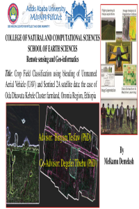
Crop Field Classification using Data Fusion of Unmanned Aerial Vehicle (UAV) and Sentinel 2A satellite: the case of Oda Dhawata Kebele Cluster farmland, Oromia Region, Ethiopia

Melkamu Demelash Beyene 1

Dr .Binyam Tesfaw Hailu 2
'%3e%3cpath%20d='M12.6647%2010.9104C12.4176%2010.325%2012.0589%209.7933%2011.6088%209.34485C11.16%208.89511%2010.6283%208.53653%2010.0432%208.28891C10.038%208.28629%2010.0327%208.28498%2010.0275%208.28236C10.8437%207.69282%2011.3743%206.73252%2011.3743%205.64907C11.3743%203.85423%209.92005%202.40002%208.12522%202.40002C6.33038%202.40002%204.87618%203.85423%204.87618%205.64907C4.87618%206.73252%205.40677%207.69282%206.22296%208.28367C6.21772%208.28629%206.21248%208.2876%206.20724%208.29022C5.62031%208.53783%205.09365%208.89287%204.64167%209.34616C4.19192%209.79496%203.83334%2010.3266%203.58573%2010.9117C3.34247%2011.4846%203.21128%2012.0987%203.19925%2012.721C3.1989%2012.735%203.20135%2012.7489%203.20646%2012.7619C3.21157%2012.7749%203.21924%2012.7868%203.22901%2012.7968C3.23877%2012.8068%203.25045%2012.8148%203.26334%2012.8202C3.27623%2012.8256%203.29007%2012.8284%203.30406%2012.8284H4.09012C4.14776%2012.8284%204.19362%2012.7825%204.19493%2012.7262C4.22113%2011.7148%204.62726%2010.7676%205.34519%2010.0497C6.08802%209.30686%207.07452%208.89811%208.12522%208.89811C9.17592%208.89811%2010.1624%209.30686%2010.9052%2010.0497C11.6232%2010.7676%2012.0293%2011.7148%2012.0555%2012.7262C12.0568%2012.7839%2012.1027%2012.8284%2012.1603%2012.8284H12.9464C12.9604%2012.8284%2012.9742%2012.8256%2012.9871%2012.8202C13%2012.8148%2013.0117%2012.8068%2013.0214%2012.7968C13.0312%2012.7868%2013.0389%2012.7749%2013.044%2012.7619C13.0491%2012.7489%2013.0515%2012.735%2013.0512%2012.721C13.0381%2012.0947%2012.9084%2011.4856%2012.6647%2010.9104ZM8.12522%207.90243C7.52388%207.90243%206.95792%207.66793%206.53214%207.24215C6.10636%206.81636%205.87185%206.2504%205.87185%205.64907C5.87185%205.04773%206.10636%204.48177%206.53214%204.05599C6.95792%203.63021%207.52388%203.3957%208.12522%203.3957C8.72655%203.3957%209.29252%203.63021%209.7183%204.05599C10.1441%204.48177%2010.3786%205.04773%2010.3786%205.64907C10.3786%206.2504%2010.1441%206.81636%209.7183%207.24215C9.29252%207.66793%208.72655%207.90243%208.12522%207.90243Z'%20fill='%235D1EE1'/%3e%3c/g%3e%3c/svg%3e)
Dr.Degefie Tibebe Degefie 3
1. Researcher , Ethiopian Institute of Agricultural Research ,(climate ,geospatial and biometric program ),Ethiopia
2. Lecturer at School of Earth Sciences, Addis Ababa University, Ethiopia.
3. Researcher and Lecturer at Water and Land Resource Center, Addis Ababa University
Abstract
Accurate crop classification using remote sensing based satellite imageries approach remains challenging due to mix in spectral signatures. Employing Unmanned Aerial Vehicle (UAV) together with satellite imageries is believed in improving crop classification at field. Accordingly, this study aims to evaluate the potential of UAV images by blending with Sentinel 2A satellite images for crop field classification in Ethiopian agricultural context. The main purpose of the blending is to upgrade and or improve the lower resolution of the data source that is the sentinel 2A data which was 10m resolution. In the study, UAV data was used and preprocessed. The preprocessing includes camera calibration, photo alignment, dense point cloud generation based on the estimated camera positioning of scouting crop types. Then, orthomosaic UAV image was generated from single dense point cloud. Then, the processed UAV data was fused with Sentinel 2A (medium resolution) satellite data using Gram Schmidt pan sharpening method.this method is the most approach that it can run large data sets of spatial resultions. For crop classification, the Random forest (RF) machine-learning algorithm and Maximum likelihood methods were applied. Apart from the UAV and S2A data, field data was collected for training the crop classification. The point field data was collected from Teff, Wheat, Faba bean, Barley and Sorghum crop fields The results show that RF classifier algorithm classifies the crop types with 94% overall accuracy whereas the Maximum likelihood classifier with 90% overall accuracy. This implies that fused image has a potential to be used for crop type classification together with relatively better classification technique with high accuracy level
Keywords
UAV
Sentinel 2A
fusion
Random forest
maximum likelihood and crop type classification.
Manuscript
sciforum-056682.pdf
Poster
Melkamu D .Msc thesis presentation.pdf
Influence of maturity stage on polyphenolic content and antioxidant activity of fig (Ficus carica L.) fruit in native Albanian varieties
Effects of superabsorbent polymer on yield and yield components of Sesame under water deficit conditions