Event submissions
EventsThe 3rd International Electronic Conference on Forests — Exploring New Discoveries and New Directions in Forests
Published

This submission belongs to the session S7. Forest Wildfires and Other Natural Hazards of the event The 3rd International Electronic Conference on Forests — Exploring New Discoveries and New Directions in Forests
Published date
15 Oct, 2022
Academic Editor
'%3e%3cpath%20d='M12.6657%2010.9104C12.4185%2010.325%2012.0599%209.79327%2011.6097%209.34482C11.1609%208.89508%2010.6293%208.5365%2010.0442%208.28888C10.0389%208.28626%2010.0337%208.28495%2010.0285%208.28233C10.8446%207.69279%2011.3752%206.73249%2011.3752%205.64904C11.3752%203.8542%209.92103%202.39999%208.1262%202.39999C6.33136%202.39999%204.87715%203.8542%204.87715%205.64904C4.87715%206.73249%205.40774%207.69279%206.22393%208.28364C6.21869%208.28626%206.21345%208.28757%206.20821%208.29019C5.62129%208.5378%205.09463%208.89284%204.64265%209.34613C4.1929%209.79493%203.83432%2010.3266%203.58671%2010.9117C3.34345%2011.4845%203.21226%2012.0987%203.20023%2012.7209C3.19988%2012.7349%203.20233%2012.7488%203.20744%2012.7619C3.21255%2012.7749%203.22022%2012.7867%203.22998%2012.7968C3.23975%2012.8068%203.25142%2012.8147%203.26431%2012.8202C3.2772%2012.8256%203.29105%2012.8284%203.30504%2012.8284H4.09109C4.14874%2012.8284%204.19459%2012.7825%204.1959%2012.7262C4.2221%2011.7148%204.62823%2010.7676%205.34617%2010.0497C6.08899%209.30683%207.0755%208.89808%208.1262%208.89808C9.17689%208.89808%2010.1634%209.30683%2010.9062%2010.0497C11.6242%2010.7676%2012.0303%2011.7148%2012.0565%2012.7262C12.0578%2012.7838%2012.1037%2012.8284%2012.1613%2012.8284H12.9474C12.9613%2012.8284%2012.9752%2012.8256%2012.9881%2012.8202C13.001%2012.8147%2013.0126%2012.8068%2013.0224%2012.7968C13.0322%2012.7867%2013.0398%2012.7749%2013.0449%2012.7619C13.0501%2012.7488%2013.0525%2012.7349%2013.0522%2012.7209C13.0391%2012.0947%2012.9094%2011.4855%2012.6657%2010.9104ZM8.1262%207.9024C7.52486%207.9024%206.9589%207.6679%206.53312%207.24211C6.10733%206.81633%205.87283%206.25037%205.87283%205.64904C5.87283%205.0477%206.10733%204.48174%206.53312%204.05596C6.9589%203.63018%207.52486%203.39567%208.1262%203.39567C8.72753%203.39567%209.29349%203.63018%209.71927%204.05596C10.1451%204.48174%2010.3796%205.0477%2010.3796%205.64904C10.3796%206.25037%2010.1451%206.81633%209.71927%207.24211C9.29349%207.6679%208.72753%207.9024%208.1262%207.9024Z'%20fill='%235D1EE1'/%3e%3c/g%3e%3c/svg%3e) Olga Viedma
Olga ViedmaCitation
Corina Sanucci, Sofía Laura Gonzalez, Luciana Ghermandi, Mapping the wildland-urban interface using structure locations and terrain slope in Patagonia Argentina, in Proceedings of The 3rd International Electronic Conference on Forests — Exploring New Discoveries and New Directions in Forests, 15 October–31 October 2022, MDPI: Basel, Switzerland, doi: 10.3390/IECF2022-13041
Share
Email
Facebook
Twitter
LinkedIn
Mapping the wildland-urban interface using structure locations and terrain slope in Patagonia Argentina
'%3e%3cpath%20d='M12.6647%2010.9104C12.4176%2010.325%2012.0589%209.7933%2011.6088%209.34485C11.16%208.89511%2010.6283%208.53653%2010.0432%208.28891C10.038%208.28629%2010.0327%208.28498%2010.0275%208.28236C10.8437%207.69282%2011.3743%206.73252%2011.3743%205.64907C11.3743%203.85423%209.92005%202.40002%208.12522%202.40002C6.33038%202.40002%204.87618%203.85423%204.87618%205.64907C4.87618%206.73252%205.40677%207.69282%206.22296%208.28367C6.21772%208.28629%206.21248%208.2876%206.20724%208.29022C5.62031%208.53783%205.09365%208.89287%204.64167%209.34616C4.19192%209.79496%203.83334%2010.3266%203.58573%2010.9117C3.34247%2011.4846%203.21128%2012.0987%203.19925%2012.721C3.1989%2012.735%203.20135%2012.7489%203.20646%2012.7619C3.21157%2012.7749%203.21924%2012.7868%203.22901%2012.7968C3.23877%2012.8068%203.25045%2012.8148%203.26334%2012.8202C3.27623%2012.8256%203.29007%2012.8284%203.30406%2012.8284H4.09012C4.14776%2012.8284%204.19362%2012.7825%204.19493%2012.7262C4.22113%2011.7148%204.62726%2010.7676%205.34519%2010.0497C6.08802%209.30686%207.07452%208.89811%208.12522%208.89811C9.17592%208.89811%2010.1624%209.30686%2010.9052%2010.0497C11.6232%2010.7676%2012.0293%2011.7148%2012.0555%2012.7262C12.0568%2012.7839%2012.1027%2012.8284%2012.1603%2012.8284H12.9464C12.9604%2012.8284%2012.9742%2012.8256%2012.9871%2012.8202C13%2012.8148%2013.0117%2012.8068%2013.0214%2012.7968C13.0312%2012.7868%2013.0389%2012.7749%2013.044%2012.7619C13.0491%2012.7489%2013.0515%2012.735%2013.0512%2012.721C13.0381%2012.0947%2012.9084%2011.4856%2012.6647%2010.9104ZM8.12522%207.90243C7.52388%207.90243%206.95792%207.66793%206.53214%207.24215C6.10636%206.81636%205.87185%206.2504%205.87185%205.64907C5.87185%205.04773%206.10636%204.48177%206.53214%204.05599C6.95792%203.63021%207.52388%203.3957%208.12522%203.3957C8.72655%203.3957%209.29252%203.63021%209.7183%204.05599C10.1441%204.48177%2010.3786%205.04773%2010.3786%205.64907C10.3786%206.2504%2010.1441%206.81636%209.7183%207.24215C9.29252%207.66793%208.72655%207.90243%208.12522%207.90243Z'%20fill='%235D1EE1'/%3e%3c/g%3e%3c/svg%3e)
Corina Sanucci 1
Sofía Laura Gonzalez 1
Luciana Ghermandi 1
1. Instituto de Investigaciones en Biodiversidad y Medioambiente, CONICET, Quintral 1250, Bariloche 8400, Argentina
Abstract
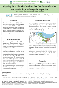
Residential development in forested areas increases the wildland-urban interface (WUI); in this area, wildfires are the primary conflict for humans and ecosystems. The methodologies to determine the WUI use dwellings location and vegetation fuels. The main difference in the WUI mapping has been the application of housing density limits and the maximum extent from houses into vegetation. Our objectives were to (i) determine the wildland-urban interface using a novel approach in the city of Bariloche, in NW Patagonia, Argentina; and (i) evaluate the relationship between the WUI and fire ignition points. We mapped the WUI based on housing information derived from a recently released building footprint dataset, land-cover data, and a digital elevation model. Our method improves the accuracy of mapping based on local terrain conditions, making it possible to apply it for local management and planning. The determined WUI has higher extension under steep slopes ascending towards dwellings (>20%), where the rate of fire spread is high. In 2021, the wildland-urban interface in Bariloche included 89% of the buildings, even though it occupied 25% (133 km2) of the municipal district. Between 2016-2018, 90% of fire ignitions occurred in the WUI, highlighting the importance of the WUI for planning and management to reduce wildfire risk.
Keywords
Wildland-urban interface
fire ignitions
wildfire risk
Andean Patagonian region
Manuscript
sciforum-062368.pdf
Poster
Poster-2022-Sanucci.pdf
A new Model for Calculating the Impact of Forests and Wood Use on the Balance of С-СО2 in the Earth's Atmosphere
Properties of thermally modified woods by a Brazilian process