Event submissions
Published

This submission belongs to the session F. Hydrological Extremes, Hazards and Disasters of the event The 7th International Electronic Conference on Water Sciences
Published date
16 Mar, 2023
Academic Editor
'%3e%3cpath%20d='M12.6657%2010.9104C12.4185%2010.325%2012.0599%209.79327%2011.6097%209.34482C11.1609%208.89508%2010.6293%208.5365%2010.0442%208.28888C10.0389%208.28626%2010.0337%208.28495%2010.0285%208.28233C10.8446%207.69279%2011.3752%206.73249%2011.3752%205.64904C11.3752%203.8542%209.92103%202.39999%208.1262%202.39999C6.33136%202.39999%204.87715%203.8542%204.87715%205.64904C4.87715%206.73249%205.40774%207.69279%206.22393%208.28364C6.21869%208.28626%206.21345%208.28757%206.20821%208.29019C5.62129%208.5378%205.09463%208.89284%204.64265%209.34613C4.1929%209.79493%203.83432%2010.3266%203.58671%2010.9117C3.34345%2011.4845%203.21226%2012.0987%203.20023%2012.7209C3.19988%2012.7349%203.20233%2012.7488%203.20744%2012.7619C3.21255%2012.7749%203.22022%2012.7867%203.22998%2012.7968C3.23975%2012.8068%203.25142%2012.8147%203.26431%2012.8202C3.2772%2012.8256%203.29105%2012.8284%203.30504%2012.8284H4.09109C4.14874%2012.8284%204.19459%2012.7825%204.1959%2012.7262C4.2221%2011.7148%204.62823%2010.7676%205.34617%2010.0497C6.08899%209.30683%207.0755%208.89808%208.1262%208.89808C9.17689%208.89808%2010.1634%209.30683%2010.9062%2010.0497C11.6242%2010.7676%2012.0303%2011.7148%2012.0565%2012.7262C12.0578%2012.7838%2012.1037%2012.8284%2012.1613%2012.8284H12.9474C12.9613%2012.8284%2012.9752%2012.8256%2012.9881%2012.8202C13.001%2012.8147%2013.0126%2012.8068%2013.0224%2012.7968C13.0322%2012.7867%2013.0398%2012.7749%2013.0449%2012.7619C13.0501%2012.7488%2013.0525%2012.7349%2013.0522%2012.7209C13.0391%2012.0947%2012.9094%2011.4855%2012.6657%2010.9104ZM8.1262%207.9024C7.52486%207.9024%206.9589%207.6679%206.53312%207.24211C6.10733%206.81633%205.87283%206.25037%205.87283%205.64904C5.87283%205.0477%206.10733%204.48174%206.53312%204.05596C6.9589%203.63018%207.52486%203.39567%208.1262%203.39567C8.72753%203.39567%209.29349%203.63018%209.71927%204.05596C10.1451%204.48174%2010.3796%205.0477%2010.3796%205.64904C10.3796%206.25037%2010.1451%206.81633%209.71927%207.24211C9.29349%207.6679%208.72753%207.9024%208.1262%207.9024Z'%20fill='%235D1EE1'/%3e%3c/g%3e%3c/svg%3e) ATHANASIOS LOUKAS
ATHANASIOS LOUKASCitation
Heather McGrath, Piper Norah Gohl, Prediction and classification of flood susceptibility based on historic record in a large, diverse, and data sparse country, in Proceedings of The 7th International Electronic Conference on Water Sciences, 15 March–30 March 2023, MDPI: Basel, Switzerland, doi: 10.3390/ECWS-7-14235
Share
Email
Facebook
Twitter
LinkedIn
Prediction and classification of flood susceptibility based on historic record in a large, diverse, and data sparse country
'%3e%3cpath%20d='M12.6647%2010.9104C12.4176%2010.325%2012.0589%209.7933%2011.6088%209.34485C11.16%208.89511%2010.6283%208.53653%2010.0432%208.28891C10.038%208.28629%2010.0327%208.28498%2010.0275%208.28236C10.8437%207.69282%2011.3743%206.73252%2011.3743%205.64907C11.3743%203.85423%209.92005%202.40002%208.12522%202.40002C6.33038%202.40002%204.87618%203.85423%204.87618%205.64907C4.87618%206.73252%205.40677%207.69282%206.22296%208.28367C6.21772%208.28629%206.21248%208.2876%206.20724%208.29022C5.62031%208.53783%205.09365%208.89287%204.64167%209.34616C4.19192%209.79496%203.83334%2010.3266%203.58573%2010.9117C3.34247%2011.4846%203.21128%2012.0987%203.19925%2012.721C3.1989%2012.735%203.20135%2012.7489%203.20646%2012.7619C3.21157%2012.7749%203.21924%2012.7868%203.22901%2012.7968C3.23877%2012.8068%203.25045%2012.8148%203.26334%2012.8202C3.27623%2012.8256%203.29007%2012.8284%203.30406%2012.8284H4.09012C4.14776%2012.8284%204.19362%2012.7825%204.19493%2012.7262C4.22113%2011.7148%204.62726%2010.7676%205.34519%2010.0497C6.08802%209.30686%207.07452%208.89811%208.12522%208.89811C9.17592%208.89811%2010.1624%209.30686%2010.9052%2010.0497C11.6232%2010.7676%2012.0293%2011.7148%2012.0555%2012.7262C12.0568%2012.7839%2012.1027%2012.8284%2012.1603%2012.8284H12.9464C12.9604%2012.8284%2012.9742%2012.8256%2012.9871%2012.8202C13%2012.8148%2013.0117%2012.8068%2013.0214%2012.7968C13.0312%2012.7868%2013.0389%2012.7749%2013.044%2012.7619C13.0491%2012.7489%2013.0515%2012.735%2013.0512%2012.721C13.0381%2012.0947%2012.9084%2011.4856%2012.6647%2010.9104ZM8.12522%207.90243C7.52388%207.90243%206.95792%207.66793%206.53214%207.24215C6.10636%206.81636%205.87185%206.2504%205.87185%205.64907C5.87185%205.04773%206.10636%204.48177%206.53214%204.05599C6.95792%203.63021%207.52388%203.3957%208.12522%203.3957C8.72655%203.3957%209.29252%203.63021%209.7183%204.05599C10.1441%204.48177%2010.3786%205.04773%2010.3786%205.64907C10.3786%206.2504%2010.1441%206.81636%209.7183%207.24215C9.29252%207.66793%208.72655%207.90243%208.12522%207.90243Z'%20fill='%235D1EE1'/%3e%3c/g%3e%3c/svg%3e)
Heather McGrath 1
Piper Norah Gohl 1
1. Natural Resources Canada
Abstract
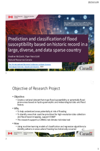
The emergence of Machine learning (ML) algorithms have shown competency in a variety of fields and are growing in popularity in their application to geospatial science issues. Most recently and notably, ML algorithms have been applied to flood susceptibility (FS) mapping. Leveraging high power computing systems and existing ML algorithms with national datasets of Canada, this project has explored methods to create a national FS layer across a geographically large and diverse country with limited training data. First, approaches were considered on how to generate a map of FS for Canada, (i) national, which combined all training data into one model, and (ii) regional, where multiple models were created, based on regional similarities, and the results were mosaicked to generate a FS map. The second experiment explored the predictive capability of several ML algorithms across the geographically large and diverse landscape. Results indicate that the national approach provides a better prediction of FS, with 95.7 % of the test points, 91.5% of the pixels in the training sites, and 89.6% of the pixels across the country correctly predicted as flooded, compared to 65.5%, 80.6% and 75.6% respectively in the regional approach. ML models applied across the country found that support vector machine (svmRadial) and Neural Network (nnet) performed poorly in areas away from the training sites, while random forest (parRF) and Multivariate Adaptive Regression Spline (earth) performed better. A national ensemble model was ultimately selected as this blend of models compensated for the biases found in the individual models in geographic areas far removed training sites.
Keywords
flood susceptibility
Canada
machine learning
flood priority setting
Manuscript
sciforum-068368.pdf
Poster
sciforum-068368_PPTX_McGrath.pdf
“APPLICATION OF EPANET 2.0 SOFTWARE AND JAL-TANTRA WEB SYSTEM FOR OPTIMAL HYDRAULIC DESIGN OF WATER DISTRIBUTION SYSTEM FOR UNIVERSITY OF KASHMIR”
Time Series based Air Temperature forecasting based on the Outlier Robust Extreme Learning Machine