Event submissions
Published

This submission belongs to the session H. Urban and Agricultural Water Systems of the event The 7th International Electronic Conference on Water Sciences
Published date
16 Mar, 2023
Academic Editor
'%3e%3cpath%20d='M12.6657%2010.9104C12.4185%2010.325%2012.0599%209.79327%2011.6097%209.34482C11.1609%208.89508%2010.6293%208.5365%2010.0442%208.28888C10.0389%208.28626%2010.0337%208.28495%2010.0285%208.28233C10.8446%207.69279%2011.3752%206.73249%2011.3752%205.64904C11.3752%203.8542%209.92103%202.39999%208.1262%202.39999C6.33136%202.39999%204.87715%203.8542%204.87715%205.64904C4.87715%206.73249%205.40774%207.69279%206.22393%208.28364C6.21869%208.28626%206.21345%208.28757%206.20821%208.29019C5.62129%208.5378%205.09463%208.89284%204.64265%209.34613C4.1929%209.79493%203.83432%2010.3266%203.58671%2010.9117C3.34345%2011.4845%203.21226%2012.0987%203.20023%2012.7209C3.19988%2012.7349%203.20233%2012.7488%203.20744%2012.7619C3.21255%2012.7749%203.22022%2012.7867%203.22998%2012.7968C3.23975%2012.8068%203.25142%2012.8147%203.26431%2012.8202C3.2772%2012.8256%203.29105%2012.8284%203.30504%2012.8284H4.09109C4.14874%2012.8284%204.19459%2012.7825%204.1959%2012.7262C4.2221%2011.7148%204.62823%2010.7676%205.34617%2010.0497C6.08899%209.30683%207.0755%208.89808%208.1262%208.89808C9.17689%208.89808%2010.1634%209.30683%2010.9062%2010.0497C11.6242%2010.7676%2012.0303%2011.7148%2012.0565%2012.7262C12.0578%2012.7838%2012.1037%2012.8284%2012.1613%2012.8284H12.9474C12.9613%2012.8284%2012.9752%2012.8256%2012.9881%2012.8202C13.001%2012.8147%2013.0126%2012.8068%2013.0224%2012.7968C13.0322%2012.7867%2013.0398%2012.7749%2013.0449%2012.7619C13.0501%2012.7488%2013.0525%2012.7349%2013.0522%2012.7209C13.0391%2012.0947%2012.9094%2011.4855%2012.6657%2010.9104ZM8.1262%207.9024C7.52486%207.9024%206.9589%207.6679%206.53312%207.24211C6.10733%206.81633%205.87283%206.25037%205.87283%205.64904C5.87283%205.0477%206.10733%204.48174%206.53312%204.05596C6.9589%203.63018%207.52486%203.39567%208.1262%203.39567C8.72753%203.39567%209.29349%203.63018%209.71927%204.05596C10.1451%204.48174%2010.3796%205.0477%2010.3796%205.64904C10.3796%206.25037%2010.1451%206.81633%209.71927%207.24211C9.29349%207.6679%208.72753%207.9024%208.1262%207.9024Z'%20fill='%235D1EE1'/%3e%3c/g%3e%3c/svg%3e) ATHANASIOS LOUKAS
ATHANASIOS LOUKASCitation
Usha Pandya, Ashwini Mudaliar, Amol Gaikwad, Forecasting of Banana Crop Productivity using Geospatial Approach: A Case Study of Anand District, in Proceedings of The 7th International Electronic Conference on Water Sciences, 15 March–30 March 2023, MDPI: Basel, Switzerland, doi: 10.3390/ECWS-7-14248
Share
Email
Facebook
Twitter
LinkedIn
Forecasting of Banana Crop Productivity using Geospatial Approach: A Case Study of Anand District
'%3e%3cpath%20d='M12.6647%2010.9104C12.4176%2010.325%2012.0589%209.7933%2011.6088%209.34485C11.16%208.89511%2010.6283%208.53653%2010.0432%208.28891C10.038%208.28629%2010.0327%208.28498%2010.0275%208.28236C10.8437%207.69282%2011.3743%206.73252%2011.3743%205.64907C11.3743%203.85423%209.92005%202.40002%208.12522%202.40002C6.33038%202.40002%204.87618%203.85423%204.87618%205.64907C4.87618%206.73252%205.40677%207.69282%206.22296%208.28367C6.21772%208.28629%206.21248%208.2876%206.20724%208.29022C5.62031%208.53783%205.09365%208.89287%204.64167%209.34616C4.19192%209.79496%203.83334%2010.3266%203.58573%2010.9117C3.34247%2011.4846%203.21128%2012.0987%203.19925%2012.721C3.1989%2012.735%203.20135%2012.7489%203.20646%2012.7619C3.21157%2012.7749%203.21924%2012.7868%203.22901%2012.7968C3.23877%2012.8068%203.25045%2012.8148%203.26334%2012.8202C3.27623%2012.8256%203.29007%2012.8284%203.30406%2012.8284H4.09012C4.14776%2012.8284%204.19362%2012.7825%204.19493%2012.7262C4.22113%2011.7148%204.62726%2010.7676%205.34519%2010.0497C6.08802%209.30686%207.07452%208.89811%208.12522%208.89811C9.17592%208.89811%2010.1624%209.30686%2010.9052%2010.0497C11.6232%2010.7676%2012.0293%2011.7148%2012.0555%2012.7262C12.0568%2012.7839%2012.1027%2012.8284%2012.1603%2012.8284H12.9464C12.9604%2012.8284%2012.9742%2012.8256%2012.9871%2012.8202C13%2012.8148%2013.0117%2012.8068%2013.0214%2012.7968C13.0312%2012.7868%2013.0389%2012.7749%2013.044%2012.7619C13.0491%2012.7489%2013.0515%2012.735%2013.0512%2012.721C13.0381%2012.0947%2012.9084%2011.4856%2012.6647%2010.9104ZM8.12522%207.90243C7.52388%207.90243%206.95792%207.66793%206.53214%207.24215C6.10636%206.81636%205.87185%206.2504%205.87185%205.64907C5.87185%205.04773%206.10636%204.48177%206.53214%204.05599C6.95792%203.63021%207.52388%203.3957%208.12522%203.3957C8.72655%203.3957%209.29252%203.63021%209.7183%204.05599C10.1441%204.48177%2010.3786%205.04773%2010.3786%205.64907C10.3786%206.2504%2010.1441%206.81636%209.7183%207.24215C9.29252%207.66793%208.72655%207.90243%208.12522%207.90243Z'%20fill='%235D1EE1'/%3e%3c/g%3e%3c/svg%3e)
Usha Pandya 1
Ashwini Mudaliar 2
Amol Gaikwad 3
1. Department of Botany, Government College, Daman, Daman-396210
2. Department of Botany, Faculty of Science, The Maharaja Sayajirao University Of Baroda
Vadodara-390002
3. Government College, Daman, Nani Daman, Daman-396210
Abstract
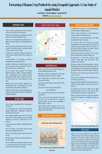
Banana is one of the main fruit crops in the world as it has gained importance in the global market due to its high source of nutrients and fiber content for many industries. Owing to climate change and irregular precipitation, the yield of banana crops is becoming very unpredictable and thus, there is a need to understand the impact of climatic parameters on the yield. Mathematical models are crucial for strategic and forecasting applications; however, models related to the banana crop are less common, and reviews on previous modelling efforts are scarce, emphasizing the need for evidence-based studies on this topic. This study employs the geospatial approach to establish a relationship between climatic variables and banana crop productivity of Anand district of Gujarat, India. Sentinel data was utilized to derive various indices like Normalized Difference Vegetation Index (NDVI), Leaf Area Index (LAI), Enhanced Vegetation Index (EVI) and Normalized Difference Water Index (NDWI). Land Surface Temperature (LST) was also derived using Landsat dataset. Evapotranspiration data was also considered while understanding the impact of these parameters on yield. Values were extracted based on the ground control points (GCP) of different agricultural fields of study area. Derived data was analyzed using different statistical tools to understand the relationship between different indices and productivity of banana crop. Results indicated that the banana yield is highly dependent on water availability and evapotranspiration of the study area proving that these parameters can be utilized for generating predicting models of banana yield.
Keywords
Banana
Sentinel data
Landsat
EVI
NDWI
Evapotransipration
Manuscript
sciforum-068779.pdf
Poster
poster_new_Usha_25 Jan 2023.pdf
Clay based sorbents for environmental protection from inorganic pollutants
Pathways of Antarctic Bottom Water propagation in the Atlantic