Event submissions
Published

This submission belongs to the session S1. Remote sensing systems and techniques of the event The 5th International Electronic Conference on Remote Sensing
Published date
14 Nov, 2023
Academic Editor
'%3e%3cpath%20d='M12.6657%2010.9104C12.4185%2010.325%2012.0599%209.79327%2011.6097%209.34482C11.1609%208.89508%2010.6293%208.5365%2010.0442%208.28888C10.0389%208.28626%2010.0337%208.28495%2010.0285%208.28233C10.8446%207.69279%2011.3752%206.73249%2011.3752%205.64904C11.3752%203.8542%209.92103%202.39999%208.1262%202.39999C6.33136%202.39999%204.87715%203.8542%204.87715%205.64904C4.87715%206.73249%205.40774%207.69279%206.22393%208.28364C6.21869%208.28626%206.21345%208.28757%206.20821%208.29019C5.62129%208.5378%205.09463%208.89284%204.64265%209.34613C4.1929%209.79493%203.83432%2010.3266%203.58671%2010.9117C3.34345%2011.4845%203.21226%2012.0987%203.20023%2012.7209C3.19988%2012.7349%203.20233%2012.7488%203.20744%2012.7619C3.21255%2012.7749%203.22022%2012.7867%203.22998%2012.7968C3.23975%2012.8068%203.25142%2012.8147%203.26431%2012.8202C3.2772%2012.8256%203.29105%2012.8284%203.30504%2012.8284H4.09109C4.14874%2012.8284%204.19459%2012.7825%204.1959%2012.7262C4.2221%2011.7148%204.62823%2010.7676%205.34617%2010.0497C6.08899%209.30683%207.0755%208.89808%208.1262%208.89808C9.17689%208.89808%2010.1634%209.30683%2010.9062%2010.0497C11.6242%2010.7676%2012.0303%2011.7148%2012.0565%2012.7262C12.0578%2012.7838%2012.1037%2012.8284%2012.1613%2012.8284H12.9474C12.9613%2012.8284%2012.9752%2012.8256%2012.9881%2012.8202C13.001%2012.8147%2013.0126%2012.8068%2013.0224%2012.7968C13.0322%2012.7867%2013.0398%2012.7749%2013.0449%2012.7619C13.0501%2012.7488%2013.0525%2012.7349%2013.0522%2012.7209C13.0391%2012.0947%2012.9094%2011.4855%2012.6657%2010.9104ZM8.1262%207.9024C7.52486%207.9024%206.9589%207.6679%206.53312%207.24211C6.10733%206.81633%205.87283%206.25037%205.87283%205.64904C5.87283%205.0477%206.10733%204.48174%206.53312%204.05596C6.9589%203.63018%207.52486%203.39567%208.1262%203.39567C8.72753%203.39567%209.29349%203.63018%209.71927%204.05596C10.1451%204.48174%2010.3796%205.0477%2010.3796%205.64904C10.3796%206.25037%2010.1451%206.81633%209.71927%207.24211C9.29349%207.6679%208.72753%207.9024%208.1262%207.9024Z'%20fill='%235D1EE1'/%3e%3c/g%3e%3c/svg%3e) Luca Lelli
Luca LelliCitation
Mehdi Khoshboresh-Masouleh, Reza Shah-Hosseini, Drone-based Smart Weed Localization from Limited Training Data and Radiometric Calibration Parameters, in Proceedings of The 5th International Electronic Conference on Remote Sensing, 7 November–21 November 2023, MDPI: Basel, Switzerland, doi: 10.3390/ECRS2023-15854
Share
Email
Facebook
Twitter
LinkedIn
Drone-based Smart Weed Localization from Limited Training Data and Radiometric Calibration Parameters
'%3e%3cpath%20d='M12.6647%2010.9104C12.4176%2010.325%2012.0589%209.7933%2011.6088%209.34485C11.16%208.89511%2010.6283%208.53653%2010.0432%208.28891C10.038%208.28629%2010.0327%208.28498%2010.0275%208.28236C10.8437%207.69282%2011.3743%206.73252%2011.3743%205.64907C11.3743%203.85423%209.92005%202.40002%208.12522%202.40002C6.33038%202.40002%204.87618%203.85423%204.87618%205.64907C4.87618%206.73252%205.40677%207.69282%206.22296%208.28367C6.21772%208.28629%206.21248%208.2876%206.20724%208.29022C5.62031%208.53783%205.09365%208.89287%204.64167%209.34616C4.19192%209.79496%203.83334%2010.3266%203.58573%2010.9117C3.34247%2011.4846%203.21128%2012.0987%203.19925%2012.721C3.1989%2012.735%203.20135%2012.7489%203.20646%2012.7619C3.21157%2012.7749%203.21924%2012.7868%203.22901%2012.7968C3.23877%2012.8068%203.25045%2012.8148%203.26334%2012.8202C3.27623%2012.8256%203.29007%2012.8284%203.30406%2012.8284H4.09012C4.14776%2012.8284%204.19362%2012.7825%204.19493%2012.7262C4.22113%2011.7148%204.62726%2010.7676%205.34519%2010.0497C6.08802%209.30686%207.07452%208.89811%208.12522%208.89811C9.17592%208.89811%2010.1624%209.30686%2010.9052%2010.0497C11.6232%2010.7676%2012.0293%2011.7148%2012.0555%2012.7262C12.0568%2012.7839%2012.1027%2012.8284%2012.1603%2012.8284H12.9464C12.9604%2012.8284%2012.9742%2012.8256%2012.9871%2012.8202C13%2012.8148%2013.0117%2012.8068%2013.0214%2012.7968C13.0312%2012.7868%2013.0389%2012.7749%2013.044%2012.7619C13.0491%2012.7489%2013.0515%2012.735%2013.0512%2012.721C13.0381%2012.0947%2012.9084%2011.4856%2012.6647%2010.9104ZM8.12522%207.90243C7.52388%207.90243%206.95792%207.66793%206.53214%207.24215C6.10636%206.81636%205.87185%206.2504%205.87185%205.64907C5.87185%205.04773%206.10636%204.48177%206.53214%204.05599C6.95792%203.63021%207.52388%203.3957%208.12522%203.3957C8.72655%203.3957%209.29252%203.63021%209.7183%204.05599C10.1441%204.48177%2010.3786%205.04773%2010.3786%205.64907C10.3786%206.2504%2010.1441%206.81636%209.7183%207.24215C9.29252%207.66793%208.72655%207.90243%208.12522%207.90243Z'%20fill='%235D1EE1'/%3e%3c/g%3e%3c/svg%3e)
Mehdi Khoshboresh-Masouleh 1

Reza Shah-Hosseini 2
1. School of Surveying and Geospatial Engineering, College of Engineering, University of Tehran, Tehran, Iran
2. School of Surveying and Geospatial Engineering, College of Engineering, University of Tehran, Iran
Abstract
Increased world population growth will demand more high-quality food production, which can only be achieved by applying a sustainable method for increasing crop yields. According to the Food and Agriculture Organization (FAO) report, weed grasses increase the environmental and economic costs of pesticide use by spreading them across farm boundaries, and their competition with agricultural crops reduces quantity and quality output. Among the pests, weed grasses are considered a crucial biotic constraint to food production. In traditional pest control methods in agriculture, most farm fields are spatially variable in grass weed infestation to a certain degree, but general weed management methods for herbicide application are based on the assumption that grass weeds are distributed uniformly in agricultural fields. However, a smart weed localization system for optimized herbicide dose in the agricultural field is a crucial step for smart farming and is still an open problem in pest control methods. While many object detection models appear to understand localization with a huge training data, a few-shot learning strategy potentially improves scene understanding with limited training data. In this study, the purpose of weed grasses localization from drone-based multispectral images is to locate the weed on large-scale images by using pixel-wise classification. Weed grasses localization with the use of uncertainty modeling in few-shot learning for drone-based multispectral images potentially improves multispectral scene understanding with a small training dataset, while many weed detection methods appear to understand single-time localization with a big training dataset. Few-shot learning can perform on unseen tasks after training a few annotated data and considers several tasks to produce a predictive function, and is an inductive transfer system whose main goal is to improve generalization ability for multiple tasks. Weed grasses localization of the trained model can be just blindly assumed accurate but the truth is not for decision making.
Keywords
Few-shot Learning
Weed Grasses Monitoring
Drone Imagery
Deep Learning
Limited Training Data.
Manuscript
environsciproc-sciforum-077487.pdf
Poster
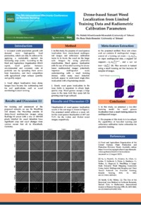
Khoshboresh_ECRS2023_Poster.v8.pdf
Coastal Vegetation Change Detection Using Remote Sensing Approach
A methodological approach for assessing the resilience of Pinus halepensis L. plant communities using UAV-LiDAR data