Event submissions
Published
This submission belongs to the session S1. Remote sensing systems and techniques of the event The 5th International Electronic Conference on Remote Sensing
Published date
11 Dec, 2023
Academic Editor
'%3e%3cpath%20d='M12.6657%2010.9104C12.4185%2010.325%2012.0599%209.79327%2011.6097%209.34482C11.1609%208.89508%2010.6293%208.5365%2010.0442%208.28888C10.0389%208.28626%2010.0337%208.28495%2010.0285%208.28233C10.8446%207.69279%2011.3752%206.73249%2011.3752%205.64904C11.3752%203.8542%209.92103%202.39999%208.1262%202.39999C6.33136%202.39999%204.87715%203.8542%204.87715%205.64904C4.87715%206.73249%205.40774%207.69279%206.22393%208.28364C6.21869%208.28626%206.21345%208.28757%206.20821%208.29019C5.62129%208.5378%205.09463%208.89284%204.64265%209.34613C4.1929%209.79493%203.83432%2010.3266%203.58671%2010.9117C3.34345%2011.4845%203.21226%2012.0987%203.20023%2012.7209C3.19988%2012.7349%203.20233%2012.7488%203.20744%2012.7619C3.21255%2012.7749%203.22022%2012.7867%203.22998%2012.7968C3.23975%2012.8068%203.25142%2012.8147%203.26431%2012.8202C3.2772%2012.8256%203.29105%2012.8284%203.30504%2012.8284H4.09109C4.14874%2012.8284%204.19459%2012.7825%204.1959%2012.7262C4.2221%2011.7148%204.62823%2010.7676%205.34617%2010.0497C6.08899%209.30683%207.0755%208.89808%208.1262%208.89808C9.17689%208.89808%2010.1634%209.30683%2010.9062%2010.0497C11.6242%2010.7676%2012.0303%2011.7148%2012.0565%2012.7262C12.0578%2012.7838%2012.1037%2012.8284%2012.1613%2012.8284H12.9474C12.9613%2012.8284%2012.9752%2012.8256%2012.9881%2012.8202C13.001%2012.8147%2013.0126%2012.8068%2013.0224%2012.7968C13.0322%2012.7867%2013.0398%2012.7749%2013.0449%2012.7619C13.0501%2012.7488%2013.0525%2012.7349%2013.0522%2012.7209C13.0391%2012.0947%2012.9094%2011.4855%2012.6657%2010.9104ZM8.1262%207.9024C7.52486%207.9024%206.9589%207.6679%206.53312%207.24211C6.10733%206.81633%205.87283%206.25037%205.87283%205.64904C5.87283%205.0477%206.10733%204.48174%206.53312%204.05596C6.9589%203.63018%207.52486%203.39567%208.1262%203.39567C8.72753%203.39567%209.29349%203.63018%209.71927%204.05596C10.1451%204.48174%2010.3796%205.0477%2010.3796%205.64904C10.3796%206.25037%2010.1451%206.81633%209.71927%207.24211C9.29349%207.6679%208.72753%207.9024%208.1262%207.9024Z'%20fill='%235D1EE1'/%3e%3c/g%3e%3c/svg%3e) Luca Lelli
Luca LelliCitation
Rui Mota, José Pacheco, Artur Gil, Volcanic clouds monitoring: a systematic review, in Proceedings of The 5th International Electronic Conference on Remote Sensing, 7 November–21 November 2023, MDPI: Basel, Switzerland
Share
Email
Facebook
Twitter
LinkedIn
Volcanic clouds monitoring: a systematic review

Rui Mota 1
'%3e%3cpath%20d='M12.6647%2010.9104C12.4176%2010.325%2012.0589%209.7933%2011.6088%209.34485C11.16%208.89511%2010.6283%208.53653%2010.0432%208.28891C10.038%208.28629%2010.0327%208.28498%2010.0275%208.28236C10.8437%207.69282%2011.3743%206.73252%2011.3743%205.64907C11.3743%203.85423%209.92005%202.40002%208.12522%202.40002C6.33038%202.40002%204.87618%203.85423%204.87618%205.64907C4.87618%206.73252%205.40677%207.69282%206.22296%208.28367C6.21772%208.28629%206.21248%208.2876%206.20724%208.29022C5.62031%208.53783%205.09365%208.89287%204.64167%209.34616C4.19192%209.79496%203.83334%2010.3266%203.58573%2010.9117C3.34247%2011.4846%203.21128%2012.0987%203.19925%2012.721C3.1989%2012.735%203.20135%2012.7489%203.20646%2012.7619C3.21157%2012.7749%203.21924%2012.7868%203.22901%2012.7968C3.23877%2012.8068%203.25045%2012.8148%203.26334%2012.8202C3.27623%2012.8256%203.29007%2012.8284%203.30406%2012.8284H4.09012C4.14776%2012.8284%204.19362%2012.7825%204.19493%2012.7262C4.22113%2011.7148%204.62726%2010.7676%205.34519%2010.0497C6.08802%209.30686%207.07452%208.89811%208.12522%208.89811C9.17592%208.89811%2010.1624%209.30686%2010.9052%2010.0497C11.6232%2010.7676%2012.0293%2011.7148%2012.0555%2012.7262C12.0568%2012.7839%2012.1027%2012.8284%2012.1603%2012.8284H12.9464C12.9604%2012.8284%2012.9742%2012.8256%2012.9871%2012.8202C13%2012.8148%2013.0117%2012.8068%2013.0214%2012.7968C13.0312%2012.7868%2013.0389%2012.7749%2013.044%2012.7619C13.0491%2012.7489%2013.0515%2012.735%2013.0512%2012.721C13.0381%2012.0947%2012.9084%2011.4856%2012.6647%2010.9104ZM8.12522%207.90243C7.52388%207.90243%206.95792%207.66793%206.53214%207.24215C6.10636%206.81636%205.87185%206.2504%205.87185%205.64907C5.87185%205.04773%206.10636%204.48177%206.53214%204.05599C6.95792%203.63021%207.52388%203.3957%208.12522%203.3957C8.72655%203.3957%209.29252%203.63021%209.7183%204.05599C10.1441%204.48177%2010.3786%205.04773%2010.3786%205.64907C10.3786%206.2504%2010.1441%206.81636%209.7183%207.24215C9.29252%207.66793%208.72655%207.90243%208.12522%207.90243Z'%20fill='%235D1EE1'/%3e%3c/g%3e%3c/svg%3e)
José Pacheco 1
Artur Gil 1
1. Research Institute for Volcanology and Risk Assessment (IVAR), University of the Azores, 9500-321 Ponta Delgada, Azores, Portugal
Abstract
Volcanic eruptions are natural disasters that can have severe impacts on human life both locally and globally. Remote sensing using satellites enables the monitoring and tracking of volcanic clouds, even in locations with difficult or no access, and helps determine eruption source parameters (e.g., erupted volume, plume height, and mass eruption rate), which are essential for describing eruption dynamics and evaluating the associated natural risks.
A systematic literature review was conducted to understand how satellite remote sensing can be used to monitor and detect ash and SO2. This review ranges from optical (multispectral, hyperspectral and LiDAR) to radar and thermal sensors. This review aims to identify the accuracy, advantages, and limitations of different sensors and algorithms. The Preferred Reporting Items for Systematic Reviews and Meta-analyses (PRISMA) was used to conduct the review, and the search parameters included keywords related to the review topic and articles published in peer-reviewed journals between January 1st, 2010, to September 30th, 2022.
From this search, 53 papers were chosen based on the use of satellites to detect and monitor volcanic clouds and estimate eruptive source parameters. This review revealed that SEVIRI, AHI, AVHRR, and MODIS are commonly used sensors because of their availability and near real-time capabilities. MISR and CALIOP are also frequently used because of their high spatial and vertical resolutions. The traditional brightness temperature difference (BTD) with radiative transfer models (RTM) is the most used approach to detect and retrieve volcanic clouds parameters despite its limitations. Hyperspectral sensors, such as IASI and TROPOMI, are commonly utilized for SO2 detection and estimation. Limitations related to scattering, which occur during cloudy conditions, make accurate measurements difficult or impossible under extreme cloudy conditions. When used with the COBRA algorithm, the TROPOMI sensor shows improved resolution and accuracy, reducing noise and scattering.
Although individual approaches and their integration have contributed to the study of volcanic ash and SO2 emissions, there are limitations both to remote sensing sensors and algorithms used. To overcome the limitations of current sensors and retrieval methods, future research should prioritize the integration of multi-sensor data, address limitations in spatial and temporal resolutions, and utilize computational methods, such as statistical methods, neural networks, and deep learning algorithms, to eliminate the need for fixed threshold constraints present in traditional methods.
Keywords
Remote Sensing
Satellite
Volcanology
Volcanic clouds
Monitoring
Manuscript
Abastract_ECRS.pdf
Poster
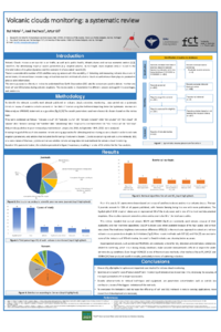
Poster ECRS.pdf
Deep Learning Based Edge Detection for Improving Building Footprint Extraction from Satellite Images
Development And Evaluation of a New Temperature Effect Removal Algorithm for AMSR2 Satellite Soil Moisture Product using Brightness Temperature