Event submissions
Published
This submission belongs to the session S2. Forest Biodiversity, Ecosystem Services, and Earth Observations of the event The 4th International Electronic Conference on Forests
Published date
19 Sep, 2024
Academic Editor
'%3e%3cpath%20d='M12.6657%2010.9104C12.4185%2010.325%2012.0599%209.79327%2011.6097%209.34482C11.1609%208.89508%2010.6293%208.5365%2010.0442%208.28888C10.0389%208.28626%2010.0337%208.28495%2010.0285%208.28233C10.8446%207.69279%2011.3752%206.73249%2011.3752%205.64904C11.3752%203.8542%209.92103%202.39999%208.1262%202.39999C6.33136%202.39999%204.87715%203.8542%204.87715%205.64904C4.87715%206.73249%205.40774%207.69279%206.22393%208.28364C6.21869%208.28626%206.21345%208.28757%206.20821%208.29019C5.62129%208.5378%205.09463%208.89284%204.64265%209.34613C4.1929%209.79493%203.83432%2010.3266%203.58671%2010.9117C3.34345%2011.4845%203.21226%2012.0987%203.20023%2012.7209C3.19988%2012.7349%203.20233%2012.7488%203.20744%2012.7619C3.21255%2012.7749%203.22022%2012.7867%203.22998%2012.7968C3.23975%2012.8068%203.25142%2012.8147%203.26431%2012.8202C3.2772%2012.8256%203.29105%2012.8284%203.30504%2012.8284H4.09109C4.14874%2012.8284%204.19459%2012.7825%204.1959%2012.7262C4.2221%2011.7148%204.62823%2010.7676%205.34617%2010.0497C6.08899%209.30683%207.0755%208.89808%208.1262%208.89808C9.17689%208.89808%2010.1634%209.30683%2010.9062%2010.0497C11.6242%2010.7676%2012.0303%2011.7148%2012.0565%2012.7262C12.0578%2012.7838%2012.1037%2012.8284%2012.1613%2012.8284H12.9474C12.9613%2012.8284%2012.9752%2012.8256%2012.9881%2012.8202C13.001%2012.8147%2013.0126%2012.8068%2013.0224%2012.7968C13.0322%2012.7867%2013.0398%2012.7749%2013.0449%2012.7619C13.0501%2012.7488%2013.0525%2012.7349%2013.0522%2012.7209C13.0391%2012.0947%2012.9094%2011.4855%2012.6657%2010.9104ZM8.1262%207.9024C7.52486%207.9024%206.9589%207.6679%206.53312%207.24211C6.10733%206.81633%205.87283%206.25037%205.87283%205.64904C5.87283%205.0477%206.10733%204.48174%206.53312%204.05596C6.9589%203.63018%207.52486%203.39567%208.1262%203.39567C8.72753%203.39567%209.29349%203.63018%209.71927%204.05596C10.1451%204.48174%2010.3796%205.0477%2010.3796%205.64904C10.3796%206.25037%2010.1451%206.81633%209.71927%207.24211C9.29349%207.6679%208.72753%207.9024%208.1262%207.9024Z'%20fill='%235D1EE1'/%3e%3c/g%3e%3c/svg%3e) Giorgos Mallinis
Giorgos MallinisCitation
Abdalrahman Ahmed, Czimber Kornel, Analysing the climate variability and reforestation activities in the areas adjacent to internally displaced camps in Darfur, in Proceedings of The 4th International Electronic Conference on Forests, 23 September–25 September 2024, MDPI: Basel, Switzerland
Share
Email
Facebook
Twitter
LinkedIn
Analysing the climate variability and reforestation activities in the areas adjacent to internally displaced camps in Darfur
'%3e%3cpath%20d='M12.6647%2010.9104C12.4176%2010.325%2012.0589%209.7933%2011.6088%209.34485C11.16%208.89511%2010.6283%208.53653%2010.0432%208.28891C10.038%208.28629%2010.0327%208.28498%2010.0275%208.28236C10.8437%207.69282%2011.3743%206.73252%2011.3743%205.64907C11.3743%203.85423%209.92005%202.40002%208.12522%202.40002C6.33038%202.40002%204.87618%203.85423%204.87618%205.64907C4.87618%206.73252%205.40677%207.69282%206.22296%208.28367C6.21772%208.28629%206.21248%208.2876%206.20724%208.29022C5.62031%208.53783%205.09365%208.89287%204.64167%209.34616C4.19192%209.79496%203.83334%2010.3266%203.58573%2010.9117C3.34247%2011.4846%203.21128%2012.0987%203.19925%2012.721C3.1989%2012.735%203.20135%2012.7489%203.20646%2012.7619C3.21157%2012.7749%203.21924%2012.7868%203.22901%2012.7968C3.23877%2012.8068%203.25045%2012.8148%203.26334%2012.8202C3.27623%2012.8256%203.29007%2012.8284%203.30406%2012.8284H4.09012C4.14776%2012.8284%204.19362%2012.7825%204.19493%2012.7262C4.22113%2011.7148%204.62726%2010.7676%205.34519%2010.0497C6.08802%209.30686%207.07452%208.89811%208.12522%208.89811C9.17592%208.89811%2010.1624%209.30686%2010.9052%2010.0497C11.6232%2010.7676%2012.0293%2011.7148%2012.0555%2012.7262C12.0568%2012.7839%2012.1027%2012.8284%2012.1603%2012.8284H12.9464C12.9604%2012.8284%2012.9742%2012.8256%2012.9871%2012.8202C13%2012.8148%2013.0117%2012.8068%2013.0214%2012.7968C13.0312%2012.7868%2013.0389%2012.7749%2013.044%2012.7619C13.0491%2012.7489%2013.0515%2012.735%2013.0512%2012.721C13.0381%2012.0947%2012.9084%2011.4856%2012.6647%2010.9104ZM8.12522%207.90243C7.52388%207.90243%206.95792%207.66793%206.53214%207.24215C6.10636%206.81636%205.87185%206.2504%205.87185%205.64907C5.87185%205.04773%206.10636%204.48177%206.53214%204.05599C6.95792%203.63021%207.52388%203.3957%208.12522%203.3957C8.72655%203.3957%209.29252%203.63021%209.7183%204.05599C10.1441%204.48177%2010.3786%205.04773%2010.3786%205.64907C10.3786%206.2504%2010.1441%206.81636%209.7183%207.24215C9.29252%207.66793%208.72655%207.90243%208.12522%207.90243Z'%20fill='%235D1EE1'/%3e%3c/g%3e%3c/svg%3e)
Abdalrahman Ahmed 1,2
Czimber Kornel 1
1. Institute of Geomatics and Civil Engineering, Faculty of Forestry, University of Sopron. Bajcsy-Zs 4, Sopron, 9400, Hungary
2. Department of Forest and Environment, Faculty of Forest Science and Technology, University of Gezira, Sudan.
Abstract
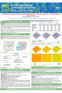
Decades of conflict in the Darfur region of Sudan have inflicted widespread environmental degradation and displacement of local communities. This study employs advanced high-resolution satellite imagery analysis to investigate the intricate impact of prolonged conflict on land use management in Darfur, focusing on the assessment of afforestation activities and their implications for achieving Sustainable Development Goal (SDG) 15—Life on Land. This research utilized PlanetScope time-series imagery to examine the El-Salam internally displaced persons (IDPs) camp in Southern Darfur. Object-based image classification (OBIA) methods within QGIS 3.28.6 and Orfeo ToolBox 8.1.2 were applied for accurate image classification. Major land use and land cover (LULC) classes, including agricultural land, built-up, vegetation cover, bareland, water bodies, and dry wadi, were successfully identified through supervised classification with an overall accuracy ranging from 90.66% to 95.14%. The findings reveal a noteworthy increase in the percentage of vegetation cover, rising from 1.48% to 2.33% between 2010 and 2024, respectively, indicating a substantial change of 0.85% over the study period. Additionally, water bodies experienced a significant increase from no water bodies 0 to 0.03%, equivalent to (6.08) hectares. These improvements are linked to reforestation initiatives, where artificial water harvesting aquifers are built, and the considerable general increase in rainfall from 2014 to 2022. The statistics further show a rapid reduction in bareland areas from 58.43% to 42.40% between 2010 and 2024, respectively. This research significantly contributes to the existing knowledge on the positive environmental consequences of sustainable land use management, particularly in conflict-affected regions. The implications extend to the global sustainable development agenda, offering valuable insights into the restoration and preservation of terrestrial ecosystems within conflict zones, thereby addressing SDG 15: Life on Land. A future study is suggested to investigate in detail the drivers and consequences of the changes in conflict-affected communities.
Keywords
Analyse
Reforestation
Land use/cover
Internal displacement
Darfur
Poster
sciforum-097735_AbdalrahmanAhmed.pdf
Biomonitoring air quality for praseodymium in Leicestershire (UK)
Evaluation of Land Cover and Use through Artificial Intelligence in the Premontane Humid Forest of the Munchique Natural Reserve, Quilichao River Basin, Cauca, Colombia