Event submissions
Published
This submission belongs to the session S2. Forest Biodiversity, Ecosystem Services, and Earth Observations of the event The 4th International Electronic Conference on Forests
Published date
19 Sep, 2024
Academic Editor
'%3e%3cpath%20d='M12.6657%2010.9104C12.4185%2010.325%2012.0599%209.79327%2011.6097%209.34482C11.1609%208.89508%2010.6293%208.5365%2010.0442%208.28888C10.0389%208.28626%2010.0337%208.28495%2010.0285%208.28233C10.8446%207.69279%2011.3752%206.73249%2011.3752%205.64904C11.3752%203.8542%209.92103%202.39999%208.1262%202.39999C6.33136%202.39999%204.87715%203.8542%204.87715%205.64904C4.87715%206.73249%205.40774%207.69279%206.22393%208.28364C6.21869%208.28626%206.21345%208.28757%206.20821%208.29019C5.62129%208.5378%205.09463%208.89284%204.64265%209.34613C4.1929%209.79493%203.83432%2010.3266%203.58671%2010.9117C3.34345%2011.4845%203.21226%2012.0987%203.20023%2012.7209C3.19988%2012.7349%203.20233%2012.7488%203.20744%2012.7619C3.21255%2012.7749%203.22022%2012.7867%203.22998%2012.7968C3.23975%2012.8068%203.25142%2012.8147%203.26431%2012.8202C3.2772%2012.8256%203.29105%2012.8284%203.30504%2012.8284H4.09109C4.14874%2012.8284%204.19459%2012.7825%204.1959%2012.7262C4.2221%2011.7148%204.62823%2010.7676%205.34617%2010.0497C6.08899%209.30683%207.0755%208.89808%208.1262%208.89808C9.17689%208.89808%2010.1634%209.30683%2010.9062%2010.0497C11.6242%2010.7676%2012.0303%2011.7148%2012.0565%2012.7262C12.0578%2012.7838%2012.1037%2012.8284%2012.1613%2012.8284H12.9474C12.9613%2012.8284%2012.9752%2012.8256%2012.9881%2012.8202C13.001%2012.8147%2013.0126%2012.8068%2013.0224%2012.7968C13.0322%2012.7867%2013.0398%2012.7749%2013.0449%2012.7619C13.0501%2012.7488%2013.0525%2012.7349%2013.0522%2012.7209C13.0391%2012.0947%2012.9094%2011.4855%2012.6657%2010.9104ZM8.1262%207.9024C7.52486%207.9024%206.9589%207.6679%206.53312%207.24211C6.10733%206.81633%205.87283%206.25037%205.87283%205.64904C5.87283%205.0477%206.10733%204.48174%206.53312%204.05596C6.9589%203.63018%207.52486%203.39567%208.1262%203.39567C8.72753%203.39567%209.29349%203.63018%209.71927%204.05596C10.1451%204.48174%2010.3796%205.0477%2010.3796%205.64904C10.3796%206.25037%2010.1451%206.81633%209.71927%207.24211C9.29349%207.6679%208.72753%207.9024%208.1262%207.9024Z'%20fill='%235D1EE1'/%3e%3c/g%3e%3c/svg%3e) Giorgos Mallinis
Giorgos MallinisCitation
DAVID ALEJANDRO MUNOZ, Elkin de Jesus Salcedo Hurtado, Diego Fernando Tarapuez Bolaños, Adriana Martínez Arias, Yesid Carvajal Escobar, Evaluation of Land Cover and Use through Artificial Intelligence in the Premontane Humid Forest of the Munchique Natural Reserve, Quilichao River Basin, Cauca, Colombia, in Proceedings of The 4th International Electronic Conference on Forests, 23 September–25 September 2024, MDPI: Basel, Switzerland
Share
Email
Facebook
Twitter
LinkedIn
Evaluation of Land Cover and Use through Artificial Intelligence in the Premontane Humid Forest of the Munchique Natural Reserve, Quilichao River Basin, Cauca, Colombia

DAVID ALEJANDRO MUNOZ 1
'%3e%3cpath%20d='M12.6647%2010.9104C12.4176%2010.325%2012.0589%209.7933%2011.6088%209.34485C11.16%208.89511%2010.6283%208.53653%2010.0432%208.28891C10.038%208.28629%2010.0327%208.28498%2010.0275%208.28236C10.8437%207.69282%2011.3743%206.73252%2011.3743%205.64907C11.3743%203.85423%209.92005%202.40002%208.12522%202.40002C6.33038%202.40002%204.87618%203.85423%204.87618%205.64907C4.87618%206.73252%205.40677%207.69282%206.22296%208.28367C6.21772%208.28629%206.21248%208.2876%206.20724%208.29022C5.62031%208.53783%205.09365%208.89287%204.64167%209.34616C4.19192%209.79496%203.83334%2010.3266%203.58573%2010.9117C3.34247%2011.4846%203.21128%2012.0987%203.19925%2012.721C3.1989%2012.735%203.20135%2012.7489%203.20646%2012.7619C3.21157%2012.7749%203.21924%2012.7868%203.22901%2012.7968C3.23877%2012.8068%203.25045%2012.8148%203.26334%2012.8202C3.27623%2012.8256%203.29007%2012.8284%203.30406%2012.8284H4.09012C4.14776%2012.8284%204.19362%2012.7825%204.19493%2012.7262C4.22113%2011.7148%204.62726%2010.7676%205.34519%2010.0497C6.08802%209.30686%207.07452%208.89811%208.12522%208.89811C9.17592%208.89811%2010.1624%209.30686%2010.9052%2010.0497C11.6232%2010.7676%2012.0293%2011.7148%2012.0555%2012.7262C12.0568%2012.7839%2012.1027%2012.8284%2012.1603%2012.8284H12.9464C12.9604%2012.8284%2012.9742%2012.8256%2012.9871%2012.8202C13%2012.8148%2013.0117%2012.8068%2013.0214%2012.7968C13.0312%2012.7868%2013.0389%2012.7749%2013.044%2012.7619C13.0491%2012.7489%2013.0515%2012.735%2013.0512%2012.721C13.0381%2012.0947%2012.9084%2011.4856%2012.6647%2010.9104ZM8.12522%207.90243C7.52388%207.90243%206.95792%207.66793%206.53214%207.24215C6.10636%206.81636%205.87185%206.2504%205.87185%205.64907C5.87185%205.04773%206.10636%204.48177%206.53214%204.05599C6.95792%203.63021%207.52388%203.3957%208.12522%203.3957C8.72655%203.3957%209.29252%203.63021%209.7183%204.05599C10.1441%204.48177%2010.3786%205.04773%2010.3786%205.64907C10.3786%206.2504%2010.1441%206.81636%209.7183%207.24215C9.29252%207.66793%208.72655%207.90243%208.12522%207.90243Z'%20fill='%235D1EE1'/%3e%3c/g%3e%3c/svg%3e)
Elkin de Jesus Salcedo Hurtado 1
Diego Fernando Tarapuez Bolaños 2
Adriana Martínez Arias 3
Yesid Carvajal Escobar 4
1. Department of Geography/Faculty of Humanities/Meléndez Campus, Universidad del Valle, Santiago de Cali 760034, Colombia
2. Department of Mathematics/Facultad de Ciencias Naturales y Exactas/Campus Meléndez, Universidad del Valle, Santiago de Cali 760034, Colombia
3. Faculty of Engineering and Administration/Palmira Campus, Universidad Nacional de Colombia, Palmira 763537, Colombia
4. Faculty of Engineering / School of Natural Resources and Environmental Engineering (EIDENAR) /Meléndez Campus, Universidad del Valle, Santiago de Cali 760034, Colombia
Abstract
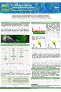
Land cover and land use assessment is crucial for the sustainable management of natural resources and biodiversity conservation, especially in diverse and fragile ecosystems such as the Andean forests. This research aimed to identify changes in vegetation cover and their impact on land use in the Munchique Natural Reserve, in the Quilichao river basin, Cauca, Colombia, an area that harbors high biodiversity and numerous ecosystem services.
A land use and land cover classification (LULC) was performed using Sentinel 2 satellite imagery for the period 2018-2021, using ArcMap 10.8 and QGIS 2.18 software with the MOLUSCE plugin. A multi-layer artificial neural network (ANN) was used to predict changes up to the years 2030 and 2050, allowing to assess future land use dynamics. The land transition analysis showed a reduction of 102 ha of dense vegetation and 17 ha of pasture between 2019 and 2021, due to agricultural expansion.
The MOLUSCE plugin simulated land cover for 2030 and 2050. The validation of the simulation showed an accuracy of 98.70% and a kappa coefficient of 0.99487, indicating high accuracy in predicting land cover change. Future predictions suggest the loss of more than 300 ha of dense vegetation between 2021 and 2030, and 437.26 ha between 2021 and 2050, in addition to an increase of approximately 800 ha of crops in the same period. These impacts must be integrated into planning to ensure biodiversity and ecosystem services.
The results of this research provide key information to identify territorial conflicts and contribute to the sustainable management of natural resources in this region of Colombia.
Keywords
Land Cover
Land Use
Artificial neural network (ANN)
MOLUSCE
Ecosystem Services
Poster
sciforum-095438_DAVID ALEJANDRO MUNOZ (revised).pdf
Analysing the climate variability and reforestation activities in the areas adjacent to internally displaced camps in Darfur
Exploration of forest resource by both man and butterflies—a case study on utilization of medicinal plants as a larval resource by nymphalinae butterflies