Event submissions
Published
This submission belongs to the session S1. Forest Ecology and Management of the event The 4th International Electronic Conference on Forests
Published date
19 Sep, 2024
Academic Editor
'%3e%3cpath%20d='M12.6657%2010.9104C12.4185%2010.325%2012.0599%209.79327%2011.6097%209.34482C11.1609%208.89508%2010.6293%208.5365%2010.0442%208.28888C10.0389%208.28626%2010.0337%208.28495%2010.0285%208.28233C10.8446%207.69279%2011.3752%206.73249%2011.3752%205.64904C11.3752%203.8542%209.92103%202.39999%208.1262%202.39999C6.33136%202.39999%204.87715%203.8542%204.87715%205.64904C4.87715%206.73249%205.40774%207.69279%206.22393%208.28364C6.21869%208.28626%206.21345%208.28757%206.20821%208.29019C5.62129%208.5378%205.09463%208.89284%204.64265%209.34613C4.1929%209.79493%203.83432%2010.3266%203.58671%2010.9117C3.34345%2011.4845%203.21226%2012.0987%203.20023%2012.7209C3.19988%2012.7349%203.20233%2012.7488%203.20744%2012.7619C3.21255%2012.7749%203.22022%2012.7867%203.22998%2012.7968C3.23975%2012.8068%203.25142%2012.8147%203.26431%2012.8202C3.2772%2012.8256%203.29105%2012.8284%203.30504%2012.8284H4.09109C4.14874%2012.8284%204.19459%2012.7825%204.1959%2012.7262C4.2221%2011.7148%204.62823%2010.7676%205.34617%2010.0497C6.08899%209.30683%207.0755%208.89808%208.1262%208.89808C9.17689%208.89808%2010.1634%209.30683%2010.9062%2010.0497C11.6242%2010.7676%2012.0303%2011.7148%2012.0565%2012.7262C12.0578%2012.7838%2012.1037%2012.8284%2012.1613%2012.8284H12.9474C12.9613%2012.8284%2012.9752%2012.8256%2012.9881%2012.8202C13.001%2012.8147%2013.0126%2012.8068%2013.0224%2012.7968C13.0322%2012.7867%2013.0398%2012.7749%2013.0449%2012.7619C13.0501%2012.7488%2013.0525%2012.7349%2013.0522%2012.7209C13.0391%2012.0947%2012.9094%2011.4855%2012.6657%2010.9104ZM8.1262%207.9024C7.52486%207.9024%206.9589%207.6679%206.53312%207.24211C6.10733%206.81633%205.87283%206.25037%205.87283%205.64904C5.87283%205.0477%206.10733%204.48174%206.53312%204.05596C6.9589%203.63018%207.52486%203.39567%208.1262%203.39567C8.72753%203.39567%209.29349%203.63018%209.71927%204.05596C10.1451%204.48174%2010.3796%205.0477%2010.3796%205.64904C10.3796%206.25037%2010.1451%206.81633%209.71927%207.24211C9.29349%207.6679%208.72753%207.9024%208.1262%207.9024Z'%20fill='%235D1EE1'/%3e%3c/g%3e%3c/svg%3e) Giovanna Battipaglia
Giovanna BattipagliaCitation
Savanah Franco de Freitas, Juliana Sousa de Holanda, André Luiz Alencar de Mendonça, Aerophotogrammetry and artificial intelligence to quantify trees and palms in Amazon native Rainforests, in Proceedings of The 4th International Electronic Conference on Forests, 23 September–25 September 2024, MDPI: Basel, Switzerland
Share
Email
Facebook
Twitter
LinkedIn
Aerophotogrammetry and artificial intelligence to quantify trees and palms in Amazon native Rainforests

Savanah Franco de Freitas 1
'%3e%3cpath%20d='M12.6647%2010.9104C12.4176%2010.325%2012.0589%209.7933%2011.6088%209.34485C11.16%208.89511%2010.6283%208.53653%2010.0432%208.28891C10.038%208.28629%2010.0327%208.28498%2010.0275%208.28236C10.8437%207.69282%2011.3743%206.73252%2011.3743%205.64907C11.3743%203.85423%209.92005%202.40002%208.12522%202.40002C6.33038%202.40002%204.87618%203.85423%204.87618%205.64907C4.87618%206.73252%205.40677%207.69282%206.22296%208.28367C6.21772%208.28629%206.21248%208.2876%206.20724%208.29022C5.62031%208.53783%205.09365%208.89287%204.64167%209.34616C4.19192%209.79496%203.83334%2010.3266%203.58573%2010.9117C3.34247%2011.4846%203.21128%2012.0987%203.19925%2012.721C3.1989%2012.735%203.20135%2012.7489%203.20646%2012.7619C3.21157%2012.7749%203.21924%2012.7868%203.22901%2012.7968C3.23877%2012.8068%203.25045%2012.8148%203.26334%2012.8202C3.27623%2012.8256%203.29007%2012.8284%203.30406%2012.8284H4.09012C4.14776%2012.8284%204.19362%2012.7825%204.19493%2012.7262C4.22113%2011.7148%204.62726%2010.7676%205.34519%2010.0497C6.08802%209.30686%207.07452%208.89811%208.12522%208.89811C9.17592%208.89811%2010.1624%209.30686%2010.9052%2010.0497C11.6232%2010.7676%2012.0293%2011.7148%2012.0555%2012.7262C12.0568%2012.7839%2012.1027%2012.8284%2012.1603%2012.8284H12.9464C12.9604%2012.8284%2012.9742%2012.8256%2012.9871%2012.8202C13%2012.8148%2013.0117%2012.8068%2013.0214%2012.7968C13.0312%2012.7868%2013.0389%2012.7749%2013.044%2012.7619C13.0491%2012.7489%2013.0515%2012.735%2013.0512%2012.721C13.0381%2012.0947%2012.9084%2011.4856%2012.6647%2010.9104ZM8.12522%207.90243C7.52388%207.90243%206.95792%207.66793%206.53214%207.24215C6.10636%206.81636%205.87185%206.2504%205.87185%205.64907C5.87185%205.04773%206.10636%204.48177%206.53214%204.05599C6.95792%203.63021%207.52388%203.3957%208.12522%203.3957C8.72655%203.3957%209.29252%203.63021%209.7183%204.05599C10.1441%204.48177%2010.3786%205.04773%2010.3786%205.64907C10.3786%206.2504%2010.1441%206.81636%209.7183%207.24215C9.29252%207.66793%208.72655%207.90243%208.12522%207.90243Z'%20fill='%235D1EE1'/%3e%3c/g%3e%3c/svg%3e)
Juliana Sousa de Holanda 1
André Luiz Alencar de Mendonça 1
1. Forest Sciences Department, Faculty of Agricultural Sciences, Manaus Campus, Federal University of Amazonas, Manaus 69077-000, Brazil
Abstract
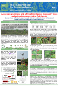
The Amazon rainforest is composed of dense and large vegetation; this implies arduous data collection to study forest dynamics. To assist with these studies, remotely piloted aircrafts (RPAs) can be used to collect images of the forest to acquire characteristics such as the height of the forest, used for biomass and carbon calculations. This technology with machine learning can help in the processing of extensive data; however, it has not yet been applied to Amazon forests, and it offers an opportunity to improve the accuracy of carbon estimates. The aim of this study was to investigate the performance of the artificial intelligence (AI) YOLOv5 in a Google Colab environment to count palms and trees in aerophotogrammetric images captured with the DJI Phantom 4 Pro and a camera. The AI training, validation and testing phases were applied with 1229 images to generate six models to detect and quantify palms and trees in three sites in the state of Amazonas in Brazil. The models were evaluated using the AI metrics precision, recall and mean average precision (mAP) and the remote sensing metrics omission errors, commission errors and accuracy. The models Palms400 and Trees600 obtained the best performances in mAP, with 76% for both; nevertheless, accuracy was highest in the Trees200 and Palms200 models, with 53% and 38%, respectively. In all models, the omission was higher than the commission, where the models did not detect all the objects, while commission errors did not exceed 20%. Thus, it is possible to say that the models performed well and it is recommended to use more different images of the objects in the AI phases, such as different shapes and colors, to improve AI for forestry applications, in order to satisfy remote sensing metrics as well as AI metrics.
Keywords
Remote sense
Forest monitoring
Machine learning
Forest management
Poster
sciforum-087505_SavanahFrancodeFreitas.pdf
The Urgency of Implementing Field Research for Fir Forest Conservation and Management: Case Studies in Central Greece
Composite effects of forest harvests and seismic lines influence the re-establishment of trees and shrubs in Alberta’s mesic upland boreal forest.