Event submissions
Published
This submission belongs to the session S2. Forest Biodiversity, Ecosystem Services, and Earth Observations of the event The 4th International Electronic Conference on Forests
Published date
19 Sep, 2024
Academic Editor
'%3e%3cpath%20d='M12.6657%2010.9104C12.4185%2010.325%2012.0599%209.79327%2011.6097%209.34482C11.1609%208.89508%2010.6293%208.5365%2010.0442%208.28888C10.0389%208.28626%2010.0337%208.28495%2010.0285%208.28233C10.8446%207.69279%2011.3752%206.73249%2011.3752%205.64904C11.3752%203.8542%209.92103%202.39999%208.1262%202.39999C6.33136%202.39999%204.87715%203.8542%204.87715%205.64904C4.87715%206.73249%205.40774%207.69279%206.22393%208.28364C6.21869%208.28626%206.21345%208.28757%206.20821%208.29019C5.62129%208.5378%205.09463%208.89284%204.64265%209.34613C4.1929%209.79493%203.83432%2010.3266%203.58671%2010.9117C3.34345%2011.4845%203.21226%2012.0987%203.20023%2012.7209C3.19988%2012.7349%203.20233%2012.7488%203.20744%2012.7619C3.21255%2012.7749%203.22022%2012.7867%203.22998%2012.7968C3.23975%2012.8068%203.25142%2012.8147%203.26431%2012.8202C3.2772%2012.8256%203.29105%2012.8284%203.30504%2012.8284H4.09109C4.14874%2012.8284%204.19459%2012.7825%204.1959%2012.7262C4.2221%2011.7148%204.62823%2010.7676%205.34617%2010.0497C6.08899%209.30683%207.0755%208.89808%208.1262%208.89808C9.17689%208.89808%2010.1634%209.30683%2010.9062%2010.0497C11.6242%2010.7676%2012.0303%2011.7148%2012.0565%2012.7262C12.0578%2012.7838%2012.1037%2012.8284%2012.1613%2012.8284H12.9474C12.9613%2012.8284%2012.9752%2012.8256%2012.9881%2012.8202C13.001%2012.8147%2013.0126%2012.8068%2013.0224%2012.7968C13.0322%2012.7867%2013.0398%2012.7749%2013.0449%2012.7619C13.0501%2012.7488%2013.0525%2012.7349%2013.0522%2012.7209C13.0391%2012.0947%2012.9094%2011.4855%2012.6657%2010.9104ZM8.1262%207.9024C7.52486%207.9024%206.9589%207.6679%206.53312%207.24211C6.10733%206.81633%205.87283%206.25037%205.87283%205.64904C5.87283%205.0477%206.10733%204.48174%206.53312%204.05596C6.9589%203.63018%207.52486%203.39567%208.1262%203.39567C8.72753%203.39567%209.29349%203.63018%209.71927%204.05596C10.1451%204.48174%2010.3796%205.0477%2010.3796%205.64904C10.3796%206.25037%2010.1451%206.81633%209.71927%207.24211C9.29349%207.6679%208.72753%207.9024%208.1262%207.9024Z'%20fill='%235D1EE1'/%3e%3c/g%3e%3c/svg%3e) Giorgos Mallinis
Giorgos MallinisCitation
José Carlos Porto Rodríguez, Ángela Blázquez Casado, Identyfing suitable thinning areas in pure stands of Scots and maritine pine through Sentinel-2 imagery and LiDAR, in Proceedings of The 4th International Electronic Conference on Forests, 23 September–25 September 2024, MDPI: Basel, Switzerland
Share
Email
Facebook
Twitter
LinkedIn
Identyfing suitable thinning areas in pure stands of Scots and maritine pine through Sentinel-2 imagery and LiDAR
'%3e%3cpath%20d='M12.6647%2010.9104C12.4176%2010.325%2012.0589%209.7933%2011.6088%209.34485C11.16%208.89511%2010.6283%208.53653%2010.0432%208.28891C10.038%208.28629%2010.0327%208.28498%2010.0275%208.28236C10.8437%207.69282%2011.3743%206.73252%2011.3743%205.64907C11.3743%203.85423%209.92005%202.40002%208.12522%202.40002C6.33038%202.40002%204.87618%203.85423%204.87618%205.64907C4.87618%206.73252%205.40677%207.69282%206.22296%208.28367C6.21772%208.28629%206.21248%208.2876%206.20724%208.29022C5.62031%208.53783%205.09365%208.89287%204.64167%209.34616C4.19192%209.79496%203.83334%2010.3266%203.58573%2010.9117C3.34247%2011.4846%203.21128%2012.0987%203.19925%2012.721C3.1989%2012.735%203.20135%2012.7489%203.20646%2012.7619C3.21157%2012.7749%203.21924%2012.7868%203.22901%2012.7968C3.23877%2012.8068%203.25045%2012.8148%203.26334%2012.8202C3.27623%2012.8256%203.29007%2012.8284%203.30406%2012.8284H4.09012C4.14776%2012.8284%204.19362%2012.7825%204.19493%2012.7262C4.22113%2011.7148%204.62726%2010.7676%205.34519%2010.0497C6.08802%209.30686%207.07452%208.89811%208.12522%208.89811C9.17592%208.89811%2010.1624%209.30686%2010.9052%2010.0497C11.6232%2010.7676%2012.0293%2011.7148%2012.0555%2012.7262C12.0568%2012.7839%2012.1027%2012.8284%2012.1603%2012.8284H12.9464C12.9604%2012.8284%2012.9742%2012.8256%2012.9871%2012.8202C13%2012.8148%2013.0117%2012.8068%2013.0214%2012.7968C13.0312%2012.7868%2013.0389%2012.7749%2013.044%2012.7619C13.0491%2012.7489%2013.0515%2012.735%2013.0512%2012.721C13.0381%2012.0947%2012.9084%2011.4856%2012.6647%2010.9104ZM8.12522%207.90243C7.52388%207.90243%206.95792%207.66793%206.53214%207.24215C6.10636%206.81636%205.87185%206.2504%205.87185%205.64907C5.87185%205.04773%206.10636%204.48177%206.53214%204.05599C6.95792%203.63021%207.52388%203.3957%208.12522%203.3957C8.72655%203.3957%209.29252%203.63021%209.7183%204.05599C10.1441%204.48177%2010.3786%205.04773%2010.3786%205.64907C10.3786%206.2504%2010.1441%206.81636%209.7183%207.24215C9.29252%207.66793%208.72655%207.90243%208.12522%207.90243Z'%20fill='%235D1EE1'/%3e%3c/g%3e%3c/svg%3e)
José Carlos Porto Rodríguez 1

Ángela Blázquez Casado 1
1. Fundación Centro de Servicios y Promoción Forestal de Castilla y León (CESEFOR). Calle C, 42005 Soria, Spain
Abstract
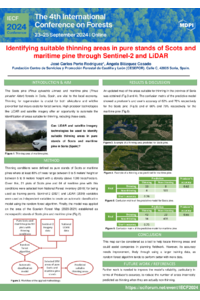
Scots pine (Pinus sylvestris Linneo) and maritime pine (Pinus pinaster Aiton) forests are essential to the local economy in the province of Soria (Spain). Thus, regeneration care through thinning is key, not only from a silvicultural point of view, but also in terms of wildfire prevention. However, this operation incurs costs for forest owners. The availability of high-precision technologies such as LiDAR and high upgradability such as satellite imagery provide an excellent opportunity to automate the location of these areas suitable for thinning and therefore reducing costs. Free national LiDAR data are available for the year 2010, whereas Sentinel-2 obtains images every 3-5 days. Given this, the National Forest Inventory (2019) was used to identify plots that meet the conditions for applying thinning: pure stands of Scots or maritime pines where at least 80% of trees range between 0 and 5 meters’ height or between 5 and 9 meters’ height with a density above 1000 trees/hectare. In this way, the Sentinel 2 and LiDAR variables were used to create an automatic classification model using the random forest algorithm. The model was extrapolated on the area of the Spanish Forest Map established as monospecific stands of Scots pine and maritime pine. As a result, an updated map of the areas suitable for thinning in the province of Soria was obtained. The validation of the results showed a producer’s and user’s accuracy of 62% and 76%, respectively, for the Scots pine and of 66% and 75%, respectively, for the maritime pine. In conclusion, this map can be considered as a tool that facilitates the location of thinning areas.
Keywords
Forest management
remote sensing
map
Sentinel 2
LiDAR
Poster
sciforum-094857_José Carlos Porto Rodríguez.pdf
Forest biodiversity at risk, and rural and peri-urban land consumption
Dynamic Models applied in Paricá Production Optimization