Event submissions
Published
This submission belongs to the session S5. Numerical and Experimental Methods, Data Analyses, Digital Twin, IoT Machine Learning and AI in Water Sciences of the event The 8th International Electronic Conference on Water Sciences
Published date
11 Oct, 2024
Academic Editor
'%3e%3cpath%20d='M12.6657%2010.9104C12.4185%2010.325%2012.0599%209.79327%2011.6097%209.34482C11.1609%208.89508%2010.6293%208.5365%2010.0442%208.28888C10.0389%208.28626%2010.0337%208.28495%2010.0285%208.28233C10.8446%207.69279%2011.3752%206.73249%2011.3752%205.64904C11.3752%203.8542%209.92103%202.39999%208.1262%202.39999C6.33136%202.39999%204.87715%203.8542%204.87715%205.64904C4.87715%206.73249%205.40774%207.69279%206.22393%208.28364C6.21869%208.28626%206.21345%208.28757%206.20821%208.29019C5.62129%208.5378%205.09463%208.89284%204.64265%209.34613C4.1929%209.79493%203.83432%2010.3266%203.58671%2010.9117C3.34345%2011.4845%203.21226%2012.0987%203.20023%2012.7209C3.19988%2012.7349%203.20233%2012.7488%203.20744%2012.7619C3.21255%2012.7749%203.22022%2012.7867%203.22998%2012.7968C3.23975%2012.8068%203.25142%2012.8147%203.26431%2012.8202C3.2772%2012.8256%203.29105%2012.8284%203.30504%2012.8284H4.09109C4.14874%2012.8284%204.19459%2012.7825%204.1959%2012.7262C4.2221%2011.7148%204.62823%2010.7676%205.34617%2010.0497C6.08899%209.30683%207.0755%208.89808%208.1262%208.89808C9.17689%208.89808%2010.1634%209.30683%2010.9062%2010.0497C11.6242%2010.7676%2012.0303%2011.7148%2012.0565%2012.7262C12.0578%2012.7838%2012.1037%2012.8284%2012.1613%2012.8284H12.9474C12.9613%2012.8284%2012.9752%2012.8256%2012.9881%2012.8202C13.001%2012.8147%2013.0126%2012.8068%2013.0224%2012.7968C13.0322%2012.7867%2013.0398%2012.7749%2013.0449%2012.7619C13.0501%2012.7488%2013.0525%2012.7349%2013.0522%2012.7209C13.0391%2012.0947%2012.9094%2011.4855%2012.6657%2010.9104ZM8.1262%207.9024C7.52486%207.9024%206.9589%207.6679%206.53312%207.24211C6.10733%206.81633%205.87283%206.25037%205.87283%205.64904C5.87283%205.0477%206.10733%204.48174%206.53312%204.05596C6.9589%203.63018%207.52486%203.39567%208.1262%203.39567C8.72753%203.39567%209.29349%203.63018%209.71927%204.05596C10.1451%204.48174%2010.3796%205.0477%2010.3796%205.64904C10.3796%206.25037%2010.1451%206.81633%209.71927%207.24211C9.29349%207.6679%208.72753%207.9024%208.1262%207.9024Z'%20fill='%235D1EE1'/%3e%3c/g%3e%3c/svg%3e) Junye Wang
Junye WangCitation
Parisa Dodangeh, Reza Shah-Hosseini, Enhanced Chlorophyll-a Estimation in the Anzali Wetland Using the Sentinel-2 and -3 Satellites and a Machine Learning Fusion Model, in Proceedings of The 8th International Electronic Conference on Water Sciences, 14 October–16 October 2024, MDPI: Basel, Switzerland
Share
Email
Facebook
Twitter
LinkedIn
Enhanced Chlorophyll-a Estimation in the Anzali Wetland Using the Sentinel-2 and -3 Satellites and a Machine Learning Fusion Model
'%3e%3cpath%20d='M12.6647%2010.9104C12.4176%2010.325%2012.0589%209.7933%2011.6088%209.34485C11.16%208.89511%2010.6283%208.53653%2010.0432%208.28891C10.038%208.28629%2010.0327%208.28498%2010.0275%208.28236C10.8437%207.69282%2011.3743%206.73252%2011.3743%205.64907C11.3743%203.85423%209.92005%202.40002%208.12522%202.40002C6.33038%202.40002%204.87618%203.85423%204.87618%205.64907C4.87618%206.73252%205.40677%207.69282%206.22296%208.28367C6.21772%208.28629%206.21248%208.2876%206.20724%208.29022C5.62031%208.53783%205.09365%208.89287%204.64167%209.34616C4.19192%209.79496%203.83334%2010.3266%203.58573%2010.9117C3.34247%2011.4846%203.21128%2012.0987%203.19925%2012.721C3.1989%2012.735%203.20135%2012.7489%203.20646%2012.7619C3.21157%2012.7749%203.21924%2012.7868%203.22901%2012.7968C3.23877%2012.8068%203.25045%2012.8148%203.26334%2012.8202C3.27623%2012.8256%203.29007%2012.8284%203.30406%2012.8284H4.09012C4.14776%2012.8284%204.19362%2012.7825%204.19493%2012.7262C4.22113%2011.7148%204.62726%2010.7676%205.34519%2010.0497C6.08802%209.30686%207.07452%208.89811%208.12522%208.89811C9.17592%208.89811%2010.1624%209.30686%2010.9052%2010.0497C11.6232%2010.7676%2012.0293%2011.7148%2012.0555%2012.7262C12.0568%2012.7839%2012.1027%2012.8284%2012.1603%2012.8284H12.9464C12.9604%2012.8284%2012.9742%2012.8256%2012.9871%2012.8202C13%2012.8148%2013.0117%2012.8068%2013.0214%2012.7968C13.0312%2012.7868%2013.0389%2012.7749%2013.044%2012.7619C13.0491%2012.7489%2013.0515%2012.735%2013.0512%2012.721C13.0381%2012.0947%2012.9084%2011.4856%2012.6647%2010.9104ZM8.12522%207.90243C7.52388%207.90243%206.95792%207.66793%206.53214%207.24215C6.10636%206.81636%205.87185%206.2504%205.87185%205.64907C5.87185%205.04773%206.10636%204.48177%206.53214%204.05599C6.95792%203.63021%207.52388%203.3957%208.12522%203.3957C8.72655%203.3957%209.29252%203.63021%209.7183%204.05599C10.1441%204.48177%2010.3786%205.04773%2010.3786%205.64907C10.3786%206.2504%2010.1441%206.81636%209.7183%207.24215C9.29252%207.66793%208.72655%207.90243%208.12522%207.90243Z'%20fill='%235D1EE1'/%3e%3c/g%3e%3c/svg%3e)
Parisa Dodangeh 1

Reza Shah-Hosseini 1
1. School of Surveying and Geospatial Engineering, College of Engineering, University of Tehran, Iran
Abstract
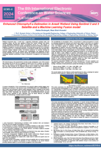
Quantifying chlorophyll-a (Chl-a) concentrations is paramount in wetland ecosystems as a key indicator of phytoplankton biomass and overall water quality. In this study, we applied three distinct models—Gilerson, Gulin, and Mishra—to derive the Chl-a concentrations from Sentinel-3 satellite data in the Anzali wetland, Iran, in 2023. The Anzali wetland, located on the southwestern coast of the Caspian Sea in Gilan Province, is one of northern Iran's most significant and biodiverse wetlands.
The Gilerson and Gulin models were based on band ratios, specifically the red-edge band ratio. In contrast, the Mishra model utilized an empirical model based on the Normalized Difference Chlorophyll Index (NDCI). These models initially generated Chl-a maps with a lower spatial resolution, which was subsequently enhanced to a 20-meter spatial resolution using features extracted from Sentinel-2 data. Machine learning played a crucial role in this enhancement process, where a Random Forest classifier was trained with the extracted features to refine the Chl-a maps from the Sentinel-3 data. This approach improved the spatial resolution of the chlorophyll concentration estimations across the Anzali wetland.
Sentinel-3 data were resampled to 20 meters for accuracy assessment and utilized as ground-truth data. Field data were collected using in situ measurements of the Chl-a concentrations, ensuring robust ground-truthing. Evaluation of the accuracy metrics revealed the following outcomes for the Gilerson, Gulin, and Mishra models, respectively: RMSE values of 3.71, 10.12, and 11.63; bias values of 0.65, 1.46, and 2.64; and MAE values of 2.85, 7.74, and 8.83. These results indicate that the Gilerson model had the highest accuracy, followed by the Gulin and Mishra models. The synergistic fusion of the Sentinel-2 (S2) and Sentinel-3 (S3) data enhanced the spatiotemporal resolution, providing valuable insights into the Chl-a dynamics at varying scales, thus aiding in refining management strategies and preserving wetland ecosystems.
Keywords
Google Earth Engine
Sentinel 3
Sentinel 2
Machine learning
Chlorophyll-a
Spatiotemporal Fusion.
Poster
Parisa Dodangeh-ECWS-8 Paper1-V1.pdf
Remote Sensing-Based Crop Mapping in Tehran Province, Iran: Focus on Wheat and Barley for Efficient Agricultural Management
Generative AI-Aided Digital Twin for Urban Flood Risk Assessment: Challenges and Opportunities