Event submissions
Published

This submission belongs to the session S3. Sensor Networks, IoT, Smart Cities and Heath Monitoring of the event The 11th International Electronic Conference on Sensors and Applications
Published date
26 Nov, 2024
Academic Editor
'%3e%3cpath%20d='M12.6657%2010.9104C12.4185%2010.325%2012.0599%209.79327%2011.6097%209.34482C11.1609%208.89508%2010.6293%208.5365%2010.0442%208.28888C10.0389%208.28626%2010.0337%208.28495%2010.0285%208.28233C10.8446%207.69279%2011.3752%206.73249%2011.3752%205.64904C11.3752%203.8542%209.92103%202.39999%208.1262%202.39999C6.33136%202.39999%204.87715%203.8542%204.87715%205.64904C4.87715%206.73249%205.40774%207.69279%206.22393%208.28364C6.21869%208.28626%206.21345%208.28757%206.20821%208.29019C5.62129%208.5378%205.09463%208.89284%204.64265%209.34613C4.1929%209.79493%203.83432%2010.3266%203.58671%2010.9117C3.34345%2011.4845%203.21226%2012.0987%203.20023%2012.7209C3.19988%2012.7349%203.20233%2012.7488%203.20744%2012.7619C3.21255%2012.7749%203.22022%2012.7867%203.22998%2012.7968C3.23975%2012.8068%203.25142%2012.8147%203.26431%2012.8202C3.2772%2012.8256%203.29105%2012.8284%203.30504%2012.8284H4.09109C4.14874%2012.8284%204.19459%2012.7825%204.1959%2012.7262C4.2221%2011.7148%204.62823%2010.7676%205.34617%2010.0497C6.08899%209.30683%207.0755%208.89808%208.1262%208.89808C9.17689%208.89808%2010.1634%209.30683%2010.9062%2010.0497C11.6242%2010.7676%2012.0303%2011.7148%2012.0565%2012.7262C12.0578%2012.7838%2012.1037%2012.8284%2012.1613%2012.8284H12.9474C12.9613%2012.8284%2012.9752%2012.8256%2012.9881%2012.8202C13.001%2012.8147%2013.0126%2012.8068%2013.0224%2012.7968C13.0322%2012.7867%2013.0398%2012.7749%2013.0449%2012.7619C13.0501%2012.7488%2013.0525%2012.7349%2013.0522%2012.7209C13.0391%2012.0947%2012.9094%2011.4855%2012.6657%2010.9104ZM8.1262%207.9024C7.52486%207.9024%206.9589%207.6679%206.53312%207.24211C6.10733%206.81633%205.87283%206.25037%205.87283%205.64904C5.87283%205.0477%206.10733%204.48174%206.53312%204.05596C6.9589%203.63018%207.52486%203.39567%208.1262%203.39567C8.72753%203.39567%209.29349%203.63018%209.71927%204.05596C10.1451%204.48174%2010.3796%205.0477%2010.3796%205.64904C10.3796%206.25037%2010.1451%206.81633%209.71927%207.24211C9.29349%207.6679%208.72753%207.9024%208.1262%207.9024Z'%20fill='%235D1EE1'/%3e%3c/g%3e%3c/svg%3e) Jean-marc Laheurte
Jean-marc LaheurteCitation
Namrata Maity, Varun Narayan Mishra, Urban Growth Analysis Using Multi- Temporal Remote Sensing Image and Landscape Metrics for Smart City Planning of Lucknow District, India, in Proceedings of The 11th International Electronic Conference on Sensors and Applications, 26 November–28 November 2024, MDPI: Basel, Switzerland, doi: 10.3390/ecsa-11-20514
Share
Email
Facebook
Twitter
LinkedIn
Urban Growth Analysis Using Multi- Temporal Remote Sensing Image and Landscape Metrics for Smart City Planning of Lucknow District, India
'%3e%3cpath%20d='M12.6647%2010.9104C12.4176%2010.325%2012.0589%209.7933%2011.6088%209.34485C11.16%208.89511%2010.6283%208.53653%2010.0432%208.28891C10.038%208.28629%2010.0327%208.28498%2010.0275%208.28236C10.8437%207.69282%2011.3743%206.73252%2011.3743%205.64907C11.3743%203.85423%209.92005%202.40002%208.12522%202.40002C6.33038%202.40002%204.87618%203.85423%204.87618%205.64907C4.87618%206.73252%205.40677%207.69282%206.22296%208.28367C6.21772%208.28629%206.21248%208.2876%206.20724%208.29022C5.62031%208.53783%205.09365%208.89287%204.64167%209.34616C4.19192%209.79496%203.83334%2010.3266%203.58573%2010.9117C3.34247%2011.4846%203.21128%2012.0987%203.19925%2012.721C3.1989%2012.735%203.20135%2012.7489%203.20646%2012.7619C3.21157%2012.7749%203.21924%2012.7868%203.22901%2012.7968C3.23877%2012.8068%203.25045%2012.8148%203.26334%2012.8202C3.27623%2012.8256%203.29007%2012.8284%203.30406%2012.8284H4.09012C4.14776%2012.8284%204.19362%2012.7825%204.19493%2012.7262C4.22113%2011.7148%204.62726%2010.7676%205.34519%2010.0497C6.08802%209.30686%207.07452%208.89811%208.12522%208.89811C9.17592%208.89811%2010.1624%209.30686%2010.9052%2010.0497C11.6232%2010.7676%2012.0293%2011.7148%2012.0555%2012.7262C12.0568%2012.7839%2012.1027%2012.8284%2012.1603%2012.8284H12.9464C12.9604%2012.8284%2012.9742%2012.8256%2012.9871%2012.8202C13%2012.8148%2013.0117%2012.8068%2013.0214%2012.7968C13.0312%2012.7868%2013.0389%2012.7749%2013.044%2012.7619C13.0491%2012.7489%2013.0515%2012.735%2013.0512%2012.721C13.0381%2012.0947%2012.9084%2011.4856%2012.6647%2010.9104ZM8.12522%207.90243C7.52388%207.90243%206.95792%207.66793%206.53214%207.24215C6.10636%206.81636%205.87185%206.2504%205.87185%205.64907C5.87185%205.04773%206.10636%204.48177%206.53214%204.05599C6.95792%203.63021%207.52388%203.3957%208.12522%203.3957C8.72655%203.3957%209.29252%203.63021%209.7183%204.05599C10.1441%204.48177%2010.3786%205.04773%2010.3786%205.64907C10.3786%206.2504%2010.1441%206.81636%209.7183%207.24215C9.29252%207.66793%208.72655%207.90243%208.12522%207.90243Z'%20fill='%235D1EE1'/%3e%3c/g%3e%3c/svg%3e)
Namrata Maity 1
Varun Narayan Mishra 1
1. Amity Institute of Geoinformatics and Remote Sensing (AIGIRS), Amity University, Sector 125, Noida 201313, India
Abstract
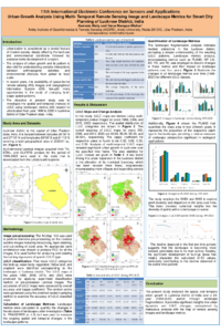
Rapid urbanization causes a high concentration of human population and economic activities that leads to the changes in landscape and spatial growth of the cities. Landscape features play a key role in understanding land use and land (LULC) dynamics of urban areas. This work aims to analyse and quantify the changes in LULC over 24 years (1999 to 2023) in Lucknow District of India. It focuses on different land use types including Built-up Area, Cropland, Water Body, Vegetation, and Fallow Land, using USGS satellite imagery. Multi-temporal Landsat satellite data from the years 1999, 2008, 2015, and 2023 were employed to prepare LULC maps including major classes namely built-up area, cropland, water body, vegetation, and fallow land. Several landscape metrics like Number of Patches (NP), Patch Density (PD), Largest Patch Index (LPI), Landscape Shape Index (LSI), Edge Density (ED), and Total Edge (TE) were calculated to analyse spatial patterns and changes of LULC categories. The study revealed significant changes in the landscape of Lucknow District, characterized by variations in the extent and distribution of the land use categories. Key findings include a remarkable increase in built-up area from 9.04% in 1999 to 25.91% in 2023, and a decrease in vegetation from 26.01% in 1999 to 11.71% in 2023. The PD and ED showed an increased fragmentation, especially in built-up areas where PD increased from 9.18 patches/100 ha in 1999 to 11.85 patches/100 ha in 2023. The LPI for built-up areas significantly grew, indicating larger continuous urban regions. The findings of this study emphasize the importance of monitoring landscape changes using multi-temporal remote sensing images over urban landscapes. Analysing landscape metrics helps to understand the ongoing changes in LULC, providing essential information for effective sustainable land management practices.
Keywords
Urban Growth
Landscape Metrics
LULC
Remote Sensing
Sustainable Development
Smart City
Manuscript
engproc-sciforum_100420_S3.pdf
Poster
ECSA 11_POSTER_sciforum-100420.pdf
Glucose Prediction with Long Short-Term Memory (LSTM) Models on Three Distinct Populations
Detection of Peak Intensity Using an Integrated Optical Modeling Method for Identifying Defective Apple Leaves