Event submissions
Published
This submission belongs to the session S7. Water Use and Irrigation of the event The 4th International Electronic Conference on Agronomy
Published date
29 Nov, 2024
Academic Editor
'%3e%3cpath%20d='M12.6657%2010.9104C12.4185%2010.325%2012.0599%209.79327%2011.6097%209.34482C11.1609%208.89508%2010.6293%208.5365%2010.0442%208.28888C10.0389%208.28626%2010.0337%208.28495%2010.0285%208.28233C10.8446%207.69279%2011.3752%206.73249%2011.3752%205.64904C11.3752%203.8542%209.92103%202.39999%208.1262%202.39999C6.33136%202.39999%204.87715%203.8542%204.87715%205.64904C4.87715%206.73249%205.40774%207.69279%206.22393%208.28364C6.21869%208.28626%206.21345%208.28757%206.20821%208.29019C5.62129%208.5378%205.09463%208.89284%204.64265%209.34613C4.1929%209.79493%203.83432%2010.3266%203.58671%2010.9117C3.34345%2011.4845%203.21226%2012.0987%203.20023%2012.7209C3.19988%2012.7349%203.20233%2012.7488%203.20744%2012.7619C3.21255%2012.7749%203.22022%2012.7867%203.22998%2012.7968C3.23975%2012.8068%203.25142%2012.8147%203.26431%2012.8202C3.2772%2012.8256%203.29105%2012.8284%203.30504%2012.8284H4.09109C4.14874%2012.8284%204.19459%2012.7825%204.1959%2012.7262C4.2221%2011.7148%204.62823%2010.7676%205.34617%2010.0497C6.08899%209.30683%207.0755%208.89808%208.1262%208.89808C9.17689%208.89808%2010.1634%209.30683%2010.9062%2010.0497C11.6242%2010.7676%2012.0303%2011.7148%2012.0565%2012.7262C12.0578%2012.7838%2012.1037%2012.8284%2012.1613%2012.8284H12.9474C12.9613%2012.8284%2012.9752%2012.8256%2012.9881%2012.8202C13.001%2012.8147%2013.0126%2012.8068%2013.0224%2012.7968C13.0322%2012.7867%2013.0398%2012.7749%2013.0449%2012.7619C13.0501%2012.7488%2013.0525%2012.7349%2013.0522%2012.7209C13.0391%2012.0947%2012.9094%2011.4855%2012.6657%2010.9104ZM8.1262%207.9024C7.52486%207.9024%206.9589%207.6679%206.53312%207.24211C6.10733%206.81633%205.87283%206.25037%205.87283%205.64904C5.87283%205.0477%206.10733%204.48174%206.53312%204.05596C6.9589%203.63018%207.52486%203.39567%208.1262%203.39567C8.72753%203.39567%209.29349%203.63018%209.71927%204.05596C10.1451%204.48174%2010.3796%205.0477%2010.3796%205.64904C10.3796%206.25037%2010.1451%206.81633%209.71927%207.24211C9.29349%207.6679%208.72753%207.9024%208.1262%207.9024Z'%20fill='%235D1EE1'/%3e%3c/g%3e%3c/svg%3e) Cristina Calheiros
Cristina CalheirosCitation
Abdelmejid Rahimi, Ikram El Mjiri, Mohammed Bounif, Importance of remote sensing data in investigating potential groundwater zones in semi-arid areas, in Proceedings of The 4th International Electronic Conference on Agronomy, 2 December–5 December 2024, MDPI: Basel, Switzerland
Share
Email
Facebook
Twitter
LinkedIn
Importance of remote sensing data in investigating potential groundwater zones in semi-arid areas
'%3e%3cpath%20d='M12.6647%2010.9104C12.4176%2010.325%2012.0589%209.7933%2011.6088%209.34485C11.16%208.89511%2010.6283%208.53653%2010.0432%208.28891C10.038%208.28629%2010.0327%208.28498%2010.0275%208.28236C10.8437%207.69282%2011.3743%206.73252%2011.3743%205.64907C11.3743%203.85423%209.92005%202.40002%208.12522%202.40002C6.33038%202.40002%204.87618%203.85423%204.87618%205.64907C4.87618%206.73252%205.40677%207.69282%206.22296%208.28367C6.21772%208.28629%206.21248%208.2876%206.20724%208.29022C5.62031%208.53783%205.09365%208.89287%204.64167%209.34616C4.19192%209.79496%203.83334%2010.3266%203.58573%2010.9117C3.34247%2011.4846%203.21128%2012.0987%203.19925%2012.721C3.1989%2012.735%203.20135%2012.7489%203.20646%2012.7619C3.21157%2012.7749%203.21924%2012.7868%203.22901%2012.7968C3.23877%2012.8068%203.25045%2012.8148%203.26334%2012.8202C3.27623%2012.8256%203.29007%2012.8284%203.30406%2012.8284H4.09012C4.14776%2012.8284%204.19362%2012.7825%204.19493%2012.7262C4.22113%2011.7148%204.62726%2010.7676%205.34519%2010.0497C6.08802%209.30686%207.07452%208.89811%208.12522%208.89811C9.17592%208.89811%2010.1624%209.30686%2010.9052%2010.0497C11.6232%2010.7676%2012.0293%2011.7148%2012.0555%2012.7262C12.0568%2012.7839%2012.1027%2012.8284%2012.1603%2012.8284H12.9464C12.9604%2012.8284%2012.9742%2012.8256%2012.9871%2012.8202C13%2012.8148%2013.0117%2012.8068%2013.0214%2012.7968C13.0312%2012.7868%2013.0389%2012.7749%2013.044%2012.7619C13.0491%2012.7489%2013.0515%2012.735%2013.0512%2012.721C13.0381%2012.0947%2012.9084%2011.4856%2012.6647%2010.9104ZM8.12522%207.90243C7.52388%207.90243%206.95792%207.66793%206.53214%207.24215C6.10636%206.81636%205.87185%206.2504%205.87185%205.64907C5.87185%205.04773%206.10636%204.48177%206.53214%204.05599C6.95792%203.63021%207.52388%203.3957%208.12522%203.3957C8.72655%203.3957%209.29252%203.63021%209.7183%204.05599C10.1441%204.48177%2010.3786%205.04773%2010.3786%205.64907C10.3786%206.2504%2010.1441%206.81636%209.7183%207.24215C9.29252%207.66793%208.72655%207.90243%208.12522%207.90243Z'%20fill='%235D1EE1'/%3e%3c/g%3e%3c/svg%3e)
Abdelmejid Rahimi 1
Ikram El Mjiri 2
Mohammed Bounif 2
1. Laboratory of Geodynamics and Geomatics, Faculty of Science El Jadida, Chouaib Doukkali University, El Jadida, Morocco
2. Chouaib Doukkali University
Department of Geology, Faculty of Sciences, Chouaib Doukkali University, El Jadida, 24000, Morocco
Abstract
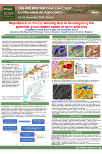
The Tagragra-Akka region, located in the Moroccan Anti-Atlas, is mainly composed of crystalline and crystallophyllian rocks. In this area, agricultural activities are primarily based on oasis cropping, which is essentially irrigated by surface water resources. This area belongs to an arid/semi-arid climate and has been living, over the last few decades, with a very severe drought. This has led to a water irrigation shortage and made groundwater a unique alternative source. However, investigating potential groundwater zones is financially demanding and time-consuming. Hence, remote sensing data and GISs are essential tools for precisely determining these zones. We used these tools to study fracturing and its spatial relationship with potential groundwater zones. Therefore, a Landsat-8 image was acquired and processed to extract three pieces of information, namely a fracturing map using the Sobel filtering technique, the fracturing density, and a lithology Support Vector Machine classifier. The main concept of using fracturing network mapping is of fundamental importance in hydrogeological investigations since they represent the preferred route for the infiltration and circulation of groundwater. Additionally, we used an image from a digital elevation model (DEM) to generate the slope, hydrological network, and drainage density maps. The resulting raster maps were integrated into a GIS workflow to identify places with high-potential groundwater resources. This approach made it possible to identify the most promising zones for establishing wells to provide sufficient water irrigation. The produced maps could be used for future hydrogeological investigation campaigns. This study also highlights interest in remote sensing and GISs to aid in resolving problems related to drought and water irrigation management in zones exposed to climate change effects. This approach could also be used in areas suffering from similar issues.
Keywords
Drought
groundwater zones
remote sensing
GIS
lineaments
lithology
Poster
Poster Rahimi et al 2024 IECAG 2024.pdf
Irrigation water resources in the Moroccan urban environment: diagnosis, challenges and sustainable prospects (the case of the city of Marrakech)
Evaluation of different scenarios to optimize the delineation of Daya surfaces using the multi-band water index (MBWI)