Event submissions
Published
This submission belongs to the session S4. Precision and Digital Agriculture of the event The 4th International Electronic Conference on Agronomy
Published date
02 Dec, 2024
Academic Editor
'%3e%3cpath%20d='M12.6657%2010.9104C12.4185%2010.325%2012.0599%209.79327%2011.6097%209.34482C11.1609%208.89508%2010.6293%208.5365%2010.0442%208.28888C10.0389%208.28626%2010.0337%208.28495%2010.0285%208.28233C10.8446%207.69279%2011.3752%206.73249%2011.3752%205.64904C11.3752%203.8542%209.92103%202.39999%208.1262%202.39999C6.33136%202.39999%204.87715%203.8542%204.87715%205.64904C4.87715%206.73249%205.40774%207.69279%206.22393%208.28364C6.21869%208.28626%206.21345%208.28757%206.20821%208.29019C5.62129%208.5378%205.09463%208.89284%204.64265%209.34613C4.1929%209.79493%203.83432%2010.3266%203.58671%2010.9117C3.34345%2011.4845%203.21226%2012.0987%203.20023%2012.7209C3.19988%2012.7349%203.20233%2012.7488%203.20744%2012.7619C3.21255%2012.7749%203.22022%2012.7867%203.22998%2012.7968C3.23975%2012.8068%203.25142%2012.8147%203.26431%2012.8202C3.2772%2012.8256%203.29105%2012.8284%203.30504%2012.8284H4.09109C4.14874%2012.8284%204.19459%2012.7825%204.1959%2012.7262C4.2221%2011.7148%204.62823%2010.7676%205.34617%2010.0497C6.08899%209.30683%207.0755%208.89808%208.1262%208.89808C9.17689%208.89808%2010.1634%209.30683%2010.9062%2010.0497C11.6242%2010.7676%2012.0303%2011.7148%2012.0565%2012.7262C12.0578%2012.7838%2012.1037%2012.8284%2012.1613%2012.8284H12.9474C12.9613%2012.8284%2012.9752%2012.8256%2012.9881%2012.8202C13.001%2012.8147%2013.0126%2012.8068%2013.0224%2012.7968C13.0322%2012.7867%2013.0398%2012.7749%2013.0449%2012.7619C13.0501%2012.7488%2013.0525%2012.7349%2013.0522%2012.7209C13.0391%2012.0947%2012.9094%2011.4855%2012.6657%2010.9104ZM8.1262%207.9024C7.52486%207.9024%206.9589%207.6679%206.53312%207.24211C6.10733%206.81633%205.87283%206.25037%205.87283%205.64904C5.87283%205.0477%206.10733%204.48174%206.53312%204.05596C6.9589%203.63018%207.52486%203.39567%208.1262%203.39567C8.72753%203.39567%209.29349%203.63018%209.71927%204.05596C10.1451%204.48174%2010.3796%205.0477%2010.3796%205.64904C10.3796%206.25037%2010.1451%206.81633%209.71927%207.24211C9.29349%207.6679%208.72753%207.9024%208.1262%207.9024Z'%20fill='%235D1EE1'/%3e%3c/g%3e%3c/svg%3e) Mario Cunha
Mario CunhaCitation
R. G. Rejith, Rabi N. Sahoo, Rajeev Ranjan, Tarun Kondraju, Amrita Bhandari, Shalini Gakhar, Estimating Leaf Area Index of Wheat using UAV Hyperspectral Remote Sensing and Machine Learning, in Proceedings of The 4th International Electronic Conference on Agronomy, 2 December–5 December 2024, MDPI: Basel, Switzerland
Share
Email
Facebook
Twitter
LinkedIn
Estimating Leaf Area Index of Wheat using UAV Hyperspectral Remote Sensing and Machine Learning
'%3e%3cpath%20d='M12.6647%2010.9104C12.4176%2010.325%2012.0589%209.7933%2011.6088%209.34485C11.16%208.89511%2010.6283%208.53653%2010.0432%208.28891C10.038%208.28629%2010.0327%208.28498%2010.0275%208.28236C10.8437%207.69282%2011.3743%206.73252%2011.3743%205.64907C11.3743%203.85423%209.92005%202.40002%208.12522%202.40002C6.33038%202.40002%204.87618%203.85423%204.87618%205.64907C4.87618%206.73252%205.40677%207.69282%206.22296%208.28367C6.21772%208.28629%206.21248%208.2876%206.20724%208.29022C5.62031%208.53783%205.09365%208.89287%204.64167%209.34616C4.19192%209.79496%203.83334%2010.3266%203.58573%2010.9117C3.34247%2011.4846%203.21128%2012.0987%203.19925%2012.721C3.1989%2012.735%203.20135%2012.7489%203.20646%2012.7619C3.21157%2012.7749%203.21924%2012.7868%203.22901%2012.7968C3.23877%2012.8068%203.25045%2012.8148%203.26334%2012.8202C3.27623%2012.8256%203.29007%2012.8284%203.30406%2012.8284H4.09012C4.14776%2012.8284%204.19362%2012.7825%204.19493%2012.7262C4.22113%2011.7148%204.62726%2010.7676%205.34519%2010.0497C6.08802%209.30686%207.07452%208.89811%208.12522%208.89811C9.17592%208.89811%2010.1624%209.30686%2010.9052%2010.0497C11.6232%2010.7676%2012.0293%2011.7148%2012.0555%2012.7262C12.0568%2012.7839%2012.1027%2012.8284%2012.1603%2012.8284H12.9464C12.9604%2012.8284%2012.9742%2012.8256%2012.9871%2012.8202C13%2012.8148%2013.0117%2012.8068%2013.0214%2012.7968C13.0312%2012.7868%2013.0389%2012.7749%2013.044%2012.7619C13.0491%2012.7489%2013.0515%2012.735%2013.0512%2012.721C13.0381%2012.0947%2012.9084%2011.4856%2012.6647%2010.9104ZM8.12522%207.90243C7.52388%207.90243%206.95792%207.66793%206.53214%207.24215C6.10636%206.81636%205.87185%206.2504%205.87185%205.64907C5.87185%205.04773%206.10636%204.48177%206.53214%204.05599C6.95792%203.63021%207.52388%203.3957%208.12522%203.3957C8.72655%203.3957%209.29252%203.63021%209.7183%204.05599C10.1441%204.48177%2010.3786%205.04773%2010.3786%205.64907C10.3786%206.2504%2010.1441%206.81636%209.7183%207.24215C9.29252%207.66793%208.72655%207.90243%208.12522%207.90243Z'%20fill='%235D1EE1'/%3e%3c/g%3e%3c/svg%3e)
R. G. Rejith 1
Rabi N. Sahoo 1
Rajeev Ranjan 1
Tarun Kondraju 1
Amrita Bhandari 1
Shalini Gakhar 2
1. Division of Agricultural Physics, Indian Council of Agricultural Research (ICAR) – Indian Agricultural Research Institute (IARI), Pusa, New Delhi 110012, India
2. International Rice Research Institute, New Delhi 110012, India
Abstract
Hyperspectral remote sensing using Unmanned Aerial Vehicles (UAVs) provides accurate, near-real-time, and large-scale spatial estimation of leaf area index (LAI), a very important crop variable used for monitoring crop growth. In the present study, the LAI of wheat crops was estimated using high-resolution UAV-borne hyperspectral data with a spectral range of 400-1000nm and a spatial resolution of 4cm. A total of twenty-seven hyperspectral vegetation indices were computed. The PLS (Partial Least Squares) regression combined with the VIP (Variable Importance in the Projection) scores were used for selecting the optimum indices as feature vectors for the Extreme Gradient Boosting (Xgboost) model for predicting LAI. The twelve optimal vegetation indices with VIP scores above 1 were selected to develop the prediction model. Once validated against the in situ-measured LAI values, the prediction model showed good accuracy, with R2 of 0.71, RMSE of 0.52, and MAE of 0.44. The model was used to generate a spatial map showing the variability in the LAI of wheat fields. Accurate mapping of LAI for wheat crops was achieved by integrating high-resolution UAV data and machine learning models. The results can be up-scaled to farmers’ fields for the operational delivery of LAI of crops to monitor crop growth and predict yield.
Keywords
Hyperspectral Remote sensing
Unmanned Aerial Vehicles
Leaf Area Index (LAI)
Wheat crops
Machine Learning
Poster
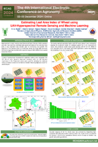
Poster_RGRejith_sciforum-103951.pdf
Harnessing Nanotechnology for Eco-Friendly Viticulture: Combating Botrytis cinerea in the Ribera de Duero
From Ornamental to Defender: Camellia japonica Flower Extracts Control Erwinia amylovora in Pear Orchards