Event submissions
Published
This submission belongs to the session S4. Precision and Digital Agriculture of the event The 4th International Electronic Conference on Agronomy
Published date
02 Dec, 2024
Academic Editor
'%3e%3cpath%20d='M12.6657%2010.9104C12.4185%2010.325%2012.0599%209.79327%2011.6097%209.34482C11.1609%208.89508%2010.6293%208.5365%2010.0442%208.28888C10.0389%208.28626%2010.0337%208.28495%2010.0285%208.28233C10.8446%207.69279%2011.3752%206.73249%2011.3752%205.64904C11.3752%203.8542%209.92103%202.39999%208.1262%202.39999C6.33136%202.39999%204.87715%203.8542%204.87715%205.64904C4.87715%206.73249%205.40774%207.69279%206.22393%208.28364C6.21869%208.28626%206.21345%208.28757%206.20821%208.29019C5.62129%208.5378%205.09463%208.89284%204.64265%209.34613C4.1929%209.79493%203.83432%2010.3266%203.58671%2010.9117C3.34345%2011.4845%203.21226%2012.0987%203.20023%2012.7209C3.19988%2012.7349%203.20233%2012.7488%203.20744%2012.7619C3.21255%2012.7749%203.22022%2012.7867%203.22998%2012.7968C3.23975%2012.8068%203.25142%2012.8147%203.26431%2012.8202C3.2772%2012.8256%203.29105%2012.8284%203.30504%2012.8284H4.09109C4.14874%2012.8284%204.19459%2012.7825%204.1959%2012.7262C4.2221%2011.7148%204.62823%2010.7676%205.34617%2010.0497C6.08899%209.30683%207.0755%208.89808%208.1262%208.89808C9.17689%208.89808%2010.1634%209.30683%2010.9062%2010.0497C11.6242%2010.7676%2012.0303%2011.7148%2012.0565%2012.7262C12.0578%2012.7838%2012.1037%2012.8284%2012.1613%2012.8284H12.9474C12.9613%2012.8284%2012.9752%2012.8256%2012.9881%2012.8202C13.001%2012.8147%2013.0126%2012.8068%2013.0224%2012.7968C13.0322%2012.7867%2013.0398%2012.7749%2013.0449%2012.7619C13.0501%2012.7488%2013.0525%2012.7349%2013.0522%2012.7209C13.0391%2012.0947%2012.9094%2011.4855%2012.6657%2010.9104ZM8.1262%207.9024C7.52486%207.9024%206.9589%207.6679%206.53312%207.24211C6.10733%206.81633%205.87283%206.25037%205.87283%205.64904C5.87283%205.0477%206.10733%204.48174%206.53312%204.05596C6.9589%203.63018%207.52486%203.39567%208.1262%203.39567C8.72753%203.39567%209.29349%203.63018%209.71927%204.05596C10.1451%204.48174%2010.3796%205.0477%2010.3796%205.64904C10.3796%206.25037%2010.1451%206.81633%209.71927%207.24211C9.29349%207.6679%208.72753%207.9024%208.1262%207.9024Z'%20fill='%235D1EE1'/%3e%3c/g%3e%3c/svg%3e) Mario Cunha
Mario CunhaCitation
Devanakonda Venkata Sai Chakradhar Reddy, Rabi N. Sahoo, Tarun Kondraju, R. G. Rejith, Rajeev Ranjan, Amrita Bhandari, Ali Moursy, S. C. Tripathi, Nitesh Kumar, Drone-based Multispectral Imaging for Precision Monitoring of Crop Growth Variables, in Proceedings of The 4th International Electronic Conference on Agronomy, 2 December–5 December 2024, MDPI: Basel, Switzerland
Share
Email
Facebook
Twitter
LinkedIn
Drone-based Multispectral Imaging for Precision Monitoring of Crop Growth Variables

Devanakonda Venkata Sai Chakradhar Reddy 1
'%3e%3cpath%20d='M12.6647%2010.9104C12.4176%2010.325%2012.0589%209.7933%2011.6088%209.34485C11.16%208.89511%2010.6283%208.53653%2010.0432%208.28891C10.038%208.28629%2010.0327%208.28498%2010.0275%208.28236C10.8437%207.69282%2011.3743%206.73252%2011.3743%205.64907C11.3743%203.85423%209.92005%202.40002%208.12522%202.40002C6.33038%202.40002%204.87618%203.85423%204.87618%205.64907C4.87618%206.73252%205.40677%207.69282%206.22296%208.28367C6.21772%208.28629%206.21248%208.2876%206.20724%208.29022C5.62031%208.53783%205.09365%208.89287%204.64167%209.34616C4.19192%209.79496%203.83334%2010.3266%203.58573%2010.9117C3.34247%2011.4846%203.21128%2012.0987%203.19925%2012.721C3.1989%2012.735%203.20135%2012.7489%203.20646%2012.7619C3.21157%2012.7749%203.21924%2012.7868%203.22901%2012.7968C3.23877%2012.8068%203.25045%2012.8148%203.26334%2012.8202C3.27623%2012.8256%203.29007%2012.8284%203.30406%2012.8284H4.09012C4.14776%2012.8284%204.19362%2012.7825%204.19493%2012.7262C4.22113%2011.7148%204.62726%2010.7676%205.34519%2010.0497C6.08802%209.30686%207.07452%208.89811%208.12522%208.89811C9.17592%208.89811%2010.1624%209.30686%2010.9052%2010.0497C11.6232%2010.7676%2012.0293%2011.7148%2012.0555%2012.7262C12.0568%2012.7839%2012.1027%2012.8284%2012.1603%2012.8284H12.9464C12.9604%2012.8284%2012.9742%2012.8256%2012.9871%2012.8202C13%2012.8148%2013.0117%2012.8068%2013.0214%2012.7968C13.0312%2012.7868%2013.0389%2012.7749%2013.044%2012.7619C13.0491%2012.7489%2013.0515%2012.735%2013.0512%2012.721C13.0381%2012.0947%2012.9084%2011.4856%2012.6647%2010.9104ZM8.12522%207.90243C7.52388%207.90243%206.95792%207.66793%206.53214%207.24215C6.10636%206.81636%205.87185%206.2504%205.87185%205.64907C5.87185%205.04773%206.10636%204.48177%206.53214%204.05599C6.95792%203.63021%207.52388%203.3957%208.12522%203.3957C8.72655%203.3957%209.29252%203.63021%209.7183%204.05599C10.1441%204.48177%2010.3786%205.04773%2010.3786%205.64907C10.3786%206.2504%2010.1441%206.81636%209.7183%207.24215C9.29252%207.66793%208.72655%207.90243%208.12522%207.90243Z'%20fill='%235D1EE1'/%3e%3c/g%3e%3c/svg%3e)
Rabi N. Sahoo 1
Tarun Kondraju 1
R. G. Rejith 1
Rajeev Ranjan 1
Amrita Bhandari 1

Ali Moursy 2
S. C. Tripathi 3
Nitesh Kumar 3
1. Division of Agricultural Physics, Indian Council of Agricultural Research (ICAR) - Indian Agricultural Research Institute (IARI), Pusa, New Delhi 110012, India
2. Soil and Water Department, Faculty of Agriculture, Sohag University, Sohag 82524, Egypt
3. Indian Council of Agricultural Research (ICAR) - Indian Institute of Wheat and Barley Research, Karnal 132001, India
Abstract
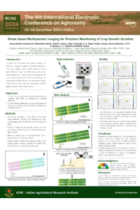
Drone-assisted crop growth monitoring has significantly boosted the demand for precision agriculture in recent years. Different vegetation spectral indices derived from drone-based multispectral images could be found more appropriate, as well as near-real-time monitoring tools over traditional methods and satellite remote sensing. The present study was conducted to estimate the leaf area index (LAI) and leaf nitrogen content (LNC) of wheat crops from drone-image-derived NDVI. Drone-based multispectral imaging of a wheat field with three wheat varieties (DBW-187, HD-3086, PBW-826) under eight nitrogen treatments (N0, N30, N60, N90, N120, N150, N180, N210) was completed at the flowering (90 DAS) and grain-filling stages (108 DAS), respectively. Multiple correlation analysis revealed that the squared Pearson’s correlation (R²) values of NDVI with LAI and LNC during the flowering stage were 0.78, 0.86, and 0.80 for DBW-187, HD-3086, and PBW-826, respectively, and improved to 0.89, 0.88, and 0.90 during the grain-filling stage. These results indicate a strong, positive relationship between NDVI, LAI, and LNC, which becomes stronger as the crop matures. Thus, drone remote sensing can effectively assess the biophysical variables of crops, potentially reducing the need for labor-intensive conventional methods of estimation. This study demonstrated that drone-assisted approaches can greatly enhance crop growth monitoring efficiency, offering a viable alternative to traditional methods.
Keywords
Precision Agriculture
Crop Growth Monitoring
UAV multispectral imagery
NDVI
Poster
Devanakonda_Sciforum-104001.pdf
From Ornamental to Defender: Camellia japonica Flower Extracts Control Erwinia amylovora in Pear Orchards
Plant metabolite role in developing abiotic stress resilience in plants: Evaluating the Effects of Melatonin and Myoinositol on the photosynthetic efficiency of apple rootstocks in the western Himalayan region.