Event submissions
Published
This submission belongs to the session S6. Climatology of the event The 7th International Electronic Conference on Atmospheric Sciences
Published date
30 May, 2025
Academic Editor
'%3e%3cpath%20d='M12.6657%2010.9104C12.4185%2010.325%2012.0599%209.79327%2011.6097%209.34482C11.1609%208.89508%2010.6293%208.5365%2010.0442%208.28888C10.0389%208.28626%2010.0337%208.28495%2010.0285%208.28233C10.8446%207.69279%2011.3752%206.73249%2011.3752%205.64904C11.3752%203.8542%209.92103%202.39999%208.1262%202.39999C6.33136%202.39999%204.87715%203.8542%204.87715%205.64904C4.87715%206.73249%205.40774%207.69279%206.22393%208.28364C6.21869%208.28626%206.21345%208.28757%206.20821%208.29019C5.62129%208.5378%205.09463%208.89284%204.64265%209.34613C4.1929%209.79493%203.83432%2010.3266%203.58671%2010.9117C3.34345%2011.4845%203.21226%2012.0987%203.20023%2012.7209C3.19988%2012.7349%203.20233%2012.7488%203.20744%2012.7619C3.21255%2012.7749%203.22022%2012.7867%203.22998%2012.7968C3.23975%2012.8068%203.25142%2012.8147%203.26431%2012.8202C3.2772%2012.8256%203.29105%2012.8284%203.30504%2012.8284H4.09109C4.14874%2012.8284%204.19459%2012.7825%204.1959%2012.7262C4.2221%2011.7148%204.62823%2010.7676%205.34617%2010.0497C6.08899%209.30683%207.0755%208.89808%208.1262%208.89808C9.17689%208.89808%2010.1634%209.30683%2010.9062%2010.0497C11.6242%2010.7676%2012.0303%2011.7148%2012.0565%2012.7262C12.0578%2012.7838%2012.1037%2012.8284%2012.1613%2012.8284H12.9474C12.9613%2012.8284%2012.9752%2012.8256%2012.9881%2012.8202C13.001%2012.8147%2013.0126%2012.8068%2013.0224%2012.7968C13.0322%2012.7867%2013.0398%2012.7749%2013.0449%2012.7619C13.0501%2012.7488%2013.0525%2012.7349%2013.0522%2012.7209C13.0391%2012.0947%2012.9094%2011.4855%2012.6657%2010.9104ZM8.1262%207.9024C7.52486%207.9024%206.9589%207.6679%206.53312%207.24211C6.10733%206.81633%205.87283%206.25037%205.87283%205.64904C5.87283%205.0477%206.10733%204.48174%206.53312%204.05596C6.9589%203.63018%207.52486%203.39567%208.1262%203.39567C8.72753%203.39567%209.29349%203.63018%209.71927%204.05596C10.1451%204.48174%2010.3796%205.0477%2010.3796%205.64904C10.3796%206.25037%2010.1451%206.81633%209.71927%207.24211C9.29349%207.6679%208.72753%207.9024%208.1262%207.9024Z'%20fill='%235D1EE1'/%3e%3c/g%3e%3c/svg%3e) Eugene Rozanov
Eugene RozanovCitation
Katyelle Ferreira da Silva Bezerra, Helber Barros Gomes, Janaína M Pinto do Nascimento, Marisol Osman, Maria Cristina Lemos da Silva, Daniel Milano Costa de Lima, A SPATIOTEMPORAL ANALYSIS OF THE OCCURRENCE OF FIRES IN THE CAATINGA BIOME: A CLIMATOLOGICAL APPROACH USING MACHINE LEARNING, in Proceedings of The 7th International Electronic Conference on Atmospheric Sciences, 4 June–6 June 2025, MDPI: Basel, Switzerland
Share
Email
Facebook
Twitter
LinkedIn
A SPATIOTEMPORAL ANALYSIS OF THE OCCURRENCE OF FIRES IN THE CAATINGA BIOME: A CLIMATOLOGICAL APPROACH USING MACHINE LEARNING
'%3e%3cpath%20d='M12.6647%2010.9104C12.4176%2010.325%2012.0589%209.7933%2011.6088%209.34485C11.16%208.89511%2010.6283%208.53653%2010.0432%208.28891C10.038%208.28629%2010.0327%208.28498%2010.0275%208.28236C10.8437%207.69282%2011.3743%206.73252%2011.3743%205.64907C11.3743%203.85423%209.92005%202.40002%208.12522%202.40002C6.33038%202.40002%204.87618%203.85423%204.87618%205.64907C4.87618%206.73252%205.40677%207.69282%206.22296%208.28367C6.21772%208.28629%206.21248%208.2876%206.20724%208.29022C5.62031%208.53783%205.09365%208.89287%204.64167%209.34616C4.19192%209.79496%203.83334%2010.3266%203.58573%2010.9117C3.34247%2011.4846%203.21128%2012.0987%203.19925%2012.721C3.1989%2012.735%203.20135%2012.7489%203.20646%2012.7619C3.21157%2012.7749%203.21924%2012.7868%203.22901%2012.7968C3.23877%2012.8068%203.25045%2012.8148%203.26334%2012.8202C3.27623%2012.8256%203.29007%2012.8284%203.30406%2012.8284H4.09012C4.14776%2012.8284%204.19362%2012.7825%204.19493%2012.7262C4.22113%2011.7148%204.62726%2010.7676%205.34519%2010.0497C6.08802%209.30686%207.07452%208.89811%208.12522%208.89811C9.17592%208.89811%2010.1624%209.30686%2010.9052%2010.0497C11.6232%2010.7676%2012.0293%2011.7148%2012.0555%2012.7262C12.0568%2012.7839%2012.1027%2012.8284%2012.1603%2012.8284H12.9464C12.9604%2012.8284%2012.9742%2012.8256%2012.9871%2012.8202C13%2012.8148%2013.0117%2012.8068%2013.0214%2012.7968C13.0312%2012.7868%2013.0389%2012.7749%2013.044%2012.7619C13.0491%2012.7489%2013.0515%2012.735%2013.0512%2012.721C13.0381%2012.0947%2012.9084%2011.4856%2012.6647%2010.9104ZM8.12522%207.90243C7.52388%207.90243%206.95792%207.66793%206.53214%207.24215C6.10636%206.81636%205.87185%206.2504%205.87185%205.64907C5.87185%205.04773%206.10636%204.48177%206.53214%204.05599C6.95792%203.63021%207.52388%203.3957%208.12522%203.3957C8.72655%203.3957%209.29252%203.63021%209.7183%204.05599C10.1441%204.48177%2010.3786%205.04773%2010.3786%205.64907C10.3786%206.2504%2010.1441%206.81636%209.7183%207.24215C9.29252%207.66793%208.72655%207.90243%208.12522%207.90243Z'%20fill='%235D1EE1'/%3e%3c/g%3e%3c/svg%3e)
Katyelle Ferreira da Silva Bezerra 1,2

Helber Barros Gomes 1,2
Janaína M Pinto do Nascimento 3,4
Marisol Osman 5,6
Maria Cristina Lemos da Silva 1,2
Daniel Milano Costa de Lima 7
1. Federal University of Alagoas
2. Institute of Atmospheric Sciences - ICAT
3. Cooperative Institute for Research in Environmental Sciences, University of Colorado, Boulder, CO 80309,
USA
4. NOAA OAR Global Systems Laboratory (GSL)
5. Universidad de Buenos Aires, Facultad de Ciencias Exactas y Naturales, Departamento de Ciencias de la
Atmósfera y los Océanos
6. CONICET – Universidad de Buenos Aires, Centro de Investigaciones del Mar y la Atmósfera (CIMA); CNRS – IRD – CONICET – UBA, Instituto Franco-Argentino para el Estudio del Clima y sus Impactos (IRL 3351
IFAECI), Buenos Aires, Argentina
7. Federal University of Campina Grande
Abstract
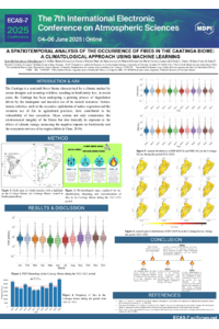
The Caatinga is a semi-arid forest biome with a climate that is marked by severe droughts and recurrent fires, resulting in a loss of biodiversity. This research uses daily data from the VIIRS active fire detection product (onboard the S-NPP and NOAA-20 satellites) to analyze fires from 2012 to 2023 in the Caatinga Biome, where the data set was filtered, including only Fire Radiative Power (FRP) values above zero and considering only detections that were longer than 24 hours. The clustering methodology of Nascimento et al. was then applied, using the DBSCAN algorithm to identify and group the fires. The latitude, longitude, and time coordinates were transformed into a common Cartesian space, allowing for the identification of patterns in the distribution of fires, in which unique identifiers, called “fire_id”, were used to identify the frequency, duration, and intensity of these fires. The climatology of the FRP and Fire Radiative Energy (FRE) data showed significant variability, especially from July onwards, where the highest climatological averages of the FRP occurred in November (~17 MW/h) and October (~16 MW/h), respectively. The highest climatological averages of the RES occurred in August (300.000 MJ) and September (200.000 MJ), respectively. The annual distribution showed FRP peaks throughout all years, with a significant increase in 2021 (~1500 MW/h), but the highest frequency of fire_id markers was recorded in October 2023 (7455). In addition, the highest fire_id frequencies occurred mainly in the months of September to November. A kernel density analysis, which mapped the spatial distribution of the FRP density, showed that the states of Bahia and Piauí had the highest FRP intensities, indicating a significant concentration of fires in these regions. These results contribute to the development of prevention and mitigation strategies, both in the short and long term.
Keywords
Fire
Caatinga
Machine Learning
VIIRS
Remote Sensing
Poster
CAATINGA-ECAS.pptx.pdf
Quantifying Urban Air Quality Across Global Megacities
AN ANALYSIS OF FIRE DYNAMICS IN THE STATE OF ALAGOAS AND THEIR RELATIONSHIP WITH METEOROLOGICAL VARIABLES