Event submissions
Published
This submission belongs to the session S5. Atmospheric Techniques, Instruments and Modeling of the event The 7th International Electronic Conference on Atmospheric Sciences
Published date
30 May, 2025
Academic Editor
'%3e%3cpath%20d='M12.6657%2010.9104C12.4185%2010.325%2012.0599%209.79327%2011.6097%209.34482C11.1609%208.89508%2010.6293%208.5365%2010.0442%208.28888C10.0389%208.28626%2010.0337%208.28495%2010.0285%208.28233C10.8446%207.69279%2011.3752%206.73249%2011.3752%205.64904C11.3752%203.8542%209.92103%202.39999%208.1262%202.39999C6.33136%202.39999%204.87715%203.8542%204.87715%205.64904C4.87715%206.73249%205.40774%207.69279%206.22393%208.28364C6.21869%208.28626%206.21345%208.28757%206.20821%208.29019C5.62129%208.5378%205.09463%208.89284%204.64265%209.34613C4.1929%209.79493%203.83432%2010.3266%203.58671%2010.9117C3.34345%2011.4845%203.21226%2012.0987%203.20023%2012.7209C3.19988%2012.7349%203.20233%2012.7488%203.20744%2012.7619C3.21255%2012.7749%203.22022%2012.7867%203.22998%2012.7968C3.23975%2012.8068%203.25142%2012.8147%203.26431%2012.8202C3.2772%2012.8256%203.29105%2012.8284%203.30504%2012.8284H4.09109C4.14874%2012.8284%204.19459%2012.7825%204.1959%2012.7262C4.2221%2011.7148%204.62823%2010.7676%205.34617%2010.0497C6.08899%209.30683%207.0755%208.89808%208.1262%208.89808C9.17689%208.89808%2010.1634%209.30683%2010.9062%2010.0497C11.6242%2010.7676%2012.0303%2011.7148%2012.0565%2012.7262C12.0578%2012.7838%2012.1037%2012.8284%2012.1613%2012.8284H12.9474C12.9613%2012.8284%2012.9752%2012.8256%2012.9881%2012.8202C13.001%2012.8147%2013.0126%2012.8068%2013.0224%2012.7968C13.0322%2012.7867%2013.0398%2012.7749%2013.0449%2012.7619C13.0501%2012.7488%2013.0525%2012.7349%2013.0522%2012.7209C13.0391%2012.0947%2012.9094%2011.4855%2012.6657%2010.9104ZM8.1262%207.9024C7.52486%207.9024%206.9589%207.6679%206.53312%207.24211C6.10733%206.81633%205.87283%206.25037%205.87283%205.64904C5.87283%205.0477%206.10733%204.48174%206.53312%204.05596C6.9589%203.63018%207.52486%203.39567%208.1262%203.39567C8.72753%203.39567%209.29349%203.63018%209.71927%204.05596C10.1451%204.48174%2010.3796%205.0477%2010.3796%205.64904C10.3796%206.25037%2010.1451%206.81633%209.71927%207.24211C9.29349%207.6679%208.72753%207.9024%208.1262%207.9024Z'%20fill='%235D1EE1'/%3e%3c/g%3e%3c/svg%3e) Riccardo Buccolieri
Riccardo BuccolieriCitation
Gabriel Marques da Silva, Mateus Fernandes, Laura Silva Pelicer, Gregori de Arruda Moreira, Alexandre Cacheffo, Fábio Juliano da Silva Lopes, Giovanni Souza, Luisa D’Antola de Mello, Eduardo Landulfo, Applying remote sensing techniques to investigate the trajectory of smoke plumes during biomass burning events, in Proceedings of The 7th International Electronic Conference on Atmospheric Sciences, 4 June–6 June 2025, MDPI: Basel, Switzerland
Share
Email
Facebook
Twitter
LinkedIn
Applying remote sensing techniques to investigate the trajectory of smoke plumes during biomass burning events

Gabriel Marques da Silva 1
'%3e%3cpath%20d='M12.6647%2010.9104C12.4176%2010.325%2012.0589%209.7933%2011.6088%209.34485C11.16%208.89511%2010.6283%208.53653%2010.0432%208.28891C10.038%208.28629%2010.0327%208.28498%2010.0275%208.28236C10.8437%207.69282%2011.3743%206.73252%2011.3743%205.64907C11.3743%203.85423%209.92005%202.40002%208.12522%202.40002C6.33038%202.40002%204.87618%203.85423%204.87618%205.64907C4.87618%206.73252%205.40677%207.69282%206.22296%208.28367C6.21772%208.28629%206.21248%208.2876%206.20724%208.29022C5.62031%208.53783%205.09365%208.89287%204.64167%209.34616C4.19192%209.79496%203.83334%2010.3266%203.58573%2010.9117C3.34247%2011.4846%203.21128%2012.0987%203.19925%2012.721C3.1989%2012.735%203.20135%2012.7489%203.20646%2012.7619C3.21157%2012.7749%203.21924%2012.7868%203.22901%2012.7968C3.23877%2012.8068%203.25045%2012.8148%203.26334%2012.8202C3.27623%2012.8256%203.29007%2012.8284%203.30406%2012.8284H4.09012C4.14776%2012.8284%204.19362%2012.7825%204.19493%2012.7262C4.22113%2011.7148%204.62726%2010.7676%205.34519%2010.0497C6.08802%209.30686%207.07452%208.89811%208.12522%208.89811C9.17592%208.89811%2010.1624%209.30686%2010.9052%2010.0497C11.6232%2010.7676%2012.0293%2011.7148%2012.0555%2012.7262C12.0568%2012.7839%2012.1027%2012.8284%2012.1603%2012.8284H12.9464C12.9604%2012.8284%2012.9742%2012.8256%2012.9871%2012.8202C13%2012.8148%2013.0117%2012.8068%2013.0214%2012.7968C13.0312%2012.7868%2013.0389%2012.7749%2013.044%2012.7619C13.0491%2012.7489%2013.0515%2012.735%2013.0512%2012.721C13.0381%2012.0947%2012.9084%2011.4856%2012.6647%2010.9104ZM8.12522%207.90243C7.52388%207.90243%206.95792%207.66793%206.53214%207.24215C6.10636%206.81636%205.87185%206.2504%205.87185%205.64907C5.87185%205.04773%206.10636%204.48177%206.53214%204.05599C6.95792%203.63021%207.52388%203.3957%208.12522%203.3957C8.72655%203.3957%209.29252%203.63021%209.7183%204.05599C10.1441%204.48177%2010.3786%205.04773%2010.3786%205.64907C10.3786%206.2504%2010.1441%206.81636%209.7183%207.24215C9.29252%207.66793%208.72655%207.90243%208.12522%207.90243Z'%20fill='%235D1EE1'/%3e%3c/g%3e%3c/svg%3e)
Mateus Fernandes 1
Laura Silva Pelicer 1

Gregori de Arruda Moreira 1,2

Alexandre Cacheffo 1,3

Fábio Juliano da Silva Lopes 1,4
Giovanni Souza 1
Luisa D’Antola de Mello 1

Eduardo Landulfo 1
1. Center of Lasers and Applications (CELAP), Energy and Nuclear Research Institute, São Paulo 05508-000, Brazil
2. Federal Institute of Education, Science and Technology of São Paulo (IFSP), Campus Registro, São Paulo 11900-000, Brazil
3. Institute of Exact and Natural Sciences of Pontal (ICENP), Federal University of Uberlândia (UFU), Campus Pontal, Ituiutaba 38304-402, Brazil
4. Department of Environmental Sciences, Institute of Environmental, Chemical and Pharmaceutical Sciences (ICAQF), Federal University of São Paulo (UNIFESP), Campus Diadema, São Paulo 09913-030, Brazil
Abstract
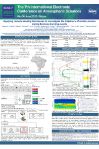
The wildfires in Brazil in 2024 reached unprecedented levels, serving as yet another indicator of the effects of climate change. LIDAR measurements conducted in São Paulo detected intense aerosol plumes generated during the wildfire period in August and September in the Mato Grosso do Sul and Pará regions. This study investigates the potential transport of aerosol plumes generated by these wildfires to São Paulo. To analyze the relationship between these plumes and wildfires in other regions of Brazil, data from the recently launched EarthCARE satellite, backward trajectory analysis using the HYSPLIT model, and AERONET sun photometers and Raman–LIDAR measurements were utilized. As part of the EarthCARE satellite calibration and validation process, this study compared three days of LIDAR data collected for São Paulo. After validating the backscatter and extinction coefficients and the LIDAR ratio, the HYSPLIT model was used to determine the potential trajectories of the aerosol plumes on the days with the highest heat source index. Once the source locations were identified, their correlation with wildfire-affected areas was examined. Sun photometer data were analyzed to infer the properties of the aerosol plumes. The results indicated three trajectories that coincided with fire hotspots, enabling the identification of wildfires in the city of Corumbá (Mato Grosso do Sul) and São Félix do Xingu (Pará) as the likely primary sources of the aerosol plumes observed in São Paulo.
Keywords
Validation
remote sensing
biomass burning
aerossol.
Poster
ECAS-7_2025_Conference (1).pdf
AN ANALYSIS OF FIRE DYNAMICS IN THE STATE OF ALAGOAS AND THEIR RELATIONSHIP WITH METEOROLOGICAL VARIABLES
The Climatology and synoptic conditions of the driest and warmest months in Northeast Brazil