Event submissions
Published
This submission belongs to the session S7. Resilient Agricultural Landscape Systems of the event The 2nd International Electronic Conference on Land
Published date
02 Sep, 2025
Academic Editor
'%3e%3cpath%20d='M12.6657%2010.9104C12.4185%2010.325%2012.0599%209.79327%2011.6097%209.34482C11.1609%208.89508%2010.6293%208.5365%2010.0442%208.28888C10.0389%208.28626%2010.0337%208.28495%2010.0285%208.28233C10.8446%207.69279%2011.3752%206.73249%2011.3752%205.64904C11.3752%203.8542%209.92103%202.39999%208.1262%202.39999C6.33136%202.39999%204.87715%203.8542%204.87715%205.64904C4.87715%206.73249%205.40774%207.69279%206.22393%208.28364C6.21869%208.28626%206.21345%208.28757%206.20821%208.29019C5.62129%208.5378%205.09463%208.89284%204.64265%209.34613C4.1929%209.79493%203.83432%2010.3266%203.58671%2010.9117C3.34345%2011.4845%203.21226%2012.0987%203.20023%2012.7209C3.19988%2012.7349%203.20233%2012.7488%203.20744%2012.7619C3.21255%2012.7749%203.22022%2012.7867%203.22998%2012.7968C3.23975%2012.8068%203.25142%2012.8147%203.26431%2012.8202C3.2772%2012.8256%203.29105%2012.8284%203.30504%2012.8284H4.09109C4.14874%2012.8284%204.19459%2012.7825%204.1959%2012.7262C4.2221%2011.7148%204.62823%2010.7676%205.34617%2010.0497C6.08899%209.30683%207.0755%208.89808%208.1262%208.89808C9.17689%208.89808%2010.1634%209.30683%2010.9062%2010.0497C11.6242%2010.7676%2012.0303%2011.7148%2012.0565%2012.7262C12.0578%2012.7838%2012.1037%2012.8284%2012.1613%2012.8284H12.9474C12.9613%2012.8284%2012.9752%2012.8256%2012.9881%2012.8202C13.001%2012.8147%2013.0126%2012.8068%2013.0224%2012.7968C13.0322%2012.7867%2013.0398%2012.7749%2013.0449%2012.7619C13.0501%2012.7488%2013.0525%2012.7349%2013.0522%2012.7209C13.0391%2012.0947%2012.9094%2011.4855%2012.6657%2010.9104ZM8.1262%207.9024C7.52486%207.9024%206.9589%207.6679%206.53312%207.24211C6.10733%206.81633%205.87283%206.25037%205.87283%205.64904C5.87283%205.0477%206.10733%204.48174%206.53312%204.05596C6.9589%203.63018%207.52486%203.39567%208.1262%203.39567C8.72753%203.39567%209.29349%203.63018%209.71927%204.05596C10.1451%204.48174%2010.3796%205.0477%2010.3796%205.64904C10.3796%206.25037%2010.1451%206.81633%209.71927%207.24211C9.29349%207.6679%208.72753%207.9024%208.1262%207.9024Z'%20fill='%235D1EE1'/%3e%3c/g%3e%3c/svg%3e) Hossein Azadi
Hossein AzadiCitation
Reza Peykanpour Fard, Ferial Farasat, An Integrated Geospatial Framework for Assessing Agricultural Suitability Using Multi-Source Environmental Criteria, in Proceedings of The 2nd International Electronic Conference on Land, 4 September–5 September 2025, MDPI: Basel, Switzerland
Share
Email
Facebook
Twitter
LinkedIn
An Integrated Geospatial Framework for Assessing Agricultural Suitability Using Multi-Source Environmental Criteria
'%3e%3cpath%20d='M12.6647%2010.9104C12.4176%2010.325%2012.0589%209.7933%2011.6088%209.34485C11.16%208.89511%2010.6283%208.53653%2010.0432%208.28891C10.038%208.28629%2010.0327%208.28498%2010.0275%208.28236C10.8437%207.69282%2011.3743%206.73252%2011.3743%205.64907C11.3743%203.85423%209.92005%202.40002%208.12522%202.40002C6.33038%202.40002%204.87618%203.85423%204.87618%205.64907C4.87618%206.73252%205.40677%207.69282%206.22296%208.28367C6.21772%208.28629%206.21248%208.2876%206.20724%208.29022C5.62031%208.53783%205.09365%208.89287%204.64167%209.34616C4.19192%209.79496%203.83334%2010.3266%203.58573%2010.9117C3.34247%2011.4846%203.21128%2012.0987%203.19925%2012.721C3.1989%2012.735%203.20135%2012.7489%203.20646%2012.7619C3.21157%2012.7749%203.21924%2012.7868%203.22901%2012.7968C3.23877%2012.8068%203.25045%2012.8148%203.26334%2012.8202C3.27623%2012.8256%203.29007%2012.8284%203.30406%2012.8284H4.09012C4.14776%2012.8284%204.19362%2012.7825%204.19493%2012.7262C4.22113%2011.7148%204.62726%2010.7676%205.34519%2010.0497C6.08802%209.30686%207.07452%208.89811%208.12522%208.89811C9.17592%208.89811%2010.1624%209.30686%2010.9052%2010.0497C11.6232%2010.7676%2012.0293%2011.7148%2012.0555%2012.7262C12.0568%2012.7839%2012.1027%2012.8284%2012.1603%2012.8284H12.9464C12.9604%2012.8284%2012.9742%2012.8256%2012.9871%2012.8202C13%2012.8148%2013.0117%2012.8068%2013.0214%2012.7968C13.0312%2012.7868%2013.0389%2012.7749%2013.044%2012.7619C13.0491%2012.7489%2013.0515%2012.735%2013.0512%2012.721C13.0381%2012.0947%2012.9084%2011.4856%2012.6647%2010.9104ZM8.12522%207.90243C7.52388%207.90243%206.95792%207.66793%206.53214%207.24215C6.10636%206.81636%205.87185%206.2504%205.87185%205.64907C5.87185%205.04773%206.10636%204.48177%206.53214%204.05599C6.95792%203.63021%207.52388%203.3957%208.12522%203.3957C8.72655%203.3957%209.29252%203.63021%209.7183%204.05599C10.1441%204.48177%2010.3786%205.04773%2010.3786%205.64907C10.3786%206.2504%2010.1441%206.81636%209.7183%207.24215C9.29252%207.66793%208.72655%207.90243%208.12522%207.90243Z'%20fill='%235D1EE1'/%3e%3c/g%3e%3c/svg%3e)
Reza Peykanpour Fard 1
Ferial Farasat 1
1. Department of Natural Resources; Isfahan University of Technology; Isfahan; 84156-83111; Iran
Abstract
Abstract:
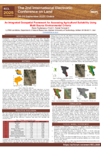
Achieving sustainable farming in dry and semi-dry areas depends on accurately identifying optimal land zones by evaluating environmental factors. This research presents a combined approach merging object-oriented image processing with pixel-level modeling to evaluate farming land suitability in Iran's Anjir Plain. By employing Landsat-9 satellite data, 525 spatial units were created via multi-scale segmentation, ensuring boundaries matched natural terrain characteristics. Eleven environmental criteria related to water, climate, and terrain were normalized and combined using the Ordered Weighted Averaging (OWA) method to generate a suitability score (0–1) for each unit.
Findings revealed that altitude (r = 0.8), soil composition and bedrock (r = 0.7), and nearness to groundwater sources (r = 0.7) had the strongest positive correlation with farming suitability, whereas local climate conditions and temperature variables exhibited adverse effects. Merely 7 spatial units, spanning about 8,670 hectares, surpassed the high-suitability benchmark of 0.9, marking them as prime areas for agricultural expansion. Validation using 40 randomly sampled field data points yielded 90% accuracy and an 80% Kappa score. The combined method improved both classification precision and spatial consistency, ensuring better conformity with actual land divisions.
These outcomes highlight the efficacy of blending object-based analysis and OWA for pinpointing feasible agricultural lands, especially in water-limited settings. The framework serves as a practical planning aid for optimizing land use and managing farming resources in arid regions.
Keywords
Farming land assessment
Integrated methodology
Object-oriented remote sensing
Geospatial evaluation
Poster
an Integrated Geospatial Framework for Assessing Agricultural Suitability Using Multi-Source Environmental Criteria(1).pdf
Parametric Timber Urbanism: Algorithmic Wooden Megastructures for Low-Entropy, High-Density Land Use
Storage and use of rainwater in urban areas: Gambelas university courtyard