Event submissions
Published
This submission belongs to the session S1. Urbanization and Land Use: Navigating the Future of Cities of the event The 2nd International Electronic Conference on Land
Published date
02 Sep, 2025
Academic Editor
'%3e%3cpath%20d='M12.6657%2010.9104C12.4185%2010.325%2012.0599%209.79327%2011.6097%209.34482C11.1609%208.89508%2010.6293%208.5365%2010.0442%208.28888C10.0389%208.28626%2010.0337%208.28495%2010.0285%208.28233C10.8446%207.69279%2011.3752%206.73249%2011.3752%205.64904C11.3752%203.8542%209.92103%202.39999%208.1262%202.39999C6.33136%202.39999%204.87715%203.8542%204.87715%205.64904C4.87715%206.73249%205.40774%207.69279%206.22393%208.28364C6.21869%208.28626%206.21345%208.28757%206.20821%208.29019C5.62129%208.5378%205.09463%208.89284%204.64265%209.34613C4.1929%209.79493%203.83432%2010.3266%203.58671%2010.9117C3.34345%2011.4845%203.21226%2012.0987%203.20023%2012.7209C3.19988%2012.7349%203.20233%2012.7488%203.20744%2012.7619C3.21255%2012.7749%203.22022%2012.7867%203.22998%2012.7968C3.23975%2012.8068%203.25142%2012.8147%203.26431%2012.8202C3.2772%2012.8256%203.29105%2012.8284%203.30504%2012.8284H4.09109C4.14874%2012.8284%204.19459%2012.7825%204.1959%2012.7262C4.2221%2011.7148%204.62823%2010.7676%205.34617%2010.0497C6.08899%209.30683%207.0755%208.89808%208.1262%208.89808C9.17689%208.89808%2010.1634%209.30683%2010.9062%2010.0497C11.6242%2010.7676%2012.0303%2011.7148%2012.0565%2012.7262C12.0578%2012.7838%2012.1037%2012.8284%2012.1613%2012.8284H12.9474C12.9613%2012.8284%2012.9752%2012.8256%2012.9881%2012.8202C13.001%2012.8147%2013.0126%2012.8068%2013.0224%2012.7968C13.0322%2012.7867%2013.0398%2012.7749%2013.0449%2012.7619C13.0501%2012.7488%2013.0525%2012.7349%2013.0522%2012.7209C13.0391%2012.0947%2012.9094%2011.4855%2012.6657%2010.9104ZM8.1262%207.9024C7.52486%207.9024%206.9589%207.6679%206.53312%207.24211C6.10733%206.81633%205.87283%206.25037%205.87283%205.64904C5.87283%205.0477%206.10733%204.48174%206.53312%204.05596C6.9589%203.63018%207.52486%203.39567%208.1262%203.39567C8.72753%203.39567%209.29349%203.63018%209.71927%204.05596C10.1451%204.48174%2010.3796%205.0477%2010.3796%205.64904C10.3796%206.25037%2010.1451%206.81633%209.71927%207.24211C9.29349%207.6679%208.72753%207.9024%208.1262%207.9024Z'%20fill='%235D1EE1'/%3e%3c/g%3e%3c/svg%3e) Chuanrong Zhang
Chuanrong ZhangCitation
Sk. Tanjim Jaman Supto, Dewan Reza Hamid Karzai, Ettahad Islam Adib, Assessing Industrial Land's Suitability for Sustainable Urban Planning in Dhaka Region Using Geospatial Techniques, in Proceedings of The 2nd International Electronic Conference on Land, 4 September–5 September 2025, MDPI: Basel, Switzerland
Share
Email
Facebook
Twitter
LinkedIn
Assessing Industrial Land's Suitability for Sustainable Urban Planning in Dhaka Region Using Geospatial Techniques

Sk. Tanjim Jaman Supto 1

Dewan Reza Hamid Karzai 2
'%3e%3cpath%20d='M12.6647%2010.9104C12.4176%2010.325%2012.0589%209.7933%2011.6088%209.34485C11.16%208.89511%2010.6283%208.53653%2010.0432%208.28891C10.038%208.28629%2010.0327%208.28498%2010.0275%208.28236C10.8437%207.69282%2011.3743%206.73252%2011.3743%205.64907C11.3743%203.85423%209.92005%202.40002%208.12522%202.40002C6.33038%202.40002%204.87618%203.85423%204.87618%205.64907C4.87618%206.73252%205.40677%207.69282%206.22296%208.28367C6.21772%208.28629%206.21248%208.2876%206.20724%208.29022C5.62031%208.53783%205.09365%208.89287%204.64167%209.34616C4.19192%209.79496%203.83334%2010.3266%203.58573%2010.9117C3.34247%2011.4846%203.21128%2012.0987%203.19925%2012.721C3.1989%2012.735%203.20135%2012.7489%203.20646%2012.7619C3.21157%2012.7749%203.21924%2012.7868%203.22901%2012.7968C3.23877%2012.8068%203.25045%2012.8148%203.26334%2012.8202C3.27623%2012.8256%203.29007%2012.8284%203.30406%2012.8284H4.09012C4.14776%2012.8284%204.19362%2012.7825%204.19493%2012.7262C4.22113%2011.7148%204.62726%2010.7676%205.34519%2010.0497C6.08802%209.30686%207.07452%208.89811%208.12522%208.89811C9.17592%208.89811%2010.1624%209.30686%2010.9052%2010.0497C11.6232%2010.7676%2012.0293%2011.7148%2012.0555%2012.7262C12.0568%2012.7839%2012.1027%2012.8284%2012.1603%2012.8284H12.9464C12.9604%2012.8284%2012.9742%2012.8256%2012.9871%2012.8202C13%2012.8148%2013.0117%2012.8068%2013.0214%2012.7968C13.0312%2012.7868%2013.0389%2012.7749%2013.044%2012.7619C13.0491%2012.7489%2013.0515%2012.735%2013.0512%2012.721C13.0381%2012.0947%2012.9084%2011.4856%2012.6647%2010.9104ZM8.12522%207.90243C7.52388%207.90243%206.95792%207.66793%206.53214%207.24215C6.10636%206.81636%205.87185%206.2504%205.87185%205.64907C5.87185%205.04773%206.10636%204.48177%206.53214%204.05599C6.95792%203.63021%207.52388%203.3957%208.12522%203.3957C8.72655%203.3957%209.29252%203.63021%209.7183%204.05599C10.1441%204.48177%2010.3786%205.04773%2010.3786%205.64907C10.3786%206.2504%2010.1441%206.81636%209.7183%207.24215C9.29252%207.66793%208.72655%207.90243%208.12522%207.90243Z'%20fill='%235D1EE1'/%3e%3c/g%3e%3c/svg%3e)
Ettahad Islam Adib 2
1. Department of Environmental Research, Nano Research Centre; Sylhet; 3114; Bangladesh
2. Department of Industrial and Production Engineering; Shahjalal University of Science and Technology; Sylhet; 3114; Bangladesh
Abstract
The Dhaka Metropolitan Area is experiencing rapid industrial growth alongside uncontrolled urban expansion, leading to significant land-use conflicts and environmental pressures. This study investigates how to identify the optimal sites for industrial development that support sustainable urban growth by leveraging Geographic Information Systems (GISs), combined with a structured decision-making approach. The analysis incorporates key environmental and infrastructural factors to guide responsible planning aligned with global sustainability objectives. This study integrates spatial variables such as transport accessibility, land use, environmental sensitivity, and infrastructure presence. Up-to-date satellite imagery and land-use information from recent years ensure relevant and precise analysis. The findings indicate that roughly 10-15% of the metropolitan area is highly suitable for industrial activities, predominantly in the eastern and southern sectors. However, a considerable portion of existing industries is situated outside the officially designated zones, with nearly 9% infringing on protected environments, pointing to gaps in land management policies. Additionally, between 2014 and 2020, industrial expansion resulted in the conversion of over 1,100 hectares of natural land, underscoring urgent ecological concerns. Scenario modeling further demonstrates how strategic land allocation can balance industrial growth with environmental conservation. This research highlights the value of integrating a GIS with multi-criteria evaluation to provide a flexible, data-driven framework for sustainable industrial land-use planning.
Keywords
Land Use Land Cover (LULC)
Environment
Environmental Impact Assessment (EIA)
Industrial Land Suitability
Sustainable Urban Planning
Geographic Information Systems (GIS)
Dhaka Metropolitan
Poster
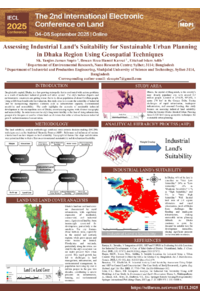
(sciforum-132648)Assessing Industrial Land's Suitability for Sustainable Urban Planning in Dhaka Re.pdf
CNN-Based Insect Detection Using YOLO for Resilient Agricultural Systems
The Cañadas Reales of the UNESCO Global Geopark Volcanes de Calatrava, Ciudad Real (Spain): a backbone of geomorphological heritage and Geotourism