Event submissions
Published
This submission belongs to the session S6. Climate Action on Land Use of the event The 2nd International Electronic Conference on Land
Published date
02 Sep, 2025
Academic Editor
'%3e%3cpath%20d='M12.6657%2010.9104C12.4185%2010.325%2012.0599%209.79327%2011.6097%209.34482C11.1609%208.89508%2010.6293%208.5365%2010.0442%208.28888C10.0389%208.28626%2010.0337%208.28495%2010.0285%208.28233C10.8446%207.69279%2011.3752%206.73249%2011.3752%205.64904C11.3752%203.8542%209.92103%202.39999%208.1262%202.39999C6.33136%202.39999%204.87715%203.8542%204.87715%205.64904C4.87715%206.73249%205.40774%207.69279%206.22393%208.28364C6.21869%208.28626%206.21345%208.28757%206.20821%208.29019C5.62129%208.5378%205.09463%208.89284%204.64265%209.34613C4.1929%209.79493%203.83432%2010.3266%203.58671%2010.9117C3.34345%2011.4845%203.21226%2012.0987%203.20023%2012.7209C3.19988%2012.7349%203.20233%2012.7488%203.20744%2012.7619C3.21255%2012.7749%203.22022%2012.7867%203.22998%2012.7968C3.23975%2012.8068%203.25142%2012.8147%203.26431%2012.8202C3.2772%2012.8256%203.29105%2012.8284%203.30504%2012.8284H4.09109C4.14874%2012.8284%204.19459%2012.7825%204.1959%2012.7262C4.2221%2011.7148%204.62823%2010.7676%205.34617%2010.0497C6.08899%209.30683%207.0755%208.89808%208.1262%208.89808C9.17689%208.89808%2010.1634%209.30683%2010.9062%2010.0497C11.6242%2010.7676%2012.0303%2011.7148%2012.0565%2012.7262C12.0578%2012.7838%2012.1037%2012.8284%2012.1613%2012.8284H12.9474C12.9613%2012.8284%2012.9752%2012.8256%2012.9881%2012.8202C13.001%2012.8147%2013.0126%2012.8068%2013.0224%2012.7968C13.0322%2012.7867%2013.0398%2012.7749%2013.0449%2012.7619C13.0501%2012.7488%2013.0525%2012.7349%2013.0522%2012.7209C13.0391%2012.0947%2012.9094%2011.4855%2012.6657%2010.9104ZM8.1262%207.9024C7.52486%207.9024%206.9589%207.6679%206.53312%207.24211C6.10733%206.81633%205.87283%206.25037%205.87283%205.64904C5.87283%205.0477%206.10733%204.48174%206.53312%204.05596C6.9589%203.63018%207.52486%203.39567%208.1262%203.39567C8.72753%203.39567%209.29349%203.63018%209.71927%204.05596C10.1451%204.48174%2010.3796%205.0477%2010.3796%205.64904C10.3796%206.25037%2010.1451%206.81633%209.71927%207.24211C9.29349%207.6679%208.72753%207.9024%208.1262%207.9024Z'%20fill='%235D1EE1'/%3e%3c/g%3e%3c/svg%3e) Hossein Azadi
Hossein AzadiCitation
Saffi Ur Rehman, Tingting Chang, Muhammad Zaman, Rainfall–Runoff Simulation Using the HEC-HMS and a GIS for Climate-Resilient Watershed Management: A Case Study of the Mangla Watershed, Pakistan, in Proceedings of The 2nd International Electronic Conference on Land, 4 September–5 September 2025, MDPI: Basel, Switzerland
Share
Email
Facebook
Twitter
LinkedIn
Rainfall–Runoff Simulation Using the HEC-HMS and a GIS for Climate-Resilient Watershed Management: A Case Study of the Mangla Watershed, Pakistan

Saffi Ur Rehman 1

Tingting Chang 1

Muhammad Zaman 2
1. College of Agricultural Science and Engineering; Hohai University; Nanjing; 210098; China
2. Department of Irrigation and Drainage; University of Agriculture; Faisalabad; 38000; Pakistan
Abstract
Due to climate change, runoff simulations and understanding the relationship between rainfall and runoff are of great importance. Various hydrological models have been developed and used to simulate runoff in multiple watersheds in different parts of the world. This study combined a Geographic Information System (GIS) and the Hydrologic Engineering Centre-Hydrologic Modeling System (HEC-HMS) to simulate rainfall-based runoff for the Mangla watershed. This study used a digital elevation model (DEM), freely available satellite-based soil and land use and land cover data, rainfall data for the catchment delineation, and hydrological modeling using the GIS and the HEC-HMS. In the HEC-HMS, different parameters were used for the simulations, like the Soil Conservation Service (SCS)'s Curve Number loss method, the SCS's Unit Hydrograph transform method, the recession baseflow method, and the Muskingum reach routing method. The climate data was obtained from the Pakistan Meteorological Department (PMD), and the hydrological data was obtained from the Water and Power Development Authority (WAPDA). The model was manually calibrated from 1991 to 2000 and validated from 2001 to 2010. This study revealed the direct rainfall-based runoff modeling for the watershed using the HEC-HMS model. The model's efficiency was tested based on its statistical parameters, like the root mean square error (RMSE), standard deviation, Percent Bias, and Nash–Sutcliffe efficiency. The Nash–Sutcliffe efficiency for calibration and validation was 0.919 and 0.945, respectively. The results of this study suggest that the hydrological modeling using the HEC-HMS for the Mangla watershed could be applicable to future work on rainfall-based runoff modeling, and to reduce the impact of floods, it is crucial to have strong flood protection measures and emergency response strategies.
Keywords
Hydrological Modelling
HEC-HMS model
GIS
Mangla
Rainfall-Runoff
flood risk management.
Poster
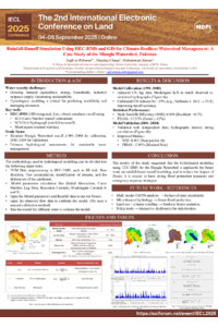
Poster.pdf
Total belowground carbon flux response of Eucalyptus genotypes to water deficit in Mediterranean Chile
Land (Dis)mobilisation and conflicts in the urban/rural continuum in Greater Ouaga, Burkina Faso