Event submissions
Published
This submission belongs to the session S2. Landscape Architecture and Land Restoration of the event The 2nd International Electronic Conference on Land
Published date
02 Sep, 2025
Academic Editor
'%3e%3cpath%20d='M12.6657%2010.9104C12.4185%2010.325%2012.0599%209.79327%2011.6097%209.34482C11.1609%208.89508%2010.6293%208.5365%2010.0442%208.28888C10.0389%208.28626%2010.0337%208.28495%2010.0285%208.28233C10.8446%207.69279%2011.3752%206.73249%2011.3752%205.64904C11.3752%203.8542%209.92103%202.39999%208.1262%202.39999C6.33136%202.39999%204.87715%203.8542%204.87715%205.64904C4.87715%206.73249%205.40774%207.69279%206.22393%208.28364C6.21869%208.28626%206.21345%208.28757%206.20821%208.29019C5.62129%208.5378%205.09463%208.89284%204.64265%209.34613C4.1929%209.79493%203.83432%2010.3266%203.58671%2010.9117C3.34345%2011.4845%203.21226%2012.0987%203.20023%2012.7209C3.19988%2012.7349%203.20233%2012.7488%203.20744%2012.7619C3.21255%2012.7749%203.22022%2012.7867%203.22998%2012.7968C3.23975%2012.8068%203.25142%2012.8147%203.26431%2012.8202C3.2772%2012.8256%203.29105%2012.8284%203.30504%2012.8284H4.09109C4.14874%2012.8284%204.19459%2012.7825%204.1959%2012.7262C4.2221%2011.7148%204.62823%2010.7676%205.34617%2010.0497C6.08899%209.30683%207.0755%208.89808%208.1262%208.89808C9.17689%208.89808%2010.1634%209.30683%2010.9062%2010.0497C11.6242%2010.7676%2012.0303%2011.7148%2012.0565%2012.7262C12.0578%2012.7838%2012.1037%2012.8284%2012.1613%2012.8284H12.9474C12.9613%2012.8284%2012.9752%2012.8256%2012.9881%2012.8202C13.001%2012.8147%2013.0126%2012.8068%2013.0224%2012.7968C13.0322%2012.7867%2013.0398%2012.7749%2013.0449%2012.7619C13.0501%2012.7488%2013.0525%2012.7349%2013.0522%2012.7209C13.0391%2012.0947%2012.9094%2011.4855%2012.6657%2010.9104ZM8.1262%207.9024C7.52486%207.9024%206.9589%207.6679%206.53312%207.24211C6.10733%206.81633%205.87283%206.25037%205.87283%205.64904C5.87283%205.0477%206.10733%204.48174%206.53312%204.05596C6.9589%203.63018%207.52486%203.39567%208.1262%203.39567C8.72753%203.39567%209.29349%203.63018%209.71927%204.05596C10.1451%204.48174%2010.3796%205.0477%2010.3796%205.64904C10.3796%206.25037%2010.1451%206.81633%209.71927%207.24211C9.29349%207.6679%208.72753%207.9024%208.1262%207.9024Z'%20fill='%235D1EE1'/%3e%3c/g%3e%3c/svg%3e) Thomas Panagopoulos
Thomas PanagopoulosCitation
Indishe P Senanayake, Gregory R Hancock, Assessing the Performance of Landform Evolution Models in a Natural Catchment Analogous to a Post-Mining Landform, in Proceedings of The 2nd International Electronic Conference on Land, 4 September–5 September 2025, MDPI: Basel, Switzerland
Share
Email
Facebook
Twitter
LinkedIn
Assessing the Performance of Landform Evolution Models in a Natural Catchment Analogous to a Post-Mining Landform

Indishe P Senanayake 1
'%3e%3cpath%20d='M12.6647%2010.9104C12.4176%2010.325%2012.0589%209.7933%2011.6088%209.34485C11.16%208.89511%2010.6283%208.53653%2010.0432%208.28891C10.038%208.28629%2010.0327%208.28498%2010.0275%208.28236C10.8437%207.69282%2011.3743%206.73252%2011.3743%205.64907C11.3743%203.85423%209.92005%202.40002%208.12522%202.40002C6.33038%202.40002%204.87618%203.85423%204.87618%205.64907C4.87618%206.73252%205.40677%207.69282%206.22296%208.28367C6.21772%208.28629%206.21248%208.2876%206.20724%208.29022C5.62031%208.53783%205.09365%208.89287%204.64167%209.34616C4.19192%209.79496%203.83334%2010.3266%203.58573%2010.9117C3.34247%2011.4846%203.21128%2012.0987%203.19925%2012.721C3.1989%2012.735%203.20135%2012.7489%203.20646%2012.7619C3.21157%2012.7749%203.21924%2012.7868%203.22901%2012.7968C3.23877%2012.8068%203.25045%2012.8148%203.26334%2012.8202C3.27623%2012.8256%203.29007%2012.8284%203.30406%2012.8284H4.09012C4.14776%2012.8284%204.19362%2012.7825%204.19493%2012.7262C4.22113%2011.7148%204.62726%2010.7676%205.34519%2010.0497C6.08802%209.30686%207.07452%208.89811%208.12522%208.89811C9.17592%208.89811%2010.1624%209.30686%2010.9052%2010.0497C11.6232%2010.7676%2012.0293%2011.7148%2012.0555%2012.7262C12.0568%2012.7839%2012.1027%2012.8284%2012.1603%2012.8284H12.9464C12.9604%2012.8284%2012.9742%2012.8256%2012.9871%2012.8202C13%2012.8148%2013.0117%2012.8068%2013.0214%2012.7968C13.0312%2012.7868%2013.0389%2012.7749%2013.044%2012.7619C13.0491%2012.7489%2013.0515%2012.735%2013.0512%2012.721C13.0381%2012.0947%2012.9084%2011.4856%2012.6647%2010.9104ZM8.12522%207.90243C7.52388%207.90243%206.95792%207.66793%206.53214%207.24215C6.10636%206.81636%205.87185%206.2504%205.87185%205.64907C5.87185%205.04773%206.10636%204.48177%206.53214%204.05599C6.95792%203.63021%207.52388%203.3957%208.12522%203.3957C8.72655%203.3957%209.29252%203.63021%209.7183%204.05599C10.1441%204.48177%2010.3786%205.04773%2010.3786%205.64907C10.3786%206.2504%2010.1441%206.81636%209.7183%207.24215C9.29252%207.66793%208.72655%207.90243%208.12522%207.90243Z'%20fill='%235D1EE1'/%3e%3c/g%3e%3c/svg%3e)
Gregory R Hancock 1
1. School of Engineering; The University of Newcastle; Callaghan, NSW; 2308; Australia
Abstract
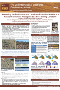
Ensuring the long-term erosional stability of post-mining landforms in Australia remains a first-order priority for the mining industry, particularly because these constructed landscapes must integrate seamlessly with the surrounding natural environment. This necessitates the evaluation of erosion rates not only on post-mining landforms—during both design and operational phases—but also on adjacent natural terrains. Landform evolution models (LEMs) offer a practical means for such assessments. However, accurately and reliably evaluating their performance across varying topographic, soil, and vegetation conditions remains a challenge. This study presents an evaluation of two landform evolution models—SIBERIA, widely applied within the Australian mining industry, and SSSPAM, a state-of-the-art coupled soilscape–landform model—using a natural catchment in the Upper Hunter region of Australia. This catchment, chosen for being analogous to a nearby mining site, was assessed under both dense and moderate grass cover conditions. High-resolution LiDAR-derived digital elevation data and site-specific parameters were used to perform the simulations. Field-based erosion estimates were obtained using sediment accumulation in a pond at the catchment outlet and the fallout radionuclide ¹³⁷Cs method. Sediment pond measurements indicated erosion rates ranging from 0.43 to 0.61 t/ha/yr, while the ¹³⁷Cs technique revealed maximum erosion and deposition rates of 1.5 t/ha/yr and 1.1 t/ha/yr, respectively. Model predictions varied with vegetation cover: SIBERIA estimated erosion at 1.07 t/ha/yr (dense grass) and 4.37 t/ha/yr (moderate grass), whereas SSSPAM predicted 0.35 t/ha/yr (dense grass) and 2.43 t/ha/yr (moderate grass). The results of both field-based methods and model evaluations are within comparable ranges, providing confidence in the models and their predictions. These findings highlight the utility of both field and modelling approaches in capturing erosion dynamics and offer valuable insights for model calibration and application in post-mining landscape design.
Keywords
Landform evolution modelling
post-mining landforms
SIBERIA
Soil erosion
SSSPAM
Poster
IECL 2025 Indishe Senanayake and Greg Hancock.pdf
Integrating remote sensing and modeling to assess land use changes and carbon dynamics in the Indian Himalayas
Eco-physiological Modeling of Gmelina arborea for Adaptive Plantation Design and Landscape Restoration