Event submissions
Published
This submission belongs to the session S7. Remote Sensing, Artificial Intelligence and New Technologies in Water Sciences of the event The 9th International Electronic Conference on Water Sciences
Published date
06 Nov, 2025
Academic Editor
'%3e%3cpath%20d='M12.6657%2010.9104C12.4185%2010.325%2012.0599%209.79327%2011.6097%209.34482C11.1609%208.89508%2010.6293%208.5365%2010.0442%208.28888C10.0389%208.28626%2010.0337%208.28495%2010.0285%208.28233C10.8446%207.69279%2011.3752%206.73249%2011.3752%205.64904C11.3752%203.8542%209.92103%202.39999%208.1262%202.39999C6.33136%202.39999%204.87715%203.8542%204.87715%205.64904C4.87715%206.73249%205.40774%207.69279%206.22393%208.28364C6.21869%208.28626%206.21345%208.28757%206.20821%208.29019C5.62129%208.5378%205.09463%208.89284%204.64265%209.34613C4.1929%209.79493%203.83432%2010.3266%203.58671%2010.9117C3.34345%2011.4845%203.21226%2012.0987%203.20023%2012.7209C3.19988%2012.7349%203.20233%2012.7488%203.20744%2012.7619C3.21255%2012.7749%203.22022%2012.7867%203.22998%2012.7968C3.23975%2012.8068%203.25142%2012.8147%203.26431%2012.8202C3.2772%2012.8256%203.29105%2012.8284%203.30504%2012.8284H4.09109C4.14874%2012.8284%204.19459%2012.7825%204.1959%2012.7262C4.2221%2011.7148%204.62823%2010.7676%205.34617%2010.0497C6.08899%209.30683%207.0755%208.89808%208.1262%208.89808C9.17689%208.89808%2010.1634%209.30683%2010.9062%2010.0497C11.6242%2010.7676%2012.0303%2011.7148%2012.0565%2012.7262C12.0578%2012.7838%2012.1037%2012.8284%2012.1613%2012.8284H12.9474C12.9613%2012.8284%2012.9752%2012.8256%2012.9881%2012.8202C13.001%2012.8147%2013.0126%2012.8068%2013.0224%2012.7968C13.0322%2012.7867%2013.0398%2012.7749%2013.0449%2012.7619C13.0501%2012.7488%2013.0525%2012.7349%2013.0522%2012.7209C13.0391%2012.0947%2012.9094%2011.4855%2012.6657%2010.9104ZM8.1262%207.9024C7.52486%207.9024%206.9589%207.6679%206.53312%207.24211C6.10733%206.81633%205.87283%206.25037%205.87283%205.64904C5.87283%205.0477%206.10733%204.48174%206.53312%204.05596C6.9589%203.63018%207.52486%203.39567%208.1262%203.39567C8.72753%203.39567%209.29349%203.63018%209.71927%204.05596C10.1451%204.48174%2010.3796%205.0477%2010.3796%205.64904C10.3796%206.25037%2010.1451%206.81633%209.71927%207.24211C9.29349%207.6679%208.72753%207.9024%208.1262%207.9024Z'%20fill='%235D1EE1'/%3e%3c/g%3e%3c/svg%3e) Nikiforos Samarinas
Nikiforos SamarinasCitation
Alka Kumari, Mohit Arora, Harpreet Singh Sidhu, Evaluation of different spectral indices for assessment ecological conditions of Harike Wetland (Ramsar Site) using Remote Sensing and Geospatial Technique, in Proceedings of The 9th International Electronic Conference on Water Sciences, 11 November–14 November 2025, MDPI: Basel, Switzerland
Share
Email
Facebook
Twitter
LinkedIn
Evaluation of different spectral indices for assessment ecological conditions of Harike Wetland (Ramsar Site) using Remote Sensing and Geospatial Technique
'%3e%3cpath%20d='M12.6647%2010.9104C12.4176%2010.325%2012.0589%209.7933%2011.6088%209.34485C11.16%208.89511%2010.6283%208.53653%2010.0432%208.28891C10.038%208.28629%2010.0327%208.28498%2010.0275%208.28236C10.8437%207.69282%2011.3743%206.73252%2011.3743%205.64907C11.3743%203.85423%209.92005%202.40002%208.12522%202.40002C6.33038%202.40002%204.87618%203.85423%204.87618%205.64907C4.87618%206.73252%205.40677%207.69282%206.22296%208.28367C6.21772%208.28629%206.21248%208.2876%206.20724%208.29022C5.62031%208.53783%205.09365%208.89287%204.64167%209.34616C4.19192%209.79496%203.83334%2010.3266%203.58573%2010.9117C3.34247%2011.4846%203.21128%2012.0987%203.19925%2012.721C3.1989%2012.735%203.20135%2012.7489%203.20646%2012.7619C3.21157%2012.7749%203.21924%2012.7868%203.22901%2012.7968C3.23877%2012.8068%203.25045%2012.8148%203.26334%2012.8202C3.27623%2012.8256%203.29007%2012.8284%203.30406%2012.8284H4.09012C4.14776%2012.8284%204.19362%2012.7825%204.19493%2012.7262C4.22113%2011.7148%204.62726%2010.7676%205.34519%2010.0497C6.08802%209.30686%207.07452%208.89811%208.12522%208.89811C9.17592%208.89811%2010.1624%209.30686%2010.9052%2010.0497C11.6232%2010.7676%2012.0293%2011.7148%2012.0555%2012.7262C12.0568%2012.7839%2012.1027%2012.8284%2012.1603%2012.8284H12.9464C12.9604%2012.8284%2012.9742%2012.8256%2012.9871%2012.8202C13%2012.8148%2013.0117%2012.8068%2013.0214%2012.7968C13.0312%2012.7868%2013.0389%2012.7749%2013.044%2012.7619C13.0491%2012.7489%2013.0515%2012.735%2013.0512%2012.721C13.0381%2012.0947%2012.9084%2011.4856%2012.6647%2010.9104ZM8.12522%207.90243C7.52388%207.90243%206.95792%207.66793%206.53214%207.24215C6.10636%206.81636%205.87185%206.2504%205.87185%205.64907C5.87185%205.04773%206.10636%204.48177%206.53214%204.05599C6.95792%203.63021%207.52388%203.3957%208.12522%203.3957C8.72655%203.3957%209.29252%203.63021%209.7183%204.05599C10.1441%204.48177%2010.3786%205.04773%2010.3786%205.64907C10.3786%206.2504%2010.1441%206.81636%209.7183%207.24215C9.29252%207.66793%208.72655%207.90243%208.12522%207.90243Z'%20fill='%235D1EE1'/%3e%3c/g%3e%3c/svg%3e)
Alka Kumari 1
Mohit Arora 2
Harpreet Singh Sidhu 3
1. Department of Geophysics, Kurukshetra University, Kurukshtra, Haryana 136119, India
2. Geology, Water Resources and Geoinformatics Division, Punjab Remote Sensing Centre (PRSC), Ludhiana, Punjab, 141004, India
3. Department of Geography, Lovely Professional University, Jalandhar, Punjab, 144411, India
Abstract
Wetlands play a crucial role in maintaining ecological balance and are among the most productive ecosystems on the planet. This study presents a comprehensive geospatial analysis of the Harike Wetland, Punjab, using multispectral (Landsat 8) and hyperspectral (PRISMA) satellite imagery to evaluate its ecological structure and water dynamics. Six spectral indices—Normalized Difference Vegetation Index (NDVI), Normalized Difference Aquatic Vegetation Index (NDAVI), Normalized Difference Water Index (NDWI), Modified NDWI (MNDWI), Floating Algal Index (FAI), and Algal Bloom Detection Index (ABDI)—were calculated to detect and map vegetation, aquatic vegetation, surface water, and algal bloom distribution across the wetland landscape. The area under different land cover types—vegetation, aquatic vegetation, and water—was estimated using threshold-based classification of index outputs. NDVI and NDAVI are more effective in capturing vegetative cover, while NDWI and MNDWI provide refined detection of water-related features. In addition, Z-spectral analysis was conducted to extract and compare reflectance profiles of four key surface features: algae, agricultural land, open water, and built-up areas. This process enhances the shape and curvature of the spectral signature, allowing for a more detailed comparison between land cover types based solely on their relative spectral behaviour. Z-spectra are especially useful when analysing hyperspectral data, where subtle differences in reflectance across narrow bands can reveal important biophysical traits. This approach enabled a better understanding of their unique spectral signatures and improved classification reliability, especially in spectrally mixed zones. By integrating index-based mapping with detailed spectral profiling, the study demonstrates the effectiveness of combining multispectral and hyperspectral data for wetland monitoring. The findings contribute to improved assessment of ecological conditions and can support future conservation and water management strategies in dynamic wetland environments.
Keywords
Hyperspectral Remote Sensing
Wetland
Ecology
Water Management
Poster
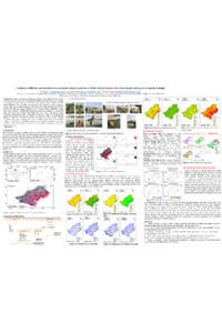
Mohit-poster.pdf
Laccase-functionalized nanoparticles for endocrine disruptors oxidation: from synthesis to characterization
Innovative Synergies: How SFDMBR, Electrochemical Processes, and Algae Transform Wastewater into a Resource