Event submissions
Published
This submission belongs to the session S7. Remote Sensing, Artificial Intelligence and New Technologies in Water Sciences of the event The 9th International Electronic Conference on Water Sciences
Published date
06 Nov, 2025
Academic Editor
'%3e%3cpath%20d='M12.6657%2010.9104C12.4185%2010.325%2012.0599%209.79327%2011.6097%209.34482C11.1609%208.89508%2010.6293%208.5365%2010.0442%208.28888C10.0389%208.28626%2010.0337%208.28495%2010.0285%208.28233C10.8446%207.69279%2011.3752%206.73249%2011.3752%205.64904C11.3752%203.8542%209.92103%202.39999%208.1262%202.39999C6.33136%202.39999%204.87715%203.8542%204.87715%205.64904C4.87715%206.73249%205.40774%207.69279%206.22393%208.28364C6.21869%208.28626%206.21345%208.28757%206.20821%208.29019C5.62129%208.5378%205.09463%208.89284%204.64265%209.34613C4.1929%209.79493%203.83432%2010.3266%203.58671%2010.9117C3.34345%2011.4845%203.21226%2012.0987%203.20023%2012.7209C3.19988%2012.7349%203.20233%2012.7488%203.20744%2012.7619C3.21255%2012.7749%203.22022%2012.7867%203.22998%2012.7968C3.23975%2012.8068%203.25142%2012.8147%203.26431%2012.8202C3.2772%2012.8256%203.29105%2012.8284%203.30504%2012.8284H4.09109C4.14874%2012.8284%204.19459%2012.7825%204.1959%2012.7262C4.2221%2011.7148%204.62823%2010.7676%205.34617%2010.0497C6.08899%209.30683%207.0755%208.89808%208.1262%208.89808C9.17689%208.89808%2010.1634%209.30683%2010.9062%2010.0497C11.6242%2010.7676%2012.0303%2011.7148%2012.0565%2012.7262C12.0578%2012.7838%2012.1037%2012.8284%2012.1613%2012.8284H12.9474C12.9613%2012.8284%2012.9752%2012.8256%2012.9881%2012.8202C13.001%2012.8147%2013.0126%2012.8068%2013.0224%2012.7968C13.0322%2012.7867%2013.0398%2012.7749%2013.0449%2012.7619C13.0501%2012.7488%2013.0525%2012.7349%2013.0522%2012.7209C13.0391%2012.0947%2012.9094%2011.4855%2012.6657%2010.9104ZM8.1262%207.9024C7.52486%207.9024%206.9589%207.6679%206.53312%207.24211C6.10733%206.81633%205.87283%206.25037%205.87283%205.64904C5.87283%205.0477%206.10733%204.48174%206.53312%204.05596C6.9589%203.63018%207.52486%203.39567%208.1262%203.39567C8.72753%203.39567%209.29349%203.63018%209.71927%204.05596C10.1451%204.48174%2010.3796%205.0477%2010.3796%205.64904C10.3796%206.25037%2010.1451%206.81633%209.71927%207.24211C9.29349%207.6679%208.72753%207.9024%208.1262%207.9024Z'%20fill='%235D1EE1'/%3e%3c/g%3e%3c/svg%3e) Nikiforos Samarinas
Nikiforos SamarinasCitation
Waruth POJSILAPACHAI, Tomohito J. YAMADA, Takehiko ITO, Optimized UAV-LiDAR Workflows for Fine-Scale Stream Network Mapping in Low-Gradient Wetlands: A Kushiro Wetland, Japan Case Study, in Proceedings of The 9th International Electronic Conference on Water Sciences, 11 November–14 November 2025, MDPI: Basel, Switzerland
Share
Email
Facebook
Twitter
LinkedIn
Optimized UAV-LiDAR Workflows for Fine-Scale Stream Network Mapping in Low-Gradient Wetlands: A Kushiro Wetland, Japan Case Study

Waruth POJSILAPACHAI 1
'%3e%3cpath%20d='M12.6647%2010.9104C12.4176%2010.325%2012.0589%209.7933%2011.6088%209.34485C11.16%208.89511%2010.6283%208.53653%2010.0432%208.28891C10.038%208.28629%2010.0327%208.28498%2010.0275%208.28236C10.8437%207.69282%2011.3743%206.73252%2011.3743%205.64907C11.3743%203.85423%209.92005%202.40002%208.12522%202.40002C6.33038%202.40002%204.87618%203.85423%204.87618%205.64907C4.87618%206.73252%205.40677%207.69282%206.22296%208.28367C6.21772%208.28629%206.21248%208.2876%206.20724%208.29022C5.62031%208.53783%205.09365%208.89287%204.64167%209.34616C4.19192%209.79496%203.83334%2010.3266%203.58573%2010.9117C3.34247%2011.4846%203.21128%2012.0987%203.19925%2012.721C3.1989%2012.735%203.20135%2012.7489%203.20646%2012.7619C3.21157%2012.7749%203.21924%2012.7868%203.22901%2012.7968C3.23877%2012.8068%203.25045%2012.8148%203.26334%2012.8202C3.27623%2012.8256%203.29007%2012.8284%203.30406%2012.8284H4.09012C4.14776%2012.8284%204.19362%2012.7825%204.19493%2012.7262C4.22113%2011.7148%204.62726%2010.7676%205.34519%2010.0497C6.08802%209.30686%207.07452%208.89811%208.12522%208.89811C9.17592%208.89811%2010.1624%209.30686%2010.9052%2010.0497C11.6232%2010.7676%2012.0293%2011.7148%2012.0555%2012.7262C12.0568%2012.7839%2012.1027%2012.8284%2012.1603%2012.8284H12.9464C12.9604%2012.8284%2012.9742%2012.8256%2012.9871%2012.8202C13%2012.8148%2013.0117%2012.8068%2013.0214%2012.7968C13.0312%2012.7868%2013.0389%2012.7749%2013.044%2012.7619C13.0491%2012.7489%2013.0515%2012.735%2013.0512%2012.721C13.0381%2012.0947%2012.9084%2011.4856%2012.6647%2010.9104ZM8.12522%207.90243C7.52388%207.90243%206.95792%207.66793%206.53214%207.24215C6.10636%206.81636%205.87185%206.2504%205.87185%205.64907C5.87185%205.04773%206.10636%204.48177%206.53214%204.05599C6.95792%203.63021%207.52388%203.3957%208.12522%203.3957C8.72655%203.3957%209.29252%203.63021%209.7183%204.05599C10.1441%204.48177%2010.3786%205.04773%2010.3786%205.64907C10.3786%206.2504%2010.1441%206.81636%209.7183%207.24215C9.29252%207.66793%208.72655%207.90243%208.12522%207.90243Z'%20fill='%235D1EE1'/%3e%3c/g%3e%3c/svg%3e)
Tomohito J. YAMADA 2
Takehiko ITO 2
1. Graduate School of Engineering, Hokkaido University, Sapporo 060-8628, Japan
2. Engineering Faculty, Hokkaido University, Sapporo 060-8628, Japan
Abstract
Accurate stream network delineation in low-gradient wetlands is essential for hydrological modeling, flood risk assessment, and ecological restoration. However, the subtle terrain features and dense vegetation in these environments present significant challenges. This study systematically evaluated 48 UAV-LiDAR processing workflows to identify the optimal approach for mapping fine-scale stream channels in the Kushiro Wetland, Japan, a Ramsar-protected site known for its ecological importance. Workflows combined three ground filtering methods (PMF, CSF, MCC), four interpolation techniques (IDW, TIN, KRG, MBA), two sink-filling algorithms (Wang & Liu, Planchon & Darboux), and two flow direction models (D8, D-infinity). Performance was assessed using the Intersection over Union (IoU) metric to quantify the accuracy of channel network delineation.
The results showed that workflow configuration significantly impacts detection precision, with the optimal workflow—CSF, MBA, Planchon, and D8—achieving a high IoU of 0.85. CSF excelled at preserving complex terrain structures crucial for wetland hydrology. While KRG provided robust interpolation for general terrain representation, MBA was more effective for channel delineation within the optimal workflow. Planchon’s sink-filling algorithm substantially improved hydrological connectivity representation, outperforming Wang & Liu. Minimal differences were observed between D8 and D-infinity flow direction models, suggesting D8’s computational efficiency makes it preferable for similar environments.
These findings provide actionable recommendations for high-resolution wetland mapping and hydrological analysis. The methodological framework developed in this study supports the ongoing Kushiro Wetland Restoration Project and can be applied to other degraded wetland systems globally, contributing to conservation, restoration planning, and ecosystem management efforts.
Keywords
high-resolution mapping
multiscale curvature
classification
wetland hydrology
channelization impacts
Kushiro Wetland
Poster
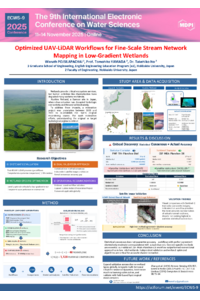
sciforum-151928_session7_Waruth.pdf
Next-Generation Water Management: Integrating Generative and Agentic AI for Enhanced Efficiency and Resilience
Multiparameter Optical Probes and IoT Networks for Real-Time Water Quality Monitoring