Event submissions
Published
This submission belongs to the session S7. Remote Sensing, Artificial Intelligence and New Technologies in Water Sciences of the event The 9th International Electronic Conference on Water Sciences
Published date
06 Nov, 2025
Academic Editor
'%3e%3cpath%20d='M12.6657%2010.9104C12.4185%2010.325%2012.0599%209.79327%2011.6097%209.34482C11.1609%208.89508%2010.6293%208.5365%2010.0442%208.28888C10.0389%208.28626%2010.0337%208.28495%2010.0285%208.28233C10.8446%207.69279%2011.3752%206.73249%2011.3752%205.64904C11.3752%203.8542%209.92103%202.39999%208.1262%202.39999C6.33136%202.39999%204.87715%203.8542%204.87715%205.64904C4.87715%206.73249%205.40774%207.69279%206.22393%208.28364C6.21869%208.28626%206.21345%208.28757%206.20821%208.29019C5.62129%208.5378%205.09463%208.89284%204.64265%209.34613C4.1929%209.79493%203.83432%2010.3266%203.58671%2010.9117C3.34345%2011.4845%203.21226%2012.0987%203.20023%2012.7209C3.19988%2012.7349%203.20233%2012.7488%203.20744%2012.7619C3.21255%2012.7749%203.22022%2012.7867%203.22998%2012.7968C3.23975%2012.8068%203.25142%2012.8147%203.26431%2012.8202C3.2772%2012.8256%203.29105%2012.8284%203.30504%2012.8284H4.09109C4.14874%2012.8284%204.19459%2012.7825%204.1959%2012.7262C4.2221%2011.7148%204.62823%2010.7676%205.34617%2010.0497C6.08899%209.30683%207.0755%208.89808%208.1262%208.89808C9.17689%208.89808%2010.1634%209.30683%2010.9062%2010.0497C11.6242%2010.7676%2012.0303%2011.7148%2012.0565%2012.7262C12.0578%2012.7838%2012.1037%2012.8284%2012.1613%2012.8284H12.9474C12.9613%2012.8284%2012.9752%2012.8256%2012.9881%2012.8202C13.001%2012.8147%2013.0126%2012.8068%2013.0224%2012.7968C13.0322%2012.7867%2013.0398%2012.7749%2013.0449%2012.7619C13.0501%2012.7488%2013.0525%2012.7349%2013.0522%2012.7209C13.0391%2012.0947%2012.9094%2011.4855%2012.6657%2010.9104ZM8.1262%207.9024C7.52486%207.9024%206.9589%207.6679%206.53312%207.24211C6.10733%206.81633%205.87283%206.25037%205.87283%205.64904C5.87283%205.0477%206.10733%204.48174%206.53312%204.05596C6.9589%203.63018%207.52486%203.39567%208.1262%203.39567C8.72753%203.39567%209.29349%203.63018%209.71927%204.05596C10.1451%204.48174%2010.3796%205.0477%2010.3796%205.64904C10.3796%206.25037%2010.1451%206.81633%209.71927%207.24211C9.29349%207.6679%208.72753%207.9024%208.1262%207.9024Z'%20fill='%235D1EE1'/%3e%3c/g%3e%3c/svg%3e) Nikiforos Samarinas
Nikiforos SamarinasCitation
Sujoy Dey, S. M. Tasin Zahid, Pranto Kumar Sarker, Land Use and Land Cover Analysis and Prediction Using Machine Learning Approach: A Case Study of Gaibandha District, Bangladesh, in Proceedings of The 9th International Electronic Conference on Water Sciences, 11 November–14 November 2025, MDPI: Basel, Switzerland
Share
Email
Facebook
Twitter
LinkedIn
Land Use and Land Cover Analysis and Prediction Using Machine Learning Approach: A Case Study of Gaibandha District, Bangladesh
'%3e%3cpath%20d='M12.6647%2010.9104C12.4176%2010.325%2012.0589%209.7933%2011.6088%209.34485C11.16%208.89511%2010.6283%208.53653%2010.0432%208.28891C10.038%208.28629%2010.0327%208.28498%2010.0275%208.28236C10.8437%207.69282%2011.3743%206.73252%2011.3743%205.64907C11.3743%203.85423%209.92005%202.40002%208.12522%202.40002C6.33038%202.40002%204.87618%203.85423%204.87618%205.64907C4.87618%206.73252%205.40677%207.69282%206.22296%208.28367C6.21772%208.28629%206.21248%208.2876%206.20724%208.29022C5.62031%208.53783%205.09365%208.89287%204.64167%209.34616C4.19192%209.79496%203.83334%2010.3266%203.58573%2010.9117C3.34247%2011.4846%203.21128%2012.0987%203.19925%2012.721C3.1989%2012.735%203.20135%2012.7489%203.20646%2012.7619C3.21157%2012.7749%203.21924%2012.7868%203.22901%2012.7968C3.23877%2012.8068%203.25045%2012.8148%203.26334%2012.8202C3.27623%2012.8256%203.29007%2012.8284%203.30406%2012.8284H4.09012C4.14776%2012.8284%204.19362%2012.7825%204.19493%2012.7262C4.22113%2011.7148%204.62726%2010.7676%205.34519%2010.0497C6.08802%209.30686%207.07452%208.89811%208.12522%208.89811C9.17592%208.89811%2010.1624%209.30686%2010.9052%2010.0497C11.6232%2010.7676%2012.0293%2011.7148%2012.0555%2012.7262C12.0568%2012.7839%2012.1027%2012.8284%2012.1603%2012.8284H12.9464C12.9604%2012.8284%2012.9742%2012.8256%2012.9871%2012.8202C13%2012.8148%2013.0117%2012.8068%2013.0214%2012.7968C13.0312%2012.7868%2013.0389%2012.7749%2013.044%2012.7619C13.0491%2012.7489%2013.0515%2012.735%2013.0512%2012.721C13.0381%2012.0947%2012.9084%2011.4856%2012.6647%2010.9104ZM8.12522%207.90243C7.52388%207.90243%206.95792%207.66793%206.53214%207.24215C6.10636%206.81636%205.87185%206.2504%205.87185%205.64907C5.87185%205.04773%206.10636%204.48177%206.53214%204.05599C6.95792%203.63021%207.52388%203.3957%208.12522%203.3957C8.72655%203.3957%209.29252%203.63021%209.7183%204.05599C10.1441%204.48177%2010.3786%205.04773%2010.3786%205.64907C10.3786%206.2504%2010.1441%206.81636%209.7183%207.24215C9.29252%207.66793%208.72655%207.90243%208.12522%207.90243Z'%20fill='%235D1EE1'/%3e%3c/g%3e%3c/svg%3e)
Sujoy Dey 1
S. M. Tasin Zahid 1

Pranto Kumar Sarker 1
1. Department of Water Resources Engineering, Bangladesh University of Engineering and Technology, Dhaka 1000, Bangladesh.
Abstract
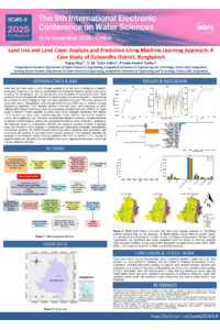
Land use and land cover (LULC) change analysis is crucial for sustainable environmental management and policy formulation in Bangladesh's rapidly changing landscape. This study employs Google Earth Engine and machine learning techniques to analyze LULC dynamics and predict future changes in Gaibandha district, Bangladesh, using ESRI Global Land Cover data from 2019 and 2022, with predictions extending to 2025. A Random Forest classifier was developed using multi-temporal satellite imagery, incorporating elevation data from SRTM and temporal variables to model land cover transitions. Nine LULC classes were identified: water, trees, flooded vegetation, crops, built area, bare ground, snow/ice, clouds, and rangeland. The model achieved high accuracy (>90%) and kappa coefficient (>0.9), validated through hyperparameter tuning and cross-validation across different random seeds. Results reveal significant landscape transformations between 2019 and 2022, with notable transitions from agricultural to built-up areas and changes in vegetation cover. The Shannon diversity index analysis indicates fluctuating landscape heterogeneity over the study period. Transition matrix analysis identified crop-to-built area conversion as a dominant change pattern, reflecting rapid urbanization pressures. The 2025 predictions suggest continued urban expansion and agricultural land conversion, highlighting potential environmental challenges. Model stability over seeds and overfitting analysis indicate the robustness and reliability of the machine learning framework. Feature importance analysis revealed that historical land cover patterns and elevation are primary drivers of change. The methodology demonstrates the effectiveness of cloud-based remote sensing platforms for large-scale LULC monitoring and prediction, supporting evidence-based decision-making for regional development and climate adaptation planning.
Keywords
land use change
remote sensing
google earth engine
random forest
bangladesh
prediction modeling
Poster
water6.pdf
Soil Moisture Time Series Gap-Filling Using Random Forest Machine Learning Models: A Case Study in the Arta Plain
Erosion severity mapping in the Portaikos mountainous watershed (Thessaly, Greece) using Earth Observation data