Event submissions
Published
This submission belongs to the session B. Coastal Engineering of the event The 1st International Online Conference on Marine Science and Engineering
Published date
19 Nov, 2025
Academic Editor
'%3e%3cpath%20d='M12.6657%2010.9104C12.4185%2010.325%2012.0599%209.79327%2011.6097%209.34482C11.1609%208.89508%2010.6293%208.5365%2010.0442%208.28888C10.0389%208.28626%2010.0337%208.28495%2010.0285%208.28233C10.8446%207.69279%2011.3752%206.73249%2011.3752%205.64904C11.3752%203.8542%209.92103%202.39999%208.1262%202.39999C6.33136%202.39999%204.87715%203.8542%204.87715%205.64904C4.87715%206.73249%205.40774%207.69279%206.22393%208.28364C6.21869%208.28626%206.21345%208.28757%206.20821%208.29019C5.62129%208.5378%205.09463%208.89284%204.64265%209.34613C4.1929%209.79493%203.83432%2010.3266%203.58671%2010.9117C3.34345%2011.4845%203.21226%2012.0987%203.20023%2012.7209C3.19988%2012.7349%203.20233%2012.7488%203.20744%2012.7619C3.21255%2012.7749%203.22022%2012.7867%203.22998%2012.7968C3.23975%2012.8068%203.25142%2012.8147%203.26431%2012.8202C3.2772%2012.8256%203.29105%2012.8284%203.30504%2012.8284H4.09109C4.14874%2012.8284%204.19459%2012.7825%204.1959%2012.7262C4.2221%2011.7148%204.62823%2010.7676%205.34617%2010.0497C6.08899%209.30683%207.0755%208.89808%208.1262%208.89808C9.17689%208.89808%2010.1634%209.30683%2010.9062%2010.0497C11.6242%2010.7676%2012.0303%2011.7148%2012.0565%2012.7262C12.0578%2012.7838%2012.1037%2012.8284%2012.1613%2012.8284H12.9474C12.9613%2012.8284%2012.9752%2012.8256%2012.9881%2012.8202C13.001%2012.8147%2013.0126%2012.8068%2013.0224%2012.7968C13.0322%2012.7867%2013.0398%2012.7749%2013.0449%2012.7619C13.0501%2012.7488%2013.0525%2012.7349%2013.0522%2012.7209C13.0391%2012.0947%2012.9094%2011.4855%2012.6657%2010.9104ZM8.1262%207.9024C7.52486%207.9024%206.9589%207.6679%206.53312%207.24211C6.10733%206.81633%205.87283%206.25037%205.87283%205.64904C5.87283%205.0477%206.10733%204.48174%206.53312%204.05596C6.9589%203.63018%207.52486%203.39567%208.1262%203.39567C8.72753%203.39567%209.29349%203.63018%209.71927%204.05596C10.1451%204.48174%2010.3796%205.0477%2010.3796%205.64904C10.3796%206.25037%2010.1451%206.81633%209.71927%207.24211C9.29349%207.6679%208.72753%207.9024%208.1262%207.9024Z'%20fill='%235D1EE1'/%3e%3c/g%3e%3c/svg%3e) Rafael J. Bergillos
Rafael J. BergillosCitation
Carlos Davila, Angel Quesquen, Jhianpiere Salinas, Fernando Garcia, Jairo Cueva, Miguel Estrada, Automated Forecasting System for Tsunami Hazard and Exposure Reports Using Numerical Simulations and Web-Based Geospatial Visualization, in Proceedings of The 1st International Online Conference on Marine Science and Engineering, 24 November–26 November 2025, MDPI: Basel, Switzerland
Share
Email
Facebook
Twitter
LinkedIn
Automated Forecasting System for Tsunami Hazard and Exposure Reports Using Numerical Simulations and Web-Based Geospatial Visualization

Carlos Davila 1,2

Angel Quesquen 1,2
'%3e%3cpath%20d='M12.6647%2010.9104C12.4176%2010.325%2012.0589%209.7933%2011.6088%209.34485C11.16%208.89511%2010.6283%208.53653%2010.0432%208.28891C10.038%208.28629%2010.0327%208.28498%2010.0275%208.28236C10.8437%207.69282%2011.3743%206.73252%2011.3743%205.64907C11.3743%203.85423%209.92005%202.40002%208.12522%202.40002C6.33038%202.40002%204.87618%203.85423%204.87618%205.64907C4.87618%206.73252%205.40677%207.69282%206.22296%208.28367C6.21772%208.28629%206.21248%208.2876%206.20724%208.29022C5.62031%208.53783%205.09365%208.89287%204.64167%209.34616C4.19192%209.79496%203.83334%2010.3266%203.58573%2010.9117C3.34247%2011.4846%203.21128%2012.0987%203.19925%2012.721C3.1989%2012.735%203.20135%2012.7489%203.20646%2012.7619C3.21157%2012.7749%203.21924%2012.7868%203.22901%2012.7968C3.23877%2012.8068%203.25045%2012.8148%203.26334%2012.8202C3.27623%2012.8256%203.29007%2012.8284%203.30406%2012.8284H4.09012C4.14776%2012.8284%204.19362%2012.7825%204.19493%2012.7262C4.22113%2011.7148%204.62726%2010.7676%205.34519%2010.0497C6.08802%209.30686%207.07452%208.89811%208.12522%208.89811C9.17592%208.89811%2010.1624%209.30686%2010.9052%2010.0497C11.6232%2010.7676%2012.0293%2011.7148%2012.0555%2012.7262C12.0568%2012.7839%2012.1027%2012.8284%2012.1603%2012.8284H12.9464C12.9604%2012.8284%2012.9742%2012.8256%2012.9871%2012.8202C13%2012.8148%2013.0117%2012.8068%2013.0214%2012.7968C13.0312%2012.7868%2013.0389%2012.7749%2013.044%2012.7619C13.0491%2012.7489%2013.0515%2012.735%2013.0512%2012.721C13.0381%2012.0947%2012.9084%2011.4856%2012.6647%2010.9104ZM8.12522%207.90243C7.52388%207.90243%206.95792%207.66793%206.53214%207.24215C6.10636%206.81636%205.87185%206.2504%205.87185%205.64907C5.87185%205.04773%206.10636%204.48177%206.53214%204.05599C6.95792%203.63021%207.52388%203.3957%208.12522%203.3957C8.72655%203.3957%209.29252%203.63021%209.7183%204.05599C10.1441%204.48177%2010.3786%205.04773%2010.3786%205.64907C10.3786%206.2504%2010.1441%206.81636%209.7183%207.24215C9.29252%207.66793%208.72655%207.90243%208.12522%207.90243Z'%20fill='%235D1EE1'/%3e%3c/g%3e%3c/svg%3e)
Jhianpiere Salinas 2

Fernando Garcia 1,2
Jairo Cueva 2

Miguel Estrada 1,2
1. GeoGiRD Research Group, Facultad de Ingenieria Civil, Universidad Nacional de Ingenieria, Lima 15333, Peru
2. Centro Peruano Japones de Investigaciones Sismicas y Mitigacion de Desastres, Lima 15333, Peru
Abstract
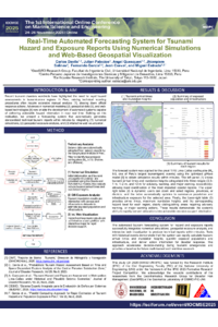
Tsunamis pose a major threat to coastal regions in seismic zones such as Peru. Current tsunami response protocols require time-intensive technical procedures to generate reports, delaying critical decision-making. This study presents the development of a forecasting system that automatically generates standardized technical tsunami reports within minutes. The system integrates numerical simulations, geospatial exposure analysis, and interactive web visualization.
The proposed system employs bathymetric and topographic data, combined with seismic parameters, to automatically define simulation domains along the Peruvian coast. The tsunami generation and propagation are modeled using the Okada and TUNAMI-N2 formulations. Subsequently, census and cadastral data are geospatially intersected with inundation maps to quantify exposed populations and infrastructure, stratified by hazard and exposure levels.
A dynamic web-based platform was developed to visualize simulation outputs and generate downloadable, interactive reports, including wave arrival times, maximum inundation heights, and exposure statistics. The system was tested using historical tsunami scenarios (Camaná 2001 and Pisco 2007), demonstrating its capability to generate technical reports in minutes.
This innovation has direct application for disaster response agencies, national risk management systems, and local governments. The system supports rapid decision-making under emergency conditions and provides a scalable framework for future multi-hazard integration. The proposed tool represents a significant advancement in coastal engineering and disaster risk management for tsunami-prone regions.
Keywords
tsunami forecasting
numerical simulation
hazard
exposure
web-based visualization
Poster
28_IOCMSE_TsunamiReport.pdf
Dynamic salinity equilibrium in a former estuary after reintroducing seawater inflow
Immersive Virtual Reality Tsunami Evacuation Model using High-Resolution Unmanned Aerial Vehicle Imagery and Numerical Simulation