Event submissions
Published

This submission belongs to the session A. True Smart & Green Urban Society of the event 8th Conference of the International Forum on Urbanism (IFoU)
Published date
15 Jun, 2015
Citation
Rosita Samsudin, Puay Yok Tan, Assessment of Green Spatial Equity in Singapore's Urbanity, in Proceedings of 8th Conference of the International Forum on Urbanism (IFoU), Incheon, 22 June–24 June 2015, MDPI: Basel, Switzerland, doi: 10.3390/ifou-A010
Share
Email
Facebook
Twitter
LinkedIn
Assessment of Green Spatial Equity in Singapore's Urbanity
'%3e%3cpath%20d='M12.6647%2010.9104C12.4176%2010.325%2012.0589%209.7933%2011.6088%209.34485C11.16%208.89511%2010.6283%208.53653%2010.0432%208.28891C10.038%208.28629%2010.0327%208.28498%2010.0275%208.28236C10.8437%207.69282%2011.3743%206.73252%2011.3743%205.64907C11.3743%203.85423%209.92005%202.40002%208.12522%202.40002C6.33038%202.40002%204.87618%203.85423%204.87618%205.64907C4.87618%206.73252%205.40677%207.69282%206.22296%208.28367C6.21772%208.28629%206.21248%208.2876%206.20724%208.29022C5.62031%208.53783%205.09365%208.89287%204.64167%209.34616C4.19192%209.79496%203.83334%2010.3266%203.58573%2010.9117C3.34247%2011.4846%203.21128%2012.0987%203.19925%2012.721C3.1989%2012.735%203.20135%2012.7489%203.20646%2012.7619C3.21157%2012.7749%203.21924%2012.7868%203.22901%2012.7968C3.23877%2012.8068%203.25045%2012.8148%203.26334%2012.8202C3.27623%2012.8256%203.29007%2012.8284%203.30406%2012.8284H4.09012C4.14776%2012.8284%204.19362%2012.7825%204.19493%2012.7262C4.22113%2011.7148%204.62726%2010.7676%205.34519%2010.0497C6.08802%209.30686%207.07452%208.89811%208.12522%208.89811C9.17592%208.89811%2010.1624%209.30686%2010.9052%2010.0497C11.6232%2010.7676%2012.0293%2011.7148%2012.0555%2012.7262C12.0568%2012.7839%2012.1027%2012.8284%2012.1603%2012.8284H12.9464C12.9604%2012.8284%2012.9742%2012.8256%2012.9871%2012.8202C13%2012.8148%2013.0117%2012.8068%2013.0214%2012.7968C13.0312%2012.7868%2013.0389%2012.7749%2013.044%2012.7619C13.0491%2012.7489%2013.0515%2012.735%2013.0512%2012.721C13.0381%2012.0947%2012.9084%2011.4856%2012.6647%2010.9104ZM8.12522%207.90243C7.52388%207.90243%206.95792%207.66793%206.53214%207.24215C6.10636%206.81636%205.87185%206.2504%205.87185%205.64907C5.87185%205.04773%206.10636%204.48177%206.53214%204.05599C6.95792%203.63021%207.52388%203.3957%208.12522%203.3957C8.72655%203.3957%209.29252%203.63021%209.7183%204.05599C10.1441%204.48177%2010.3786%205.04773%2010.3786%205.64907C10.3786%206.2504%2010.1441%206.81636%209.7183%207.24215C9.29252%207.66793%208.72655%207.90243%208.12522%207.90243Z'%20fill='%235D1EE1'/%3e%3c/g%3e%3c/svg%3e)
Rosita Samsudin 1
Puay Yok Tan 1
1. Department of Architecture, National University of Singapore
Abstract
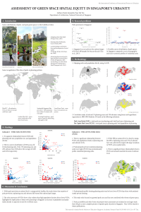
The "Garden City" concept has been the main planning concept that drives Singapore's urban development for the past five decades. This has led to a remarkably green city despite it being a high-density city. As of 2012, Singapore's National Parks Board manages approximately 2,850 hectares of parks, and based on future land use plan, it is expected that more parks will be added over the next two decades. This is also supported by Sustainable Singapore Blueprint 2015, a long term strategic and sustainable development plan in which urban greenery has been given prominence. It aims to bring green spaces nearer to people through a national park provision target of 0.8 hectare of park area per 1,000 people, and by planning parks to be within 10 minutes-walk from homes. While this is highly commendable, it is also necessary to consider where parks are distributed in relation to socio-demographic profile, i.e., to consider if there are current issues on unequal distribution of parks. This is currently an unknown area in park planning in Singapore, and falls within the emerging area of spatial equity, which traditionally has focused on "environment bads" but is now increasingly applied to "environmental goods". Green spatial equity is a broad term that considers the distribution of green spaces such that the benefits of green spaces are provided where needs are the strongest. In this study, we examined correlations between key social demographic profile (population, population density, income, types of home ownership) of planning units at two spatial scales to understand spatial distribution of parks in relation to needs. Through the use of spatial analysis in GIS, we report on several novel findings of distinct parks distribution pattern and gaps of parks provision between different social demographic groups, examined in two planning scales. This findings highlight that local park planning need to consider the effects of scale, and to correct for apparent unequal distribution of parks in Singapore. Our results can provide the foundation to explore urban interventions that are able to promote more equitable distribution of a key public amenity of importance to livability in Singapore.
Keywords
green spatial equity
urban planning
Singapore
Manuscript
A010-sciforum-003510-abstract-only.pdf
Poster
A010-POSTER_IFOU08_ROSITA.pdf
Water-Energy-Food Nexus of Concave Green-Roof in SNU
Surgery of City Wall-Canal System from Urban Segregator to Green Archival Linkage - Rejuvenation of Historic Eastern Water Gate Area of Nanjing