Event submissions
Published
This submission belongs to the session S6. Energy, Environmental and Earth Science of the event The 6th International Electronic Conference on Applied Sciences
Published date
03 Dec, 2025
Academic Editor
'%3e%3cpath%20d='M12.6657%2010.9104C12.4185%2010.325%2012.0599%209.79327%2011.6097%209.34482C11.1609%208.89508%2010.6293%208.5365%2010.0442%208.28888C10.0389%208.28626%2010.0337%208.28495%2010.0285%208.28233C10.8446%207.69279%2011.3752%206.73249%2011.3752%205.64904C11.3752%203.8542%209.92103%202.39999%208.1262%202.39999C6.33136%202.39999%204.87715%203.8542%204.87715%205.64904C4.87715%206.73249%205.40774%207.69279%206.22393%208.28364C6.21869%208.28626%206.21345%208.28757%206.20821%208.29019C5.62129%208.5378%205.09463%208.89284%204.64265%209.34613C4.1929%209.79493%203.83432%2010.3266%203.58671%2010.9117C3.34345%2011.4845%203.21226%2012.0987%203.20023%2012.7209C3.19988%2012.7349%203.20233%2012.7488%203.20744%2012.7619C3.21255%2012.7749%203.22022%2012.7867%203.22998%2012.7968C3.23975%2012.8068%203.25142%2012.8147%203.26431%2012.8202C3.2772%2012.8256%203.29105%2012.8284%203.30504%2012.8284H4.09109C4.14874%2012.8284%204.19459%2012.7825%204.1959%2012.7262C4.2221%2011.7148%204.62823%2010.7676%205.34617%2010.0497C6.08899%209.30683%207.0755%208.89808%208.1262%208.89808C9.17689%208.89808%2010.1634%209.30683%2010.9062%2010.0497C11.6242%2010.7676%2012.0303%2011.7148%2012.0565%2012.7262C12.0578%2012.7838%2012.1037%2012.8284%2012.1613%2012.8284H12.9474C12.9613%2012.8284%2012.9752%2012.8256%2012.9881%2012.8202C13.001%2012.8147%2013.0126%2012.8068%2013.0224%2012.7968C13.0322%2012.7867%2013.0398%2012.7749%2013.0449%2012.7619C13.0501%2012.7488%2013.0525%2012.7349%2013.0522%2012.7209C13.0391%2012.0947%2012.9094%2011.4855%2012.6657%2010.9104ZM8.1262%207.9024C7.52486%207.9024%206.9589%207.6679%206.53312%207.24211C6.10733%206.81633%205.87283%206.25037%205.87283%205.64904C5.87283%205.0477%206.10733%204.48174%206.53312%204.05596C6.9589%203.63018%207.52486%203.39567%208.1262%203.39567C8.72753%203.39567%209.29349%203.63018%209.71927%204.05596C10.1451%204.48174%2010.3796%205.0477%2010.3796%205.64904C10.3796%206.25037%2010.1451%206.81633%209.71927%207.24211C9.29349%207.6679%208.72753%207.9024%208.1262%207.9024Z'%20fill='%235D1EE1'/%3e%3c/g%3e%3c/svg%3e) Simeone Chianese
Simeone ChianeseCitation
Miko Santos, Candice Aura Fernandez, Charlize Kirsten Brodeth, Alliyah Gaberielle Zulueta, Jazzie Rosales Jao, Edgar Vallar, Scenario-Based Flood Susceptibility Mapping using Machine Learning: A Case in Manila City, Philippines, in Proceedings of The 6th International Electronic Conference on Applied Sciences, 9 December–11 December 2025, MDPI: Basel, Switzerland
Share
Email
Facebook
Twitter
LinkedIn
Scenario-Based Flood Susceptibility Mapping using Machine Learning: A Case in Manila City, Philippines
'%3e%3cpath%20d='M12.6647%2010.9104C12.4176%2010.325%2012.0589%209.7933%2011.6088%209.34485C11.16%208.89511%2010.6283%208.53653%2010.0432%208.28891C10.038%208.28629%2010.0327%208.28498%2010.0275%208.28236C10.8437%207.69282%2011.3743%206.73252%2011.3743%205.64907C11.3743%203.85423%209.92005%202.40002%208.12522%202.40002C6.33038%202.40002%204.87618%203.85423%204.87618%205.64907C4.87618%206.73252%205.40677%207.69282%206.22296%208.28367C6.21772%208.28629%206.21248%208.2876%206.20724%208.29022C5.62031%208.53783%205.09365%208.89287%204.64167%209.34616C4.19192%209.79496%203.83334%2010.3266%203.58573%2010.9117C3.34247%2011.4846%203.21128%2012.0987%203.19925%2012.721C3.1989%2012.735%203.20135%2012.7489%203.20646%2012.7619C3.21157%2012.7749%203.21924%2012.7868%203.22901%2012.7968C3.23877%2012.8068%203.25045%2012.8148%203.26334%2012.8202C3.27623%2012.8256%203.29007%2012.8284%203.30406%2012.8284H4.09012C4.14776%2012.8284%204.19362%2012.7825%204.19493%2012.7262C4.22113%2011.7148%204.62726%2010.7676%205.34519%2010.0497C6.08802%209.30686%207.07452%208.89811%208.12522%208.89811C9.17592%208.89811%2010.1624%209.30686%2010.9052%2010.0497C11.6232%2010.7676%2012.0293%2011.7148%2012.0555%2012.7262C12.0568%2012.7839%2012.1027%2012.8284%2012.1603%2012.8284H12.9464C12.9604%2012.8284%2012.9742%2012.8256%2012.9871%2012.8202C13%2012.8148%2013.0117%2012.8068%2013.0214%2012.7968C13.0312%2012.7868%2013.0389%2012.7749%2013.044%2012.7619C13.0491%2012.7489%2013.0515%2012.735%2013.0512%2012.721C13.0381%2012.0947%2012.9084%2011.4856%2012.6647%2010.9104ZM8.12522%207.90243C7.52388%207.90243%206.95792%207.66793%206.53214%207.24215C6.10636%206.81636%205.87185%206.2504%205.87185%205.64907C5.87185%205.04773%206.10636%204.48177%206.53214%204.05599C6.95792%203.63021%207.52388%203.3957%208.12522%203.3957C8.72655%203.3957%209.29252%203.63021%209.7183%204.05599C10.1441%204.48177%2010.3786%205.04773%2010.3786%205.64907C10.3786%206.2504%2010.1441%206.81636%209.7183%207.24215C9.29252%207.66793%208.72655%207.90243%208.12522%207.90243Z'%20fill='%235D1EE1'/%3e%3c/g%3e%3c/svg%3e)
Miko Santos 1
Candice Aura Fernandez 1
Charlize Kirsten Brodeth 1
Alliyah Gaberielle Zulueta 1
Jazzie Rosales Jao 1
Edgar Vallar 2
1. Department of Software Technology, College of Computer Studies, De La Salle University, Manila, Philippines
2. Department of Physics, College of Science, De La Salle University, Manila, Philippines
Abstract
Manila City experiences recurrent flooding driven by its low-lying topography, high population density, and rapid urbanization. Traditional hydrodynamic models, while accurate, are computationally expensive and unsuitable for rapid scenario evaluation. This study proposes a structured, scenario-based flood susceptibility mapping framework using supervised machine learning trained on synthetic hydrodynamic simulations to address these limitations. Synthetic rainfall hyetographs each representing rainfall intensities at 5-minute intervals over a 2-hour duration were used to simulate flood events through two-dimensional unsteady flow modeling in HEC-RAS. The resulting maximum flood extent maps serve as ground truth data for model training. Input features consist of digital elevation model (DEM), soil type, land use, and the rainfall hyetograph vector, all preprocessed into spatially aligned raster datasets. Machine learning classifiers including Support Vector Machine (SVM), Random Forest (RF), and Extreme Gradient Boosting (XGBoost) were trained to identify flooded areas at the pixel level and feature vectors were constructed by combining spatial characteristics with rainfall inputs. The trained models accept new input conditions comprising DEM, soil type, land use, and a defined rainfall hyetograph and produce a corresponding maximum flood susceptibility map. This capability enables flood susceptibility predictions for a wide range of hypothetical rainfall events without the need to rerun simulations wherein resulting maps can inform land-use planning, infrastructure design, evacuation planning, and disaster risk management in flood-prone urban environments such as Manila City.
Keywords
flood susceptibility mapping
machine learning
rainfall hyetograph
urban flooding
Random Forest
Support Vector Machine
XGBoost
digital elevation model
land use
soil type
Manila City
flood risk assessment
Poster
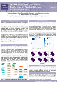
Scenario-Based Flood Susceptibility Mapping using Machine Learning A Case in Manila City, Philippines.pdf
EVALUATION OF THE CHEMICAL COMPOSITION AND THE HISTOCHEMICAL LOCALIZATION OF SALVIA NEMOROSA L. ESSENTIAL OILS
Three-Dimensional-Printed Natural Fiber-Reinforced Composite Honeycomb Sandwich Structures Inspired by Beetle Forewings for Circular Economy Applications