Event submissions
Published
This submission belongs to the session S6. Energy, Environmental and Earth Science of the event The 6th International Electronic Conference on Applied Sciences
Published date
03 Dec, 2025
Academic Editor
'%3e%3cpath%20d='M12.6657%2010.9104C12.4185%2010.325%2012.0599%209.79327%2011.6097%209.34482C11.1609%208.89508%2010.6293%208.5365%2010.0442%208.28888C10.0389%208.28626%2010.0337%208.28495%2010.0285%208.28233C10.8446%207.69279%2011.3752%206.73249%2011.3752%205.64904C11.3752%203.8542%209.92103%202.39999%208.1262%202.39999C6.33136%202.39999%204.87715%203.8542%204.87715%205.64904C4.87715%206.73249%205.40774%207.69279%206.22393%208.28364C6.21869%208.28626%206.21345%208.28757%206.20821%208.29019C5.62129%208.5378%205.09463%208.89284%204.64265%209.34613C4.1929%209.79493%203.83432%2010.3266%203.58671%2010.9117C3.34345%2011.4845%203.21226%2012.0987%203.20023%2012.7209C3.19988%2012.7349%203.20233%2012.7488%203.20744%2012.7619C3.21255%2012.7749%203.22022%2012.7867%203.22998%2012.7968C3.23975%2012.8068%203.25142%2012.8147%203.26431%2012.8202C3.2772%2012.8256%203.29105%2012.8284%203.30504%2012.8284H4.09109C4.14874%2012.8284%204.19459%2012.7825%204.1959%2012.7262C4.2221%2011.7148%204.62823%2010.7676%205.34617%2010.0497C6.08899%209.30683%207.0755%208.89808%208.1262%208.89808C9.17689%208.89808%2010.1634%209.30683%2010.9062%2010.0497C11.6242%2010.7676%2012.0303%2011.7148%2012.0565%2012.7262C12.0578%2012.7838%2012.1037%2012.8284%2012.1613%2012.8284H12.9474C12.9613%2012.8284%2012.9752%2012.8256%2012.9881%2012.8202C13.001%2012.8147%2013.0126%2012.8068%2013.0224%2012.7968C13.0322%2012.7867%2013.0398%2012.7749%2013.0449%2012.7619C13.0501%2012.7488%2013.0525%2012.7349%2013.0522%2012.7209C13.0391%2012.0947%2012.9094%2011.4855%2012.6657%2010.9104ZM8.1262%207.9024C7.52486%207.9024%206.9589%207.6679%206.53312%207.24211C6.10733%206.81633%205.87283%206.25037%205.87283%205.64904C5.87283%205.0477%206.10733%204.48174%206.53312%204.05596C6.9589%203.63018%207.52486%203.39567%208.1262%203.39567C8.72753%203.39567%209.29349%203.63018%209.71927%204.05596C10.1451%204.48174%2010.3796%205.0477%2010.3796%205.64904C10.3796%206.25037%2010.1451%206.81633%209.71927%207.24211C9.29349%207.6679%208.72753%207.9024%208.1262%207.9024Z'%20fill='%235D1EE1'/%3e%3c/g%3e%3c/svg%3e) Simeone Chianese
Simeone ChianeseCitation
David Beltrán-Vargas, Fernando García-Páez, Manuel Martínez-Morales, Numerical Simulation of Water Table Dynamics for Construction Planning in a Coastal Urban Area of Mazatlán, Mexico, in Proceedings of The 6th International Electronic Conference on Applied Sciences, 9 December–11 December 2025, MDPI: Basel, Switzerland
Share
Email
Facebook
Twitter
LinkedIn
Numerical Simulation of Water Table Dynamics for Construction Planning in a Coastal Urban Area of Mazatlán, Mexico

David Beltrán-Vargas 1
'%3e%3cpath%20d='M12.6647%2010.9104C12.4176%2010.325%2012.0589%209.7933%2011.6088%209.34485C11.16%208.89511%2010.6283%208.53653%2010.0432%208.28891C10.038%208.28629%2010.0327%208.28498%2010.0275%208.28236C10.8437%207.69282%2011.3743%206.73252%2011.3743%205.64907C11.3743%203.85423%209.92005%202.40002%208.12522%202.40002C6.33038%202.40002%204.87618%203.85423%204.87618%205.64907C4.87618%206.73252%205.40677%207.69282%206.22296%208.28367C6.21772%208.28629%206.21248%208.2876%206.20724%208.29022C5.62031%208.53783%205.09365%208.89287%204.64167%209.34616C4.19192%209.79496%203.83334%2010.3266%203.58573%2010.9117C3.34247%2011.4846%203.21128%2012.0987%203.19925%2012.721C3.1989%2012.735%203.20135%2012.7489%203.20646%2012.7619C3.21157%2012.7749%203.21924%2012.7868%203.22901%2012.7968C3.23877%2012.8068%203.25045%2012.8148%203.26334%2012.8202C3.27623%2012.8256%203.29007%2012.8284%203.30406%2012.8284H4.09012C4.14776%2012.8284%204.19362%2012.7825%204.19493%2012.7262C4.22113%2011.7148%204.62726%2010.7676%205.34519%2010.0497C6.08802%209.30686%207.07452%208.89811%208.12522%208.89811C9.17592%208.89811%2010.1624%209.30686%2010.9052%2010.0497C11.6232%2010.7676%2012.0293%2011.7148%2012.0555%2012.7262C12.0568%2012.7839%2012.1027%2012.8284%2012.1603%2012.8284H12.9464C12.9604%2012.8284%2012.9742%2012.8256%2012.9871%2012.8202C13%2012.8148%2013.0117%2012.8068%2013.0214%2012.7968C13.0312%2012.7868%2013.0389%2012.7749%2013.044%2012.7619C13.0491%2012.7489%2013.0515%2012.735%2013.0512%2012.721C13.0381%2012.0947%2012.9084%2011.4856%2012.6647%2010.9104ZM8.12522%207.90243C7.52388%207.90243%206.95792%207.66793%206.53214%207.24215C6.10636%206.81636%205.87185%206.2504%205.87185%205.64907C5.87185%205.04773%206.10636%204.48177%206.53214%204.05599C6.95792%203.63021%207.52388%203.3957%208.12522%203.3957C8.72655%203.3957%209.29252%203.63021%209.7183%204.05599C10.1441%204.48177%2010.3786%205.04773%2010.3786%205.64907C10.3786%206.2504%2010.1441%206.81636%209.7183%207.24215C9.29252%207.66793%208.72655%207.90243%208.12522%207.90243Z'%20fill='%235D1EE1'/%3e%3c/g%3e%3c/svg%3e)
Fernando García-Páez 1
Manuel Martínez-Morales 2
1. Department of Civil Engineering, Autonomous University of Sinaloa, 80013, Culiacán, Sinaloa, México
2. Groundwater Hydrology Division, Mexican Institute of Water Technology, 62550, Jiutepec Morelos, Mexico
Abstract
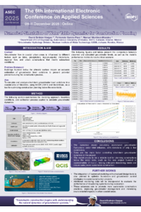
Construction planning in coastal urban areas requires a detailed understanding of water table dynamics, particularly when excavation is projected below the phreatic surface. This study presents the simulation of six critical scenarios using independent numerical models developed with MODFLOW 6 and the ModelMuse interface. These scenarios correspond to six dates between November 2023 and April 2024, selected for exhibiting astronomical tide events with maximum and minimum levels occurring within a 24-hour window—conditions considered critical for excavation and dewatering processes.
Each model was calibrated using three piezometric observations per day (09:00, 12:00, and 15:00 hours), resulting in a total of 18 field records. The comparison between simulated and observed values produced low error metrics: root mean square errors (RMSE) ranged from 0.014 to 0.087 meters and mean absolute errors (MAE) ranged from 0.012 to 0.075 meters. While these differences are small—in the order of centimeters—they are consistent with the short evaluation period and the low day-to-day variability observed during calibration. However, during the full six-month study period, recorded groundwater levels ranged from –0.10 to 0.53 meters above sea level. Understanding the dynamics of the water table across this range is essential for anticipating construction challenges and designing appropriate mitigation strategies.
Taking the 18 observations as representative, the overall model performance yielded an RMSE of 0.056 m and an MAE of 0.049 m, supporting the use of numerical simulation as a reliable planning tool for construction projects below the water table in coastal environments. Moreover, the integration of numerical modeling in early project stages promotes more sustainable construction practices by reducing environmental impacts and enabling better-informed decisions.
Keywords
coastal aquifer
numerical modeling
urban hydrogeology
complicated hydrogeological conditions
MODFLOW
Poster
POSTER-ASEC.pdf
Determination of the Diffusion Coefficient of Butylparaben and Bisphenol-A via UV-Vis Spectrometer
Phytofabrication of Silver Nanoparticles from Water Hyacinth (Eichhornia crassipes) as a Pest Control Tool for Spodoptera frugiperda