Event submissions
Published
This submission belongs to the session S3. Computing and Artificial Intelligence of the event The 6th International Electronic Conference on Applied Sciences
Published date
03 Dec, 2025
Academic Editor
'%3e%3cpath%20d='M12.6657%2010.9104C12.4185%2010.325%2012.0599%209.79327%2011.6097%209.34482C11.1609%208.89508%2010.6293%208.5365%2010.0442%208.28888C10.0389%208.28626%2010.0337%208.28495%2010.0285%208.28233C10.8446%207.69279%2011.3752%206.73249%2011.3752%205.64904C11.3752%203.8542%209.92103%202.39999%208.1262%202.39999C6.33136%202.39999%204.87715%203.8542%204.87715%205.64904C4.87715%206.73249%205.40774%207.69279%206.22393%208.28364C6.21869%208.28626%206.21345%208.28757%206.20821%208.29019C5.62129%208.5378%205.09463%208.89284%204.64265%209.34613C4.1929%209.79493%203.83432%2010.3266%203.58671%2010.9117C3.34345%2011.4845%203.21226%2012.0987%203.20023%2012.7209C3.19988%2012.7349%203.20233%2012.7488%203.20744%2012.7619C3.21255%2012.7749%203.22022%2012.7867%203.22998%2012.7968C3.23975%2012.8068%203.25142%2012.8147%203.26431%2012.8202C3.2772%2012.8256%203.29105%2012.8284%203.30504%2012.8284H4.09109C4.14874%2012.8284%204.19459%2012.7825%204.1959%2012.7262C4.2221%2011.7148%204.62823%2010.7676%205.34617%2010.0497C6.08899%209.30683%207.0755%208.89808%208.1262%208.89808C9.17689%208.89808%2010.1634%209.30683%2010.9062%2010.0497C11.6242%2010.7676%2012.0303%2011.7148%2012.0565%2012.7262C12.0578%2012.7838%2012.1037%2012.8284%2012.1613%2012.8284H12.9474C12.9613%2012.8284%2012.9752%2012.8256%2012.9881%2012.8202C13.001%2012.8147%2013.0126%2012.8068%2013.0224%2012.7968C13.0322%2012.7867%2013.0398%2012.7749%2013.0449%2012.7619C13.0501%2012.7488%2013.0525%2012.7349%2013.0522%2012.7209C13.0391%2012.0947%2012.9094%2011.4855%2012.6657%2010.9104ZM8.1262%207.9024C7.52486%207.9024%206.9589%207.6679%206.53312%207.24211C6.10733%206.81633%205.87283%206.25037%205.87283%205.64904C5.87283%205.0477%206.10733%204.48174%206.53312%204.05596C6.9589%203.63018%207.52486%203.39567%208.1262%203.39567C8.72753%203.39567%209.29349%203.63018%209.71927%204.05596C10.1451%204.48174%2010.3796%205.0477%2010.3796%205.64904C10.3796%206.25037%2010.1451%206.81633%209.71927%207.24211C9.29349%207.6679%208.72753%207.9024%208.1262%207.9024Z'%20fill='%235D1EE1'/%3e%3c/g%3e%3c/svg%3e) Lucia Billeci
Lucia BilleciCitation
Rahul Jain, Sushil Kumar Singh, Habib Khan, Om Prakash Pal, Sejal Mishra, Bhavisha Suthar, AI-Driven Spatiotemporal Mapping and Grid Optimization for Solar and Wind Energy, in Proceedings of The 6th International Electronic Conference on Applied Sciences, 9 December–11 December 2025, MDPI: Basel, Switzerland
Share
Email
Facebook
Twitter
LinkedIn
AI-Driven Spatiotemporal Mapping and Grid Optimization for Solar and Wind Energy
'%3e%3cpath%20d='M12.6647%2010.9104C12.4176%2010.325%2012.0589%209.7933%2011.6088%209.34485C11.16%208.89511%2010.6283%208.53653%2010.0432%208.28891C10.038%208.28629%2010.0327%208.28498%2010.0275%208.28236C10.8437%207.69282%2011.3743%206.73252%2011.3743%205.64907C11.3743%203.85423%209.92005%202.40002%208.12522%202.40002C6.33038%202.40002%204.87618%203.85423%204.87618%205.64907C4.87618%206.73252%205.40677%207.69282%206.22296%208.28367C6.21772%208.28629%206.21248%208.2876%206.20724%208.29022C5.62031%208.53783%205.09365%208.89287%204.64167%209.34616C4.19192%209.79496%203.83334%2010.3266%203.58573%2010.9117C3.34247%2011.4846%203.21128%2012.0987%203.19925%2012.721C3.1989%2012.735%203.20135%2012.7489%203.20646%2012.7619C3.21157%2012.7749%203.21924%2012.7868%203.22901%2012.7968C3.23877%2012.8068%203.25045%2012.8148%203.26334%2012.8202C3.27623%2012.8256%203.29007%2012.8284%203.30406%2012.8284H4.09012C4.14776%2012.8284%204.19362%2012.7825%204.19493%2012.7262C4.22113%2011.7148%204.62726%2010.7676%205.34519%2010.0497C6.08802%209.30686%207.07452%208.89811%208.12522%208.89811C9.17592%208.89811%2010.1624%209.30686%2010.9052%2010.0497C11.6232%2010.7676%2012.0293%2011.7148%2012.0555%2012.7262C12.0568%2012.7839%2012.1027%2012.8284%2012.1603%2012.8284H12.9464C12.9604%2012.8284%2012.9742%2012.8256%2012.9871%2012.8202C13%2012.8148%2013.0117%2012.8068%2013.0214%2012.7968C13.0312%2012.7868%2013.0389%2012.7749%2013.044%2012.7619C13.0491%2012.7489%2013.0515%2012.735%2013.0512%2012.721C13.0381%2012.0947%2012.9084%2011.4856%2012.6647%2010.9104ZM8.12522%207.90243C7.52388%207.90243%206.95792%207.66793%206.53214%207.24215C6.10636%206.81636%205.87185%206.2504%205.87185%205.64907C5.87185%205.04773%206.10636%204.48177%206.53214%204.05599C6.95792%203.63021%207.52388%203.3957%208.12522%203.3957C8.72655%203.3957%209.29252%203.63021%209.7183%204.05599C10.1441%204.48177%2010.3786%205.04773%2010.3786%205.64907C10.3786%206.2504%2010.1441%206.81636%209.7183%207.24215C9.29252%207.66793%208.72655%207.90243%208.12522%207.90243Z'%20fill='%235D1EE1'/%3e%3c/g%3e%3c/svg%3e)
Rahul Jain 1
Sushil Kumar Singh 1

Habib Khan 2
Om Prakash Pal 3
Sejal Mishra 4
Bhavisha Suthar 5
1. Department of Computer Engineering, Marwadi University, Rajkot, Gujarat, 360003, India
2. Department of Artificial Intelligence, Gachon University, Seongnam, 13120, South Korea
3. Department of Computer Engineering, Graphic Era University, Dehradun, 248002, India
4. Department of Computer Engineering, CT Group of Institutions Jalandhar, Greater Kailash, GT Road, Maqsudan, Jalandhar, Punjab, 144008, India
5. Department of Information Technology, Ganpat University, Mehsana, 384012, India
Abstract
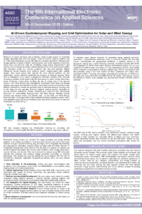
Renewable energy sources are essential for energy production and energy transfer systems. In this paper, we explore a novel approach that combines natural and social sciences through a machine learning (ML) technique, which integrates environmental and geographical information systems (GISs) and aligns with the United Nations' 17 Sustainable Development Goals (SDGs). With the help of a dataset, we derived one hundred regional observations that covered solar irradiation, wind energy, temperature, relative humidity, and altitude. Then, we enhanced this dataset using GIS information (latitude and longitude) and available energy production information at historical timestamps. This dataset was used for training the neural network. With the help of TensorFlow's Sequential Application Programming Interface (API), we used dropout regularisation and dense layers for overfitting prevention. The resulting model was a deep learning architecture that was capable of preventing overfitting. The dataset was standardised and split (80-20) for training and testing. Overfitting prevention deep learning architecture was used with a batch size of 16, trained for 50 epochs using the Adam optimiser, mean squared error (MSE) loss, and an initial training loss of 98,273.70 was obtained. The model trained loss was reduced to 16,651.12 while stabilising validation loss, indicating strong generalisation. Validation shows that the model GIS visualisations for energy generation aid in providing spatial dependence of energy interdependence for grid improvement and energy generation interdependence in spatial systems for grid planning. The proposed approach is, therefore, an integration of GIS and deep learning with the aim of obtaining spatially informative energy potential estimates.
Keywords
artificial intelligence
computations
machine learning
renewable energy
sustainable development goals
geographic information systems
grid optimization techniques
Poster
sciforum-147244 Poster.pdf
Structural and Optical Characterization of Co₃O₄ Nanostructures Synthesized via Sol–Gel Method and Calcined at Different Temperatures
Evaluation of Silicon–Graphene Oxide and Silicon Dioxide–Graphene Oxide Composite Anodes for High-Capacity Lithium-Ion Batteries in Terms of Electrochemical Performance