Event submissions
Events3rd Conference on Future Challenges in Sustainable Urban Planning & Territorial Management
Published
This submission belongs to the session GIS. Spatial Analysis of the event 3rd Conference on Future Challenges in Sustainable Urban Planning & Territorial Management
Published date
19 Jan, 2026
Academic Editor
'%3e%3cpath%20d='M12.6657%2010.9104C12.4185%2010.325%2012.0599%209.79327%2011.6097%209.34482C11.1609%208.89508%2010.6293%208.5365%2010.0442%208.28888C10.0389%208.28626%2010.0337%208.28495%2010.0285%208.28233C10.8446%207.69279%2011.3752%206.73249%2011.3752%205.64904C11.3752%203.8542%209.92103%202.39999%208.1262%202.39999C6.33136%202.39999%204.87715%203.8542%204.87715%205.64904C4.87715%206.73249%205.40774%207.69279%206.22393%208.28364C6.21869%208.28626%206.21345%208.28757%206.20821%208.29019C5.62129%208.5378%205.09463%208.89284%204.64265%209.34613C4.1929%209.79493%203.83432%2010.3266%203.58671%2010.9117C3.34345%2011.4845%203.21226%2012.0987%203.20023%2012.7209C3.19988%2012.7349%203.20233%2012.7488%203.20744%2012.7619C3.21255%2012.7749%203.22022%2012.7867%203.22998%2012.7968C3.23975%2012.8068%203.25142%2012.8147%203.26431%2012.8202C3.2772%2012.8256%203.29105%2012.8284%203.30504%2012.8284H4.09109C4.14874%2012.8284%204.19459%2012.7825%204.1959%2012.7262C4.2221%2011.7148%204.62823%2010.7676%205.34617%2010.0497C6.08899%209.30683%207.0755%208.89808%208.1262%208.89808C9.17689%208.89808%2010.1634%209.30683%2010.9062%2010.0497C11.6242%2010.7676%2012.0303%2011.7148%2012.0565%2012.7262C12.0578%2012.7838%2012.1037%2012.8284%2012.1613%2012.8284H12.9474C12.9613%2012.8284%2012.9752%2012.8256%2012.9881%2012.8202C13.001%2012.8147%2013.0126%2012.8068%2013.0224%2012.7968C13.0322%2012.7867%2013.0398%2012.7749%2013.0449%2012.7619C13.0501%2012.7488%2013.0525%2012.7349%2013.0522%2012.7209C13.0391%2012.0947%2012.9094%2011.4855%2012.6657%2010.9104ZM8.1262%207.9024C7.52486%207.9024%206.9589%207.6679%206.53312%207.24211C6.10733%206.81633%205.87283%206.25037%205.87283%205.64904C5.87283%205.0477%206.10733%204.48174%206.53312%204.05596C6.9589%203.63018%207.52486%203.39567%208.1262%203.39567C8.72753%203.39567%209.29349%203.63018%209.71927%204.05596C10.1451%204.48174%2010.3796%205.0477%2010.3796%205.64904C10.3796%206.25037%2010.1451%206.81633%209.71927%207.24211C9.29349%207.6679%208.72753%207.9024%208.1262%207.9024Z'%20fill='%235D1EE1'/%3e%3c/g%3e%3c/svg%3e) Salvador Garcia-Ayllon
Salvador Garcia-AyllonCitation
Sk. Tanjim Jaman Supto, Assessing the Impact of Land Use Land Cover Patterns on Land Surface Temperature in Dhaka Metropolitan Area A Geospatial Approach, in Proceedings of 3rd Conference on Future Challenges in Sustainable Urban Planning & Territorial Management, 20 January–22 January 2026, MDPI: Basel, Switzerland
Share
Email
Facebook
Twitter
LinkedIn
Assessing the Impact of Land Use Land Cover Patterns on Land Surface Temperature in Dhaka Metropolitan Area A Geospatial Approach

Sk. Tanjim Jaman Supto 1
1. Department of Environmental Research, Nano Research Centre, Sylhet, 3114, Bangladesh
Abstract
Bangladesh's capital, Dhaka, has one of the highest urban densities in the world and is one of the most crowded and quickly urbanizing megacities. The city's land use and land cover (LULC) has changed significantly in recent decades due to economic growth, population pressure, and infrastructural construction. The urban thermal environment is significantly impacted by these changes. From 1990 to 2025, this study examines the spatiotemporal link between land surface temperature (LST) and LULC changes in the Dhaka Metropolitan Area.We measured LULC transitions and associated LST fluctuations using a geospatial method that combines Landsat data, LULC classification, and LST retrieval by thermal band analysis. Significant urban development into arid land 22 km2 and the conversion of vegetation 16 km2 and water bodies 25 km2 to urban areas are both revealed by the LULC change matrix.Urban regions have the highest mean temperature 21.05 °C, followed closely by arid terrain 21.26 °C, while vegetation has a slightly lower mean 20.59 °C, according to LST study. Water bodies, on the other hand, have a significantly lower mean temperature of 16.27 °C, underscoring their vital cooling role in the metropolitan thermal environment. Impervious materials and lower evapotranspiration have a significant impact on heat retention, as seen by the preservation of higher LST values in both built-up and bare surfaces.The results show that Dhaka's fast, uncontrolled development has resulted in the loss of water bodies as well as the extensive destruction of trees, green spaces, and vegetated regions. Impervious surfaces like concrete and asphalt have taken the role of these natural cooling systems, increasing heat retention and decreasing evapotranspiration. Because of this, LST in both populated and unpopulated areas are much higher, which exacerbates the Urban Heat Island (UHI) effect and fuels heat stress.
Keywords
Dhaka Metropolitan Area
Land Use Land Cover change
Land Surface Temperature
Urban Heat Island effect
Urbanization
LST
LULC
Urban Heat
UHI
Sustainable urban planning
Urban thermal environment
Spatio-temporal analysis
Manuscript
Assessing the Impact of Land Use Land Cover Patterns on Land Surface Temperature in Dhaka Metropolitan Area A Geospatial Approach.pdf
Poster
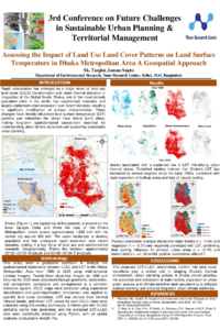
Assessing the Impact of Land Use Land Cover Patterns on Land Surface Temperature in Dhaka Metropolitan Area A Geospatial ApproachPoster.pdf
Gentrification and the 15-miute city: tensions between proximity, sustainability and spatial justice in the contemporary urban transformation
Analysis of Urban Heat Island Intensity in Dhaka and Its Relationship with Land Use Land Cover Types