Event submissions
Events3rd Conference on Future Challenges in Sustainable Urban Planning & Territorial Management
Published
This submission belongs to the session GIS. Spatial Analysis of the event 3rd Conference on Future Challenges in Sustainable Urban Planning & Territorial Management
Published date
19 Jan, 2026
Academic Editor
'%3e%3cpath%20d='M12.6657%2010.9104C12.4185%2010.325%2012.0599%209.79327%2011.6097%209.34482C11.1609%208.89508%2010.6293%208.5365%2010.0442%208.28888C10.0389%208.28626%2010.0337%208.28495%2010.0285%208.28233C10.8446%207.69279%2011.3752%206.73249%2011.3752%205.64904C11.3752%203.8542%209.92103%202.39999%208.1262%202.39999C6.33136%202.39999%204.87715%203.8542%204.87715%205.64904C4.87715%206.73249%205.40774%207.69279%206.22393%208.28364C6.21869%208.28626%206.21345%208.28757%206.20821%208.29019C5.62129%208.5378%205.09463%208.89284%204.64265%209.34613C4.1929%209.79493%203.83432%2010.3266%203.58671%2010.9117C3.34345%2011.4845%203.21226%2012.0987%203.20023%2012.7209C3.19988%2012.7349%203.20233%2012.7488%203.20744%2012.7619C3.21255%2012.7749%203.22022%2012.7867%203.22998%2012.7968C3.23975%2012.8068%203.25142%2012.8147%203.26431%2012.8202C3.2772%2012.8256%203.29105%2012.8284%203.30504%2012.8284H4.09109C4.14874%2012.8284%204.19459%2012.7825%204.1959%2012.7262C4.2221%2011.7148%204.62823%2010.7676%205.34617%2010.0497C6.08899%209.30683%207.0755%208.89808%208.1262%208.89808C9.17689%208.89808%2010.1634%209.30683%2010.9062%2010.0497C11.6242%2010.7676%2012.0303%2011.7148%2012.0565%2012.7262C12.0578%2012.7838%2012.1037%2012.8284%2012.1613%2012.8284H12.9474C12.9613%2012.8284%2012.9752%2012.8256%2012.9881%2012.8202C13.001%2012.8147%2013.0126%2012.8068%2013.0224%2012.7968C13.0322%2012.7867%2013.0398%2012.7749%2013.0449%2012.7619C13.0501%2012.7488%2013.0525%2012.7349%2013.0522%2012.7209C13.0391%2012.0947%2012.9094%2011.4855%2012.6657%2010.9104ZM8.1262%207.9024C7.52486%207.9024%206.9589%207.6679%206.53312%207.24211C6.10733%206.81633%205.87283%206.25037%205.87283%205.64904C5.87283%205.0477%206.10733%204.48174%206.53312%204.05596C6.9589%203.63018%207.52486%203.39567%208.1262%203.39567C8.72753%203.39567%209.29349%203.63018%209.71927%204.05596C10.1451%204.48174%2010.3796%205.0477%2010.3796%205.64904C10.3796%206.25037%2010.1451%206.81633%209.71927%207.24211C9.29349%207.6679%208.72753%207.9024%208.1262%207.9024Z'%20fill='%235D1EE1'/%3e%3c/g%3e%3c/svg%3e) Salvador Garcia-Ayllon
Salvador Garcia-AyllonCitation
YU-HSUAN HUANG, WAN-JU WU, YUNG-CHUNG CHUANG, From Environment to Accidents: Understanding Pedestrian Safety through Spatial Analysis in Taipei, in Proceedings of 3rd Conference on Future Challenges in Sustainable Urban Planning & Territorial Management, 20 January–22 January 2026, MDPI: Basel, Switzerland
Share
Email
Facebook
Twitter
LinkedIn
From Environment to Accidents: Understanding Pedestrian Safety through Spatial Analysis in Taipei
'%3e%3cpath%20d='M12.6647%2010.9104C12.4176%2010.325%2012.0589%209.7933%2011.6088%209.34485C11.16%208.89511%2010.6283%208.53653%2010.0432%208.28891C10.038%208.28629%2010.0327%208.28498%2010.0275%208.28236C10.8437%207.69282%2011.3743%206.73252%2011.3743%205.64907C11.3743%203.85423%209.92005%202.40002%208.12522%202.40002C6.33038%202.40002%204.87618%203.85423%204.87618%205.64907C4.87618%206.73252%205.40677%207.69282%206.22296%208.28367C6.21772%208.28629%206.21248%208.2876%206.20724%208.29022C5.62031%208.53783%205.09365%208.89287%204.64167%209.34616C4.19192%209.79496%203.83334%2010.3266%203.58573%2010.9117C3.34247%2011.4846%203.21128%2012.0987%203.19925%2012.721C3.1989%2012.735%203.20135%2012.7489%203.20646%2012.7619C3.21157%2012.7749%203.21924%2012.7868%203.22901%2012.7968C3.23877%2012.8068%203.25045%2012.8148%203.26334%2012.8202C3.27623%2012.8256%203.29007%2012.8284%203.30406%2012.8284H4.09012C4.14776%2012.8284%204.19362%2012.7825%204.19493%2012.7262C4.22113%2011.7148%204.62726%2010.7676%205.34519%2010.0497C6.08802%209.30686%207.07452%208.89811%208.12522%208.89811C9.17592%208.89811%2010.1624%209.30686%2010.9052%2010.0497C11.6232%2010.7676%2012.0293%2011.7148%2012.0555%2012.7262C12.0568%2012.7839%2012.1027%2012.8284%2012.1603%2012.8284H12.9464C12.9604%2012.8284%2012.9742%2012.8256%2012.9871%2012.8202C13%2012.8148%2013.0117%2012.8068%2013.0214%2012.7968C13.0312%2012.7868%2013.0389%2012.7749%2013.044%2012.7619C13.0491%2012.7489%2013.0515%2012.735%2013.0512%2012.721C13.0381%2012.0947%2012.9084%2011.4856%2012.6647%2010.9104ZM8.12522%207.90243C7.52388%207.90243%206.95792%207.66793%206.53214%207.24215C6.10636%206.81636%205.87185%206.2504%205.87185%205.64907C5.87185%205.04773%206.10636%204.48177%206.53214%204.05599C6.95792%203.63021%207.52388%203.3957%208.12522%203.3957C8.72655%203.3957%209.29252%203.63021%209.7183%204.05599C10.1441%204.48177%2010.3786%205.04773%2010.3786%205.64907C10.3786%206.2504%2010.1441%206.81636%209.7183%207.24215C9.29252%207.66793%208.72655%207.90243%208.12522%207.90243Z'%20fill='%235D1EE1'/%3e%3c/g%3e%3c/svg%3e)
YU-HSUAN HUANG 1
WAN-JU WU 1

YUNG-CHUNG CHUANG 2
1. Department of Urban Planning and Spatial Information,Feng Chia University,Taiwan
2. Department of Urban Planning and Spatial Information, Feng Chia University, Taiwan
Abstract
In recent years, pedestrian justice has gained increasing attention. Particularly in Taipei City, Taiwan, where public transportation is highly accessible, ensuring pedestrian safety has become a key issue in urban planning. Previous studies have primarily relied on questionnaire surveys to evaluate walkability, while systematic integration of spatial analysis with empirical accident data remains relatively limited. This study takes Taipei City, Taiwan as a case study to explore the spatial relationship between walkability indicators and pedestrian traffic accidents.
A multi-step spatial analysis framework is employed in this study. First, Moran’s I is used to examine the global spatial autocorrelation of traffic accidents, followed by Local Moran’s I to identify potential high-risk clusters. Kernel density analysis is then applied to visualize the spatial concentration of accident hotspots. To further investigate the interaction between the built environment and accidents, the bivariate Local Indicators of Spatial Association (bivariate LISA) is utilized to capture the localized relationship between walkability indicators and accident locations. Finally, a Poisson regression model is applied to assess the statistical associations between explanatory variables (walkability features) and the frequency of pedestrian accidents.
By integrating multiple spatial analysis techniques, this study aims to provide a systematic framework for understanding how walkability influences pedestrian safety outcomes. The findings are expected to advance the methodological development of spatial analysis and offer practical insights for international urban safety planning
Keywords
Walkability
Pedestrian Safety
Spatial Analysis
Manuscript
sciforum-149920 From Environment to Accidents Understanding Pedestrian Safety through Spatial Analysis in Taipei.pdf
Poster
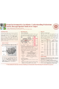
sciforum-149920 Poster From Environment to Accidents Understanding Pedestrian Safety through Spatial Analysis in Taipei.pdf
Predicting Lobby Location as an Indicator of Occupant Comfort: A Machine Learning (ML) Approach
In Search of Equity: Advances and Gaps in Transport Planning for Diversity