Event submissions
Events3rd Conference on Future Challenges in Sustainable Urban Planning & Territorial Management
Published
This submission belongs to the session GIS. Spatial Analysis of the event 3rd Conference on Future Challenges in Sustainable Urban Planning & Territorial Management
Published date
19 Jan, 2026
Academic Editor
'%3e%3cpath%20d='M12.6657%2010.9104C12.4185%2010.325%2012.0599%209.79327%2011.6097%209.34482C11.1609%208.89508%2010.6293%208.5365%2010.0442%208.28888C10.0389%208.28626%2010.0337%208.28495%2010.0285%208.28233C10.8446%207.69279%2011.3752%206.73249%2011.3752%205.64904C11.3752%203.8542%209.92103%202.39999%208.1262%202.39999C6.33136%202.39999%204.87715%203.8542%204.87715%205.64904C4.87715%206.73249%205.40774%207.69279%206.22393%208.28364C6.21869%208.28626%206.21345%208.28757%206.20821%208.29019C5.62129%208.5378%205.09463%208.89284%204.64265%209.34613C4.1929%209.79493%203.83432%2010.3266%203.58671%2010.9117C3.34345%2011.4845%203.21226%2012.0987%203.20023%2012.7209C3.19988%2012.7349%203.20233%2012.7488%203.20744%2012.7619C3.21255%2012.7749%203.22022%2012.7867%203.22998%2012.7968C3.23975%2012.8068%203.25142%2012.8147%203.26431%2012.8202C3.2772%2012.8256%203.29105%2012.8284%203.30504%2012.8284H4.09109C4.14874%2012.8284%204.19459%2012.7825%204.1959%2012.7262C4.2221%2011.7148%204.62823%2010.7676%205.34617%2010.0497C6.08899%209.30683%207.0755%208.89808%208.1262%208.89808C9.17689%208.89808%2010.1634%209.30683%2010.9062%2010.0497C11.6242%2010.7676%2012.0303%2011.7148%2012.0565%2012.7262C12.0578%2012.7838%2012.1037%2012.8284%2012.1613%2012.8284H12.9474C12.9613%2012.8284%2012.9752%2012.8256%2012.9881%2012.8202C13.001%2012.8147%2013.0126%2012.8068%2013.0224%2012.7968C13.0322%2012.7867%2013.0398%2012.7749%2013.0449%2012.7619C13.0501%2012.7488%2013.0525%2012.7349%2013.0522%2012.7209C13.0391%2012.0947%2012.9094%2011.4855%2012.6657%2010.9104ZM8.1262%207.9024C7.52486%207.9024%206.9589%207.6679%206.53312%207.24211C6.10733%206.81633%205.87283%206.25037%205.87283%205.64904C5.87283%205.0477%206.10733%204.48174%206.53312%204.05596C6.9589%203.63018%207.52486%203.39567%208.1262%203.39567C8.72753%203.39567%209.29349%203.63018%209.71927%204.05596C10.1451%204.48174%2010.3796%205.0477%2010.3796%205.64904C10.3796%206.25037%2010.1451%206.81633%209.71927%207.24211C9.29349%207.6679%208.72753%207.9024%208.1262%207.9024Z'%20fill='%235D1EE1'/%3e%3c/g%3e%3c/svg%3e) Salvador Garcia-Ayllon
Salvador Garcia-AyllonCitation
Mohd Islam, Radhika Mulay, Rahul Chopra, Spatio-Temporal Dynamics of Built-Up Areas in Pune City, Maharashtra, India (1992 and 2022): Implications for Groundwater Management and Urban Planning, in Proceedings of 3rd Conference on Future Challenges in Sustainable Urban Planning & Territorial Management, 20 January–22 January 2026, MDPI: Basel, Switzerland
Share
Email
Facebook
Twitter
LinkedIn
Spatio-Temporal Dynamics of Built-Up Areas in Pune City, Maharashtra, India (1992 and 2022): Implications for Groundwater Management and Urban Planning
'%3e%3cpath%20d='M12.6647%2010.9104C12.4176%2010.325%2012.0589%209.7933%2011.6088%209.34485C11.16%208.89511%2010.6283%208.53653%2010.0432%208.28891C10.038%208.28629%2010.0327%208.28498%2010.0275%208.28236C10.8437%207.69282%2011.3743%206.73252%2011.3743%205.64907C11.3743%203.85423%209.92005%202.40002%208.12522%202.40002C6.33038%202.40002%204.87618%203.85423%204.87618%205.64907C4.87618%206.73252%205.40677%207.69282%206.22296%208.28367C6.21772%208.28629%206.21248%208.2876%206.20724%208.29022C5.62031%208.53783%205.09365%208.89287%204.64167%209.34616C4.19192%209.79496%203.83334%2010.3266%203.58573%2010.9117C3.34247%2011.4846%203.21128%2012.0987%203.19925%2012.721C3.1989%2012.735%203.20135%2012.7489%203.20646%2012.7619C3.21157%2012.7749%203.21924%2012.7868%203.22901%2012.7968C3.23877%2012.8068%203.25045%2012.8148%203.26334%2012.8202C3.27623%2012.8256%203.29007%2012.8284%203.30406%2012.8284H4.09012C4.14776%2012.8284%204.19362%2012.7825%204.19493%2012.7262C4.22113%2011.7148%204.62726%2010.7676%205.34519%2010.0497C6.08802%209.30686%207.07452%208.89811%208.12522%208.89811C9.17592%208.89811%2010.1624%209.30686%2010.9052%2010.0497C11.6232%2010.7676%2012.0293%2011.7148%2012.0555%2012.7262C12.0568%2012.7839%2012.1027%2012.8284%2012.1603%2012.8284H12.9464C12.9604%2012.8284%2012.9742%2012.8256%2012.9871%2012.8202C13%2012.8148%2013.0117%2012.8068%2013.0214%2012.7968C13.0312%2012.7868%2013.0389%2012.7749%2013.044%2012.7619C13.0491%2012.7489%2013.0515%2012.735%2013.0512%2012.721C13.0381%2012.0947%2012.9084%2011.4856%2012.6647%2010.9104ZM8.12522%207.90243C7.52388%207.90243%206.95792%207.66793%206.53214%207.24215C6.10636%206.81636%205.87185%206.2504%205.87185%205.64907C5.87185%205.04773%206.10636%204.48177%206.53214%204.05599C6.95792%203.63021%207.52388%203.3957%208.12522%203.3957C8.72655%203.3957%209.29252%203.63021%209.7183%204.05599C10.1441%204.48177%2010.3786%205.04773%2010.3786%205.64907C10.3786%206.2504%2010.1441%206.81636%209.7183%207.24215C9.29252%207.66793%208.72655%207.90243%208.12522%207.90243Z'%20fill='%235D1EE1'/%3e%3c/g%3e%3c/svg%3e)
Mohd Islam 1
Radhika Mulay 1
Rahul Chopra 1
1. Centre for Sustainability, Environment, and Climate Change, FLAME University, Pune, India
Abstract
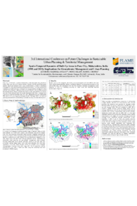
Urban metropolises, such as Pune, are undergoing rapid landuse/landcover (LULC) transformation, thereby intensifying challenges for future urban planning and water resource management. Pune city, presently the largest municipal corporation in Maharashtra, India, covers approximately 516.18 km² area. Historically, the city developed around the Mula-Mutha river watershed within the Deccan Volcanic Province, characterized by basalt formations and five unconfined aquifers. Between 1981 and 2011, the census data shows the city's population grew from 1.2 million to over 3.1 million. In this study, we used the Landsat (30m) satellite data for 1992 and 2022, employing the maximum likelihood supervised classification to quantify the spatio-temporal changes of LULC in Pune city. The findings revealed an expansion of built-up area from about 47.7 km² in 1992 to 151.5 km² in 2022, leading to increased water demand. Consequently, post-monsoon groundwater levels have shown a declining trend, falling from about ~2.2 m bgl (meters below ground level) in 1992 to nearly ~4.1 m bgl in 2022 according to Central Ground Water Board. GIS analysis was conducted by overlaying built-up areas with natural drainage density and stream order calculated by using the ALOS PALSAR (12.5m) digital elevation model (DEM) along with existing groundwater recharge zones. The results indicate that natural drainage networks and recharge zones have been overlooked during urban expansion. This suggests a correlation that groundwater depletion may not only be driven by over-extraction but also by the neglect of hydrological systems in land use planning. In this study, we emphasize the urgent need to ‘design for and around water’ by integrating natural drainage patterns and groundwater recharge zones into spatial development to implement Managed Aquifer Recharge (MAR) strategies, safeguarding groundwater resources and ensuring water security in rapidly urbanizing Pune.
Keywords
Land use/Land cover
Groundwater management
Urban planning
Managed aquifer recharge (MAR) strategy
Water security
Manuscript
FINAL_PuneIndia_SUPTM 2026 Proceedings.pdf
Poster
PuneIndia_SUPTM_Poster.pdf
The Quadaq Framework: A Multi-Level Partnership Model for Sustainable Air Quality Management
A methodology for determining power demands across urban transport routes