Event submissions
Published
This submission belongs to the session S2. Environmental Impact and Risk Assessment of the event The 1st International Online Conference on Environments
Published date
27 Feb, 2026
Academic Editor
'%3e%3cpath%20d='M12.6657%2010.9104C12.4185%2010.325%2012.0599%209.79327%2011.6097%209.34482C11.1609%208.89508%2010.6293%208.5365%2010.0442%208.28888C10.0389%208.28626%2010.0337%208.28495%2010.0285%208.28233C10.8446%207.69279%2011.3752%206.73249%2011.3752%205.64904C11.3752%203.8542%209.92103%202.39999%208.1262%202.39999C6.33136%202.39999%204.87715%203.8542%204.87715%205.64904C4.87715%206.73249%205.40774%207.69279%206.22393%208.28364C6.21869%208.28626%206.21345%208.28757%206.20821%208.29019C5.62129%208.5378%205.09463%208.89284%204.64265%209.34613C4.1929%209.79493%203.83432%2010.3266%203.58671%2010.9117C3.34345%2011.4845%203.21226%2012.0987%203.20023%2012.7209C3.19988%2012.7349%203.20233%2012.7488%203.20744%2012.7619C3.21255%2012.7749%203.22022%2012.7867%203.22998%2012.7968C3.23975%2012.8068%203.25142%2012.8147%203.26431%2012.8202C3.2772%2012.8256%203.29105%2012.8284%203.30504%2012.8284H4.09109C4.14874%2012.8284%204.19459%2012.7825%204.1959%2012.7262C4.2221%2011.7148%204.62823%2010.7676%205.34617%2010.0497C6.08899%209.30683%207.0755%208.89808%208.1262%208.89808C9.17689%208.89808%2010.1634%209.30683%2010.9062%2010.0497C11.6242%2010.7676%2012.0303%2011.7148%2012.0565%2012.7262C12.0578%2012.7838%2012.1037%2012.8284%2012.1613%2012.8284H12.9474C12.9613%2012.8284%2012.9752%2012.8256%2012.9881%2012.8202C13.001%2012.8147%2013.0126%2012.8068%2013.0224%2012.7968C13.0322%2012.7867%2013.0398%2012.7749%2013.0449%2012.7619C13.0501%2012.7488%2013.0525%2012.7349%2013.0522%2012.7209C13.0391%2012.0947%2012.9094%2011.4855%2012.6657%2010.9104ZM8.1262%207.9024C7.52486%207.9024%206.9589%207.6679%206.53312%207.24211C6.10733%206.81633%205.87283%206.25037%205.87283%205.64904C5.87283%205.0477%206.10733%204.48174%206.53312%204.05596C6.9589%203.63018%207.52486%203.39567%208.1262%203.39567C8.72753%203.39567%209.29349%203.63018%209.71927%204.05596C10.1451%204.48174%2010.3796%205.0477%2010.3796%205.64904C10.3796%206.25037%2010.1451%206.81633%209.71927%207.24211C9.29349%207.6679%208.72753%207.9024%208.1262%207.9024Z'%20fill='%235D1EE1'/%3e%3c/g%3e%3c/svg%3e) Gianniantonio Petruzzelli
Gianniantonio PetruzzelliCitation
Tarun Teja Kondraju, R. G. Rejith, Amrita Bhandari, Rajeev Ranjan, Rabi N. Sahoo, High-Resolution Soil Organic Carbon Mapping Using Sentinel-2 and Gaussian Process Regression on Google Earth Engine, in Proceedings of The 1st International Online Conference on Environments, 2 March–4 March 2026, MDPI: Basel, Switzerland
Share
Email
Facebook
Twitter
LinkedIn
High-Resolution Soil Organic Carbon Mapping Using Sentinel-2 and Gaussian Process Regression on Google Earth Engine
'%3e%3cpath%20d='M12.6647%2010.9104C12.4176%2010.325%2012.0589%209.7933%2011.6088%209.34485C11.16%208.89511%2010.6283%208.53653%2010.0432%208.28891C10.038%208.28629%2010.0327%208.28498%2010.0275%208.28236C10.8437%207.69282%2011.3743%206.73252%2011.3743%205.64907C11.3743%203.85423%209.92005%202.40002%208.12522%202.40002C6.33038%202.40002%204.87618%203.85423%204.87618%205.64907C4.87618%206.73252%205.40677%207.69282%206.22296%208.28367C6.21772%208.28629%206.21248%208.2876%206.20724%208.29022C5.62031%208.53783%205.09365%208.89287%204.64167%209.34616C4.19192%209.79496%203.83334%2010.3266%203.58573%2010.9117C3.34247%2011.4846%203.21128%2012.0987%203.19925%2012.721C3.1989%2012.735%203.20135%2012.7489%203.20646%2012.7619C3.21157%2012.7749%203.21924%2012.7868%203.22901%2012.7968C3.23877%2012.8068%203.25045%2012.8148%203.26334%2012.8202C3.27623%2012.8256%203.29007%2012.8284%203.30406%2012.8284H4.09012C4.14776%2012.8284%204.19362%2012.7825%204.19493%2012.7262C4.22113%2011.7148%204.62726%2010.7676%205.34519%2010.0497C6.08802%209.30686%207.07452%208.89811%208.12522%208.89811C9.17592%208.89811%2010.1624%209.30686%2010.9052%2010.0497C11.6232%2010.7676%2012.0293%2011.7148%2012.0555%2012.7262C12.0568%2012.7839%2012.1027%2012.8284%2012.1603%2012.8284H12.9464C12.9604%2012.8284%2012.9742%2012.8256%2012.9871%2012.8202C13%2012.8148%2013.0117%2012.8068%2013.0214%2012.7968C13.0312%2012.7868%2013.0389%2012.7749%2013.044%2012.7619C13.0491%2012.7489%2013.0515%2012.735%2013.0512%2012.721C13.0381%2012.0947%2012.9084%2011.4856%2012.6647%2010.9104ZM8.12522%207.90243C7.52388%207.90243%206.95792%207.66793%206.53214%207.24215C6.10636%206.81636%205.87185%206.2504%205.87185%205.64907C5.87185%205.04773%206.10636%204.48177%206.53214%204.05599C6.95792%203.63021%207.52388%203.3957%208.12522%203.3957C8.72655%203.3957%209.29252%203.63021%209.7183%204.05599C10.1441%204.48177%2010.3786%205.04773%2010.3786%205.64907C10.3786%206.2504%2010.1441%206.81636%209.7183%207.24215C9.29252%207.66793%208.72655%207.90243%208.12522%207.90243Z'%20fill='%235D1EE1'/%3e%3c/g%3e%3c/svg%3e)
Tarun Teja Kondraju 1
R. G. Rejith 1
Amrita Bhandari 1
Rajeev Ranjan 1
Rabi N. Sahoo 1
1. Division of Agricultural Physics, ICAR-Indian Agricultural Research Institute, New Delhi 110012, India
Abstract
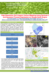
Accurate assessment of soil organic carbon (SOC) is fundamental to evaluating risks of land degradation, soil fertility decline, and climate-related vulnerabilities in rapidly transforming urban–agricultural landscapes. This study presents a remote-sensing-driven SOC estimation framework that integrates Sentinel-2 multispectral imagery, Gaussian Process Regression (GPR), and Google Earth Engine (GEE) to produce high-resolution SOC maps for the ICAR–Indian Agricultural Research Institute (ICAR-IARI) region of New Delhi, India. Ground-measured soil fertility parameters were paired with Sentinel-2 surface reflectance spectra to train a GPR model, which achieved strong predictive performance (R² = 0.67, RMSE = 0.099, MAE = 0.075) across 78 soil samples. The trained model was then migrated into GEE to enable scalable, cloud-based SOC prediction. A cloud-free Sentinel-2 image acquired on 25 May 2018 was used, and a multi-index soil mask (NDVI, NDWI, NBAI) was applied to remove vegetation, water bodies, and impervious surfaces, thereby ensuring SOC mapping was limited to exposed soil. The resulting SOC map demonstrates clear spatial variability influenced by land use, irrigation patterns, and management practices, highlighting zones of lower carbon content that may be at higher risk of degradation. By combining machine learning with openly accessible satellite data and cloud computation, this framework provides a rapid, transferable method for soil-quality risk assessment. The approach supports evidence-based planning, monitoring of anthropogenic impacts on soil health, and identification of priority zones for carbon-enhancing interventions, contributing to broader goals of sustainable land management and climate-impact mitigation.
Keywords
Soil Organic Carbon
Sentinel-2 Imagery
Gaussian Process Regression
Google Earth Engine
Remote Sensing
Soil Degradation Risk
Machine Learning
Poster
IOCE_Poster.pdf
Microbial production of biodegradable polymers using toxic compounds and CO2
Conserving Terrestrial Diversity with Natural Pesticides: Insights from Inula viscosa Applications