Event submissions
Published
This submission belongs to the session S2. Environmental Impact and Risk Assessment of the event The 1st International Online Conference on Environments
Published date
05 Mar, 2026
Academic Editor
'%3e%3cpath%20d='M12.6657%2010.9104C12.4185%2010.325%2012.0599%209.79327%2011.6097%209.34482C11.1609%208.89508%2010.6293%208.5365%2010.0442%208.28888C10.0389%208.28626%2010.0337%208.28495%2010.0285%208.28233C10.8446%207.69279%2011.3752%206.73249%2011.3752%205.64904C11.3752%203.8542%209.92103%202.39999%208.1262%202.39999C6.33136%202.39999%204.87715%203.8542%204.87715%205.64904C4.87715%206.73249%205.40774%207.69279%206.22393%208.28364C6.21869%208.28626%206.21345%208.28757%206.20821%208.29019C5.62129%208.5378%205.09463%208.89284%204.64265%209.34613C4.1929%209.79493%203.83432%2010.3266%203.58671%2010.9117C3.34345%2011.4845%203.21226%2012.0987%203.20023%2012.7209C3.19988%2012.7349%203.20233%2012.7488%203.20744%2012.7619C3.21255%2012.7749%203.22022%2012.7867%203.22998%2012.7968C3.23975%2012.8068%203.25142%2012.8147%203.26431%2012.8202C3.2772%2012.8256%203.29105%2012.8284%203.30504%2012.8284H4.09109C4.14874%2012.8284%204.19459%2012.7825%204.1959%2012.7262C4.2221%2011.7148%204.62823%2010.7676%205.34617%2010.0497C6.08899%209.30683%207.0755%208.89808%208.1262%208.89808C9.17689%208.89808%2010.1634%209.30683%2010.9062%2010.0497C11.6242%2010.7676%2012.0303%2011.7148%2012.0565%2012.7262C12.0578%2012.7838%2012.1037%2012.8284%2012.1613%2012.8284H12.9474C12.9613%2012.8284%2012.9752%2012.8256%2012.9881%2012.8202C13.001%2012.8147%2013.0126%2012.8068%2013.0224%2012.7968C13.0322%2012.7867%2013.0398%2012.7749%2013.0449%2012.7619C13.0501%2012.7488%2013.0525%2012.7349%2013.0522%2012.7209C13.0391%2012.0947%2012.9094%2011.4855%2012.6657%2010.9104ZM8.1262%207.9024C7.52486%207.9024%206.9589%207.6679%206.53312%207.24211C6.10733%206.81633%205.87283%206.25037%205.87283%205.64904C5.87283%205.0477%206.10733%204.48174%206.53312%204.05596C6.9589%203.63018%207.52486%203.39567%208.1262%203.39567C8.72753%203.39567%209.29349%203.63018%209.71927%204.05596C10.1451%204.48174%2010.3796%205.0477%2010.3796%205.64904C10.3796%206.25037%2010.1451%206.81633%209.71927%207.24211C9.29349%207.6679%208.72753%207.9024%208.1262%207.9024Z'%20fill='%235D1EE1'/%3e%3c/g%3e%3c/svg%3e) Gianniantonio Petruzzelli
Gianniantonio PetruzzelliCitation
Blessing Esther Kadiri, Satellite-Based Detection of Oil Spill in Niger Delta Region, in Proceedings of The 1st International Online Conference on Environments, 2 March–4 March 2026, MDPI: Basel, Switzerland
Share
Email
Facebook
Twitter
LinkedIn
Satellite-Based Detection of Oil Spill in Niger Delta Region
'%3e%3cpath%20d='M12.6647%2010.9104C12.4176%2010.325%2012.0589%209.7933%2011.6088%209.34485C11.16%208.89511%2010.6283%208.53653%2010.0432%208.28891C10.038%208.28629%2010.0327%208.28498%2010.0275%208.28236C10.8437%207.69282%2011.3743%206.73252%2011.3743%205.64907C11.3743%203.85423%209.92005%202.40002%208.12522%202.40002C6.33038%202.40002%204.87618%203.85423%204.87618%205.64907C4.87618%206.73252%205.40677%207.69282%206.22296%208.28367C6.21772%208.28629%206.21248%208.2876%206.20724%208.29022C5.62031%208.53783%205.09365%208.89287%204.64167%209.34616C4.19192%209.79496%203.83334%2010.3266%203.58573%2010.9117C3.34247%2011.4846%203.21128%2012.0987%203.19925%2012.721C3.1989%2012.735%203.20135%2012.7489%203.20646%2012.7619C3.21157%2012.7749%203.21924%2012.7868%203.22901%2012.7968C3.23877%2012.8068%203.25045%2012.8148%203.26334%2012.8202C3.27623%2012.8256%203.29007%2012.8284%203.30406%2012.8284H4.09012C4.14776%2012.8284%204.19362%2012.7825%204.19493%2012.7262C4.22113%2011.7148%204.62726%2010.7676%205.34519%2010.0497C6.08802%209.30686%207.07452%208.89811%208.12522%208.89811C9.17592%208.89811%2010.1624%209.30686%2010.9052%2010.0497C11.6232%2010.7676%2012.0293%2011.7148%2012.0555%2012.7262C12.0568%2012.7839%2012.1027%2012.8284%2012.1603%2012.8284H12.9464C12.9604%2012.8284%2012.9742%2012.8256%2012.9871%2012.8202C13%2012.8148%2013.0117%2012.8068%2013.0214%2012.7968C13.0312%2012.7868%2013.0389%2012.7749%2013.044%2012.7619C13.0491%2012.7489%2013.0515%2012.735%2013.0512%2012.721C13.0381%2012.0947%2012.9084%2011.4856%2012.6647%2010.9104ZM8.12522%207.90243C7.52388%207.90243%206.95792%207.66793%206.53214%207.24215C6.10636%206.81636%205.87185%206.2504%205.87185%205.64907C5.87185%205.04773%206.10636%204.48177%206.53214%204.05599C6.95792%203.63021%207.52388%203.3957%208.12522%203.3957C8.72655%203.3957%209.29252%203.63021%209.7183%204.05599C10.1441%204.48177%2010.3786%205.04773%2010.3786%205.64907C10.3786%206.2504%2010.1441%206.81636%209.7183%207.24215C9.29252%207.66793%208.72655%207.90243%208.12522%207.90243Z'%20fill='%235D1EE1'/%3e%3c/g%3e%3c/svg%3e)
Blessing Esther Kadiri 1
1. Department of Remote Sensing and GIS, School of Earth and Mineral Sciences, Federal University of Technology Akure (FUTA), Akure 340001, Nigeria
Abstract
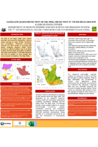
Oil spills in the Niger Delta have caused persistent environmental degradation, affecting ecosystems, water bodies, farmlands, and human livelihoods. This study assessed oil spill vulnerability across the Rivers, Bayelsa, and Delta States using Sentinel-1 Synthetic Aperture Radar (SAR) imagery and Geographic Information Systems (GIS). A specific oil spill incident recorded on December 24, 2024, guided the selection of pre- and post-spill SAR images for analysis. The difference in SAR backscatter values was used to detect oil-impacted areas. Ancillary data, including soil maps (HWSD), land use/land cover (LULC), digital elevation model (DEM), slope, river network, proximity to water bodies, and spill points, were integrated into the analysis.
Each dataset was reclassified into vulnerability levels and weighted using the Analytical Hierarchy Process (AHP). A consistency ratio of less than 0.1 validated the pairwise comparison matrix. A weighted overlay analysis was conducted in ArcMap to generate a comprehensive oil spill vulnerability map. The results revealed that 21.6% of the study area fell under high- and very-high-vulnerability zones, concentrated around southern Rivers State (Bonny axis), central Bayelsa (Yenagoa and Ogbia LGAs), and western Delta State (Warri South and Ughelli). Low-lying regions and areas within 0–2 km proximity to spill points and major rivers such as Nun, Forcados, and Bonny were the most affected. Agricultural lands and wetlands accounted for over 40% of the vulnerable zones, highlighting the risks to food security and biodiversity. Proximity and buffer analyses further emphasized that areas closest to spill sources and water bodies experienced the highest contamination risk.
This study demonstrates the effectiveness of combining SAR imagery with AHP-GIS techniques in assessing oil spill vulnerability and provides critical spatial evidence to support environmental decision-making, targeted remediation, and emergency response planning in the Niger Delta.
Keywords
Oil Spill
Sentinel-1 SAR
Niger Delta
AHP
GIS
Vulnerability Mapping
Remote Sensing
Environmental Risk Assessment
Backscatter Analysis
Oil Spill Detection.
Poster
KADIRI BLESSING Poster.pdf
CHARACTERIZATION AND SAMPLING OF LOCAL PLANT SPECIES FROM THE PURUÁNDIRO REGION (MEXICO) AS OPTIONS FOR THE RESTORATION OF THE LOCAL AGROECOSYSTEM
Quantitative assessment of radiocesium transfer processes from soil to plant for appropriate remediation of radioactive contamination in Moroccan semi-arid agricultural areas