Event submissions
Published
This submission belongs to the session S2. Mineral Systems and Ore Deposits: From Formation to Exploration of the event The 3rd International Online Conference on Mineral Science
Published date
06 Mar, 2026
Academic Editor
'%3e%3cpath%20d='M12.6657%2010.9104C12.4185%2010.325%2012.0599%209.79327%2011.6097%209.34482C11.1609%208.89508%2010.6293%208.5365%2010.0442%208.28888C10.0389%208.28626%2010.0337%208.28495%2010.0285%208.28233C10.8446%207.69279%2011.3752%206.73249%2011.3752%205.64904C11.3752%203.8542%209.92103%202.39999%208.1262%202.39999C6.33136%202.39999%204.87715%203.8542%204.87715%205.64904C4.87715%206.73249%205.40774%207.69279%206.22393%208.28364C6.21869%208.28626%206.21345%208.28757%206.20821%208.29019C5.62129%208.5378%205.09463%208.89284%204.64265%209.34613C4.1929%209.79493%203.83432%2010.3266%203.58671%2010.9117C3.34345%2011.4845%203.21226%2012.0987%203.20023%2012.7209C3.19988%2012.7349%203.20233%2012.7488%203.20744%2012.7619C3.21255%2012.7749%203.22022%2012.7867%203.22998%2012.7968C3.23975%2012.8068%203.25142%2012.8147%203.26431%2012.8202C3.2772%2012.8256%203.29105%2012.8284%203.30504%2012.8284H4.09109C4.14874%2012.8284%204.19459%2012.7825%204.1959%2012.7262C4.2221%2011.7148%204.62823%2010.7676%205.34617%2010.0497C6.08899%209.30683%207.0755%208.89808%208.1262%208.89808C9.17689%208.89808%2010.1634%209.30683%2010.9062%2010.0497C11.6242%2010.7676%2012.0303%2011.7148%2012.0565%2012.7262C12.0578%2012.7838%2012.1037%2012.8284%2012.1613%2012.8284H12.9474C12.9613%2012.8284%2012.9752%2012.8256%2012.9881%2012.8202C13.001%2012.8147%2013.0126%2012.8068%2013.0224%2012.7968C13.0322%2012.7867%2013.0398%2012.7749%2013.0449%2012.7619C13.0501%2012.7488%2013.0525%2012.7349%2013.0522%2012.7209C13.0391%2012.0947%2012.9094%2011.4855%2012.6657%2010.9104ZM8.1262%207.9024C7.52486%207.9024%206.9589%207.6679%206.53312%207.24211C6.10733%206.81633%205.87283%206.25037%205.87283%205.64904C5.87283%205.0477%206.10733%204.48174%206.53312%204.05596C6.9589%203.63018%207.52486%203.39567%208.1262%203.39567C8.72753%203.39567%209.29349%203.63018%209.71927%204.05596C10.1451%204.48174%2010.3796%205.0477%2010.3796%205.64904C10.3796%206.25037%2010.1451%206.81633%209.71927%207.24211C9.29349%207.6679%208.72753%207.9024%208.1262%207.9024Z'%20fill='%235D1EE1'/%3e%3c/g%3e%3c/svg%3e) Theodore Bornhorst
Theodore BornhorstCitation
R. G. Rejith, M Sundararajan, M A Mohammed Aslam, Machine learning approaches for mapping silica sand deposits using spaceborne remote sensing, in Proceedings of The 3rd International Online Conference on Mineral Science, 10 March–12 March 2026, MDPI: Basel, Switzerland
Share
Email
Facebook
Twitter
LinkedIn
Machine learning approaches for mapping silica sand deposits using spaceborne remote sensing
'%3e%3cpath%20d='M12.6647%2010.9104C12.4176%2010.325%2012.0589%209.7933%2011.6088%209.34485C11.16%208.89511%2010.6283%208.53653%2010.0432%208.28891C10.038%208.28629%2010.0327%208.28498%2010.0275%208.28236C10.8437%207.69282%2011.3743%206.73252%2011.3743%205.64907C11.3743%203.85423%209.92005%202.40002%208.12522%202.40002C6.33038%202.40002%204.87618%203.85423%204.87618%205.64907C4.87618%206.73252%205.40677%207.69282%206.22296%208.28367C6.21772%208.28629%206.21248%208.2876%206.20724%208.29022C5.62031%208.53783%205.09365%208.89287%204.64167%209.34616C4.19192%209.79496%203.83334%2010.3266%203.58573%2010.9117C3.34247%2011.4846%203.21128%2012.0987%203.19925%2012.721C3.1989%2012.735%203.20135%2012.7489%203.20646%2012.7619C3.21157%2012.7749%203.21924%2012.7868%203.22901%2012.7968C3.23877%2012.8068%203.25045%2012.8148%203.26334%2012.8202C3.27623%2012.8256%203.29007%2012.8284%203.30406%2012.8284H4.09012C4.14776%2012.8284%204.19362%2012.7825%204.19493%2012.7262C4.22113%2011.7148%204.62726%2010.7676%205.34519%2010.0497C6.08802%209.30686%207.07452%208.89811%208.12522%208.89811C9.17592%208.89811%2010.1624%209.30686%2010.9052%2010.0497C11.6232%2010.7676%2012.0293%2011.7148%2012.0555%2012.7262C12.0568%2012.7839%2012.1027%2012.8284%2012.1603%2012.8284H12.9464C12.9604%2012.8284%2012.9742%2012.8256%2012.9871%2012.8202C13%2012.8148%2013.0117%2012.8068%2013.0214%2012.7968C13.0312%2012.7868%2013.0389%2012.7749%2013.044%2012.7619C13.0491%2012.7489%2013.0515%2012.735%2013.0512%2012.721C13.0381%2012.0947%2012.9084%2011.4856%2012.6647%2010.9104ZM8.12522%207.90243C7.52388%207.90243%206.95792%207.66793%206.53214%207.24215C6.10636%206.81636%205.87185%206.2504%205.87185%205.64907C5.87185%205.04773%206.10636%204.48177%206.53214%204.05599C6.95792%203.63021%207.52388%203.3957%208.12522%203.3957C8.72655%203.3957%209.29252%203.63021%209.7183%204.05599C10.1441%204.48177%2010.3786%205.04773%2010.3786%205.64907C10.3786%206.2504%2010.1441%206.81636%209.7183%207.24215C9.29252%207.66793%208.72655%207.90243%208.12522%207.90243Z'%20fill='%235D1EE1'/%3e%3c/g%3e%3c/svg%3e)
R. G. Rejith 1
M Sundararajan 1
M A Mohammed Aslam 2
1. Materials Science and Technology Division, CSIR-National Institute for Interdisciplinary Science Technology (CSIR-NIIST), Thiruvananthapuram 695019, India
2. Department of Geology, Central University of Karnataka, Kalaburagi 585367, India
Abstract
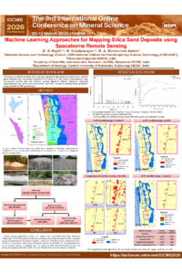
The Alappuzha district in Kerala, India, has large deposits of high-grade silica sand mainly used for glass manufacturing. In the present study, these mineral deposits were effectively mapped using multispectral satellite data and machine learning algorithms (MLAs). The samples collected from Cherthala show a silica sand content of 93.93-97.94%. Detailed geochemical characterisation using the Energy Dispersive X-ray Fluorescence (ED-XRF) technique reveals a SiO2 content of 96.93-99.13%. The X-ray diffraction (XRD) analysis reveals diffraction peaks characteristic of quartz, confirming the silica sand's composition. The spectral signatures of silica sand were captured using an ASD Fieldspec® 3 spectroradiometer (spectral range of 400–2500 nm) and compiled as a reference spectrum for mapping using Landsat and ASTER remote sensing datasets. The reference spectra of silica sand were used to generate the potential targets of silica sand occurrences, followed by a comparison of four widely used MLAs, which shows that the Support vector machine (SVM) outperforms other algorithms, such as the Random Forest Classifier (RFC), maximum likelihood classification (MLC), and artificial neural network (ANN), with an overall accuracy of 97.82% and Kappa coefficient of 0.96. The results derived from the satellite data show a good correlation with ground truth verification and laboratory analysis. Integrating remote sensing techniques, mineral characterization, and field data facilitates eco-friendly and sustainable mining of these strategic minerals.
Keywords
Mineral mapping
Silica sand
Landsat
ASTER
Machine learning algorithms
Poster
sciforum-153157_RGRejith.pdf
Influence of iron impurity on floatability of iron-bearing sphalerite
Reducing primary mineral dependence through recycling of lithium-ion batteries: An approach with deep eutectic solvents