Event submissions
Published
This submission belongs to the session S2. Urban Environments and Sustainability of the event The 1st International Online Conference on Urban Sciences
Published date
15 May, 2026
Academic Editor
'%3e%3cpath%20d='M12.6657%2010.9104C12.4185%2010.325%2012.0599%209.79327%2011.6097%209.34482C11.1609%208.89508%2010.6293%208.5365%2010.0442%208.28888C10.0389%208.28626%2010.0337%208.28495%2010.0285%208.28233C10.8446%207.69279%2011.3752%206.73249%2011.3752%205.64904C11.3752%203.8542%209.92103%202.39999%208.1262%202.39999C6.33136%202.39999%204.87715%203.8542%204.87715%205.64904C4.87715%206.73249%205.40774%207.69279%206.22393%208.28364C6.21869%208.28626%206.21345%208.28757%206.20821%208.29019C5.62129%208.5378%205.09463%208.89284%204.64265%209.34613C4.1929%209.79493%203.83432%2010.3266%203.58671%2010.9117C3.34345%2011.4845%203.21226%2012.0987%203.20023%2012.7209C3.19988%2012.7349%203.20233%2012.7488%203.20744%2012.7619C3.21255%2012.7749%203.22022%2012.7867%203.22998%2012.7968C3.23975%2012.8068%203.25142%2012.8147%203.26431%2012.8202C3.2772%2012.8256%203.29105%2012.8284%203.30504%2012.8284H4.09109C4.14874%2012.8284%204.19459%2012.7825%204.1959%2012.7262C4.2221%2011.7148%204.62823%2010.7676%205.34617%2010.0497C6.08899%209.30683%207.0755%208.89808%208.1262%208.89808C9.17689%208.89808%2010.1634%209.30683%2010.9062%2010.0497C11.6242%2010.7676%2012.0303%2011.7148%2012.0565%2012.7262C12.0578%2012.7838%2012.1037%2012.8284%2012.1613%2012.8284H12.9474C12.9613%2012.8284%2012.9752%2012.8256%2012.9881%2012.8202C13.001%2012.8147%2013.0126%2012.8068%2013.0224%2012.7968C13.0322%2012.7867%2013.0398%2012.7749%2013.0449%2012.7619C13.0501%2012.7488%2013.0525%2012.7349%2013.0522%2012.7209C13.0391%2012.0947%2012.9094%2011.4855%2012.6657%2010.9104ZM8.1262%207.9024C7.52486%207.9024%206.9589%207.6679%206.53312%207.24211C6.10733%206.81633%205.87283%206.25037%205.87283%205.64904C5.87283%205.0477%206.10733%204.48174%206.53312%204.05596C6.9589%203.63018%207.52486%203.39567%208.1262%203.39567C8.72753%203.39567%209.29349%203.63018%209.71927%204.05596C10.1451%204.48174%2010.3796%205.0477%2010.3796%205.64904C10.3796%206.25037%2010.1451%206.81633%209.71927%207.24211C9.29349%207.6679%208.72753%207.9024%208.1262%207.9024Z'%20fill='%235D1EE1'/%3e%3c/g%3e%3c/svg%3e) Eusébio Conceição
Eusébio ConceiçãoCitation
Bikash Das, Dr. Janki Prasad, Urban geo-thermodynamics mechanism of surface warming for thermal risk assessment in the Haldia urban–industrial region: A mathematical integrated approach for sustainable urban heat resilience, in Proceedings of The 1st International Online Conference on Urban Sciences, 20 May–22 May 2026, MDPI: Basel, Switzerland
Share
Email
Facebook
Twitter
LinkedIn
Urban geo-thermodynamics mechanism of surface warming for thermal risk assessment in the Haldia urban–industrial region: A mathematical integrated approach for sustainable urban heat resilience

Bikash Das 1
'%3e%3cpath%20d='M12.6647%2010.9104C12.4176%2010.325%2012.0589%209.7933%2011.6088%209.34485C11.16%208.89511%2010.6283%208.53653%2010.0432%208.28891C10.038%208.28629%2010.0327%208.28498%2010.0275%208.28236C10.8437%207.69282%2011.3743%206.73252%2011.3743%205.64907C11.3743%203.85423%209.92005%202.40002%208.12522%202.40002C6.33038%202.40002%204.87618%203.85423%204.87618%205.64907C4.87618%206.73252%205.40677%207.69282%206.22296%208.28367C6.21772%208.28629%206.21248%208.2876%206.20724%208.29022C5.62031%208.53783%205.09365%208.89287%204.64167%209.34616C4.19192%209.79496%203.83334%2010.3266%203.58573%2010.9117C3.34247%2011.4846%203.21128%2012.0987%203.19925%2012.721C3.1989%2012.735%203.20135%2012.7489%203.20646%2012.7619C3.21157%2012.7749%203.21924%2012.7868%203.22901%2012.7968C3.23877%2012.8068%203.25045%2012.8148%203.26334%2012.8202C3.27623%2012.8256%203.29007%2012.8284%203.30406%2012.8284H4.09012C4.14776%2012.8284%204.19362%2012.7825%204.19493%2012.7262C4.22113%2011.7148%204.62726%2010.7676%205.34519%2010.0497C6.08802%209.30686%207.07452%208.89811%208.12522%208.89811C9.17592%208.89811%2010.1624%209.30686%2010.9052%2010.0497C11.6232%2010.7676%2012.0293%2011.7148%2012.0555%2012.7262C12.0568%2012.7839%2012.1027%2012.8284%2012.1603%2012.8284H12.9464C12.9604%2012.8284%2012.9742%2012.8256%2012.9871%2012.8202C13%2012.8148%2013.0117%2012.8068%2013.0214%2012.7968C13.0312%2012.7868%2013.0389%2012.7749%2013.044%2012.7619C13.0491%2012.7489%2013.0515%2012.735%2013.0512%2012.721C13.0381%2012.0947%2012.9084%2011.4856%2012.6647%2010.9104ZM8.12522%207.90243C7.52388%207.90243%206.95792%207.66793%206.53214%207.24215C6.10636%206.81636%205.87185%206.2504%205.87185%205.64907C5.87185%205.04773%206.10636%204.48177%206.53214%204.05599C6.95792%203.63021%207.52388%203.3957%208.12522%203.3957C8.72655%203.3957%209.29252%203.63021%209.7183%204.05599C10.1441%204.48177%2010.3786%205.04773%2010.3786%205.64907C10.3786%206.2504%2010.1441%206.81636%209.7183%207.24215C9.29252%207.66793%208.72655%207.90243%208.12522%207.90243Z'%20fill='%235D1EE1'/%3e%3c/g%3e%3c/svg%3e)
Dr. Janki Prasad 1
1. Department of Geography, Faculty of Earth Science, Indira Gandhi National Tribal University, Amarkantak, Madhya Pradesh, India
Abstract
Rapid urban–industrial development has intensified surface warming in global cities, including India, posing critical challenges for sustainable urban environments. While advanced AI and remote sensing methods have mapped urban heat patterns, a fundamental thermodynamic understanding of how cities generate, absorb, store, and dissipate heat with the urban land transformation remains underexplored. This study conceptualizes the urban geo-thermodynamics mechanism as a comprehensive framework for quantifying urban surface energy exchanges, heat-flux dynamics, and thermal responses in the Haldia urban–industrial region (103.84 km²) of eastern India. The analysis employs Landsat-derived impervious surface expansion, land surface temperature (LST), and normalized difference vegetation index (NDVI), NASA POWER radiation fluxes, World Settlement Footprint 3D structural (2023) and material stock (2024) data, and census-based population records (1991-2021). The integrated mathematical formulations were developed after the remote sensing-GIS-based statistical analysis for the urban energy balance through the Urban Thermodynamic Index (UTI), Urban Heat Retention Efficiency (UHRE), and Urban Cooling Potential (UCP) indices, which were developed from energy balance equations linking net radiation (Q*), anthropogenic flux (QF), and latent/sensible heat terms (QE, QH). The results reveal a 36% increase in UTI and a 28% rise in UHRE between 1991 and 2021, indicating enhanced surface heat accumulation and anthropogenic energy input associated with built-up and population growth (22.87-53.37 km²) and (1452-2375 person/km2). In contrast, UCP declined by 22%, reflecting reduced evaporative cooling due to vegetation loss, and the regression-based calibration (R² = 0.89; RMSE = 0.74°C) validated the correspondence with observed LST. These findings demonstrate a quantifiable link between thermodynamic processes and the transformation of urban morphological landscapes. The proposed mathematical–thermodynamic structure provides a transferable, GIS-based statistical method for urban heat risk assessment, energy-efficient planning, and geothermal environmental management, supporting global initiatives toward climate-resilient and sustainable urban development.
Keywords
Urban geo-thermodynamics
surface warming
thermal risk assessment
Haldia urban-industrial region
sustainable urban heat resilience
Poster
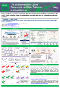
Bikash_Das_Urban_GeoThermodynamics_Poster_IOCUS2026.pdf.pdf
Evaluating the Urban Acoustic Environment Through Mobile Monitoring: Are Campus Noise Levels Within Safe WHO Standards?
CHROMIUM IN URBAN AND PERI-URBAN ENVIRONMENTS: MUSHROOMS AND SOIL AS BIOMONITORING TOOLS IN LEICESTERSHIRE, ENGLAND.