Event submissions
Published
This submission belongs to the session S1. Urban Planning and Design of the event The 1st International Online Conference on Urban Sciences
Published date
15 May, 2026
Academic Editor
'%3e%3cpath%20d='M12.6657%2010.9104C12.4185%2010.325%2012.0599%209.79327%2011.6097%209.34482C11.1609%208.89508%2010.6293%208.5365%2010.0442%208.28888C10.0389%208.28626%2010.0337%208.28495%2010.0285%208.28233C10.8446%207.69279%2011.3752%206.73249%2011.3752%205.64904C11.3752%203.8542%209.92103%202.39999%208.1262%202.39999C6.33136%202.39999%204.87715%203.8542%204.87715%205.64904C4.87715%206.73249%205.40774%207.69279%206.22393%208.28364C6.21869%208.28626%206.21345%208.28757%206.20821%208.29019C5.62129%208.5378%205.09463%208.89284%204.64265%209.34613C4.1929%209.79493%203.83432%2010.3266%203.58671%2010.9117C3.34345%2011.4845%203.21226%2012.0987%203.20023%2012.7209C3.19988%2012.7349%203.20233%2012.7488%203.20744%2012.7619C3.21255%2012.7749%203.22022%2012.7867%203.22998%2012.7968C3.23975%2012.8068%203.25142%2012.8147%203.26431%2012.8202C3.2772%2012.8256%203.29105%2012.8284%203.30504%2012.8284H4.09109C4.14874%2012.8284%204.19459%2012.7825%204.1959%2012.7262C4.2221%2011.7148%204.62823%2010.7676%205.34617%2010.0497C6.08899%209.30683%207.0755%208.89808%208.1262%208.89808C9.17689%208.89808%2010.1634%209.30683%2010.9062%2010.0497C11.6242%2010.7676%2012.0303%2011.7148%2012.0565%2012.7262C12.0578%2012.7838%2012.1037%2012.8284%2012.1613%2012.8284H12.9474C12.9613%2012.8284%2012.9752%2012.8256%2012.9881%2012.8202C13.001%2012.8147%2013.0126%2012.8068%2013.0224%2012.7968C13.0322%2012.7867%2013.0398%2012.7749%2013.0449%2012.7619C13.0501%2012.7488%2013.0525%2012.7349%2013.0522%2012.7209C13.0391%2012.0947%2012.9094%2011.4855%2012.6657%2010.9104ZM8.1262%207.9024C7.52486%207.9024%206.9589%207.6679%206.53312%207.24211C6.10733%206.81633%205.87283%206.25037%205.87283%205.64904C5.87283%205.0477%206.10733%204.48174%206.53312%204.05596C6.9589%203.63018%207.52486%203.39567%208.1262%203.39567C8.72753%203.39567%209.29349%203.63018%209.71927%204.05596C10.1451%204.48174%2010.3796%205.0477%2010.3796%205.64904C10.3796%206.25037%2010.1451%206.81633%209.71927%207.24211C9.29349%207.6679%208.72753%207.9024%208.1262%207.9024Z'%20fill='%235D1EE1'/%3e%3c/g%3e%3c/svg%3e) Bernhard Müller
Bernhard MüllerCitation
Johnny MUHINDO BAHAVIRA, Junior Lukoo Mitsindo, Michael Paluku Lukumbi, Open-Data GeoAI for Short-Term Urban Land-Use/Land-Cover Forecasting in Rapidly Growing African Cities: A Reproducible Workflow and the Kinshasa (DRC) Case Study, in Proceedings of The 1st International Online Conference on Urban Sciences, 20 May–22 May 2026, MDPI: Basel, Switzerland
Share
Email
Facebook
Twitter
LinkedIn
Open-Data GeoAI for Short-Term Urban Land-Use/Land-Cover Forecasting in Rapidly Growing African Cities: A Reproducible Workflow and the Kinshasa (DRC) Case Study

Johnny MUHINDO BAHAVIRA 1

Junior Lukoo Mitsindo 2
'%3e%3cpath%20d='M12.6647%2010.9104C12.4176%2010.325%2012.0589%209.7933%2011.6088%209.34485C11.16%208.89511%2010.6283%208.53653%2010.0432%208.28891C10.038%208.28629%2010.0327%208.28498%2010.0275%208.28236C10.8437%207.69282%2011.3743%206.73252%2011.3743%205.64907C11.3743%203.85423%209.92005%202.40002%208.12522%202.40002C6.33038%202.40002%204.87618%203.85423%204.87618%205.64907C4.87618%206.73252%205.40677%207.69282%206.22296%208.28367C6.21772%208.28629%206.21248%208.2876%206.20724%208.29022C5.62031%208.53783%205.09365%208.89287%204.64167%209.34616C4.19192%209.79496%203.83334%2010.3266%203.58573%2010.9117C3.34247%2011.4846%203.21128%2012.0987%203.19925%2012.721C3.1989%2012.735%203.20135%2012.7489%203.20646%2012.7619C3.21157%2012.7749%203.21924%2012.7868%203.22901%2012.7968C3.23877%2012.8068%203.25045%2012.8148%203.26334%2012.8202C3.27623%2012.8256%203.29007%2012.8284%203.30406%2012.8284H4.09012C4.14776%2012.8284%204.19362%2012.7825%204.19493%2012.7262C4.22113%2011.7148%204.62726%2010.7676%205.34519%2010.0497C6.08802%209.30686%207.07452%208.89811%208.12522%208.89811C9.17592%208.89811%2010.1624%209.30686%2010.9052%2010.0497C11.6232%2010.7676%2012.0293%2011.7148%2012.0555%2012.7262C12.0568%2012.7839%2012.1027%2012.8284%2012.1603%2012.8284H12.9464C12.9604%2012.8284%2012.9742%2012.8256%2012.9871%2012.8202C13%2012.8148%2013.0117%2012.8068%2013.0214%2012.7968C13.0312%2012.7868%2013.0389%2012.7749%2013.044%2012.7619C13.0491%2012.7489%2013.0515%2012.735%2013.0512%2012.721C13.0381%2012.0947%2012.9084%2011.4856%2012.6647%2010.9104ZM8.12522%207.90243C7.52388%207.90243%206.95792%207.66793%206.53214%207.24215C6.10636%206.81636%205.87185%206.2504%205.87185%205.64907C5.87185%205.04773%206.10636%204.48177%206.53214%204.05599C6.95792%203.63021%207.52388%203.3957%208.12522%203.3957C8.72655%203.3957%209.29252%203.63021%209.7183%204.05599C10.1441%204.48177%2010.3786%205.04773%2010.3786%205.64907C10.3786%206.2504%2010.1441%206.81636%209.7183%207.24215C9.29252%207.66793%208.72655%207.90243%208.12522%207.90243Z'%20fill='%235D1EE1'/%3e%3c/g%3e%3c/svg%3e)
Michael Paluku Lukumbi 2
1. Department of Building and Public works, National Institute of Building and Public Works, Kinshasa, P.O. box.4731, Democratic Republic of Congo
2. Higher Technical School of Civil Engineers, Canals and Ports, Polytechnic University of Madrid, 28040 Madrid, Spain
Abstract
Rapid urban growth in many African cities frequently outpaces official mapping and monitoring, limiting evidence-based urban planning in data-scarce contexts. This study develops and tests a fully open-data, reproducible geospatial artificial intelligence (GeoAI) workflow to forecast short-term urban land-use/land-cover (LULC) change, using Kinshasa (Democratic Republic of the Congo) as a demonstrative case study. Multi-temporal LULC maps for 2016, 2019, 2022 and 2025 were produced at 10 m resolution from Sentinel-2–derived Dynamic World Version 1 in Google Earth Engine and combined with open explanatory variables derived from NASADEM topography and OpenStreetMap proximity layers. Transition potentials were modelled in TerrSet Land Change Modeler using a multilayer perceptron (MLP) and a support vector machine (SVM) and then integrated with Markov-chain allocation to simulate near-term scenarios for 2028 and 2031 (three-year steps). From 2016 to 2025, built-up areas increased by approximately 114.48 km², while vegetation and croplands declined by about 149.64 km² and 50.80 km², respectively, with the most dynamic changes occurring during 2019–2022; vegetation was the principal donor class to urban conversion (≈110.65 km²). Predictive performance was high, with area-under-the-curve values exceeding 0.89 and overall Kappa statistics ranging between 0.78 and 0.83, indicating reliable short-term forecasting skill. The projected maps for 2028 and 2031 suggest continuing peri-urban sprawl and progressive fragmentation of vegetated zones, demonstrating that open-data GeoAI can deliver actionable, transferable spatial foresight for rapidly growing African cities.
Keywords
Open geospatial data
geospatial artificial intelligence
land-use/land-cover change
urban expansion
Dynamic World Version 1
Google Earth Engine
machine learning
Markov-chain modelling
land-change forecasting
African cities
Poster
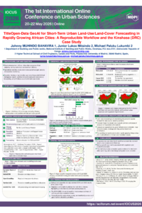
Final_IOCUS2026_GeoAI_Poster_A0.pdf
THE URBAN IMPACT OF THE CORVIN CASTLE OF HUNEDOARA: HERITAGE PRESERVATION AND SPATIAL DEVELOPMENT
The Tale of Two Troys: A Comparative Sentiment Analysis of Visitor Experiences in the Ancient City and the Museum