Event submissions
Published
This submission belongs to the session S4. Urban Mobility and Transportation of the event The 1st International Online Conference on Urban Sciences
Published date
15 May, 2026
Academic Editor
'%3e%3cpath%20d='M12.6657%2010.9104C12.4185%2010.325%2012.0599%209.79327%2011.6097%209.34482C11.1609%208.89508%2010.6293%208.5365%2010.0442%208.28888C10.0389%208.28626%2010.0337%208.28495%2010.0285%208.28233C10.8446%207.69279%2011.3752%206.73249%2011.3752%205.64904C11.3752%203.8542%209.92103%202.39999%208.1262%202.39999C6.33136%202.39999%204.87715%203.8542%204.87715%205.64904C4.87715%206.73249%205.40774%207.69279%206.22393%208.28364C6.21869%208.28626%206.21345%208.28757%206.20821%208.29019C5.62129%208.5378%205.09463%208.89284%204.64265%209.34613C4.1929%209.79493%203.83432%2010.3266%203.58671%2010.9117C3.34345%2011.4845%203.21226%2012.0987%203.20023%2012.7209C3.19988%2012.7349%203.20233%2012.7488%203.20744%2012.7619C3.21255%2012.7749%203.22022%2012.7867%203.22998%2012.7968C3.23975%2012.8068%203.25142%2012.8147%203.26431%2012.8202C3.2772%2012.8256%203.29105%2012.8284%203.30504%2012.8284H4.09109C4.14874%2012.8284%204.19459%2012.7825%204.1959%2012.7262C4.2221%2011.7148%204.62823%2010.7676%205.34617%2010.0497C6.08899%209.30683%207.0755%208.89808%208.1262%208.89808C9.17689%208.89808%2010.1634%209.30683%2010.9062%2010.0497C11.6242%2010.7676%2012.0303%2011.7148%2012.0565%2012.7262C12.0578%2012.7838%2012.1037%2012.8284%2012.1613%2012.8284H12.9474C12.9613%2012.8284%2012.9752%2012.8256%2012.9881%2012.8202C13.001%2012.8147%2013.0126%2012.8068%2013.0224%2012.7968C13.0322%2012.7867%2013.0398%2012.7749%2013.0449%2012.7619C13.0501%2012.7488%2013.0525%2012.7349%2013.0522%2012.7209C13.0391%2012.0947%2012.9094%2011.4855%2012.6657%2010.9104ZM8.1262%207.9024C7.52486%207.9024%206.9589%207.6679%206.53312%207.24211C6.10733%206.81633%205.87283%206.25037%205.87283%205.64904C5.87283%205.0477%206.10733%204.48174%206.53312%204.05596C6.9589%203.63018%207.52486%203.39567%208.1262%203.39567C8.72753%203.39567%209.29349%203.63018%209.71927%204.05596C10.1451%204.48174%2010.3796%205.0477%2010.3796%205.64904C10.3796%206.25037%2010.1451%206.81633%209.71927%207.24211C9.29349%207.6679%208.72753%207.9024%208.1262%207.9024Z'%20fill='%235D1EE1'/%3e%3c/g%3e%3c/svg%3e) Sergio Nesmachnow
Sergio NesmachnowCitation
Ezgi Tükel, Gürkan Öztürk, Saye Nihan Çabuk, GIS-Based Mapping of Slope-Dependent Energy Consumption and Recovery for Sustainable E-Bike Mobility, in Proceedings of The 1st International Online Conference on Urban Sciences, 20 May–22 May 2026, MDPI: Basel, Switzerland
Share
Email
Facebook
Twitter
LinkedIn
GIS-Based Mapping of Slope-Dependent Energy Consumption and Recovery for Sustainable E-Bike Mobility
'%3e%3cpath%20d='M12.6647%2010.9104C12.4176%2010.325%2012.0589%209.7933%2011.6088%209.34485C11.16%208.89511%2010.6283%208.53653%2010.0432%208.28891C10.038%208.28629%2010.0327%208.28498%2010.0275%208.28236C10.8437%207.69282%2011.3743%206.73252%2011.3743%205.64907C11.3743%203.85423%209.92005%202.40002%208.12522%202.40002C6.33038%202.40002%204.87618%203.85423%204.87618%205.64907C4.87618%206.73252%205.40677%207.69282%206.22296%208.28367C6.21772%208.28629%206.21248%208.2876%206.20724%208.29022C5.62031%208.53783%205.09365%208.89287%204.64167%209.34616C4.19192%209.79496%203.83334%2010.3266%203.58573%2010.9117C3.34247%2011.4846%203.21128%2012.0987%203.19925%2012.721C3.1989%2012.735%203.20135%2012.7489%203.20646%2012.7619C3.21157%2012.7749%203.21924%2012.7868%203.22901%2012.7968C3.23877%2012.8068%203.25045%2012.8148%203.26334%2012.8202C3.27623%2012.8256%203.29007%2012.8284%203.30406%2012.8284H4.09012C4.14776%2012.8284%204.19362%2012.7825%204.19493%2012.7262C4.22113%2011.7148%204.62726%2010.7676%205.34519%2010.0497C6.08802%209.30686%207.07452%208.89811%208.12522%208.89811C9.17592%208.89811%2010.1624%209.30686%2010.9052%2010.0497C11.6232%2010.7676%2012.0293%2011.7148%2012.0555%2012.7262C12.0568%2012.7839%2012.1027%2012.8284%2012.1603%2012.8284H12.9464C12.9604%2012.8284%2012.9742%2012.8256%2012.9871%2012.8202C13%2012.8148%2013.0117%2012.8068%2013.0214%2012.7968C13.0312%2012.7868%2013.0389%2012.7749%2013.044%2012.7619C13.0491%2012.7489%2013.0515%2012.735%2013.0512%2012.721C13.0381%2012.0947%2012.9084%2011.4856%2012.6647%2010.9104ZM8.12522%207.90243C7.52388%207.90243%206.95792%207.66793%206.53214%207.24215C6.10636%206.81636%205.87185%206.2504%205.87185%205.64907C5.87185%205.04773%206.10636%204.48177%206.53214%204.05599C6.95792%203.63021%207.52388%203.3957%208.12522%203.3957C8.72655%203.3957%209.29252%203.63021%209.7183%204.05599C10.1441%204.48177%2010.3786%205.04773%2010.3786%205.64907C10.3786%206.2504%2010.1441%206.81636%209.7183%207.24215C9.29252%207.66793%208.72655%207.90243%208.12522%207.90243Z'%20fill='%235D1EE1'/%3e%3c/g%3e%3c/svg%3e)
Ezgi Tükel 1,2
Gürkan Öztürk 3
Saye Nihan Çabuk 4
1. Department, of Remote Sensing and Geographical Information Science, Eskişehir Technical University, Eskişehir, Türkiye
2. Başarsoft Information Technologies, Ankara, Türkiye
3. Department of Industrial Engineering, Faculty of Engineering, Eskişehir Technical University, Eskişehir, Türkiye
4. Department of Geodesy and Geographical Information Technologies, Earth and Space Sciences Institute, Eskişehir
Technical University, Eskişehir, Türkiye
Abstract
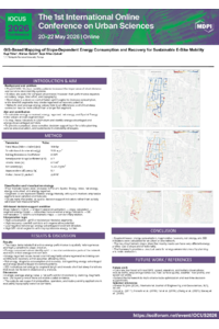
In the post-COVID-19 period, urban mobility patterns have changed significantly, making micromobility systems, particularly e-bikes, increasingly important for short-distance and last-mile travel. As the role of e-bikes in urban transportation continues to expand, energy efficiency has become a key issue affecting battery performance, operational feasibility, and the broader sustainability of micromobility systems. Among the factors influencing e-bike energy use, topography, especially road slope, is a key determinant of consumption and recovery potential.
This study presents a GIS-based framework for modelling slope-dependent energy consumption and regenerative energy recovery across an urban road network. Rather than relying solely on average energy values for the entire network, the study calculates segment-based consumption, recovery, and net energy indicators. It visualizes them as layered thematic maps in a GIS/Folium environment. This approach reveals the spatial heterogeneity of energy patterns and helps identify critical segments and corridors where short but steep transitions may generate disproportionately high energy costs.
The findings show a clear spatial relationship between slope and energy performance. The resulting net energy maps enable the identification of energy-advantaged and energy-disadvantaged parts of the network, thereby providing a more detailed understanding of urban topographic effects on micromobility systems. These outputs can support municipalities, micromobility operators, and urban mobility planners in developing more informed, place-sensitive, and energy-aware strategies for sustainable transport.
Although the framework is based on simplifying assumptions, excludes traffic-related operational conditions, and is limited to a single study area with constrained validation, it provides a practical basis for integrating topography-sensitive energy analysis into sustainable urban mobility planning.
Keywords
e-bike
micromobility
GIS
energy consumption
sustainable urban mobility
Poster
ebike_energy_poster.pdf
Compounding Socio-Ecological Failure: How Governance Exclusion Converts Community Stewards into Accidental Polluters in the Nairobi River Basin
Evaluation of Energy Harvesting from Pedestrian Movement Using Piezoelectric Flooring in Urban Mobility Infrastructure: A Case Study of “Les Fusilles” Metro Station, Algeria