Event submissions
Published
This submission belongs to the session S6. Urbanization and Social Development of the event The 1st International Online Conference on Urban Sciences
Published date
15 May, 2026
Academic Editor
'%3e%3cpath%20d='M12.6657%2010.9104C12.4185%2010.325%2012.0599%209.79327%2011.6097%209.34482C11.1609%208.89508%2010.6293%208.5365%2010.0442%208.28888C10.0389%208.28626%2010.0337%208.28495%2010.0285%208.28233C10.8446%207.69279%2011.3752%206.73249%2011.3752%205.64904C11.3752%203.8542%209.92103%202.39999%208.1262%202.39999C6.33136%202.39999%204.87715%203.8542%204.87715%205.64904C4.87715%206.73249%205.40774%207.69279%206.22393%208.28364C6.21869%208.28626%206.21345%208.28757%206.20821%208.29019C5.62129%208.5378%205.09463%208.89284%204.64265%209.34613C4.1929%209.79493%203.83432%2010.3266%203.58671%2010.9117C3.34345%2011.4845%203.21226%2012.0987%203.20023%2012.7209C3.19988%2012.7349%203.20233%2012.7488%203.20744%2012.7619C3.21255%2012.7749%203.22022%2012.7867%203.22998%2012.7968C3.23975%2012.8068%203.25142%2012.8147%203.26431%2012.8202C3.2772%2012.8256%203.29105%2012.8284%203.30504%2012.8284H4.09109C4.14874%2012.8284%204.19459%2012.7825%204.1959%2012.7262C4.2221%2011.7148%204.62823%2010.7676%205.34617%2010.0497C6.08899%209.30683%207.0755%208.89808%208.1262%208.89808C9.17689%208.89808%2010.1634%209.30683%2010.9062%2010.0497C11.6242%2010.7676%2012.0303%2011.7148%2012.0565%2012.7262C12.0578%2012.7838%2012.1037%2012.8284%2012.1613%2012.8284H12.9474C12.9613%2012.8284%2012.9752%2012.8256%2012.9881%2012.8202C13.001%2012.8147%2013.0126%2012.8068%2013.0224%2012.7968C13.0322%2012.7867%2013.0398%2012.7749%2013.0449%2012.7619C13.0501%2012.7488%2013.0525%2012.7349%2013.0522%2012.7209C13.0391%2012.0947%2012.9094%2011.4855%2012.6657%2010.9104ZM8.1262%207.9024C7.52486%207.9024%206.9589%207.6679%206.53312%207.24211C6.10733%206.81633%205.87283%206.25037%205.87283%205.64904C5.87283%205.0477%206.10733%204.48174%206.53312%204.05596C6.9589%203.63018%207.52486%203.39567%208.1262%203.39567C8.72753%203.39567%209.29349%203.63018%209.71927%204.05596C10.1451%204.48174%2010.3796%205.0477%2010.3796%205.64904C10.3796%206.25037%2010.1451%206.81633%209.71927%207.24211C9.29349%207.6679%208.72753%207.9024%208.1262%207.9024Z'%20fill='%235D1EE1'/%3e%3c/g%3e%3c/svg%3e) Teodoro Georgiadis
Teodoro GeorgiadisCitation
Mikel Barrena-Herrán, Alba Arias, Claudia Pennese, Olatz Irulegi-Garmendia, Interpreting Citizen Energy Perceptions through Bivariate Spatial Mapping: Linking Subjective Experience and Urban Context, in Proceedings of The 1st International Online Conference on Urban Sciences, 20 May–22 May 2026, MDPI: Basel, Switzerland
Share
Email
Facebook
Twitter
LinkedIn
Interpreting Citizen Energy Perceptions through Bivariate Spatial Mapping: Linking Subjective Experience and Urban Context
'%3e%3cpath%20d='M12.6647%2010.9104C12.4176%2010.325%2012.0589%209.7933%2011.6088%209.34485C11.16%208.89511%2010.6283%208.53653%2010.0432%208.28891C10.038%208.28629%2010.0327%208.28498%2010.0275%208.28236C10.8437%207.69282%2011.3743%206.73252%2011.3743%205.64907C11.3743%203.85423%209.92005%202.40002%208.12522%202.40002C6.33038%202.40002%204.87618%203.85423%204.87618%205.64907C4.87618%206.73252%205.40677%207.69282%206.22296%208.28367C6.21772%208.28629%206.21248%208.2876%206.20724%208.29022C5.62031%208.53783%205.09365%208.89287%204.64167%209.34616C4.19192%209.79496%203.83334%2010.3266%203.58573%2010.9117C3.34247%2011.4846%203.21128%2012.0987%203.19925%2012.721C3.1989%2012.735%203.20135%2012.7489%203.20646%2012.7619C3.21157%2012.7749%203.21924%2012.7868%203.22901%2012.7968C3.23877%2012.8068%203.25045%2012.8148%203.26334%2012.8202C3.27623%2012.8256%203.29007%2012.8284%203.30406%2012.8284H4.09012C4.14776%2012.8284%204.19362%2012.7825%204.19493%2012.7262C4.22113%2011.7148%204.62726%2010.7676%205.34519%2010.0497C6.08802%209.30686%207.07452%208.89811%208.12522%208.89811C9.17592%208.89811%2010.1624%209.30686%2010.9052%2010.0497C11.6232%2010.7676%2012.0293%2011.7148%2012.0555%2012.7262C12.0568%2012.7839%2012.1027%2012.8284%2012.1603%2012.8284H12.9464C12.9604%2012.8284%2012.9742%2012.8256%2012.9871%2012.8202C13%2012.8148%2013.0117%2012.8068%2013.0214%2012.7968C13.0312%2012.7868%2013.0389%2012.7749%2013.044%2012.7619C13.0491%2012.7489%2013.0515%2012.735%2013.0512%2012.721C13.0381%2012.0947%2012.9084%2011.4856%2012.6647%2010.9104ZM8.12522%207.90243C7.52388%207.90243%206.95792%207.66793%206.53214%207.24215C6.10636%206.81636%205.87185%206.2504%205.87185%205.64907C5.87185%205.04773%206.10636%204.48177%206.53214%204.05599C6.95792%203.63021%207.52388%203.3957%208.12522%203.3957C8.72655%203.3957%209.29252%203.63021%209.7183%204.05599C10.1441%204.48177%2010.3786%205.04773%2010.3786%205.64907C10.3786%206.2504%2010.1441%206.81636%209.7183%207.24215C9.29252%207.66793%208.72655%207.90243%208.12522%207.90243Z'%20fill='%235D1EE1'/%3e%3c/g%3e%3c/svg%3e)
Mikel Barrena-Herrán 1
Alba Arias 1
Claudia Pennese 1
Olatz Irulegi-Garmendia 1
1. CAVIAR (Quality of Life in Architecture) Research Group, Departament of Architecture, University of the Basque Country UPV/EHU, San Sebastián, Spain
Abstract
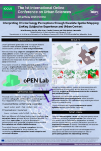
Citizen-generated spatial data offer new opportunities to understand how residents perceive the energy and socioeconomic conditions of their living environments. However, translating subjective perceptions into interpretable urban patterns remains methodologically challenging. This study explores how bivariate spatial mapping can be used to reveal alignments and mismatches between perceived conditions and measurable characteristics of the built and social environment.
The analysis is based on citizen-generated geodata collected through a neighborhood crowd-mapping platform developed within the oPEN Lab project, applied to the Rochapea district in Pamplona, Spain. The study area comprises 14 census sections, which led to a combined cartographic and descriptive analytical approach. Two independent bivariate maps were constructed: (1) perceived thermal comfort × energy consumption and (2) housing tenure × income level. Each map followed a 3×3 classification matrix, producing nine perception classes arranged along a theoretical gradient. For each class, mean values of available demographic, socioeconomic, and residential indicators were aggregated from cadastral and official statistical sources. The analysis focused on internal comparisons between classes to detect gradients, discontinuities, and inconsistencies between perception-based categories and contextual indicators.
Energy perception patterns showed a clear association with post-regulatory housing stock and the absence of interior dwellings, suggesting a link between construction standards and perceived comfort. Conversely, socioeconomic perception displayed counterintuitive spatial configurations, where favorable perceived classes did not consistently align with higher official income or newer housing. These discontinuities highlight complex socio-spatial dynamics beyond conventional indicators.
Despite a reduced spatial sample and the participatory nature of the data, including a participation bias (59% women and 53% minors due to school-based engagement activities), bivariate spatial mapping of citizen perceptions provides an exploratory framework to identify concordances and tensions between lived experience and urban structure. The approach supports evidence-informed neighborhood diagnostics and demonstrates the analytical value of participatory geodata for urban energy planning.
Keywords
Spatial analysis
Collaborative mapping
GIS
Positive energy districts
Built environment
Poster
Mikel_BarrenaHerran_citizen_energy_bivariate_mapping.pdf
Evaluating Vegetation and Surface Treatments for Urban Heat Island Mitigation in Hot Desert Campuses: A Microclimatic Study of Najran University
Integrando naturaleza y patrimonio: indicadores de sostenibilidad ambiental en el paisaje urbano histórico de Cuenca, Ecuador.