Event submissions
Published
This submission belongs to the session S5. Urban Resilience and Adaptation of the event The 1st International Online Conference on Urban Sciences
Published date
15 May, 2026
Academic Editor
'%3e%3cpath%20d='M12.6657%2010.9104C12.4185%2010.325%2012.0599%209.79327%2011.6097%209.34482C11.1609%208.89508%2010.6293%208.5365%2010.0442%208.28888C10.0389%208.28626%2010.0337%208.28495%2010.0285%208.28233C10.8446%207.69279%2011.3752%206.73249%2011.3752%205.64904C11.3752%203.8542%209.92103%202.39999%208.1262%202.39999C6.33136%202.39999%204.87715%203.8542%204.87715%205.64904C4.87715%206.73249%205.40774%207.69279%206.22393%208.28364C6.21869%208.28626%206.21345%208.28757%206.20821%208.29019C5.62129%208.5378%205.09463%208.89284%204.64265%209.34613C4.1929%209.79493%203.83432%2010.3266%203.58671%2010.9117C3.34345%2011.4845%203.21226%2012.0987%203.20023%2012.7209C3.19988%2012.7349%203.20233%2012.7488%203.20744%2012.7619C3.21255%2012.7749%203.22022%2012.7867%203.22998%2012.7968C3.23975%2012.8068%203.25142%2012.8147%203.26431%2012.8202C3.2772%2012.8256%203.29105%2012.8284%203.30504%2012.8284H4.09109C4.14874%2012.8284%204.19459%2012.7825%204.1959%2012.7262C4.2221%2011.7148%204.62823%2010.7676%205.34617%2010.0497C6.08899%209.30683%207.0755%208.89808%208.1262%208.89808C9.17689%208.89808%2010.1634%209.30683%2010.9062%2010.0497C11.6242%2010.7676%2012.0303%2011.7148%2012.0565%2012.7262C12.0578%2012.7838%2012.1037%2012.8284%2012.1613%2012.8284H12.9474C12.9613%2012.8284%2012.9752%2012.8256%2012.9881%2012.8202C13.001%2012.8147%2013.0126%2012.8068%2013.0224%2012.7968C13.0322%2012.7867%2013.0398%2012.7749%2013.0449%2012.7619C13.0501%2012.7488%2013.0525%2012.7349%2013.0522%2012.7209C13.0391%2012.0947%2012.9094%2011.4855%2012.6657%2010.9104ZM8.1262%207.9024C7.52486%207.9024%206.9589%207.6679%206.53312%207.24211C6.10733%206.81633%205.87283%206.25037%205.87283%205.64904C5.87283%205.0477%206.10733%204.48174%206.53312%204.05596C6.9589%203.63018%207.52486%203.39567%208.1262%203.39567C8.72753%203.39567%209.29349%203.63018%209.71927%204.05596C10.1451%204.48174%2010.3796%205.0477%2010.3796%205.64904C10.3796%206.25037%2010.1451%206.81633%209.71927%207.24211C9.29349%207.6679%208.72753%207.9024%208.1262%207.9024Z'%20fill='%235D1EE1'/%3e%3c/g%3e%3c/svg%3e) Luis Hernández-Callejo
Luis Hernández-CallejoCitation
Mirian Ruth Merma Onofre, Carlos Francisco Davila de la Cruz, Christopher Joseph Nuñez Varillas, Ángel Martín Quesquén Ramírez, Fernando Garcia Bashualdo, Miguel Luis Estrada Mendoza, Comparative Evaluation of LiDAR and UAV Photogrammetry for Urban Inventory Mapping through an Automated Scan-to-BIM Framework, in Proceedings of The 1st International Online Conference on Urban Sciences, 20 May–22 May 2026, MDPI: Basel, Switzerland
Share
Email
Facebook
Twitter
LinkedIn
Comparative Evaluation of LiDAR and UAV Photogrammetry for Urban Inventory Mapping through an Automated Scan-to-BIM Framework
'%3e%3cpath%20d='M12.6647%2010.9104C12.4176%2010.325%2012.0589%209.7933%2011.6088%209.34485C11.16%208.89511%2010.6283%208.53653%2010.0432%208.28891C10.038%208.28629%2010.0327%208.28498%2010.0275%208.28236C10.8437%207.69282%2011.3743%206.73252%2011.3743%205.64907C11.3743%203.85423%209.92005%202.40002%208.12522%202.40002C6.33038%202.40002%204.87618%203.85423%204.87618%205.64907C4.87618%206.73252%205.40677%207.69282%206.22296%208.28367C6.21772%208.28629%206.21248%208.2876%206.20724%208.29022C5.62031%208.53783%205.09365%208.89287%204.64167%209.34616C4.19192%209.79496%203.83334%2010.3266%203.58573%2010.9117C3.34247%2011.4846%203.21128%2012.0987%203.19925%2012.721C3.1989%2012.735%203.20135%2012.7489%203.20646%2012.7619C3.21157%2012.7749%203.21924%2012.7868%203.22901%2012.7968C3.23877%2012.8068%203.25045%2012.8148%203.26334%2012.8202C3.27623%2012.8256%203.29007%2012.8284%203.30406%2012.8284H4.09012C4.14776%2012.8284%204.19362%2012.7825%204.19493%2012.7262C4.22113%2011.7148%204.62726%2010.7676%205.34519%2010.0497C6.08802%209.30686%207.07452%208.89811%208.12522%208.89811C9.17592%208.89811%2010.1624%209.30686%2010.9052%2010.0497C11.6232%2010.7676%2012.0293%2011.7148%2012.0555%2012.7262C12.0568%2012.7839%2012.1027%2012.8284%2012.1603%2012.8284H12.9464C12.9604%2012.8284%2012.9742%2012.8256%2012.9871%2012.8202C13%2012.8148%2013.0117%2012.8068%2013.0214%2012.7968C13.0312%2012.7868%2013.0389%2012.7749%2013.044%2012.7619C13.0491%2012.7489%2013.0515%2012.735%2013.0512%2012.721C13.0381%2012.0947%2012.9084%2011.4856%2012.6647%2010.9104ZM8.12522%207.90243C7.52388%207.90243%206.95792%207.66793%206.53214%207.24215C6.10636%206.81636%205.87185%206.2504%205.87185%205.64907C5.87185%205.04773%206.10636%204.48177%206.53214%204.05599C6.95792%203.63021%207.52388%203.3957%208.12522%203.3957C8.72655%203.3957%209.29252%203.63021%209.7183%204.05599C10.1441%204.48177%2010.3786%205.04773%2010.3786%205.64907C10.3786%206.2504%2010.1441%206.81636%209.7183%207.24215C9.29252%207.66793%208.72655%207.90243%208.12522%207.90243Z'%20fill='%235D1EE1'/%3e%3c/g%3e%3c/svg%3e)
Mirian Ruth Merma Onofre 1

Carlos Francisco Davila de la Cruz 1
Christopher Joseph Nuñez Varillas 2

Ángel Martín Quesquén Ramírez 1
Fernando Garcia Bashualdo 1

Miguel Luis Estrada Mendoza 1
1. GeoGiRD Research Group, Facultad de Ingenieria Civil, Universidad Nacional de Ingenieria, Av. Tupac Amaru 210 – Lima, Peru
2. Faculty of Civil Engineering, National University of Engineering, Lima, Peru
Abstract
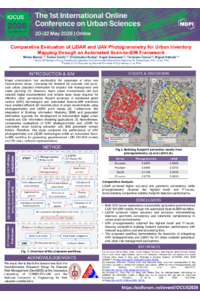
Global urbanization has grown rapidly over the past century, increasingly expanding into areas prone to natural hazards. However, insufficient planning has led to informal expansion and a lack of up-to-date cadastral data and base maps necessary for informed urban governance and effective disaster risk management. In response to this problem, automated Scan-to-BIM workflows have emerged as a strategy for the 3D reconstruction of buildings to support the updating of urban cadastres. Although unmanned aerial vehicle (UAV) technologies enable efficient data acquisition using photogrammetric techniques and LiDAR sensors, a gap remains in the comparative evaluation of their performance in detecting building footprints within automated Scan-to-BIM frameworks for urban applications. In this context, the present study develops a comparative evaluation of both approaches.
Two flight campaigns were conducted over the same study area: (1) a DJI Matrice 4E for photogrammetric data acquisition and (2) a DJI Matrice 400 equipped with a Zenmuse L2 LiDAR sensor. Georeferenced point clouds were generated from both flights and processed using an automated Scan-to-BIM workflow to produce georeferenced BIM models at Level of Development (LOD) 100, representing building volumes. Performance was quantitatively evaluated based on geometric accuracy, level of detail, and model integrity.
The results highlight the differences between the two technologies: LiDAR demonstrated greater consistency in capturing complex geometries and fewer gaps in dense urban areas, achieving better volumetric definition, while UAV photogrammetry offered competitive planimetric accuracy and advantages in terms of cost and acquisition time. Overall, this confirms the feasibility of integrating UAV technologies into Scan-to-BIM workflows for the generation of 3D urban cadastres, contributing to urban planning and risk management.
Keywords
Scan-to-BIM
LiDAR
UAV photogrammetry
building footprint extraction
3D urban cadastre
disaster risk management
urban resilience.
Poster
Póster_sciforum172721_vf.pdf
FairGNN-Climate: Fairness-Constrained Graph Neural Networks for Urban Neural Resilience Under Climate Stress
Impact of Urban Spatial Configuration on Massive Pedestrian Tsunami Evacuation through Agent-Based Modeling