Event submissions
Published
This submission belongs to the session S5. Urban Resilience and Adaptation of the event The 1st International Online Conference on Urban Sciences
Published date
15 May, 2026
Academic Editor
'%3e%3cpath%20d='M12.6657%2010.9104C12.4185%2010.325%2012.0599%209.79327%2011.6097%209.34482C11.1609%208.89508%2010.6293%208.5365%2010.0442%208.28888C10.0389%208.28626%2010.0337%208.28495%2010.0285%208.28233C10.8446%207.69279%2011.3752%206.73249%2011.3752%205.64904C11.3752%203.8542%209.92103%202.39999%208.1262%202.39999C6.33136%202.39999%204.87715%203.8542%204.87715%205.64904C4.87715%206.73249%205.40774%207.69279%206.22393%208.28364C6.21869%208.28626%206.21345%208.28757%206.20821%208.29019C5.62129%208.5378%205.09463%208.89284%204.64265%209.34613C4.1929%209.79493%203.83432%2010.3266%203.58671%2010.9117C3.34345%2011.4845%203.21226%2012.0987%203.20023%2012.7209C3.19988%2012.7349%203.20233%2012.7488%203.20744%2012.7619C3.21255%2012.7749%203.22022%2012.7867%203.22998%2012.7968C3.23975%2012.8068%203.25142%2012.8147%203.26431%2012.8202C3.2772%2012.8256%203.29105%2012.8284%203.30504%2012.8284H4.09109C4.14874%2012.8284%204.19459%2012.7825%204.1959%2012.7262C4.2221%2011.7148%204.62823%2010.7676%205.34617%2010.0497C6.08899%209.30683%207.0755%208.89808%208.1262%208.89808C9.17689%208.89808%2010.1634%209.30683%2010.9062%2010.0497C11.6242%2010.7676%2012.0303%2011.7148%2012.0565%2012.7262C12.0578%2012.7838%2012.1037%2012.8284%2012.1613%2012.8284H12.9474C12.9613%2012.8284%2012.9752%2012.8256%2012.9881%2012.8202C13.001%2012.8147%2013.0126%2012.8068%2013.0224%2012.7968C13.0322%2012.7867%2013.0398%2012.7749%2013.0449%2012.7619C13.0501%2012.7488%2013.0525%2012.7349%2013.0522%2012.7209C13.0391%2012.0947%2012.9094%2011.4855%2012.6657%2010.9104ZM8.1262%207.9024C7.52486%207.9024%206.9589%207.6679%206.53312%207.24211C6.10733%206.81633%205.87283%206.25037%205.87283%205.64904C5.87283%205.0477%206.10733%204.48174%206.53312%204.05596C6.9589%203.63018%207.52486%203.39567%208.1262%203.39567C8.72753%203.39567%209.29349%203.63018%209.71927%204.05596C10.1451%204.48174%2010.3796%205.0477%2010.3796%205.64904C10.3796%206.25037%2010.1451%206.81633%209.71927%207.24211C9.29349%207.6679%208.72753%207.9024%208.1262%207.9024Z'%20fill='%235D1EE1'/%3e%3c/g%3e%3c/svg%3e) Gang Xu
Gang XuCitation
Marcello Andre Palomino, Carlos Davila, Fernando Garcia, Miguel Estrada, Erika Nora, Erick Mas, Impact of Urban Spatial Configuration on Massive Pedestrian Tsunami Evacuation through Agent-Based Modeling, in Proceedings of The 1st International Online Conference on Urban Sciences, 20 May–22 May 2026, MDPI: Basel, Switzerland
Share
Email
Facebook
Twitter
LinkedIn
Impact of Urban Spatial Configuration on Massive Pedestrian Tsunami Evacuation through Agent-Based Modeling
'%3e%3cpath%20d='M12.6647%2010.9104C12.4176%2010.325%2012.0589%209.7933%2011.6088%209.34485C11.16%208.89511%2010.6283%208.53653%2010.0432%208.28891C10.038%208.28629%2010.0327%208.28498%2010.0275%208.28236C10.8437%207.69282%2011.3743%206.73252%2011.3743%205.64907C11.3743%203.85423%209.92005%202.40002%208.12522%202.40002C6.33038%202.40002%204.87618%203.85423%204.87618%205.64907C4.87618%206.73252%205.40677%207.69282%206.22296%208.28367C6.21772%208.28629%206.21248%208.2876%206.20724%208.29022C5.62031%208.53783%205.09365%208.89287%204.64167%209.34616C4.19192%209.79496%203.83334%2010.3266%203.58573%2010.9117C3.34247%2011.4846%203.21128%2012.0987%203.19925%2012.721C3.1989%2012.735%203.20135%2012.7489%203.20646%2012.7619C3.21157%2012.7749%203.21924%2012.7868%203.22901%2012.7968C3.23877%2012.8068%203.25045%2012.8148%203.26334%2012.8202C3.27623%2012.8256%203.29007%2012.8284%203.30406%2012.8284H4.09012C4.14776%2012.8284%204.19362%2012.7825%204.19493%2012.7262C4.22113%2011.7148%204.62726%2010.7676%205.34519%2010.0497C6.08802%209.30686%207.07452%208.89811%208.12522%208.89811C9.17592%208.89811%2010.1624%209.30686%2010.9052%2010.0497C11.6232%2010.7676%2012.0293%2011.7148%2012.0555%2012.7262C12.0568%2012.7839%2012.1027%2012.8284%2012.1603%2012.8284H12.9464C12.9604%2012.8284%2012.9742%2012.8256%2012.9871%2012.8202C13%2012.8148%2013.0117%2012.8068%2013.0214%2012.7968C13.0312%2012.7868%2013.0389%2012.7749%2013.044%2012.7619C13.0491%2012.7489%2013.0515%2012.735%2013.0512%2012.721C13.0381%2012.0947%2012.9084%2011.4856%2012.6647%2010.9104ZM8.12522%207.90243C7.52388%207.90243%206.95792%207.66793%206.53214%207.24215C6.10636%206.81636%205.87185%206.2504%205.87185%205.64907C5.87185%205.04773%206.10636%204.48177%206.53214%204.05599C6.95792%203.63021%207.52388%203.3957%208.12522%203.3957C8.72655%203.3957%209.29252%203.63021%209.7183%204.05599C10.1441%204.48177%2010.3786%205.04773%2010.3786%205.64907C10.3786%206.2504%2010.1441%206.81636%209.7183%207.24215C9.29252%207.66793%208.72655%207.90243%208.12522%207.90243Z'%20fill='%235D1EE1'/%3e%3c/g%3e%3c/svg%3e)
Marcello Andre Palomino 1,2

Carlos Davila 1,2

Fernando Garcia 1,2

Miguel Estrada 1,2
Erika Nora 2

Erick Mas 3
1. GeoGiRD Research Group, Facultad de Ingenieria Civil, Universidad Nacional de Ingenieria, Lima 15333, Peru
2. Centro Peruano Japones de Investigaciones Sismicas y Mitigacion de Desastres, Lima 15333, Peru
3. Graduate School of Engineering, Tohoku University, Sendai 980-8579, Japan
Abstract
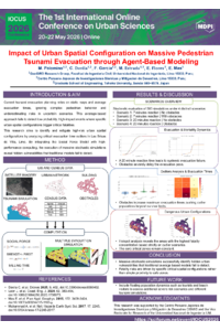
Tsunami evacuation planning has relied on static maps generated by Least Cost Distance models, which calculate optimal routes based on street network lengths. However, by focusing on average evacuation times, these methods present limitations by ignoring the complexity of human behavior and failing to identify which variables are crucial to understand evacuation times. This suggests that current evacuation maps require improvement through the integration of simulation analysis to address underestimate risks in uncertain scenarios. This research performs a massive simulation analysis by integrating the Social Force Model with high-performance multi-threaded computing to generate comprehensive scenarios with different evacuation times.
The analysis is applied to the vulnerable coastal zone of Las Brisas de Villa in Chorrillos, Lima. Stochastic scenarios were executed by varying the initial population placement. The study focuses on analyzing the resulting distribution of high evacuation times to reveal scenarios representing low probability but high-impact events. By isolating the simulation seeds of these critical outliers, the specific spatial arrangements were reconstructed and examined.
Preliminary findings indicate that risks are driven by specific urban spatial configurations. These results demonstrate that evacuation times are dependent on the urban spatial configuration. Consequently, the identification of statistical outliers in evacuation time distributions is crucial for mitigating hidden spatial configurations that average-based models fail to detect.
Keywords
Tsunami Evacuation
Agent-Based Modeling
Social Force Model
Parallel Computing
Stochastic Analysis
Casualty Estimation
Outlier Detection
Poster
Marcello_Palomino.pdf
Comparative Evaluation of LiDAR and UAV Photogrammetry for Urban Inventory Mapping through an Automated Scan-to-BIM Framework
Microclimatic Variability and Thermal Discomfort during a Terral Event: The Role of Vegetation and Urban Form in Málaga, Spain