Event submissions
Published
This submission belongs to the session S5. Urban Resilience and Adaptation of the event The 1st International Online Conference on Urban Sciences
Published date
15 May, 2026
Academic Editor
'%3e%3cpath%20d='M12.6657%2010.9104C12.4185%2010.325%2012.0599%209.79327%2011.6097%209.34482C11.1609%208.89508%2010.6293%208.5365%2010.0442%208.28888C10.0389%208.28626%2010.0337%208.28495%2010.0285%208.28233C10.8446%207.69279%2011.3752%206.73249%2011.3752%205.64904C11.3752%203.8542%209.92103%202.39999%208.1262%202.39999C6.33136%202.39999%204.87715%203.8542%204.87715%205.64904C4.87715%206.73249%205.40774%207.69279%206.22393%208.28364C6.21869%208.28626%206.21345%208.28757%206.20821%208.29019C5.62129%208.5378%205.09463%208.89284%204.64265%209.34613C4.1929%209.79493%203.83432%2010.3266%203.58671%2010.9117C3.34345%2011.4845%203.21226%2012.0987%203.20023%2012.7209C3.19988%2012.7349%203.20233%2012.7488%203.20744%2012.7619C3.21255%2012.7749%203.22022%2012.7867%203.22998%2012.7968C3.23975%2012.8068%203.25142%2012.8147%203.26431%2012.8202C3.2772%2012.8256%203.29105%2012.8284%203.30504%2012.8284H4.09109C4.14874%2012.8284%204.19459%2012.7825%204.1959%2012.7262C4.2221%2011.7148%204.62823%2010.7676%205.34617%2010.0497C6.08899%209.30683%207.0755%208.89808%208.1262%208.89808C9.17689%208.89808%2010.1634%209.30683%2010.9062%2010.0497C11.6242%2010.7676%2012.0303%2011.7148%2012.0565%2012.7262C12.0578%2012.7838%2012.1037%2012.8284%2012.1613%2012.8284H12.9474C12.9613%2012.8284%2012.9752%2012.8256%2012.9881%2012.8202C13.001%2012.8147%2013.0126%2012.8068%2013.0224%2012.7968C13.0322%2012.7867%2013.0398%2012.7749%2013.0449%2012.7619C13.0501%2012.7488%2013.0525%2012.7349%2013.0522%2012.7209C13.0391%2012.0947%2012.9094%2011.4855%2012.6657%2010.9104ZM8.1262%207.9024C7.52486%207.9024%206.9589%207.6679%206.53312%207.24211C6.10733%206.81633%205.87283%206.25037%205.87283%205.64904C5.87283%205.0477%206.10733%204.48174%206.53312%204.05596C6.9589%203.63018%207.52486%203.39567%208.1262%203.39567C8.72753%203.39567%209.29349%203.63018%209.71927%204.05596C10.1451%204.48174%2010.3796%205.0477%2010.3796%205.64904C10.3796%206.25037%2010.1451%206.81633%209.71927%207.24211C9.29349%207.6679%208.72753%207.9024%208.1262%207.9024Z'%20fill='%235D1EE1'/%3e%3c/g%3e%3c/svg%3e) Luis Hernández-Callejo
Luis Hernández-CallejoCitation
Biligt Altankhuyag, Ayurzana Badarch, Tsovoodavaa Gantumur, Arvinzaya Byambatsogt, Naranchimeg Usukhbayar, Adaptive Public Open Space Planning in A Cold-climate Ger District: A GIS and Participatory Study of Bilgekh Valley, Ulaanbaatar, Mongolia, in Proceedings of The 1st International Online Conference on Urban Sciences, 20 May–22 May 2026, MDPI: Basel, Switzerland
Share
Email
Facebook
Twitter
LinkedIn
Adaptive Public Open Space Planning in A Cold-climate Ger District: A GIS and Participatory Study of Bilgekh Valley, Ulaanbaatar, Mongolia

Biligt Altankhuyag 1

Ayurzana Badarch 2

Tsovoodavaa Gantumur 1
'%3e%3cpath%20d='M12.6647%2010.9104C12.4176%2010.325%2012.0589%209.7933%2011.6088%209.34485C11.16%208.89511%2010.6283%208.53653%2010.0432%208.28891C10.038%208.28629%2010.0327%208.28498%2010.0275%208.28236C10.8437%207.69282%2011.3743%206.73252%2011.3743%205.64907C11.3743%203.85423%209.92005%202.40002%208.12522%202.40002C6.33038%202.40002%204.87618%203.85423%204.87618%205.64907C4.87618%206.73252%205.40677%207.69282%206.22296%208.28367C6.21772%208.28629%206.21248%208.2876%206.20724%208.29022C5.62031%208.53783%205.09365%208.89287%204.64167%209.34616C4.19192%209.79496%203.83334%2010.3266%203.58573%2010.9117C3.34247%2011.4846%203.21128%2012.0987%203.19925%2012.721C3.1989%2012.735%203.20135%2012.7489%203.20646%2012.7619C3.21157%2012.7749%203.21924%2012.7868%203.22901%2012.7968C3.23877%2012.8068%203.25045%2012.8148%203.26334%2012.8202C3.27623%2012.8256%203.29007%2012.8284%203.30406%2012.8284H4.09012C4.14776%2012.8284%204.19362%2012.7825%204.19493%2012.7262C4.22113%2011.7148%204.62726%2010.7676%205.34519%2010.0497C6.08802%209.30686%207.07452%208.89811%208.12522%208.89811C9.17592%208.89811%2010.1624%209.30686%2010.9052%2010.0497C11.6232%2010.7676%2012.0293%2011.7148%2012.0555%2012.7262C12.0568%2012.7839%2012.1027%2012.8284%2012.1603%2012.8284H12.9464C12.9604%2012.8284%2012.9742%2012.8256%2012.9871%2012.8202C13%2012.8148%2013.0117%2012.8068%2013.0214%2012.7968C13.0312%2012.7868%2013.0389%2012.7749%2013.044%2012.7619C13.0491%2012.7489%2013.0515%2012.735%2013.0512%2012.721C13.0381%2012.0947%2012.9084%2011.4856%2012.6647%2010.9104ZM8.12522%207.90243C7.52388%207.90243%206.95792%207.66793%206.53214%207.24215C6.10636%206.81636%205.87185%206.2504%205.87185%205.64907C5.87185%205.04773%206.10636%204.48177%206.53214%204.05599C6.95792%203.63021%207.52388%203.3957%208.12522%203.3957C8.72655%203.3957%209.29252%203.63021%209.7183%204.05599C10.1441%204.48177%2010.3786%205.04773%2010.3786%205.64907C10.3786%206.2504%2010.1441%206.81636%209.7183%207.24215C9.29252%207.66793%208.72655%207.90243%208.12522%207.90243Z'%20fill='%235D1EE1'/%3e%3c/g%3e%3c/svg%3e)
Arvinzaya Byambatsogt 1
Naranchimeg Usukhbayar 1
1. Department of Architecture, Mongolian University of Science and Technology, Ulaanbaatar, Mongolia
2. Department of Environmental Engineering, Mongolian University of Science and Technology, Ulaanbaatar, Mongolia
Abstract
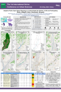
In Ulaanbaatar, the rapid and unplanned expansion of ger districts has significantly heightened exposure to seasonal environmental hazards. This vulnerability is further compounded by a critical deficiency in climate-resilient public open spaces. This paper presents a mixed-methods research framework and a reproducible approach for the adaptive planning of public spaces in Bilgekh Valley, a peri-urban ger district located in northern Ulaanbaatar. Covering approximately 7,460.17 hectares with a current population of roughly 28,950, the valley serves as a representative case of large-scale, unplanned informal settlement within a harsh, cold-climate urban fringe.
The study integrates GIS analysis with participatory mapping. The spatial-physical analysis is conducted using QGIS, leveraging high-resolution Digital Elevation Models (DEM) and Meteonorm climatic datasets. By synthesising these data, the research generates surface runoff and flood indicators (including flow accumulation and slope) as well as wind and air stagnation indices to perform a comprehensive vulnerability assessment. The initial phase focuses on land-use balance and environmental evaluation to identify unplanned, underutilised, or misused vacant lots and parcels that currently obstruct the development of community spaces.
Concurrently, community mapping surveys were conducted to document environmental vulnerabilities—such as seasonal flooding, aufeis (groundwater icing), and localised pollution—while identifying potential intervention sites suggested by residents. This community-sourced data is digitised and integrated into the QGIS environment. This conference presentation outlines the methodological framework, preliminary land-use findings, and digitised participatory maps, discussing how these results inform potential interventions for adaptive open spaces. Ultimately, the research seeks to establish a reproducibility approach for planning climate-resilient public spaces in Mongolian ger districts and similar cold-climate informal settlements.
Keywords
Adaptive design
Participatory mapping
GIS-based spatial analysis
Cold-climate informal urbanisation
Urban resilience
Ger district
Poster
sciforum-175850.pdf
Revitalizing Nabao Creek as a Walkable Urban Spine: Applying the B.A.Y.A.N. Framework in Cabanatuan City
Building a Resilient Community for a Person with Disability through Integration of Accessibility Issues with DRR in Dhaka City