Event submissions
Published
This submission belongs to the session S6. Mathematics, Computer Science and Artificial Intelligence of the event The 2nd International Online Conference on Mathematics and Applications
Published date
04 Jun, 2026
Academic Editor
'%3e%3cpath%20d='M12.6657%2010.9104C12.4185%2010.325%2012.0599%209.79327%2011.6097%209.34482C11.1609%208.89508%2010.6293%208.5365%2010.0442%208.28888C10.0389%208.28626%2010.0337%208.28495%2010.0285%208.28233C10.8446%207.69279%2011.3752%206.73249%2011.3752%205.64904C11.3752%203.8542%209.92103%202.39999%208.1262%202.39999C6.33136%202.39999%204.87715%203.8542%204.87715%205.64904C4.87715%206.73249%205.40774%207.69279%206.22393%208.28364C6.21869%208.28626%206.21345%208.28757%206.20821%208.29019C5.62129%208.5378%205.09463%208.89284%204.64265%209.34613C4.1929%209.79493%203.83432%2010.3266%203.58671%2010.9117C3.34345%2011.4845%203.21226%2012.0987%203.20023%2012.7209C3.19988%2012.7349%203.20233%2012.7488%203.20744%2012.7619C3.21255%2012.7749%203.22022%2012.7867%203.22998%2012.7968C3.23975%2012.8068%203.25142%2012.8147%203.26431%2012.8202C3.2772%2012.8256%203.29105%2012.8284%203.30504%2012.8284H4.09109C4.14874%2012.8284%204.19459%2012.7825%204.1959%2012.7262C4.2221%2011.7148%204.62823%2010.7676%205.34617%2010.0497C6.08899%209.30683%207.0755%208.89808%208.1262%208.89808C9.17689%208.89808%2010.1634%209.30683%2010.9062%2010.0497C11.6242%2010.7676%2012.0303%2011.7148%2012.0565%2012.7262C12.0578%2012.7838%2012.1037%2012.8284%2012.1613%2012.8284H12.9474C12.9613%2012.8284%2012.9752%2012.8256%2012.9881%2012.8202C13.001%2012.8147%2013.0126%2012.8068%2013.0224%2012.7968C13.0322%2012.7867%2013.0398%2012.7749%2013.0449%2012.7619C13.0501%2012.7488%2013.0525%2012.7349%2013.0522%2012.7209C13.0391%2012.0947%2012.9094%2011.4855%2012.6657%2010.9104ZM8.1262%207.9024C7.52486%207.9024%206.9589%207.6679%206.53312%207.24211C6.10733%206.81633%205.87283%206.25037%205.87283%205.64904C5.87283%205.0477%206.10733%204.48174%206.53312%204.05596C6.9589%203.63018%207.52486%203.39567%208.1262%203.39567C8.72753%203.39567%209.29349%203.63018%209.71927%204.05596C10.1451%204.48174%2010.3796%205.0477%2010.3796%205.64904C10.3796%206.25037%2010.1451%206.81633%209.71927%207.24211C9.29349%207.6679%208.72753%207.9024%208.1262%207.9024Z'%20fill='%235D1EE1'/%3e%3c/g%3e%3c/svg%3e) Marjan Mernik
Marjan MernikCitation
Mohamed Mazloum Salem, FireCast: A Hybrid Physics-Informed Diffusion Model for Nowcasting Wildfire Spread from Geostationary Satellite Data, in Proceedings of The 2nd International Online Conference on Mathematics and Applications, 10 June–12 June 2026, MDPI: Basel, Switzerland
Share
Email
Facebook
Twitter
LinkedIn
FireCast: A Hybrid Physics-Informed Diffusion Model for Nowcasting Wildfire Spread from Geostationary Satellite Data

Mohamed Mazloum Salem 1
1. Department of Computer Science, Faculty of Computers and Information, Mansoura University, Mansoura 35516, Egypt
Abstract
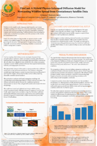
The rapid and accurate short-term forecasting (nowcasting) of wildfire spread is a critical challenge for emergency response and public safety. Traditional physics-based models, while grounded in established principles, often lack fine-scale realism and produce overly smooth predictions. Conversely, purely data-driven deep learning models can capture complex patterns but may violate fundamental physical constraints, leading to unrealistic or untrustworthy forecasts. This paper introduces FireCast, a novel, original hybrid algorithm that synergizes both approaches for high-fidelity nowcasting of wildfire perimeters for up to two hours.
FireCast employs a two-stage hybrid framework. First, a Deterministic Forecast Module uses a physics-informed cellular automaton (CA) to generate a coarse, low-resolution forecast. This CA is guided by meteorological data (wind, humidity) from ERA5 and topography from a DEM. Second, this physically-grounded prediction serves as a strong condition for a Stochastic Refinement Module. This module uses a generative diffusion model, based on the CasFormer architecture, to refine the coarse forecast. It adds realistic, high-frequency details learned from historical fire events observed in Himawari-8/9 satellite imagery.
FireCast was trained and validated on a curated dataset of 50 major wildfire events, comprising approximately 4,000 spatiotemporal sequences from the Asia-Pacific region. In a comparative analysis for a 120-minute forecast, FireCast (Dice Similarity Coefficient: 0.84, Hausdorff Distance: 3.21 pixels) significantly outperformed both the baseline Deterministic CA (DSC: 0.72, AHD: 8.45 pixels) and a purely data-driven U-Net (DSC: 0.75, AHD: 5.12 pixels). Qualitative results confirm that FireCast forecasts are not only quantitatively more accurate but also visually more realistic, capturing the complex, intricate perimeters of real fire fronts.
This work validates the power of a hybrid deterministic–stochastic approach for complex environmental forecasting. FireCast offers a viable path toward creating trustworthy, high-fidelity AI tools, providing a significant advancement for operational wildfire management and disaster response.
Keywords
nowcasting
wildfire spread
diffusion models
remote sensing
physics-informed AI
Himawari-8/9
geostationary satellite
Poster
FireCast-post.pdf
Quantitative Modeling of Teen Cybersecurity Awareness in Gamified Learning
Lightweight U-Net Architectures for Mathematics-Informed AI in Variable-Rate Spraying