Event submissions
Published
This submission belongs to the session S1. Technology Enhanced Education of the event The 1st International Online Conference on Education Sciences
Published date
10 Jun, 2026
Academic Editor
'%3e%3cpath%20d='M12.6657%2010.9104C12.4185%2010.325%2012.0599%209.79327%2011.6097%209.34482C11.1609%208.89508%2010.6293%208.5365%2010.0442%208.28888C10.0389%208.28626%2010.0337%208.28495%2010.0285%208.28233C10.8446%207.69279%2011.3752%206.73249%2011.3752%205.64904C11.3752%203.8542%209.92103%202.39999%208.1262%202.39999C6.33136%202.39999%204.87715%203.8542%204.87715%205.64904C4.87715%206.73249%205.40774%207.69279%206.22393%208.28364C6.21869%208.28626%206.21345%208.28757%206.20821%208.29019C5.62129%208.5378%205.09463%208.89284%204.64265%209.34613C4.1929%209.79493%203.83432%2010.3266%203.58671%2010.9117C3.34345%2011.4845%203.21226%2012.0987%203.20023%2012.7209C3.19988%2012.7349%203.20233%2012.7488%203.20744%2012.7619C3.21255%2012.7749%203.22022%2012.7867%203.22998%2012.7968C3.23975%2012.8068%203.25142%2012.8147%203.26431%2012.8202C3.2772%2012.8256%203.29105%2012.8284%203.30504%2012.8284H4.09109C4.14874%2012.8284%204.19459%2012.7825%204.1959%2012.7262C4.2221%2011.7148%204.62823%2010.7676%205.34617%2010.0497C6.08899%209.30683%207.0755%208.89808%208.1262%208.89808C9.17689%208.89808%2010.1634%209.30683%2010.9062%2010.0497C11.6242%2010.7676%2012.0303%2011.7148%2012.0565%2012.7262C12.0578%2012.7838%2012.1037%2012.8284%2012.1613%2012.8284H12.9474C12.9613%2012.8284%2012.9752%2012.8256%2012.9881%2012.8202C13.001%2012.8147%2013.0126%2012.8068%2013.0224%2012.7968C13.0322%2012.7867%2013.0398%2012.7749%2013.0449%2012.7619C13.0501%2012.7488%2013.0525%2012.7349%2013.0522%2012.7209C13.0391%2012.0947%2012.9094%2011.4855%2012.6657%2010.9104ZM8.1262%207.9024C7.52486%207.9024%206.9589%207.6679%206.53312%207.24211C6.10733%206.81633%205.87283%206.25037%205.87283%205.64904C5.87283%205.0477%206.10733%204.48174%206.53312%204.05596C6.9589%203.63018%207.52486%203.39567%208.1262%203.39567C8.72753%203.39567%209.29349%203.63018%209.71927%204.05596C10.1451%204.48174%2010.3796%205.0477%2010.3796%205.64904C10.3796%206.25037%2010.1451%206.81633%209.71927%207.24211C9.29349%207.6679%208.72753%207.9024%208.1262%207.9024Z'%20fill='%235D1EE1'/%3e%3c/g%3e%3c/svg%3e) Mike Joy
Mike JoyCitation
Dora Stella Lombardi, Stefano Merola, Guglielmo Abbruzzese, Teresa Celestino, Lichens and Education: Integrating GIS Technology and Montessori Pedagogy for Urban Environmental Awareness, in Proceedings of The 1st International Online Conference on Education Sciences, 15 June–17 June 2026, MDPI: Basel, Switzerland
Share
Email
Facebook
Twitter
LinkedIn
Lichens and Education: Integrating GIS Technology and Montessori Pedagogy for Urban Environmental Awareness
'%3e%3cpath%20d='M12.6647%2010.9104C12.4176%2010.325%2012.0589%209.7933%2011.6088%209.34485C11.16%208.89511%2010.6283%208.53653%2010.0432%208.28891C10.038%208.28629%2010.0327%208.28498%2010.0275%208.28236C10.8437%207.69282%2011.3743%206.73252%2011.3743%205.64907C11.3743%203.85423%209.92005%202.40002%208.12522%202.40002C6.33038%202.40002%204.87618%203.85423%204.87618%205.64907C4.87618%206.73252%205.40677%207.69282%206.22296%208.28367C6.21772%208.28629%206.21248%208.2876%206.20724%208.29022C5.62031%208.53783%205.09365%208.89287%204.64167%209.34616C4.19192%209.79496%203.83334%2010.3266%203.58573%2010.9117C3.34247%2011.4846%203.21128%2012.0987%203.19925%2012.721C3.1989%2012.735%203.20135%2012.7489%203.20646%2012.7619C3.21157%2012.7749%203.21924%2012.7868%203.22901%2012.7968C3.23877%2012.8068%203.25045%2012.8148%203.26334%2012.8202C3.27623%2012.8256%203.29007%2012.8284%203.30406%2012.8284H4.09012C4.14776%2012.8284%204.19362%2012.7825%204.19493%2012.7262C4.22113%2011.7148%204.62726%2010.7676%205.34519%2010.0497C6.08802%209.30686%207.07452%208.89811%208.12522%208.89811C9.17592%208.89811%2010.1624%209.30686%2010.9052%2010.0497C11.6232%2010.7676%2012.0293%2011.7148%2012.0555%2012.7262C12.0568%2012.7839%2012.1027%2012.8284%2012.1603%2012.8284H12.9464C12.9604%2012.8284%2012.9742%2012.8256%2012.9871%2012.8202C13%2012.8148%2013.0117%2012.8068%2013.0214%2012.7968C13.0312%2012.7868%2013.0389%2012.7749%2013.044%2012.7619C13.0491%2012.7489%2013.0515%2012.735%2013.0512%2012.721C13.0381%2012.0947%2012.9084%2011.4856%2012.6647%2010.9104ZM8.12522%207.90243C7.52388%207.90243%206.95792%207.66793%206.53214%207.24215C6.10636%206.81636%205.87185%206.2504%205.87185%205.64907C5.87185%205.04773%206.10636%204.48177%206.53214%204.05599C6.95792%203.63021%207.52388%203.3957%208.12522%203.3957C8.72655%203.3957%209.29252%203.63021%209.7183%204.05599C10.1441%204.48177%2010.3786%205.04773%2010.3786%205.64907C10.3786%206.2504%2010.1441%206.81636%209.7183%207.24215C9.29252%207.66793%208.72655%207.90243%208.12522%207.90243Z'%20fill='%235D1EE1'/%3e%3c/g%3e%3c/svg%3e)
Dora Stella Lombardi 1,2
Stefano Merola 3
Guglielmo Abbruzzese 4,5
Teresa Celestino 6
1. Teaching and Learning Centre (TLC), Saint Camillus International University of Health and Medical Sciences, Rome, 00131, Italy.
2. Department of Natural Sciences, Liceo Lucio Anneo Seneca, Rome, 00167, Italy
3. Servizio Sistemi Informativi, Azienda Territoriale per l'Edilizia Residenziale (ATER), Rome, 00186, Italy.
4. Department of Mathematics, Tor Vergata University, Rome, 00133, Italy.
5. Laboratory “Informatics and School”, Consorzio CINI, 00133, Rome, Italy.
6. Teaching and Learning Centre (TLC), Roma Tre University, Rome, 00185, Italy.
Abstract
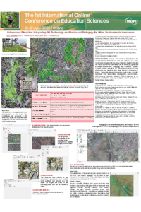
Lichens are sensitive bioindicators for environmental disturbances and air pollution [1]. This research investigates the synergy between digital tools and the Parco del Pineto naturalistic site in Rome [2], grounded in Maria Montessori’s pedagogy and inclusive, student-centred outdoor education [3]. The study involved 43 third- and fourth-year students from High School L.A. Seneca in Rome. The methodology followed a multi-phase scientific approach: field observation, photographic documentation, and specimen collection. Students utilised Pl@ntNet, an AI-based identification tool [4], alongside expert guidance to foster Citizen Science [5]. Google Earth served as the primary mapping base for recording positions via .kml files, enabling the management of three-dimensional geospatial data. Using open-source GIS software, students plotted coordinates and associated each location with specific data sheets and original photographs for laboratory-based species classification. Educational outcomes were documented through group dynamics observations and a qualitative survey evaluating the efficacy of merging outdoor education with technological resources. The primary outcome was a comprehensive GIS-based mapping system documenting the territory’s ecological recovery following the 2022 fire, particularly within wetland areas. Beyond scientific findings, the results indicate that students significantly strengthened their teamwork and rigorous scientific working methods. This project bridges the gap between scientific theory and environmental protection, providing a scalable model for urban heritage management and illustrating that technology is a vital ally in cultivating a deeper respect for our planet.
(References in additional comments)
Keywords
lichens
Citizen Science
geolocation
AI tools
outdoor education
ecopedagogy.
Poster
173085 .pdf
Bridging the Digital Divide: Scaffolding Postgraduate Academic English Proficiency Through AI-Powered Adaptive Learning Platforms
Exploration of Three Approaches to Virtual Fieldtrips for Makerspaces: Experiences and Perceptions of K-12 Educators from Rural Areas