Event submissions
Published
This submission belongs to the session S1. Forest Ecology and Sustainable Management of the event The 5th International Electronic Conference on Forests
Published date
09 Sep, 2026
Academic Editor
'%3e%3cpath%20d='M12.6657%2010.9104C12.4185%2010.325%2012.0599%209.79327%2011.6097%209.34482C11.1609%208.89508%2010.6293%208.5365%2010.0442%208.28888C10.0389%208.28626%2010.0337%208.28495%2010.0285%208.28233C10.8446%207.69279%2011.3752%206.73249%2011.3752%205.64904C11.3752%203.8542%209.92103%202.39999%208.1262%202.39999C6.33136%202.39999%204.87715%203.8542%204.87715%205.64904C4.87715%206.73249%205.40774%207.69279%206.22393%208.28364C6.21869%208.28626%206.21345%208.28757%206.20821%208.29019C5.62129%208.5378%205.09463%208.89284%204.64265%209.34613C4.1929%209.79493%203.83432%2010.3266%203.58671%2010.9117C3.34345%2011.4845%203.21226%2012.0987%203.20023%2012.7209C3.19988%2012.7349%203.20233%2012.7488%203.20744%2012.7619C3.21255%2012.7749%203.22022%2012.7867%203.22998%2012.7968C3.23975%2012.8068%203.25142%2012.8147%203.26431%2012.8202C3.2772%2012.8256%203.29105%2012.8284%203.30504%2012.8284H4.09109C4.14874%2012.8284%204.19459%2012.7825%204.1959%2012.7262C4.2221%2011.7148%204.62823%2010.7676%205.34617%2010.0497C6.08899%209.30683%207.0755%208.89808%208.1262%208.89808C9.17689%208.89808%2010.1634%209.30683%2010.9062%2010.0497C11.6242%2010.7676%2012.0303%2011.7148%2012.0565%2012.7262C12.0578%2012.7838%2012.1037%2012.8284%2012.1613%2012.8284H12.9474C12.9613%2012.8284%2012.9752%2012.8256%2012.9881%2012.8202C13.001%2012.8147%2013.0126%2012.8068%2013.0224%2012.7968C13.0322%2012.7867%2013.0398%2012.7749%2013.0449%2012.7619C13.0501%2012.7488%2013.0525%2012.7349%2013.0522%2012.7209C13.0391%2012.0947%2012.9094%2011.4855%2012.6657%2010.9104ZM8.1262%207.9024C7.52486%207.9024%206.9589%207.6679%206.53312%207.24211C6.10733%206.81633%205.87283%206.25037%205.87283%205.64904C5.87283%205.0477%206.10733%204.48174%206.53312%204.05596C6.9589%203.63018%207.52486%203.39567%208.1262%203.39567C8.72753%203.39567%209.29349%203.63018%209.71927%204.05596C10.1451%204.48174%2010.3796%205.0477%2010.3796%205.64904C10.3796%206.25037%2010.1451%206.81633%209.71927%207.24211C9.29349%207.6679%208.72753%207.9024%208.1262%207.9024Z'%20fill='%235D1EE1'/%3e%3c/g%3e%3c/svg%3e) Giovanna Battipaglia
Giovanna BattipagliaCitation
Aurora Bonaudo, Rodolfo Pichio, Rachele Venanzi, Angela Lo Monaco, Francesco Latterini, Operational Planning in Chestnut Coppices: Testing GIS–AHP Across Stakeholder Perspectives, in Proceedings of The 5th International Electronic Conference on Forests, 14 September–16 September 2026, MDPI: Basel, Switzerland
Share
Email
Facebook
Twitter
LinkedIn
Operational Planning in Chestnut Coppices: Testing GIS–AHP Across Stakeholder Perspectives

Aurora Bonaudo 1

Rodolfo Pichio 1

Rachele Venanzi 1

Angela Lo Monaco 1
'%3e%3cpath%20d='M12.6647%2010.9104C12.4176%2010.325%2012.0589%209.7933%2011.6088%209.34485C11.16%208.89511%2010.6283%208.53653%2010.0432%208.28891C10.038%208.28629%2010.0327%208.28498%2010.0275%208.28236C10.8437%207.69282%2011.3743%206.73252%2011.3743%205.64907C11.3743%203.85423%209.92005%202.40002%208.12522%202.40002C6.33038%202.40002%204.87618%203.85423%204.87618%205.64907C4.87618%206.73252%205.40677%207.69282%206.22296%208.28367C6.21772%208.28629%206.21248%208.2876%206.20724%208.29022C5.62031%208.53783%205.09365%208.89287%204.64167%209.34616C4.19192%209.79496%203.83334%2010.3266%203.58573%2010.9117C3.34247%2011.4846%203.21128%2012.0987%203.19925%2012.721C3.1989%2012.735%203.20135%2012.7489%203.20646%2012.7619C3.21157%2012.7749%203.21924%2012.7868%203.22901%2012.7968C3.23877%2012.8068%203.25045%2012.8148%203.26334%2012.8202C3.27623%2012.8256%203.29007%2012.8284%203.30406%2012.8284H4.09012C4.14776%2012.8284%204.19362%2012.7825%204.19493%2012.7262C4.22113%2011.7148%204.62726%2010.7676%205.34519%2010.0497C6.08802%209.30686%207.07452%208.89811%208.12522%208.89811C9.17592%208.89811%2010.1624%209.30686%2010.9052%2010.0497C11.6232%2010.7676%2012.0293%2011.7148%2012.0555%2012.7262C12.0568%2012.7839%2012.1027%2012.8284%2012.1603%2012.8284H12.9464C12.9604%2012.8284%2012.9742%2012.8256%2012.9871%2012.8202C13%2012.8148%2013.0117%2012.8068%2013.0214%2012.7968C13.0312%2012.7868%2013.0389%2012.7749%2013.044%2012.7619C13.0491%2012.7489%2013.0515%2012.735%2013.0512%2012.721C13.0381%2012.0947%2012.9084%2011.4856%2012.6647%2010.9104ZM8.12522%207.90243C7.52388%207.90243%206.95792%207.66793%206.53214%207.24215C6.10636%206.81636%205.87185%206.2504%205.87185%205.64907C5.87185%205.04773%206.10636%204.48177%206.53214%204.05599C6.95792%203.63021%207.52388%203.3957%208.12522%203.3957C8.72655%203.3957%209.29252%203.63021%209.7183%204.05599C10.1441%204.48177%2010.3786%205.04773%2010.3786%205.64907C10.3786%206.2504%2010.1441%206.81636%209.7183%207.24215C9.29252%207.66793%208.72655%207.90243%208.12522%207.90243Z'%20fill='%235D1EE1'/%3e%3c/g%3e%3c/svg%3e)
Francesco Latterini 2
1. Department of Agricultural and Forest Sciences, University of Tuscia, Via San Camillo de Lellis, 01100 Viterbo, Italy
2. Institute of Dendrology, Polish Academy of Sciences, Parkowa 5, 62-035 Kórnik, Poland
Abstract
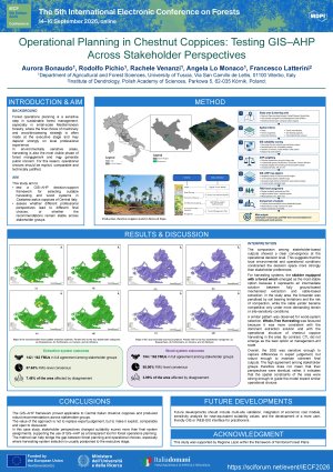
Forest operations planning is a critical step in sustainable forest management, particularly in small-scale Mediterranean forestry, where the final choice of machinery and wood-processing strategy is made within Executive Harvesting Plans, and may rely strongly on the discretion of local foresters or contractors. This is problematic in environmentally sensitive forests, where harvesting is the most visible phase of management and often the one that generates the strongest public concern. If the decision pathway is not explicit, it becomes difficult to understand why a system was selected, to compare alternatives, or to verify whether the choice was technically justified.
This contribution explores whether a spatial multi-criteria workflow can make these choices more traceable while accounting for different professional viewpoints. The test was carried out in a public Castanea sativa coppice estate in Central Italy. The forest plan included 233 planning compartments, of which about 70% were retained for the analysis because they represented actively managed stands. Six spatial constraints were used to evaluate three extraction methods: forwarder, skidder equipped with a forest winch and tower yarder. A second decision level linked these extraction options to three wood-processing strategies: Cut-to-Length (CTL), Full-Tree System (FTS) and Tree-Length System (TLS). Weights were obtained separately from four professional categories using AHP combined with a GIS environment.
The model outputs showed that expert profiles affected suitability scores more than final assigned systems. For extraction, all categories assigned the same option in about 88% of the analysed cutting blocks, while disagreement involved less than 8% of the area. For wood-system methods, agreement increased to about 95% of cutting blocks and disagreement remained below 4% of the area. The prevailing outcomes were the winch-equipped skidder and FTS. Overall, the workflow provided a clearer and more comparable basis for operational planning, without removing expert judgement from the process.
Keywords
GIS–AHP
decision support system
forest operations planning
harvesting system selection
wood system selection
chestnut coppice
sustainable forest operations
precision forestry
Poster
IECF_Bonaudo_poster.pdf
Analysing twenty-six years of phosphorus return via litterfall in two contrasting Pinus sylvestris forests under different thinning intensities (western Pyrenees, Spain)
PLANT DIVERSITY AND ECOLOGICAL CHARACTERISTICS OF THE VEGETATION OF THE DOSSO PARTIAL WILDLIFE RESERVE