Event submissions
Published
This submission belongs to the session S4. Forest Inventory, Modeling and Remote Sensing of the event The 5th International Electronic Conference on Forests
Published date
09 Sep, 2026
Academic Editor
'%3e%3cpath%20d='M12.6657%2010.9104C12.4185%2010.325%2012.0599%209.79327%2011.6097%209.34482C11.1609%208.89508%2010.6293%208.5365%2010.0442%208.28888C10.0389%208.28626%2010.0337%208.28495%2010.0285%208.28233C10.8446%207.69279%2011.3752%206.73249%2011.3752%205.64904C11.3752%203.8542%209.92103%202.39999%208.1262%202.39999C6.33136%202.39999%204.87715%203.8542%204.87715%205.64904C4.87715%206.73249%205.40774%207.69279%206.22393%208.28364C6.21869%208.28626%206.21345%208.28757%206.20821%208.29019C5.62129%208.5378%205.09463%208.89284%204.64265%209.34613C4.1929%209.79493%203.83432%2010.3266%203.58671%2010.9117C3.34345%2011.4845%203.21226%2012.0987%203.20023%2012.7209C3.19988%2012.7349%203.20233%2012.7488%203.20744%2012.7619C3.21255%2012.7749%203.22022%2012.7867%203.22998%2012.7968C3.23975%2012.8068%203.25142%2012.8147%203.26431%2012.8202C3.2772%2012.8256%203.29105%2012.8284%203.30504%2012.8284H4.09109C4.14874%2012.8284%204.19459%2012.7825%204.1959%2012.7262C4.2221%2011.7148%204.62823%2010.7676%205.34617%2010.0497C6.08899%209.30683%207.0755%208.89808%208.1262%208.89808C9.17689%208.89808%2010.1634%209.30683%2010.9062%2010.0497C11.6242%2010.7676%2012.0303%2011.7148%2012.0565%2012.7262C12.0578%2012.7838%2012.1037%2012.8284%2012.1613%2012.8284H12.9474C12.9613%2012.8284%2012.9752%2012.8256%2012.9881%2012.8202C13.001%2012.8147%2013.0126%2012.8068%2013.0224%2012.7968C13.0322%2012.7867%2013.0398%2012.7749%2013.0449%2012.7619C13.0501%2012.7488%2013.0525%2012.7349%2013.0522%2012.7209C13.0391%2012.0947%2012.9094%2011.4855%2012.6657%2010.9104ZM8.1262%207.9024C7.52486%207.9024%206.9589%207.6679%206.53312%207.24211C6.10733%206.81633%205.87283%206.25037%205.87283%205.64904C5.87283%205.0477%206.10733%204.48174%206.53312%204.05596C6.9589%203.63018%207.52486%203.39567%208.1262%203.39567C8.72753%203.39567%209.29349%203.63018%209.71927%204.05596C10.1451%204.48174%2010.3796%205.0477%2010.3796%205.64904C10.3796%206.25037%2010.1451%206.81633%209.71927%207.24211C9.29349%207.6679%208.72753%207.9024%208.1262%207.9024Z'%20fill='%235D1EE1'/%3e%3c/g%3e%3c/svg%3e) Krzysztof Stereńczak
Krzysztof StereńczakCitation
Vladimir Visacki, Lazar Pavlovic, Olivera Kalozi, Lazar Kesic, Lazar Tursijan, Lazar Jeftic, Sasa Orlovic, Remote sensing-based quantification of windbreak condition and associated crop responses in agroforestry systems: evidence from Vojvodina, Serbia, in Proceedings of The 5th International Electronic Conference on Forests, 14 September–16 September 2026, MDPI: Basel, Switzerland
Share
Email
Facebook
Twitter
LinkedIn
Remote sensing-based quantification of windbreak condition and associated crop responses in agroforestry systems: evidence from Vojvodina, Serbia

Vladimir Visacki 1

Lazar Pavlovic 2

Olivera Kalozi 2
'%3e%3cpath%20d='M12.6647%2010.9104C12.4176%2010.325%2012.0589%209.7933%2011.6088%209.34485C11.16%208.89511%2010.6283%208.53653%2010.0432%208.28891C10.038%208.28629%2010.0327%208.28498%2010.0275%208.28236C10.8437%207.69282%2011.3743%206.73252%2011.3743%205.64907C11.3743%203.85423%209.92005%202.40002%208.12522%202.40002C6.33038%202.40002%204.87618%203.85423%204.87618%205.64907C4.87618%206.73252%205.40677%207.69282%206.22296%208.28367C6.21772%208.28629%206.21248%208.2876%206.20724%208.29022C5.62031%208.53783%205.09365%208.89287%204.64167%209.34616C4.19192%209.79496%203.83334%2010.3266%203.58573%2010.9117C3.34247%2011.4846%203.21128%2012.0987%203.19925%2012.721C3.1989%2012.735%203.20135%2012.7489%203.20646%2012.7619C3.21157%2012.7749%203.21924%2012.7868%203.22901%2012.7968C3.23877%2012.8068%203.25045%2012.8148%203.26334%2012.8202C3.27623%2012.8256%203.29007%2012.8284%203.30406%2012.8284H4.09012C4.14776%2012.8284%204.19362%2012.7825%204.19493%2012.7262C4.22113%2011.7148%204.62726%2010.7676%205.34519%2010.0497C6.08802%209.30686%207.07452%208.89811%208.12522%208.89811C9.17592%208.89811%2010.1624%209.30686%2010.9052%2010.0497C11.6232%2010.7676%2012.0293%2011.7148%2012.0555%2012.7262C12.0568%2012.7839%2012.1027%2012.8284%2012.1603%2012.8284H12.9464C12.9604%2012.8284%2012.9742%2012.8256%2012.9871%2012.8202C13%2012.8148%2013.0117%2012.8068%2013.0214%2012.7968C13.0312%2012.7868%2013.0389%2012.7749%2013.044%2012.7619C13.0491%2012.7489%2013.0515%2012.735%2013.0512%2012.721C13.0381%2012.0947%2012.9084%2011.4856%2012.6647%2010.9104ZM8.12522%207.90243C7.52388%207.90243%206.95792%207.66793%206.53214%207.24215C6.10636%206.81636%205.87185%206.2504%205.87185%205.64907C5.87185%205.04773%206.10636%204.48177%206.53214%204.05599C6.95792%203.63021%207.52388%203.3957%208.12522%203.3957C8.72655%203.3957%209.29252%203.63021%209.7183%204.05599C10.1441%204.48177%2010.3786%205.04773%2010.3786%205.64907C10.3786%206.2504%2010.1441%206.81636%209.7183%207.24215C9.29252%207.66793%208.72655%207.90243%208.12522%207.90243Z'%20fill='%235D1EE1'/%3e%3c/g%3e%3c/svg%3e)
Lazar Kesic 1
Lazar Tursijan 2
Lazar Jeftic 1
Sasa Orlovic 1
1. Institute of Lowland Forestry and Environment, University of Novi Sad, Novi Sad, Serbia
2. Faculty of Agriculture, University of Novi Sad, Novi Sad, Serbia
Abstract
Agroforestry windbreaks reduce wind erosion and moderate field microclimate in Vojvodina, northern Serbia. We assessed whether multisensor remote sensing can characterize windbreak condition and crop responses. Sentinel-2 optical and Sentinel-1 SAR imagery from June–August 2023 and 2024 were analyzed for five windbreak–parcel pairs at two sites. Cadastral vectors from Serbia’s national geodetic authority defined boundaries. Within each parcel, crop vegetation 0–50 m from the windbreak was compared descriptively with the interior >50 m away. NDVI, GNDVI, GLI, and TVI represented greenness and canopy vigor, whereas CI, CVI, SR1, and SR2 were chlorophyll-sensitive indicators. Mean values and coefficients of variation classified three rows as high-, intermediate-, or low-condition. Sentinel-1 VV/VH backscatter and RVI provided structural/moisture proxies, while GEDI RH98 represented canopy height; no inferential statistical model was applied.
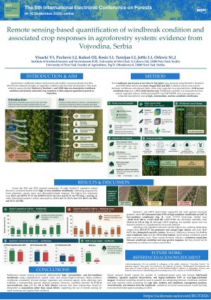
Averaged across both seasonal composites, all eight optical indices declined from high- to low-condition windbreaks. Greenness/canopy reductions were 36.6% for NDVI, 27.1% for GNDVI, 63.3% for GLI, and 39.1% for TVI; chlorophyll-sensitive reductions were 47.3% for CI, 23.7% for CVI, 40.3% for SR1, and 52.5% for SR2. Across SAR acquisitions, RVI decreased from 0.796 in the high-condition row to 0.687 in the low-condition row, while mean VV/VH backscatter shifted from −10.28/−16.37 to −11.55/−18.55 dB. GEDI RH98 decreased from 16.84 to 2.42 m, although GEDI sampling was sparse. These measurements were treated as supplementary structural indicators. Adjoining crop zones showed the same averaged ordering, with high-to-low reductions of 36.6%, 20.5%, 67.2%, and 43.6% for NDVI, GNDVI, GLI, and TVI, and 37.6%, 11.8%, 30.2%, and 41.2% for CI, CVI, SR1, and SR2. However, near-versus-interior differences varied among pairs and years, indicating association rather than causation. Multisensor remote sensing supports rapid screening and targeted field validation.
Keywords
agroforestry; windbreaks; vegetation indices; Sentinel-1; Sentinel-2; GEDI; crop monitoring;
Poster
Visacki V Windbeaks in Agroforestry impact F.pdf
Rule-Based Multi-Sensor Classification of Agroforestry Windbreak Systems Using Sentinel-1, Sentinel-2 and Land Cover Data
FORA: An Open-Source, Browser-Based Platform for Individual Tree Detection and Forest Metric Extraction from UAV LiDAR Data